 Click on photo for more information.
Traveling the Pacific Crest Trail in Tulare County
by Laurie Schwaller
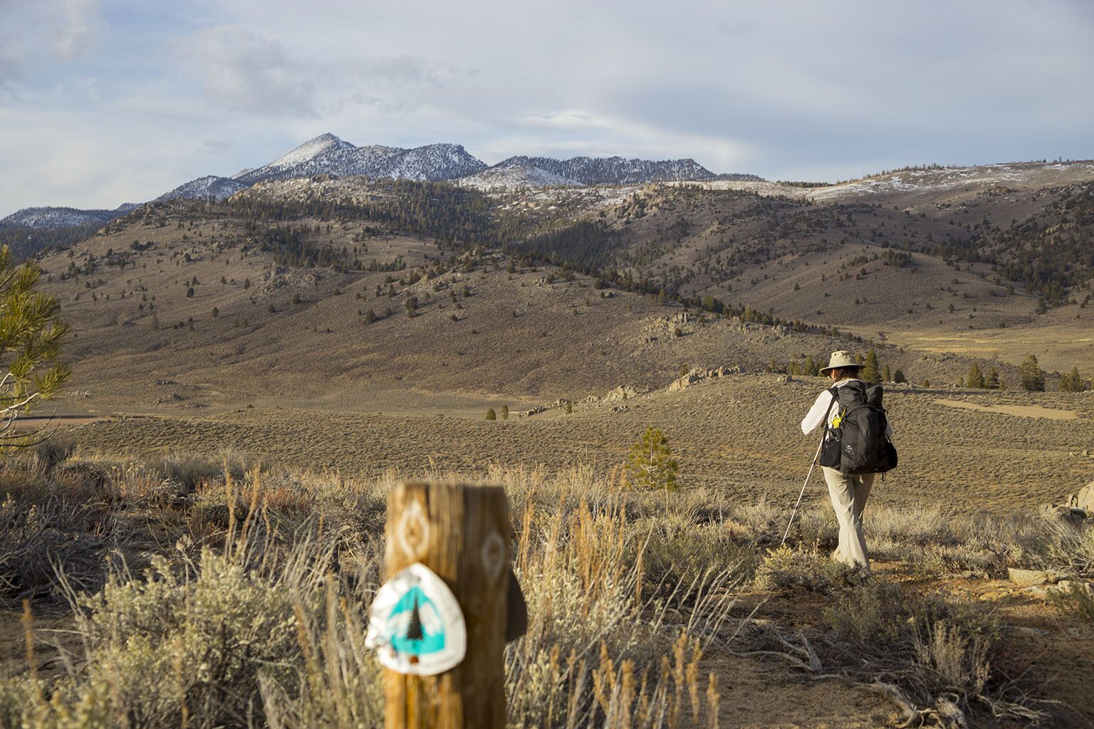
The Pacific Crest Trail travels about 125 miles within Tulare County, from mile-high high-desert expanses in the south through the trail’s highest point, atop Forester Pass (13,200′), in the High Sierra — living up to its National Scenic Trail designation all the way. With a shuttle set-up, you can hike Tulare County top to bottom (or vice-versa) on the PCT, or you can explore the PCT’s glorious TC landscapes in several shorter segments. If you can’t hike the whole 2,600-mile PCT, you can experience much of the awesome best of it right here in Tulare County.
December, 2025
NOTE: The Project Team will be conducting research for a full article as volunteer time allows. Contact us if you’d like to help research, write about, and/or illustrate this Treasure!
NOTE: There is no quick way to access the PCT from Visalia and the west side of the Sierra Nevada, but there are a number of ways to access it, depending on whether you want to thru-hike the Tulare County segment on it, or hike it in shorter segments. Most of the options work better with a shuttle set-up, unless you don’t mind retracing your steps (since the views all look different when you’re going the other way, as may the weather and the wildlife).
For a bottom-to-top trip or vice-versa, logical trailheads to the PCT would be, in the south, at the Walker Pass trailhead on Hwy 178 (maybe 10 miles below the Tulare County line) or from the Chimney Creek Campground area (maybe 5 miles above the TC line) up from Canebrake Flat on Hwy 178 on Canebrake Road/Chimney Peak Backcountry Byway (see our Chimney Peak Wilderness page for details);
and in the north from the Onion Valley trailhead (west of Independence/Hwy 395) for the Kearsarge Pass Trail going west to its junction with the PCT a few miles north of the Tulare County line (see our John Muir Trail page for details [the PCT joins the JMT for many miles in this area]). You could also consider leaving your north-end vehicle at Road’s End in Kings Canyon and hiking the Bubbs Creek Trail east to join the PCT/JMT a few miles south of the Kearsarge Pass Trail.
Directions to start from the south: From Visalia, go west on Hwy 198 and then south on Hwy 99 toward Bakersfield.
At Delano, take Hwy 155 east (left) toward Glenville and Lake Isabella. Follow Hwy 155 as it goes south along the lake to its junction with Hwy 178.
Go left (east) on Hwy 178 for about 30 miles to the Canebrake Flat area where you’ll go left (north) on rugged, graded-dirt, high-clearance, 4-wheel-drive-vehicle recommended Canebrake Road toward Chimney Creek campground. Approximately 9 miles up from Hwy 178 is the junction of Canebrake and Long Valley/Chimney Basin Roads. Per BLM, the best on-trail access is approximately 1.6 miles north of this junction at a small Pacific Crest National Scenic Trail trailhead.
Alternatively, continue past Canebrake on Hwy 178 to the Walker Pass PCT trailhead (with nearby campground).
To start from segments farther north, continue east past Canebrake on Hwy 178 to its junction with Hwy 395 and go north (left) to access trails such as those listed below:
NOTE: Several trails other than (and south of) Kearsarge Pass enable access to the PCT from Hwy 395 on the east side of the Sierra, e.g., Kennedy Meadows (via Nine Mile Canyon), Olancha Pass (via Olancha/Sage Flat Rd.), Mulkey Pass and Cottonwood Lakes (from Lone Pine and Lubken Canyon Road), etc.
Wilderness permits are required for overnight trips, and there are specific rules for PCT long-distance permit holders on camping and exiting the PCT corridor. Be sure to check the regulations for the specific areas you plan to hike before you go.