 Click on photo for more information.
The Fountain Springs Stop on the Butterfield Stage Trail
by Laurie Schwaller
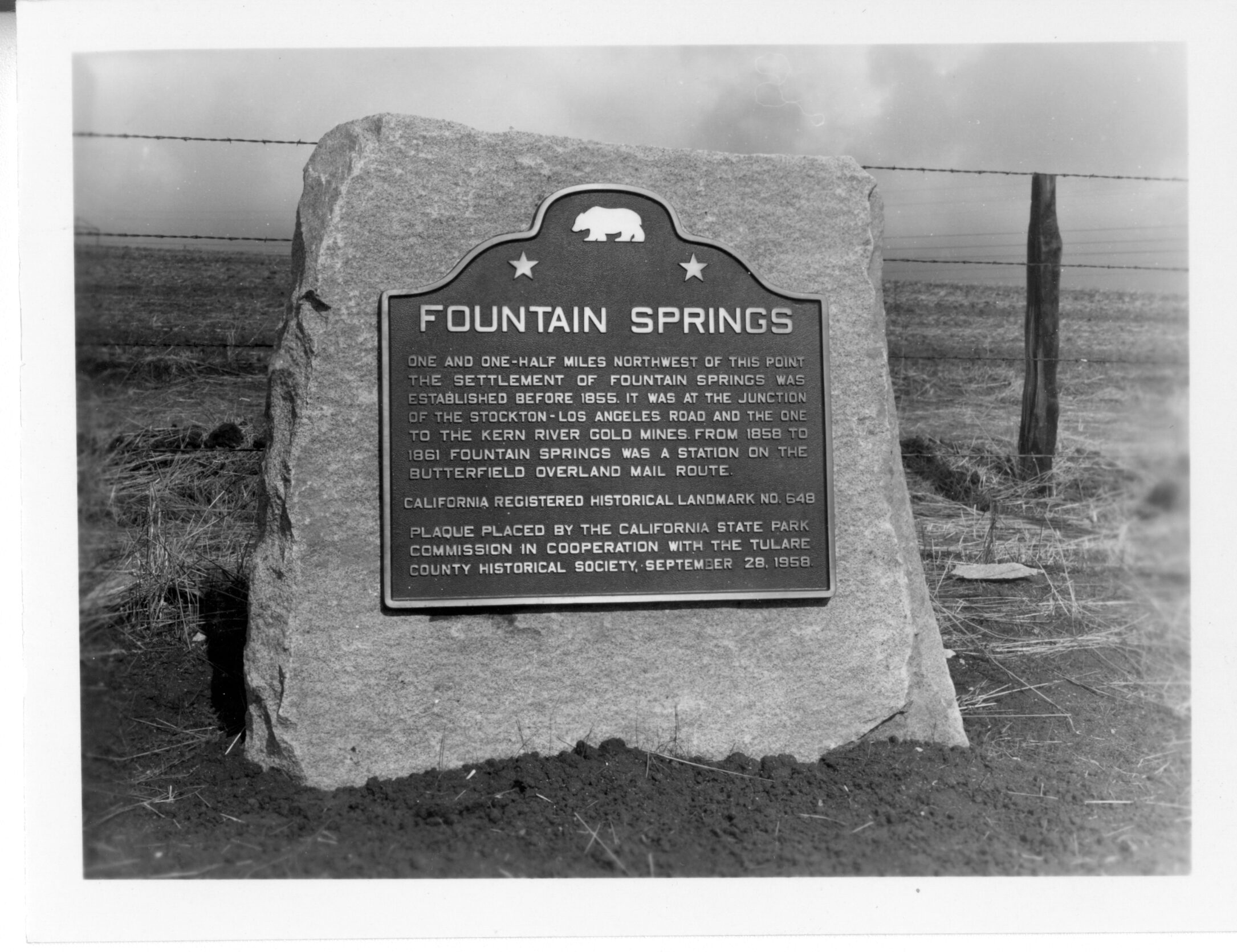
The famous Butterfield Overland Mail Stage’s route through Tulare County in 1858 to 1861 included a station at Fountain Springs, where a small settlement arose some time before 1855, about 1-1/2 miles northwest of its California historical marker (#648, erected in 1958). At the junction of the Stockton-Los Angeles Road, followed by the Butterfield stage, and the route south to the gold strikes made in the early 1850s on the White and Kern rivers, the Fountain Springs stop slaked tired travelers’ thirst and offered brief relief from the rigors of the road.
[There’s basically nothing left to see of the Fountain Springs settlement, but the springs there do still produce some water (on land not open to the public).]
October, 2025
NOTE: The Project Team will be conducting research for a full article page as volunteer time allows. Contact us if you would like to help research, write about, and/or illustrate this Treasure!
Coordinates: 35 53.559′ N, -118 55.112′ W
From Visalia, take Hwy 198 east and exit left (south) onto Hwy 65 toward Porterville. At Porterville, exit Hwy 65 onto Hwy 190 east and then go right onto Plano Road south to a sharp left onto Avenue 116, then bear right (south) onto M109-Old Stage Road to Fountain Springs at the junction with Avenue 56/County Road J22, where you’ll park to read the several historical markers. This is the southernmost Butterfield stage station marker in Tulare County.
*NOTE: There are several other Butterfield Overland Mail Stage markers and sites from Visalia to Fountain Springs along this route. See Butterfield Overland Mail Stage Route for other stops you might wish to make on your way to Fountain Springs.
For a quicker trip back to Visalia from this junction, you may want to take Avenue 56/Rd. J22 straight west to Ducor and then take Hwy 65 north back to Hwy 198 west to Visalia.
OR you may want to continue south about 8 miles on Old Stage Road/M109 to see Tailholt/White River, site of Tulare County’s gold rush in 1853.