 Click on photo for more information.
Visiting Chimney Peak Wilderness
by Laurie Schwaller
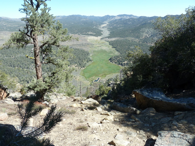
Tulare County’s southeast corner contains most of rugged, scenic Chimney Peak Wilderness: over 13,000 acres of pinyon pine covered mountains (Chimney Peak reaches almost 8,000′), occasional springs and streams supporting lusher riparian areas (find trout in Chimney Creek), desert plants including Joshua trees and creosote bushes in the lower elevations, and sage brush in between, home to bears, mule deer, bobcats, mountain lions, wonderful wildflowers (seasonally), and plenty of solitude — plus eight miles of the Pacific Crest National Scenic Trail, and the Chimney Peak Backcountry Byway along its boundary line.
November, 2025
NOTE: The Project Team will be conducting research for a full article as volunteer time allows. Contact us if you’d like to help research, write about, and/or illustrate this Treasure!
From Visalia, go west on Hwy 198 and then south on Hwy 99 toward Bakersfield. At Delano, take Hwy 155 east (left) toward Glenville and Lake Isabella. Follow Hwy 155 as it goes south along the lake to its junction with Hwy 178. Go left (east) on Hwy 178 for about 30 miles to the Canebrake Flat area where you’ll go left (north) on rugged, graded-dirt, high-clearance, 4-wheel-drive-vehicle-recommended Canebrake Road (AKA Chimney Peak Backcountry Byway) toward Chimney Creek campground.
Approximately 9 miles up from Hwy 178 is the junction of Canebrake and Long Valley/Chimney Basin roads.* Chimney Peak Wilderness is on the left as you continue on Canebrake Road or on the right if you continue onto Long Valley/Chimney Basin Road.
*NOTE: Per BLM, best on-trail access to Chimney Peak Wilderness is on Canebrake Road approximately 1.6 miles north of the prominent junction of Canebrake Road and Long Valley/Chimney Basin Road at a small Pacific Crest National Scenic Trail trailhead