Click on photo for more information.

Visiting the Domeland Wilderness

by Laurie Schwaller

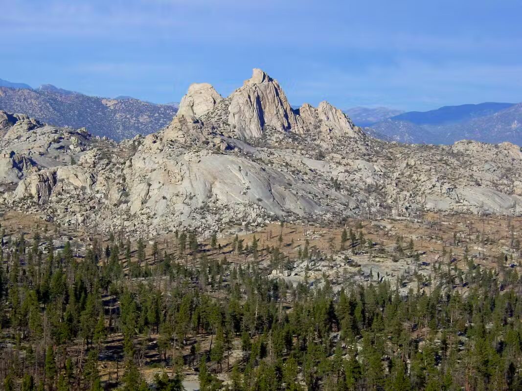
     Spectacularly diverse Domeland Wilderness, in southeastern Tulare County, offers outdoor adventurers 45 miles of trails (with 7 miles of the Pacific Crest National Scenic Trail) into over 130,000 acres of overlapping ecosystems (elevations ranging from 2,800′ to 9,977′) including the Wild and Scenic South Fork of the Kern River, deep gorges, perennial streams, big meadows, pine forested mountains, high desert areas, abundant wildlife, striking granite outcroppings, and namesake huge smooth domes that are magnets for rock climbers, hikers, backpackers, equestrians, fisher folk, birdwatchers, botanizers, and lovers of wild spaces, marvelous night skies, and solitude.

November, 2025


NOTE: The Project Team will be conducting research for a full article as volunteer time allows.  Contact us if you’d like to help research, write about, and/or illustrate this Treasure!  


Maps & Directions:


lat/long: 35.79541389, -118.1397 (BLM)


Directions: NOTE: There is no quick way to get to Domeland from our side of the Sierra.


From Visalia, go east on Hwy 198 and exit right onto Hwy 65 south toward Porterville. At Porterville, exit onto Hwy 190 east toward Springville. Continue on Hwy 190 as it curves south as the Western Divide Highway and eventually reaches the junction with Forest Road 23S03.

Take this Forest Road to Johnsondale and continue east onto FR 22S06 (Sherman Pass Road) to exit south on FR 22S12 to the trailheads for Manter Meadow and Rockhouse Meadow; or go farther east on Sherman Pass Road to get to trails entering this Wilderness from the north.


Site Details & Activities:

Environment:  130,081 acres, rugged topography, elevation 2,800′ – 9,977′, pinyon and mixed conifer forests, perennial streams, Wild and Scenic South Fork Kern River, many granite domes and outcroppings, overlapping ecosystems supporting unique plant and animal communities, large meadows, riparian habitats, brilliant night skies, about 45 miles of trail
Activities:  backpacking, birdwatching, botanizing, camping (free campfire permit required for gas lanterns, stoves, and campfires), dogs must be kept on 6′ leash and must not harass wildlife, fishing (with valid licenses and in compliance with state and local regulations), hiking (including 7 miles of Pacific Crest National Scenic Trail, along the valley of the South Fork Kern River, with the Rockhouse Trail continuing 4 more miles along the river), horseback riding and packing, hunting (with valid licenses and in compliance with state and local regulations), mountaineering, photography, rock climbing, stargazing, wildflower and wildlife viewing (watch for rattlesnakes, especially in the river area)
Open:  The Wilderness is always open, depending on weather, except when closed due to emergency conditions; low water levels and very hot temperatures in the summer
Site Stewards:  Sequoia National Forest, Kern River Ranger District, 760-376-3781 (94,081 acres, western portion);
Bureau of Land Management, Bakersfield Field Office; 661-391-6000; BLM_CA_Web_BK@blm.gov (36,000 acres, eastern addition)
This Wilderness can be accessed from numerous Sequoia National Forest trailheads, and several more remote BLM trailheads.
Opportunities for Involvement:  Visit volunteer.gov or reach out to your local National Forest or BLM office for information on opportunities near you.
Links:  Domeland Wilderness – Forest Service, https://www.fs.usda.gov/r05/sequoia/recreation/domeland-wilderness
Domeland Wilderness – Bureau of Land Management, www.blm.gov/visit/domeland.wilderness