 Click on photos for more information.
Sequoia National Park’s Incomparable High Sierra Trail
by Laurie Schwaller
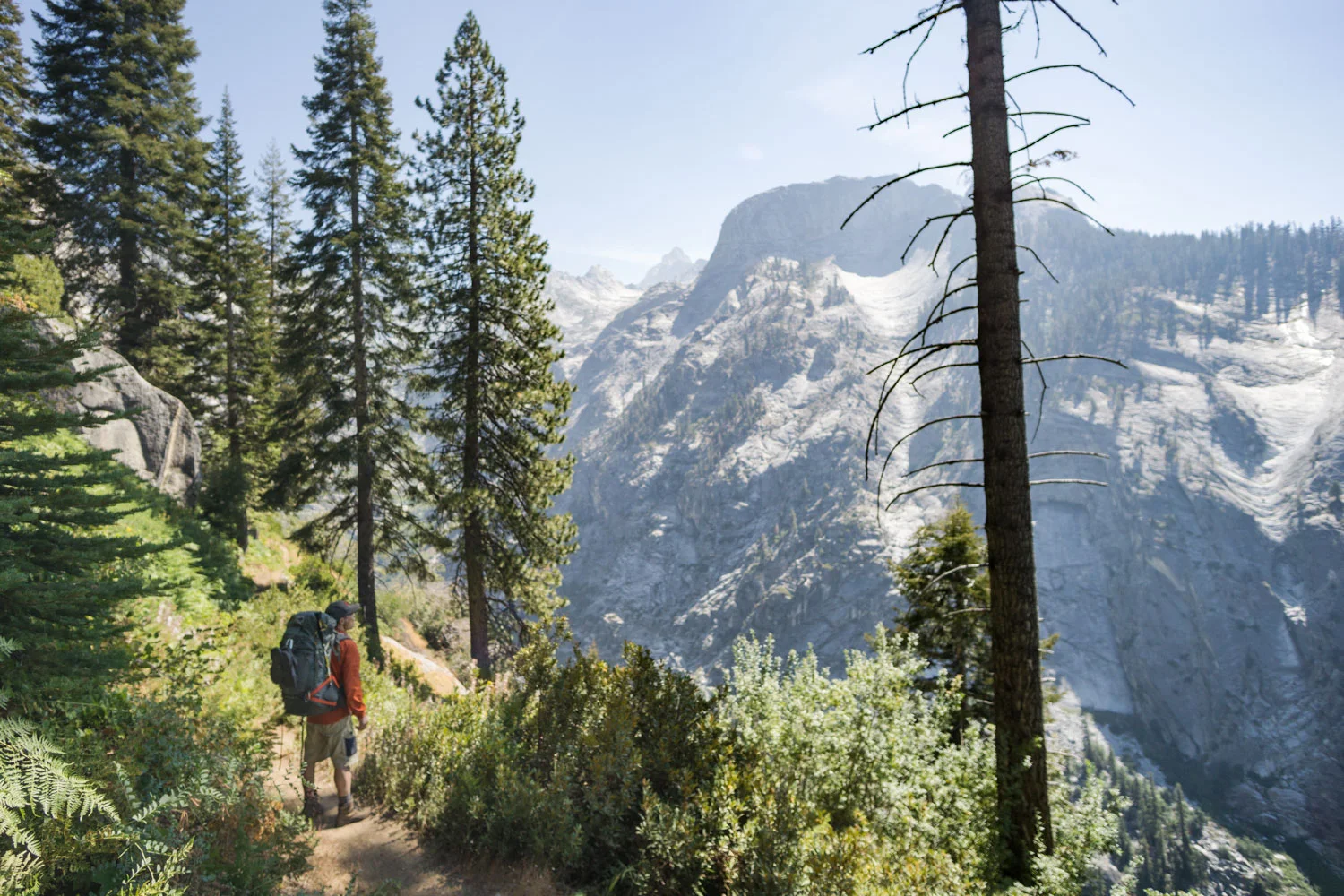
Sequoia National Park’s fabulously scenic High Sierra Trail, “the most ambitious trail ever built by the National Park Service in the southern Sierra,” leads you in 62 rugged, up and down miles from lush, giant-sequoia-ringed Crescent Meadow, elevation 6700′, to the all-rock top of Mt. Whitney at 14,505′, the highest point in the lower 48 states. (It’s about 75 miles if you hike on down the east side to road’s end at Whitney Portal.) Built in 1928-1932, this classic, incomparable trail challenges and rewards its travelers with sights and experiences they never forget.
November, 2025
NOTE: The Project Team will be conducting research for a full article as volunteer time allows. Contact us if you’d like to help research, write about, and/or illustrate this Treasure!
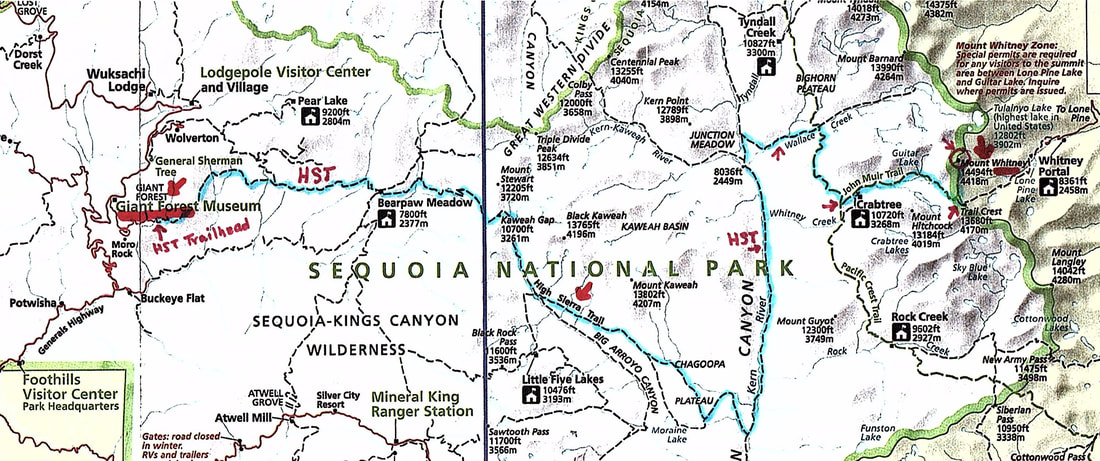
From Visalia, go east on Hwy 198 through Three Rivers to the Sequoia National Park entrance station (fee), where Hwy 198 becomes the Generals Highway. About a mile up the road, stop at the Wilderness Office near the Foothills Visitor Center to pick up your required Wilderness Permit for the High Sierra Trail (see Links in the Site Details section below). Continue up the mountain on the Generals Highway to just before the Giant Forest Museum and turn right onto the Moro Rock/Crescent Meadow Road. Follow it to its end at the Crescent Meadow parking lot. Find the HST trailhead sign near the restroom.
HST hikers typically make this a shuttle trip. Most travel the HST from west to east, culminating in summiting Mt. Whitney, then descending the 11-mile trail to Whitney Portal on the east side to meet a vehicle that will take them home (or back to the car they left at the start of their trek).
NOTE: You must obtain a Wilderness permit for the High Sierra Trail before you hike it. If you wish to complete your trip by hiking out down the east side to Whitney Portal, the Inyo National Forest will accept your Wilderness permit issued by Sequoia National Park as long as you meet the requirements for continuous wilderness travel.
(See our Smithsonian Shelter on Mt. Whitney page for a sketch map of the trail down to Whitney Portal.)