 Click on photos for more information.
Visiting Jennie Lakes Wilderness
by Laurie Schwaller
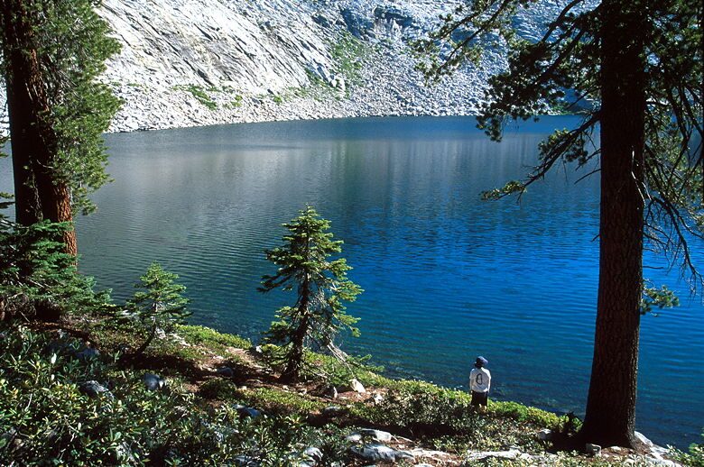
Readily accessible from four trailheads, Sequoia National Forest’s 10,500 acre Jennie Lakes Wilderness offers 26 miles of hiking trails, beautiful lakes (Jennie and Weaver are the largest), perennial streams, lovely meadows, extensive coniferous forests, rocky peaks (especially 10,365′ Mitchell Peak) affording great views, beckoning spring wildflowers, watchable wildlife, and trail access to Sequoia and Kings Canyon National Parks’ backcountry (Wilderness permit required for travel into the Parks). Jennie Lakes Wilderness lies almost entirely above 7,000′, so it’s refreshingly cool in summer; winter access is limited by road closures and its steep, snowy terrain.
November, 2025
NOTE: The Project Team will be conducting research for a full article as volunteer time allows. Contact us if you’d like to help research, write about, and/or illustrate this Treasure!

From Visalia, take Hwy 198 east through Three Rivers to the Sequoia National Park entrance station (fee), where the road becomes the Generals Highway. Follow it through Sequoia National Park and into Sequoia National Forest. Soon after the sign for Montecito Sequoia Camp, watch on your right for Big Meadows Forest Service Road (14S11). Take this road for about 5 miles to the Big Meadows trailhead (hiking trail 29E03) for a moderate to strenuous hike into the Jennie Lakes Wilderness. For the Rowell Meadows Trailhead (12 miles off of the Generals Highway), follow Big Meadows Road (14S11) and turn right onto Forest Road 13S14 for 2.5 miles to the trailhead (trail 30E08) providing an easy to moderate hike into the Wilderness. For the Marvin Pass trailhead (13 miles off of Generals Hwy), follow Big Meadows Road (14S11) and turn right onto Forest Road 13S12 for 2 miles to the trailhead (trail 30E06) providing an easy to moderate hike into the Wilderness.
Alternatively, from Visalia, take Hwy 63 north to go east (right) on Hwy 180 to the Big Stump entrance station (fee) to Kings Canyon National Park. At the upcoming “Y” junction, go right onto the Generals Highway, and then left (east) onto Big Meadows Forest Service Road (14S11). Proceed per directions above to the 3 trailheads.
The fourth trailhead (Stony Creek, trail 29E06), which is significantly the steepest, is located off the Generals Highway at the far end of Upper Stony Creek campground, which is located just a bit north of the small Stony Creek development near the south end of the Generals Highway segment in Sequoia National Forest. Turn east off the Generals Highway to access Upper Stony Creek campground and the trailhead.