 Click on photo for more information.
Traveling the John Muir Trail in Tulare County
by Laurie Schwaller
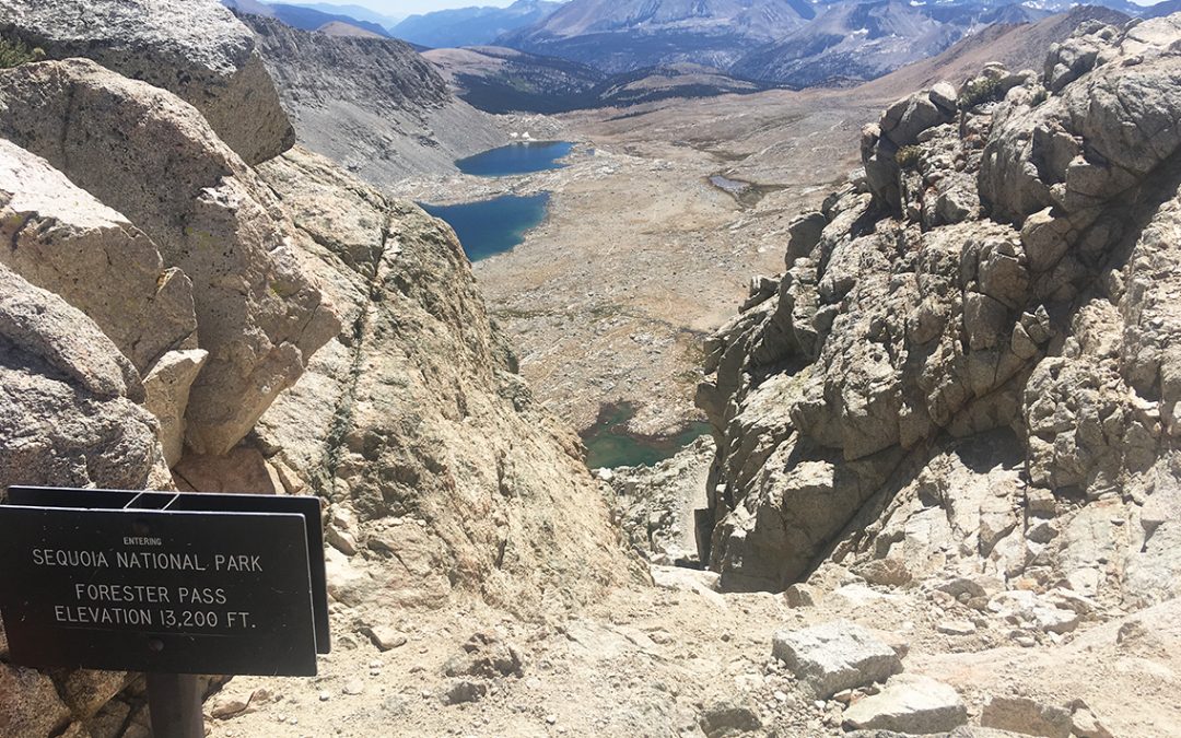
The epic grand finale of the John Muir Trail is its spectacular last 25 miles in Tulare County, all above 10,000′, culminating in summiting 14,505′ Mt. Whitney, highest peak in the contiguous 48 states. This sensational home stretch includes the climb over Forester Pass, at 13,200′ the highest on the JMT, marvelous meadows, numerous lakes and rushing creeks, vast vistas on the Bighorn Plateau, diverse coniferous forests, plentiful wildlife, wonderful wildflowers, precipitous peaks and beautiful basins, brilliant night skies, and soul-filling days in John Muir’s Range of Light. A journey of a lifetime experience.
November 2025
NOTE: The Project Team will be conducting research for a full article as volunteer time allows. Contact us if you’d like to help research, write about, and/or illustrate this Treasure!
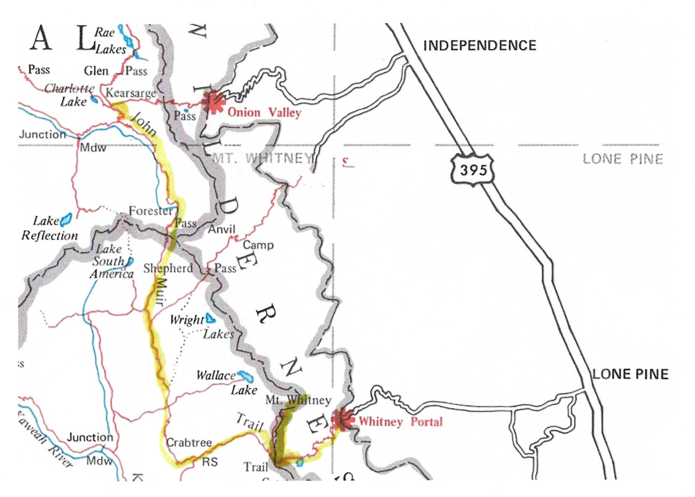
The quickest way to get to the JMT in Tulare County is to drive to the other side of the Sierra and hike west to the JMT. A recommended route for hiking this epic section of the JMT is to access the JMT via Kearsarge Pass and to leave your hike via Whitney Portal. This requires a 2-vehicle shuttle arrangement, with one vehicle for your trip home available at Whitney Portal on your exit day and the other vehicle delivering you to Onion Valley.
Wilderness Permit required. There are quotas on this trail, so reserve it well in advance via Recreation.gov (see https://www.recreation.gov/permits/233262 Inyo National Forest Wilderness Permits if you’re entering the Wilderness via Kearsarge Pass trail; specify Mt. Whitney Trail Crest exit). Try 6 days for this approximately 75 mile hike (giving yourself an overnight at one of the campgrounds coming down from Trail Crest to Whitney Portal; your knees and feet will thank you!).
Directions:
From Visalia, go west on Hwy 198 to Hwy 99 south to Bakersfield and take Hwy 58 East over Tehachapi and down to the junction with Hwy 14. Go north on Hwy 14 to Hwy 395 north to Lone Pine, then take Whitney Portal Road about 13 miles to the parking area near the JMT trail (this road is usually open from May to early November).
To proceed to Onion Valley, return to Lone Pine and continue north on Hwy 395 about 16 miles to Independence (note that a commercial shuttle can be arranged also). In Independence, go left (west) on Market Street, which soon becomes Onion Valley Road, about 14 miles to Onion Valley and the Kearsarge Pass trailhead. Elevation at Onion Valley is about 9,200′-9,600′. Spend the night in the campground there to start getting acclimated if you can. Trailhead is at 9,200′; Kearsarge Pass is at 11,709′, where it enters Kings Canyon National Park. (Onion Valley Road is closed due to snow from approximately November to April.)