 Click on photo for more information.
Owens Peak Wilderness
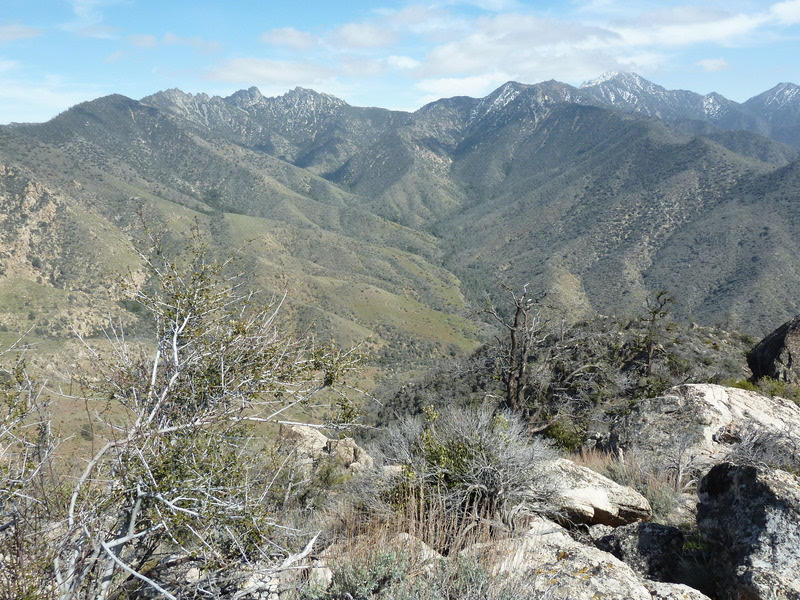
by Laurie Schwaller
Owens Peak, at 8,445′ the highest in the southern Sierra Nevada, rises in the center of its rugged 73,767-acre namesake wilderness. Here, the Great Basin, Mojave Desert, and Sierra Nevada ecoregions converge, providing a great diversity of plant life — from desert creosote, yucca, and cacti to numerous forested peaks — as well as two distinct climate zones, plenty of wildlife, vast views, and very starry night skies. Big canyons host springs, oaks, and cottonwoods. Trails include a stretch of the PCT and many use trails, such as peakbaggers’ routes to various summits. While summers are very hot here, conditions in the shoulder seasons are inviting, and spring wildflower shows after good rains can be amazing
November, 2025
NOTE: The Project Team will be conducting research for a full article as volunteer time allows. Contact us if you’d like to help research, write about, and/or illustrate this Treasure!
NOTE: There is no quick way to get to Owens Peak Wilderness from Visalia and the west side of the Sierra Nevada.
From Visalia, go west on Hwy 198 and then south on Hwy 99 toward Bakersfield.
At Delano, take Hwy 155 east (left) toward Glenville and Lake Isabella.
Follow Hwy 155 as it goes south along the lake to its junction with Hwy 178.
Go left (east) on Hwy 178 for about 30 miles to the Canebrake Flat area, where you’ll go left (north) on rugged, graded-dirt, high-clearance, 4-wheel-drive-vehicle-recommended Canebrake Road (AKA Chimney Peak Backcountry Byway) toward Chimney Creek campground.
Owens Peak Wilderness will be all along the right side of this road. There’s PCT access about 2 miles south of the campground.