Click on photos for more information.

Visiting Sequoia-Kings Canyon Wilderness

by Laurie Schwaller

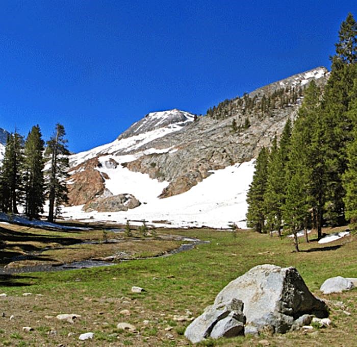
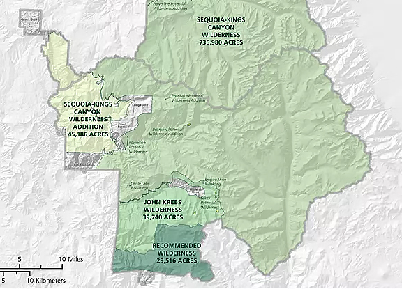
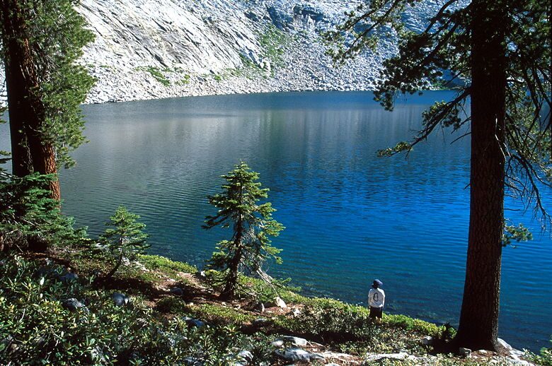
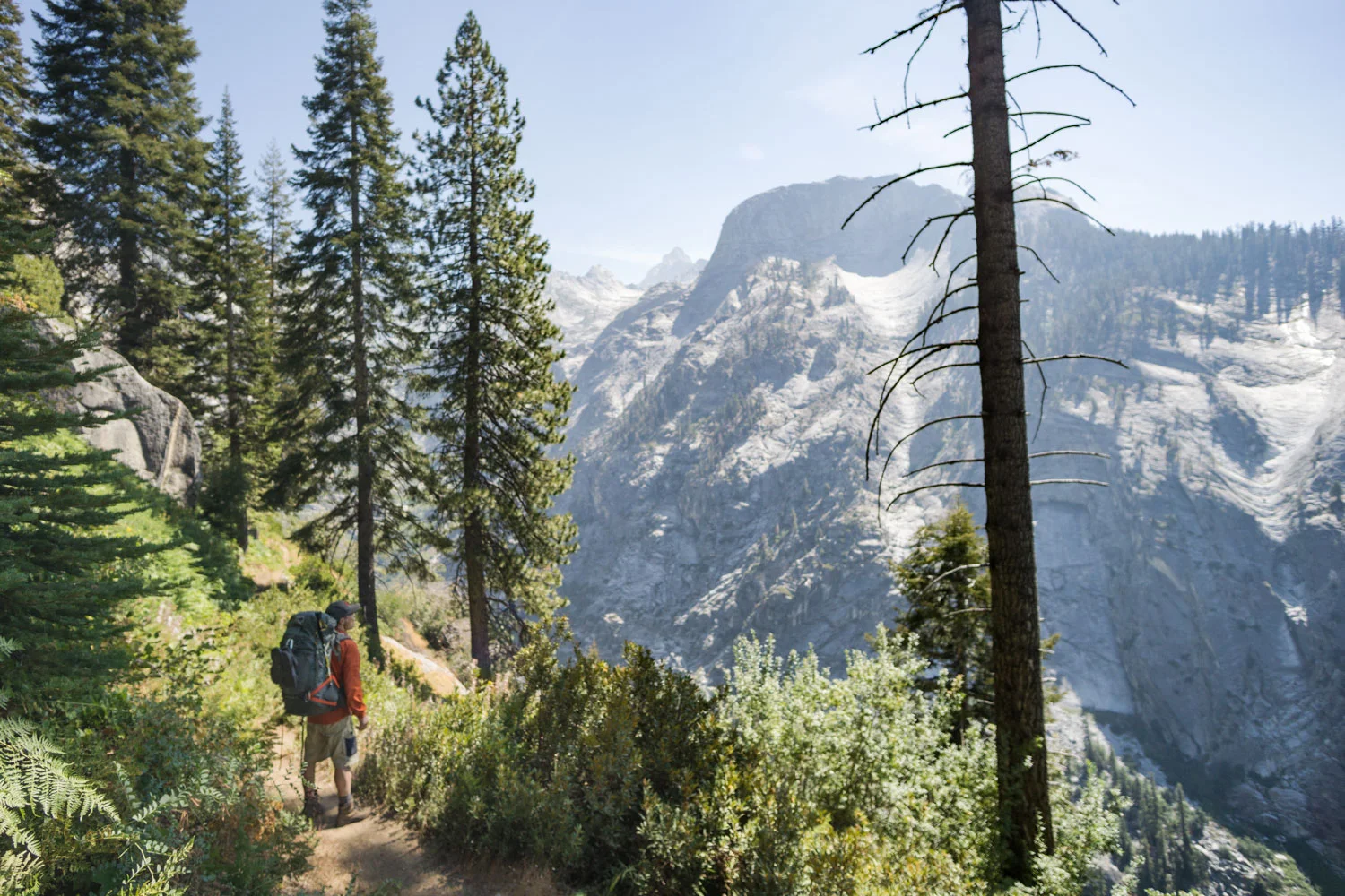
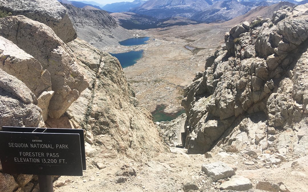
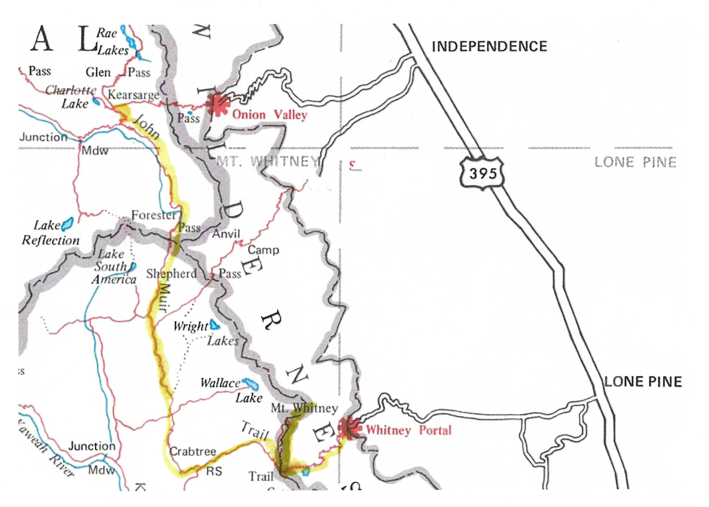
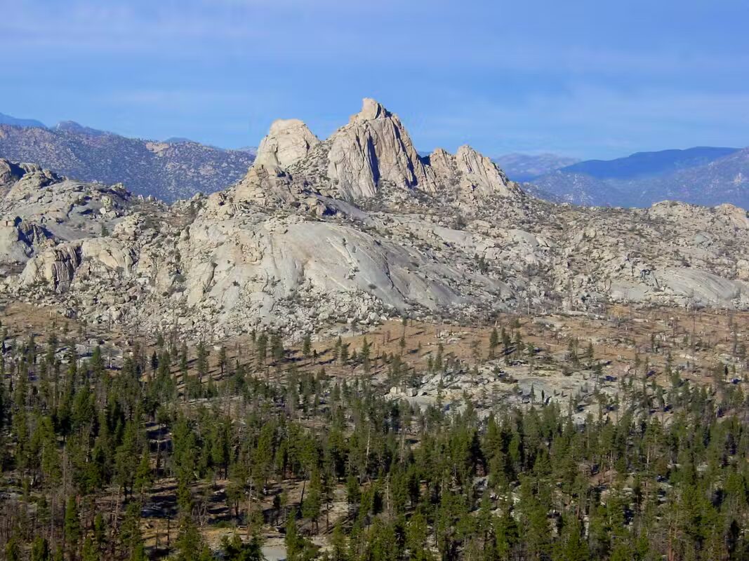
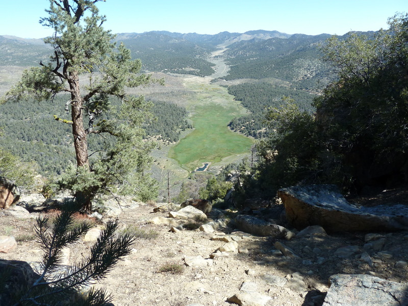
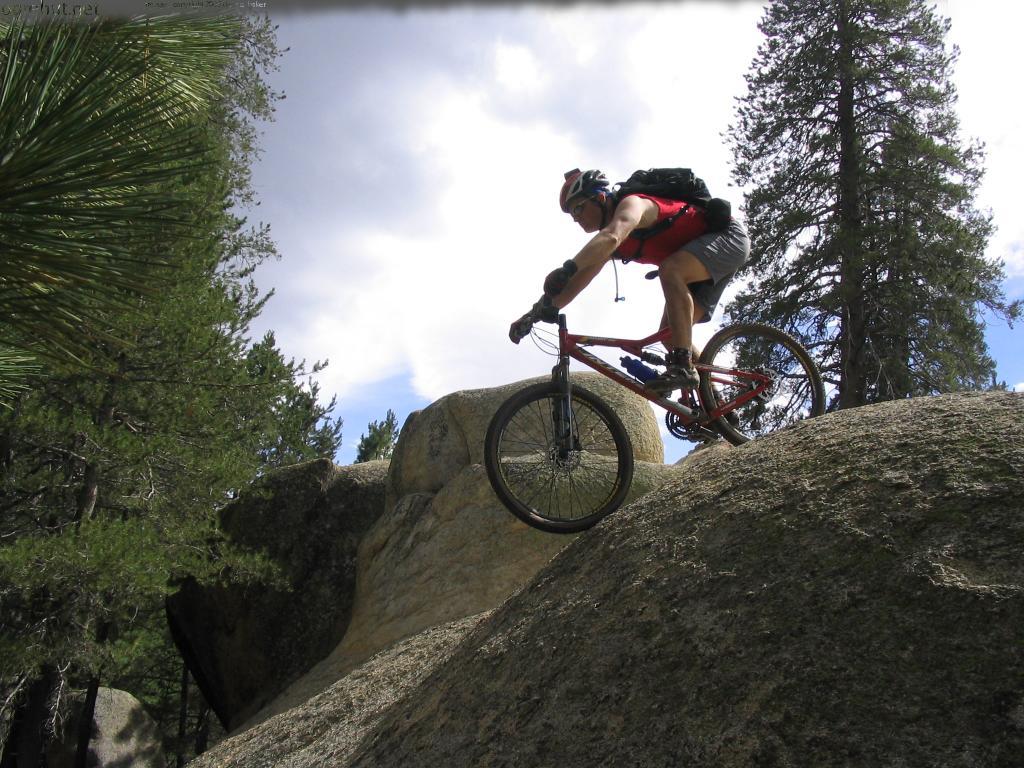
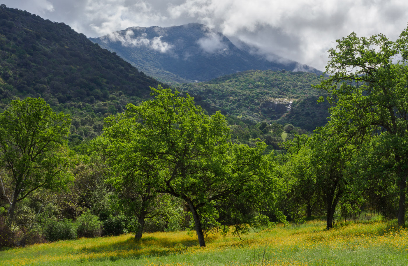
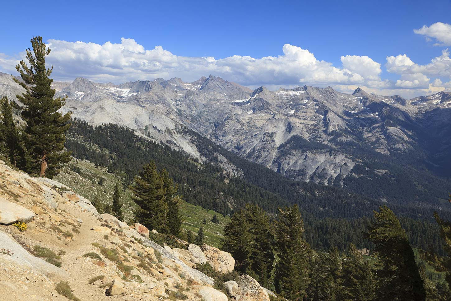
     The glorious Sequoia-Kings Canyon Wilderness is huge (over 800,000 acres) and dramatically diverse, with elevations ranging from under 2,000′ to 14,505′ atop Mt. Whitney, threaded by over 800 miles of challenging trails traveling from foothill oak woodlands through varied coniferous forest belts over high passes and along rushing creeks and rivers, through flower-bright meadows, past hundreds of lakes and tarns, into the alpine zone and up to the top of the tallest mountain in the 48 contiguous U.S. states. The scenery is spectacular, the night skies sublime, wildlife abounds, the experience is life-changing, indelible.

December, 2025

NOTE: The Project Team will be conducting research for a full article as volunteer time allows.  Contact us if you’d like to help research, write about, and/or illustrate this Treasure!  


Maps & Directions:


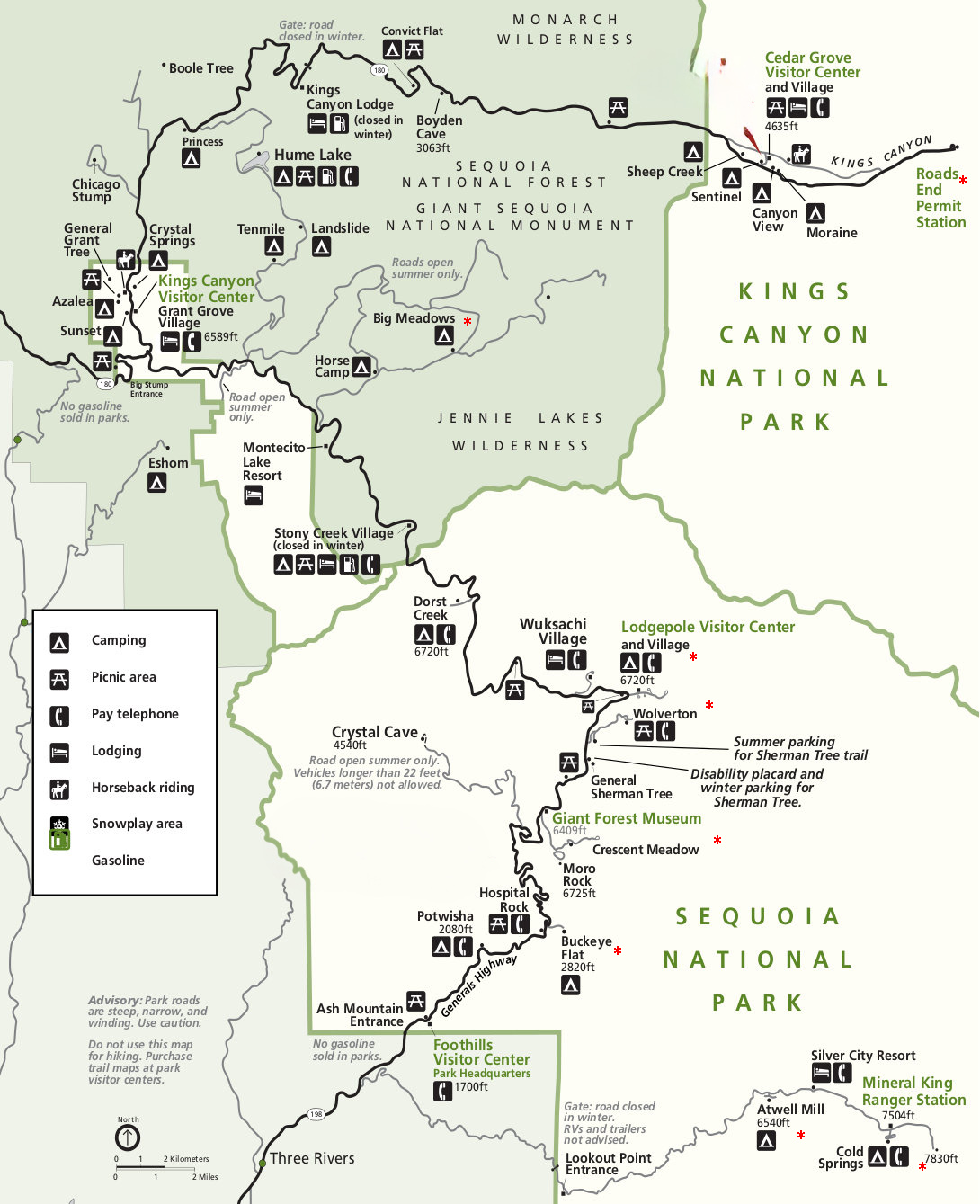
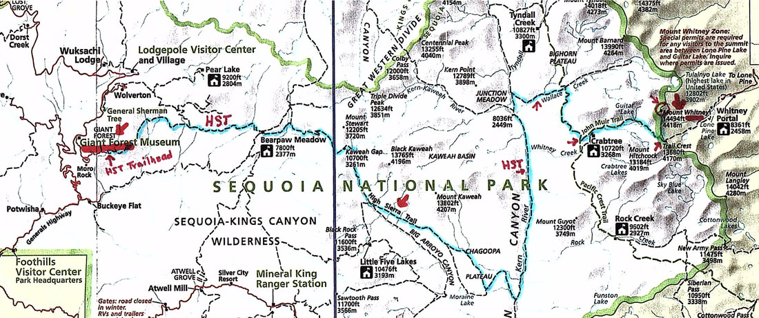
There are many points of access into the huge Sequoia-Kings Canyon Wilderness.  Here are most of the ones going north on, or not too far off, the Generals Highway:

From Visalia, go east on Hwy 198 through Three Rivers to the Sequoia National Park entrance station (fee), where Hwy 198 becomes the Generals Highway.  Stop at the Ash Mountain Visitors Center and Wilderness Office for maps, current conditions, and your Wilderness Permit.

Access points to the Sequoia-Kings Canyon Wilderness trailheads include: Buckeye Flat road off Hospital Rock; Crescent Meadow road’s end (in Giant Forest); Wolverton parking lots; Lodgepole parking lots; Forest Road 14S11 east to Big Meadows, Rowell Meadow, and Horse Corral to Marvin Pass trailhead for access via Jennie Lakes Wilderness; at the junction with Hwy 180 to Grant Grove, leave the Generals Highway and follow Hwy 180 down into Kings Canyon all the way to Roads End and trailheads there into the Wilderness.

You can also access this Wilderness from the Mineral King Road out of Three Rivers. There are trailheads at Atwell Mill, Cold Springs Campground, and road’s end in Mineral King.


Site Details & Activities:


Environment:  well over 800,000 acres, giant sequoia groves, extensive mixed conifer forests, lush meadows, creeks, rivers (including Wild and Scenic), waterfalls, lakes, tarns, vast areas above tree line, dozens of high peaks (including Mt. Whitney, the highest in the contiguous U.S., at 14,505′), huge canyons, wildflowers galore, wildlife at every elevation, over 800 miles of trails in all kinds of terrain (including about 100 miles of the John Muir Trail and the Pacific Crest National Scenic Trail, and all of the High Sierra Trail), and tremendous areas with no trails, for cross-country hikers seeking space, solitude, and the great gift of only natural sounds; carry good maps, plan your trip carefully and well in advance (Wilderness Permit required; quotas apply on many trails late May-late September)
Activities:  backpacking, birding, botanizing, camping, caving, hiking, history/historical sites, horseback riding and packing, kayaking, fishing (license required), mountaineering, photography, rock climbing, stargazing, wildflower and wildlife viewing (Wilderness Permit required for overnight stays; no pets allowed)
Open:  Sequoia and Kings Canyon National Parks are always open, weather permitting , except in emergency conditions; park entrance fee; Wilderness Permit required for overnighting; quotas apply on many trails, generally late May through late September, with Recreation fee required for entry during quota season; reservations may be made 6 months to 1 week before entry date; campfire permits may be required (NOTE that campfires are not permitted in some areas), maximum group sizes (including stock) apply.
Site Steward:  National Park Service, Sequoia and Kings Canyon National Parks, 559-565-3341; Wilderness Office, 559-565-3766
Opportunities for Involvement:  donate , volunteer, Sequoia Parks Conservancy
Links: Sequoia and Kings Canyon National Parks (NPS Site)
Visit Sequoia.com
Plan Your Visit, Permits, Current Conditions;
Sequoia Park Shuttle
Books:  1)  Challenge of the Big Trees – The Updated History of Sequoia and Kings Canyon National Parks,
by William C. Tweed and Lary M. Dilsaver (University of Virginia Press, 2017)
2)  Granite Pathways: A History of the Wilderness Trail System of Sequoia and Kings Canyon National Parks, by William C. Tweed (Sequoia Parks Conservancy, 2021)


Click on photo for more information.

Traveling the Pacific Crest Trail in Tulare County

by Laurie Schwaller

     The Pacific Crest Trail travels about 125 miles within Tulare County, from mile-high high-desert expanses in the south through the trail’s highest point, atop Forester Pass (13,200′), in the High Sierra — living up to its National Scenic Trail designation all the way.  With a shuttle set-up, you can hike Tulare County top to bottom (or vice-versa) on the PCT, or you can explore the PCT’s glorious TC landscapes in several shorter segments.  If you can’t hike the whole 2,600-mile PCT, you can experience much of the awesome best of it right here in Tulare County.

December, 2025


NOTE: The Project Team will be conducting research for a full article as volunteer time allows.  Contact us if you’d like to help research, write about, and/or illustrate this Treasure!  


Maps & Directions:

NOTE: There is no quick way to access the PCT from Visalia and the west side of the Sierra Nevada, but there are a number of ways to access it, depending on whether you want to thru-hike the Tulare County segment on it, or hike it in shorter segments.  Most of the options work better with a shuttle set-up, unless you don’t mind retracing your steps (since the views all look different when you’re going the other way, as may the weather and the wildlife).

For a bottom-to-top trip or vice-versa, logical trailheads to the PCT would be, in the south, at the Walker Pass trailhead on Hwy 178 (maybe 10 miles below the Tulare County line) or from the Chimney Creek Campground area (maybe 5 miles above the TC line) up from Canebrake Flat on Hwy 178 on Canebrake Road/Chimney Peak Backcountry Byway (see our Chimney Peak Wilderness page for details); 

and in the north from the Onion Valley trailhead (west of Independence/Hwy 395) for the Kearsarge Pass Trail going west to its junction with the PCT a few miles north of the Tulare County line (see our John Muir Trail page for details [the PCT joins the JMT for many miles in this area]).  You could also consider leaving your north-end vehicle at Road’s End in Kings Canyon and hiking the Bubbs Creek Trail east to join the PCT/JMT a few miles south of the Kearsarge Pass Trail.

Directions to start from the south: From Visalia, go west on Hwy 198 and then south on Hwy 99 toward Bakersfield.

At Delano, take Hwy 155 east (left) toward Glenville and Lake Isabella. Follow Hwy 155 as it goes south along the lake to its junction with Hwy 178.

Go left (east) on Hwy 178 for about 30 miles to the Canebrake Flat area where you’ll go left (north) on rugged, graded-dirt, high-clearance, 4-wheel-drive-vehicle recommended Canebrake Road toward Chimney Creek campground.  Approximately 9 miles up from Hwy 178 is the junction of Canebrake and Long Valley/Chimney Basin Roads.  Per BLM, the best on-trail access is approximately 1.6 miles north of this junction at a small Pacific Crest National Scenic Trail trailhead.

Alternatively, continue past Canebrake on Hwy 178 to the Walker Pass PCT trailhead (with nearby campground).

To start from segments farther north, continue east past Canebrake on Hwy 178 to its junction with Hwy 395 and go north (left) to access trails such as those listed below:

NOTE: Several trails other than (and south of) Kearsarge Pass enable access to the PCT from Hwy 395 on the east side of the Sierra, e.g., Kennedy Meadows (via Nine Mile Canyon), Olancha Pass (via Olancha/Sage Flat Rd.), Mulkey Pass and Cottonwood Lakes (from Lone Pine and Lubken Canyon Road), etc.

Wilderness permits are required for overnight trips, and there are specific rules for PCT long-distance permit holders on camping and exiting the PCT corridor. Be sure to check the regulations for the specific areas you plan to hike before you go.


Site Details & Activities:

Environment:  High Desert, Foothills, Mountains, cacti, sagebrush, chaparral, forests of various conifers, rivers, streams, cottonwoods and oaks in riparian zones, big meadows, lakes, high passes, huge canyons, major elevation gains and losses, optional summit of Mt. Whitney (elevation 14,505′);  always carry water and good Pacific Crest Trail maps
Activities:  backpacking, birding, botanizing, dogs (allowed on leash and constantly under owner’s control in BLM and National Forest lands, but not on National Parks trails or Wilderness), camping, hiking, history, horseback riding and packing, photography, stargazing, wilderness, wildflower and wildlife viewing;  this can be a very strenuous adventure with all kinds of weather: plan far ahead, be well informed, and prepare and pack carefully
Open:  The Pacific Crest Trail is always open, weather permitting, unless closed due to emergency conditions; park entrance fee; various permits required (depending on where you’re going)
Site Steward:  The PCT in Tulare County passes through segments managed by different Site Stewards, including the Bureau of Land Management (BLM), the National Forest Service, and Sequoia and Kings Canyon National Parks.  The PCT also merges with the John Muir Trail in the northern part of Tulare County.  These agencies and trails have varying regulations and requirements; get fully informed, secure all relevant maps and permits, and plan and prepare carefully well in advance of your trip!
Traveling the PCT in Tulare County, you’ll be hiking mostly on Wilderness land, managed by BLM, National Forest Service, and Sequoia and Kings Canyon National Parks.
Opportunities for Involvement:  donate , volunteer, Sequoia Parks Conservancy, volunteer.gov
Links:
Pacific Crest Trail Association:
https://www.pcta.org/     Read this website thoroughly. Too much info to show here, but here’s a little start; then keep reading (this is your gateway):
BLM (Bureau of Land Management) information:
National Forest Service:
Sequoia and Kings Canyon National Parks information:
Plan Your Visit, Permits, Current Conditions;
Plan YourVisit/Wilderness Permits
Current Trail Conditions
Books and Maps:
Many books and maps about hiking the PCT are advertised and commented on online.  (There are also many blogs and videos about hiking the PCT.)  Be well informed and prepared; a successful hike on the PCT takes careful planning and conditioning well in advance of your wonder-full journey.  Hike your hike!


Click on photo for more information.

Owens Peak Wilderness

by Laurie Schwaller

     Owens Peak, at 8,445′ the highest in the southern Sierra Nevada, rises in the center of its rugged 73,767-acre namesake wilderness. Here, the Great Basin, Mojave Desert, and Sierra Nevada ecoregions converge, providing a great diversity of plant life — from desert creosote, yucca, and cacti to numerous forested peaks — as well as two distinct climate zones, plenty of wildlife, vast views, and very starry night skies. Big canyons host springs, oaks, and cottonwoods. Trails include a stretch of the PCT and many use trails, such as peakbaggers’ routes to various summits. While summers are very hot here, conditions in the shoulder seasons are inviting, and spring wildflower shows after good rains can be amazing

November, 2025

NOTE: The Project Team will be conducting research for a full article as volunteer time allows.  Contact us if you’d like to help research, write about, and/or illustrate this Treasure!  


Maps & Directions:


NOTE: There is no quick way to get to Owens Peak Wilderness from Visalia and the west side of the Sierra Nevada.

From Visalia, go west on Hwy 198 and then south on Hwy 99 toward Bakersfield.

At Delano, take Hwy 155 east (left) toward Glenville and Lake Isabella.

Follow Hwy 155 as it goes south along the lake to its junction with Hwy 178.

Go left (east) on Hwy 178 for about 30 miles to the Canebrake Flat area, where you’ll go left (north) on rugged, graded-dirt, high-clearance, 4-wheel-drive-vehicle-recommended Canebrake Road (AKA Chimney Peak Backcountry Byway) toward Chimney Creek campground.

Owens Peak Wilderness will be all along the right side of this road.  There’s PCT access about 2 miles south of the campground.


Site Details & Activities:

Environment: Wilderness, 73,767 acres, rugged topography, high desert to forested peaks (Owens Peak 8,445′), big canyons with springs and riparian habitat, Pacific Crest National Scenic Trail segment; bordered by Chimney Peak Wilderness on the west.
Activities: backpacking, birdwatching, botanizing, camping (free campfire permit required for gas lanterns, stoves, and campfires), dogs must be on leash and under owner’s control at all times and must not harass wildlife, fishing (with valid licenses and in compliance with state and local regulations), hiking (including Pacific Crest National Scenic Trail segment), horseback riding and packing, hunting (seasonal, with valid licenses and in compliance with state and local regulations), mountaineering, peakbagging, photography, stargazing, wildflower and wildlife viewing (NOTE: Always carry a good map and plenty of water; water sources are unreliable; filter water in Wilderness; watch for rattlesnakes and ticks.)
Open: The Wilderness is always open, depending on weather, except when closed due to emergency conditions.
Site Steward: Bureau of Land Management, Ridgecrest Field Office; 760-384-5400; BLM_CA_Web_RI@blm.gov
Opportunities for Involvement: Visit volunteer.gov or reach out to your local BLM office for information on opportunities near you.
Links:


Click on photos for more information.

Visiting the John Krebs Wilderness

by Laurie Schwaller

     Sequoia National Park’s 39,740 acre John Krebs Wilderness abounds with spectacular scenery, high peaks and passes, sparkling lakes and rushing streams, forests of aspen and conifers, giant sequoia groves, glorious skies both night and day, wonderfully diverse wildlife and wildflowers, challenging trails, and a roller-coaster history including the U.S. Cavalry, vagrant sheep, silver mines, cabin owners, a game refuge, recreationists, lumber and power companies, Walt Disney, environmentalists, a landmark Supreme Court case, and an arduous journey to becoming part of Sequoia National Park and a designated Wilderness. Two campgrounds and pie are nearby!

November, 2025

NOTE: The Project Team will be conducting research for a full article as volunteer time allows.  Contact us if you’d like to help research, write about, and/or illustrate this Treasure!  

John Krebs Wilderness

Maps & Directions:

From Visalia, go east on Hwy 198 through most of Three Rivers to the marked turn-off to the right onto Mineral King Road and follow that narrow, steep, winding road up to your trailhead. (Stay left on Mineral King Road at the junction with Hammond Rd. ) RVs and trailers are not recommended on Mineral King Rd. Drive cautiously and yield to oncoming traffic.

About 12-13 miles up Mineral King Rd. there is a National Park Service self-service fee station at Lookout Point.

There are trailheads at Atwell Mill, Cold Springs Campground, and road’s end in Mineral King. Wilderness Permit required for overnight visits in the Wilderness.

NOTE: Mineral King Road is closed below Lookout Point in winter. The road is open all the way to Mineral King Valley usually from about Memorial Day to mid-October, depending on weather. For road status and advisories, call 559-563-3341, then press 1, 1, 1.

NPS Advisory: Secure your vehicle from invasive, wire-chewing marmots by driving over a tarp and then wrapping it around your entire vehicle; cover the wheel wells. Don’t wrap with chicken wire, as marmots have learned to get around the wire. See https://www.nps.gov/seki/planyourvisit/marmots.htm


Site Details & Activities:

Environment: mostly steep; Foothills, Mountains, National Park, Wilderness, historical and cultural landscape; oak-dotted foothills, dense chaparral, riparian areas along perennial streams and the South and East forks of the Kaweah River, big canyons, six giant sequoia groves, aspen groves, extensive coniferous forests, big meadows, about 20 lakes, many peaks – some over 12,000′, sensational views from all trails (and off), abundant wildlife, highly diverse plant life, marvelous night skies, wonderfully accessible wilderness
Activities: backpacking, birding, botanizing, camping, caving, hiking, history/historical sites, horseback riding and packing, fishing (license required), mountaineering, photography, rock climbing, stargazing, wildflower and wildlife viewing (no mechanized/motorized equipment and no pets allowed in Wilderness)
Open: Sequoia and Kings Canyon National Parks are always open, weather permitting , except in emergency conditions; park entrance fee; Wilderness Permit required for overnight visits; quotas apply on many trails, generally late May through late September, with Recreation fee required for entry during quota season; reservations may be made 6 months to 1 week before entry date; campfire permits may be required (NOTE that campfires are not permitted in some areas), maximum group sizes (including stock) apply.
Site Steward: National Park Service, Sequoia and Kings Canyon National Parks, 559-565-3341; Wilderness Office, 559-565-3766
Opportunities for Involvement: donate, volunteer, Sequoia Parks Conservancy
Links: Sequoia Kings Canyon National Parks (NPS Site); Visit Sequoia.com; Plan Your Visit, Permits, Current Conditions;
Mineral King Preservation Society
Mineral King Webcam
Sequoia Kings Canyon Lodging
Books: 1) Challenge of the Big Trees -The History of Sequoia and Kings Canyon National Parks, rev. edition, by William C. Tweed and Lary M. Dilsaver (University of Virginia Press, 2017)
2) Granite Pathways: A History of the Wilderness Trail System of Sequoia and Kings Canyon National Parks, by William C. Tweed (Sequoia Parks Conservancy, 2021)


Click on photos for more information.

Visiting Jennie Lakes Wilderness

by Laurie Schwaller

     Readily accessible from four trailheads, Sequoia National Forest’s 10,500 acre Jennie Lakes Wilderness offers 26 miles of hiking trails, beautiful lakes (Jennie and Weaver are the largest), perennial streams, lovely meadows, extensive coniferous forests, rocky peaks (especially 10,365′ Mitchell Peak) affording great views, beckoning spring wildflowers, watchable wildlife, and trail access to Sequoia and Kings Canyon National Parks’ backcountry (Wilderness permit required for travel into the Parks).  Jennie Lakes Wilderness lies almost entirely above 7,000′, so it’s refreshingly cool in summer; winter access is limited by road closures and its steep, snowy terrain.

November, 2025

NOTE: The Project Team will be conducting research for a full article as volunteer time allows.  Contact us if you’d like to help research, write about, and/or illustrate this Treasure!  


Jennie Lakes Wilderness


Maps & Directions:

 From Visalia, take Hwy 198 east through Three Rivers to the Sequoia National Park entrance station (fee), where the road becomes the Generals Highway. Follow it through Sequoia National Park and into Sequoia National Forest. Soon after the sign for Montecito Sequoia Camp, watch on your right for Big Meadows Forest Service Road (14S11). Take this road for about 5 miles to the Big Meadows trailhead (hiking trail 29E03) for a moderate to strenuous hike into the Jennie Lakes Wilderness. For the Rowell Meadows Trailhead (12 miles off of the Generals Highway), follow Big Meadows Road (14S11) and turn right onto Forest Road 13S14 for 2.5 miles to the trailhead (trail 30E08) providing an easy to moderate hike into the Wilderness. For the Marvin Pass trailhead (13 miles off of Generals Hwy), follow Big Meadows Road (14S11) and turn right onto Forest Road 13S12 for 2 miles to the trailhead (trail 30E06) providing an easy to moderate hike into the Wilderness.

Alternatively, from Visalia, take Hwy 63 north to go east (right) on Hwy 180 to the Big Stump entrance station (fee) to Kings Canyon National Park. At the upcoming “Y” junction, go right onto the Generals Highway, and then left (east) onto Big Meadows Forest Service Road (14S11). Proceed per directions above to the 3 trailheads.

The fourth trailhead (Stony Creek, trail 29E06), which is significantly the steepest, is located off the Generals Highway at the far end of Upper Stony Creek campground, which is located just a bit north of the small Stony Creek development near the south end of the Generals Highway segment in Sequoia National Forest. Turn east off the Generals Highway to access Upper Stony Creek campground and the trailhead.


Site Details & Activities:

Environment:  Mountains, elevations about 7,000′ to 10,365′ (on Mitchell Peak), mixed conifer forests, six lakes, meadows, perennial streams, deep Boulder Creek canyon, 26 miles of trails
Activities:  backpacking, birdwatching, botanizing, camping (free campfire permit required for gas lanterns, stoves, and campfires), dogs must be kept on 6′ leash under your control and must not harass wildlife , fishing (with valid licenses and in compliance with Federal, state, and local regulations), hiking, horseback riding and packing (maximum 15 people and 25 head of stock allowed on overnight trips), hunting (with valid licenses and in compliance with Federal, state, and local regulations), photography, rock climbing, wildflower and wildlife viewing (NOTE: hunting is NOT allowed in Sequoia and Kings Canyon National Parks, and dogs are NOT allowed in Sequoia and Kings Canyon National Parks Wilderness areas.)
Open:  The Wilderness is always open, depending on weather, except when closed due to emergency conditions. NOTE: A Wilderness permit is not required to enter Jennie Lakes Wilderness, but IS required to enter Sequoia and Kings Canyon National Parks Wilderness areas. Permit (free) required for campfires (campfires may be prohibited, depending on fire danger). All mechanized/motorized vehicles and equipment are prohibited in the Wilderness. Maximum group size: 15 people/25 head of stock per party. Leave No Trace.
Site Steward:  USDA, Sequoia National Forest, Hume Lake Ranger District, 559-338-2251
This Wilderness can be accessed from four Sequoia National Forest trailheads, and also from trailheads in Sequoia National Park and Kings Canyon National Park.
Opportunities for Involvement:  Visit volunteer.gov or reach out to your local National Forest office for information on opportunities near you.
Links: Jennie Lakes Wilderness Detailed Information: https://www.fs.usda.gov/r05/sequoia/recreation/jennie-lakes-wilderness


Click on photos for more information.

Sequoia National Park’s Incomparable High Sierra Trail

by Laurie Schwaller

     Sequoia National Park’s fabulously scenic High Sierra Trail, “the most ambitious trail ever built by the National Park Service in the southern Sierra,” leads you in 62 rugged, up and down miles from lush, giant-sequoia-ringed Crescent Meadow, elevation 6700′, to the all-rock top of Mt. Whitney at 14,505′, the highest point in the lower 48 states. (It’s about 75 miles if you hike on down the east side to road’s end at Whitney Portal.) Built in 1928-1932, this classic, incomparable trail challenges and rewards its travelers with sights and experiences they never forget.

November, 2025

NOTE: The Project Team will be conducting research for a full article as volunteer time allows.  Contact us if you’d like to help research, write about, and/or illustrate this Treasure!  

High Sierra Trail from Giant Forest to Mount Whitney Summit


Maps & Directions:

From Visalia, go east on Hwy 198 through Three Rivers to the Sequoia National Park entrance station (fee), where Hwy 198 becomes the Generals Highway. About a mile up the road, stop at the Wilderness Office near the Foothills Visitor Center to pick up your required Wilderness Permit for the High Sierra Trail (see Links in the Site Details section below). Continue up the mountain on the Generals Highway to just before the Giant Forest Museum and turn right onto the Moro Rock/Crescent Meadow Road. Follow it to its end at the Crescent Meadow parking lot. Find the HST trailhead sign near the restroom.

HST hikers typically make this a shuttle trip. Most travel the HST from west to east, culminating in summiting Mt. Whitney, then descending the 11-mile trail to Whitney Portal on the east side to meet a vehicle that will take them home (or back to the car they left at the start of their trek).

NOTE: You must obtain a Wilderness permit for the High Sierra Trail before you hike it. If you wish to complete your trip by hiking out down the east side to Whitney Portal, the Inyo National Forest will accept your Wilderness permit issued by Sequoia National Park as long as you meet the requirements for continuous wilderness travel.

(See our Smithsonian Shelter on Mt. Whitney page for a sketch map of the trail down to Whitney Portal.)


Site Details & Activities:

Environment:  Mountains, forests, rivers, streams, lakes, high passes, huge canyons, major elevation gains and losses, summit of Mt. Whitney (elevation 14,505′); carry good High Sierra Trail maps
Activities:  backpacking, birding, botanizing, camping, hiking, history, photography, stargazing, wilderness, wildflower and wildlife viewing; this is a very strenuous adventure: plan it far ahead and prepare and pack carefully
Open:  Sequoia and Kings Canyon National Parks are always open, weather permitting, unless closed due to emergency conditions; park entrance fee; High Sierra Trail Wilderness Permit required
Site Steward:  National Park Service, Sequoia National Park, 559-565-3341
Opportunities for Involvement:  donate , volunteer, Sequoia Parks Conservancy
Links:
Plan Your Visit, Permits, Current Conditions;
Sequoia Kings Canyon Lodging;
Sequoia Park Shuttle;
Plan YourVisit/Wilderness Permits
Current Trail Conditions
high_sierra_trail_gentle_ribbon_of_rock Excellent film on the planning and construction of the High Sierra Trail, narrated by WilliamTweed; see it on You Tube
Books:  1)  Granite Pathways: A History of the Wilderness Trail System of Sequoia and Kings Canyon National Parks, by William C. Tweed (Sequoia Parks Conservancy, August, 2021)
2)  A number of books about hiking the HST are advertised online. (There are also many blogs and videos about hiking the HST.) Be informed and prepared; a successful hike on the HST takes careful planning and conditioning well in advance of your journey.
See also: high_sierra_trail_gentle_ribbon_of_rock  Excellent film on the planning and construction of the High Sierra Trail, narrated by WilliamTweed; on You Tube


Click on photo for more information.

Traveling the John Muir Trail in Tulare County

by Laurie Schwaller

     The epic grand finale of the John Muir Trail is its spectacular last 25 miles in Tulare County, all above 10,000′, culminating in summiting 14,505′ Mt. Whitney, highest peak in the contiguous 48 states. This sensational home stretch includes the climb over Forester Pass, at 13,200′ the highest on the JMT, marvelous meadows, numerous lakes and rushing creeks, vast vistas on the Bighorn Plateau, diverse coniferous forests, plentiful wildlife, wonderful wildflowers, precipitous peaks and beautiful basins, brilliant night skies, and soul-filling days in John Muir’s Range of Light. A journey of a lifetime experience.

                                                                                                                                                                                                                   November 2025

NOTE: The Project Team will be conducting research for a full article as volunteer time allows.  Contact us if you’d like to help research, write about, and/or illustrate this Treasure!


John Muir Trail – The Grant Finale

Maps & Directions:

The quickest way to get to the JMT in Tulare County is to drive to the other side of the Sierra and hike west to the JMT. A recommended route for hiking this epic section of the JMT is to access the JMT via Kearsarge Pass and to leave your hike via Whitney Portal. This requires a 2-vehicle shuttle arrangement, with one vehicle for your trip home available at Whitney Portal on your exit day and the other vehicle delivering you to Onion Valley.

Wilderness Permit required. There are quotas on this trail, so reserve it well in advance via Recreation.gov (see https://www.recreation.gov/permits/233262 Inyo National Forest Wilderness Permits if you’re entering the Wilderness via Kearsarge Pass trail; specify Mt. Whitney Trail Crest exit). Try 6 days for this approximately 75 mile hike (giving yourself an overnight at one of the campgrounds coming down from Trail Crest to Whitney Portal; your knees and feet will thank you!).  

Directions:

From Visalia, go west on Hwy 198 to Hwy 99 south to Bakersfield and take Hwy 58 East over Tehachapi and down to the junction with Hwy 14. Go north on Hwy 14 to Hwy 395 north to Lone Pine, then take Whitney Portal Road about 13 miles to the parking area near the JMT trail (this road is usually open from May to early November).

To proceed to Onion Valley, return to Lone Pine and continue north on Hwy 395 about 16 miles to Independence (note that a commercial shuttle can be arranged also). In Independence, go left (west) on Market Street, which soon becomes Onion Valley Road, about 14 miles to Onion Valley and the Kearsarge Pass trailhead. Elevation at Onion Valley is about 9,200′-9,600′. Spend the night in the campground there to start getting acclimated if you can. Trailhead is at 9,200′; Kearsarge Pass is at 11,709′, where it enters Kings Canyon National Park. (Onion Valley Road is closed due to snow from approximately November to April.)


Site Details & Activities:

Environment: Mountains, mostly above 10,000′, diverse conifer forests, meadows, many lakes and tarns, rushing creeks, waterfalls, towering granite walls and peaks, almost barren Bighorn Plateau, abundant wildlife and wildflowers, challenging trails, superb scenery, highest pass (13,200′) on the JMT, exhilarating summit of Mt. Whitney (14,505′); Inyo National Forest, Kings Canyon National Park, and Sequoia National Park
Activities: backpacking, birding, botanizing, camping, hiking, history/historical sites, fishing (license required), mountaineering, photography, rock climbing, stargazing, wildflower and wildlife viewing (no mechanized/motorized equipment and no pets allowed in Wilderness)
Open: Inyo National Forest and Sequoia and Kings Canyon National Parks are always open, weather permitting , except in emergency conditions; Wilderness Permit required for overnight visits; quotas apply on many trails, generally late May through late September, with Recreation fee required for entry during quota season; reservations may be made 6 months to 1 week before entry date; campfire permits may be required (NOTE that campfires are not permitted in some areas), maximum group sizes (including stock) apply.
Site Stewards: Inyo National Forest, 760-876-6200 (reserve your Wilderness Permit via Recreation.gov ; see Link below); National Park Service, Sequoia and Kings Canyon National Parks, 559-565-3341; Wilderness Office, 559-565-3766
Opportunities for Involvement: donate, volunteer, Sequoia Parks Conservancy
Links: There are many books and online sources of information about hiking the John Muir Trail. Read as much as you can, plan thoroughly and far ahead of your trip time, study the permit system and hope you can get the dates that you want. Be prepared to be flexible. This hike is worth it.
Kearsarge Pass Trail to JMT: https://www.fs.usda.gov/sites/nfs/files/legacy-media/inyo/ROG%20Kearsarge%20Pass%20Trail.pdf
Wilderness Permit for Kearsarge Pass Trail entry through Whitney Portal Trail exit: www.recreation.gov/permits/233262 Inyo National Forest Wilderness Permits (be sure to select Overnight Exiting Mt. Whitney)
Sequoia Kings Canyon National Parks (NPS Site)


Click on photo for more information.

Visiting the Domeland Wilderness

by Laurie Schwaller

     Spectacularly diverse Domeland Wilderness, in southeastern Tulare County, offers outdoor adventurers 45 miles of trails (with 7 miles of the Pacific Crest National Scenic Trail) into over 130,000 acres of overlapping ecosystems (elevations ranging from 2,800′ to 9,977′) including the Wild and Scenic South Fork of the Kern River, deep gorges, perennial streams, big meadows, pine forested mountains, high desert areas, abundant wildlife, striking granite outcroppings, and namesake huge smooth domes that are magnets for rock climbers, hikers, backpackers, equestrians, fisher folk, birdwatchers, botanizers, and lovers of wild spaces, marvelous night skies, and solitude.

November, 2025


NOTE: The Project Team will be conducting research for a full article as volunteer time allows.  Contact us if you’d like to help research, write about, and/or illustrate this Treasure!  


Maps & Directions:


lat/long: 35.79541389, -118.1397 (BLM)


Directions: NOTE: There is no quick way to get to Domeland from our side of the Sierra.


From Visalia, go east on Hwy 198 and exit right onto Hwy 65 south toward Porterville. At Porterville, exit onto Hwy 190 east toward Springville. Continue on Hwy 190 as it curves south as the Western Divide Highway and eventually reaches the junction with Forest Road 23S03.

Take this Forest Road to Johnsondale and continue east onto FR 22S06 (Sherman Pass Road) to exit south on FR 22S12 to the trailheads for Manter Meadow and Rockhouse Meadow; or go farther east on Sherman Pass Road to get to trails entering this Wilderness from the north.


Site Details & Activities:

Environment:  130,081 acres, rugged topography, elevation 2,800′ – 9,977′, pinyon and mixed conifer forests, perennial streams, Wild and Scenic South Fork Kern River, many granite domes and outcroppings, overlapping ecosystems supporting unique plant and animal communities, large meadows, riparian habitats, brilliant night skies, about 45 miles of trail
Activities:  backpacking, birdwatching, botanizing, camping (free campfire permit required for gas lanterns, stoves, and campfires), dogs must be kept on 6′ leash and must not harass wildlife, fishing (with valid licenses and in compliance with state and local regulations), hiking (including 7 miles of Pacific Crest National Scenic Trail, along the valley of the South Fork Kern River, with the Rockhouse Trail continuing 4 more miles along the river), horseback riding and packing, hunting (with valid licenses and in compliance with state and local regulations), mountaineering, photography, rock climbing, stargazing, wildflower and wildlife viewing (watch for rattlesnakes, especially in the river area)
Open:  The Wilderness is always open, depending on weather, except when closed due to emergency conditions; low water levels and very hot temperatures in the summer
Site Stewards:  Sequoia National Forest, Kern River Ranger District, 760-376-3781 (94,081 acres, western portion);
Bureau of Land Management, Bakersfield Field Office; 661-391-6000; BLM_CA_Web_BK@blm.gov (36,000 acres, eastern addition)
This Wilderness can be accessed from numerous Sequoia National Forest trailheads, and several more remote BLM trailheads.
Opportunities for Involvement:  Visit volunteer.gov or reach out to your local National Forest or BLM office for information on opportunities near you.
Links:  Domeland Wilderness – Forest Service, https://www.fs.usda.gov/r05/sequoia/recreation/domeland-wilderness
Domeland Wilderness – Bureau of Land Management, www.blm.gov/visit/domeland.wilderness


Click on photo for more information.

Visiting the Dillonwood Grove and Dillon Mill Site in Sequoia National Park

by Laurie Schwaller


     In 2001, the 1540-acre Dillonwood Giant Sequoia Grove and its historic Dillon Mill remains became part of Sequoia National Park, reuniting Dillonwood with its other half, the Garfield Grove, which had been protected in the park since its establishment in 1890.  Straddling the north and south flanks of Dennison Ridge respectively, Garfield and Dillonwood comprise one of the five largest of all the Big Tree groves.  But these two halves have very different histories: privately vs. publicly owned, logged vs. unlogged, almost unscathed vs. recently badly burned (NPS is planting restoration seedlings in the Dillonwood grove in 2025) — providing tremendous research opportunities and very different visitor experiences, with hope that Dillonwood may once again thrive anew.

November, 2025

NOTE: The Project Team will be conducting research for a full article as volunteer time allows.  Contact us if you’d like to help research, write about, and/or illustrate this Treasure!  


Maps & Directions:

NOTE: Dillonwood is hard to get to, and two extreme wildfires have destroyed almost all the remains of the mill structures and many of the trees, so you may want to delay visiting until some restoration results can be seen. You’ll need a high-clearance, 4-wheel-drive vehicle to reach the National Park’s closed gate, beyond which you’ll have to walk a few miles to get into the Dillonwood grove. [NEED TO TALK TO PARK PEOPLE RE THIS PART.]

The shortest driving route to Dillonwood is via Yokohl Drive/M-296 to its junction with Balch Park Drive, but it’s probably faster to go the longer route through Springville:

From Visalia, go east on Hwy 198 to take Hwy 65 south near Exeter down to Porterville. There, take Hwy 190 east to Springville. Go through Springville to the really big white barn on your left, where you will go left (north) onto Balch Park Dr./Rd. J37.  At the junction with Yokohl Drive, stay right on Balch Park Dr. until you go straight onto Forest Road 19S09 (instead of taking Balch Park Dr. on a sharp right toward Mountain Home/Balch Park).  This is where you’ll need high-clearance four-wheel-drive to get to the Park’s locked gate, beyond which you’ll have to hike a few miles to get into what’s left of the Dillonwood Grove and the remaining fragments of Dillon’s mill. NEED TO ASK SNP RE THIS.

Nearby Treasures: Mountain Home Demonstration State Forest, Balch Park, SCICON, McCarthy Blue Oak Ranch Preserve, River Ridge Ranch and Institute, Springville Historical Museum, Success Lake, Bartlett Park.


Site Details & Activities:

Environment: Mountains, 5400′-8000′, resilient giant sequoia forest (repeatedly logged for a century, added to Sequoia National Park in 2001), source of the North Fork of the Tule River, creeks, meadows, cultural resources – Native American activity sites, site of the large Dillon’s sawmill and extensive logging operation, followed by the Dillon Wood Corporation, extensive regrowth of young sequoias after logging ceased followed by devastating wildfires in 2020 and 2021
Activities: birding, botanizing, hiking (mostly cross-country, virtually no trails), history, photography, wildflower and wildlife viewing (NOTE: no facilities at Dillonwood; water in creeks, etc. must be purified before drinking]
Open: daily, weather permitting, except in emergency conditions (note that you cannot drive all the way to Dillonwood; the Park gate is locked, so you must hike the last few miles up to the grove area)
Site Steward: National Park Service, Sequoia National Park, 559-565-3341
Opportunities for Involvement: donate , volunteer, Sequoia Parks Conservancy
Links: Sequoia and Kings Canyon National Parks (NPS Site); Visit Sequoia.com; Plan Your Visit, Permits, Current Conditions
Books: 1) Challenge of the Big Trees -The Updated History of Sequoia and Kings Canyon National Parks, by William C. Tweed and Lary M. Dilsaver (University of Virginia Press, 2017)
2) A Guide to the Sequoia Groves of California, by Dwight Willard (Yosemite Association, 2000)
3) King Sequoia: The Tree That Inspired a Nation, Created Our National Park System, and Changed the Way We Think about Nature, by William C. Tweed (Heyday, 2016)
54 The Men of Mammoth Forest: A Hundred-year History of a Sequoia Forest and its People in Tulare County, California, by Floyd L. Otter, 1963 (printed by BookCrafter’s, Inc., 1963, 1964, 1976, 1982, 1986, 1995)


Click on photo for more information.

Visiting Chimney Peak Wilderness

by Laurie Schwaller

     Tulare County’s southeast corner contains most of rugged, scenic Chimney Peak Wilderness:  over 13,000 acres of pinyon pine covered mountains (Chimney Peak reaches almost 8,000′), occasional springs and streams supporting lusher riparian areas (find trout in Chimney Creek), desert plants including Joshua trees and creosote bushes in the lower elevations, and sage brush in between, home to bears, mule deer, bobcats, mountain lions, wonderful wildflowers (seasonally), and plenty of solitude — plus eight miles of the Pacific Crest National Scenic Trail, and the Chimney Peak Backcountry Byway along its boundary line.

November, 2025

NOTE: The Project Team will be conducting research for a full article as volunteer time allows.  Contact us if you’d like to help research, write about, and/or illustrate this Treasure!  


Maps & Directions:


From Visalia, go west on Hwy 198 and then south on Hwy 99 toward Bakersfield. At Delano, take Hwy 155 east (left) toward Glenville and Lake Isabella. Follow Hwy 155 as it goes south along the lake to its junction with Hwy 178. Go left (east) on Hwy 178 for about 30 miles to the Canebrake Flat area where you’ll go left (north) on rugged, graded-dirt, high-clearance, 4-wheel-drive-vehicle-recommended Canebrake Road (AKA Chimney Peak Backcountry Byway) toward Chimney Creek campground.

Approximately 9 miles up from Hwy 178 is the junction of Canebrake and Long Valley/Chimney Basin roads.* Chimney Peak Wilderness is on the left as you continue on Canebrake Road or on the right if you continue onto Long Valley/Chimney Basin Road.

*NOTE: Per BLM, best on-trail access to Chimney Peak Wilderness is on Canebrake Road approximately 1.6 miles north of the prominent junction of Canebrake Road and Long Valley/Chimney Basin Road at a small Pacific Crest National Scenic Trail trailhead


Site Details & Activities:

Environment: 13,140 acres, rugged topography, elevation 5,246′-7,951′, pinyon-covered rocky mountains, canyons, sagebrush, scattered springs and streams with riparian habitats, Mojave Desert plants (e.g., Joshua trees and creosote bushes on valley floors, foothills, and alluvial fans), and overlapping ecosystems, includes about 8 miles of the Pacific Crest National Scenic Trail; Chimney Peak Wilderness is bordered by Domeland Wilderness on the west and Owens Peak Wilderness and Sacatar Trail Wilderness on the east
Activities: backpacking, birdwatching, botanizing, camping (free campfire permit required for gas lanterns, stoves, and campfires), dogs must be under owner’s control at all times and must not harass wildlife, fishing (with valid licenses and in compliance with state and local regulations), hiking (including 7 miles of Pacific Crest National Scenic Trail, along the valley of the South Fork Kern River, with the Rockhouse Trail continuing 4 more miles along the river), horseback riding and packing, hunting (seasonal, with valid licenses and in compliance with state and local regulations), mountaineering, photography, rock climbing, wildflower and wildlife viewing
Open: The Wilderness is always open, depending on weather, except when closed due to emergency conditions.
Site Steward: Bureau of Land Management, Bakersfield Field Office; 661-391-6000; BLM_CA_Web_BK@blm.gov (36,000 acres)
Opportunities for Involvement: Visit volunteer.gov or reach out to your local BLM office for information on opportunities near you.
Links:
BLM Chimney Peak Wilderness Information
BLM Chimney Creek Campground Information
Additional Chimney Peak Wilderness Information


Click on photo for more information.

Cannell Meadow National Recreation Trail, Sequoia National Forest

by Laurie Schwaller

     Sequoia National Forest’s super scenic Cannell Meadow National Recreation Trail runs south 23.7 rugged miles from 9200′ elevation at Sherman Pass on Tulare County Road J-41/FR 22S05 to about 2600′ just south of our county line above Kernville and Lake Isabella. Open year-round (check for snow closures in winter; Sherman Pass Road is likely to close sometime in November until late May/early June), no fee or permit required (except free permit required for campfires), for backpacking, birding, camping, hiking, horseback riding, and mountain biking (middle section closed to mechanized/motorized use), this challenging trail travels through mixed pine and fir forests, meadows, and chaparral, with plenty of major ups and downs, ending in its epic 9-mile-long, 5,000′ Plunge.

October. 2025

NOTE:  The Project Team will be conducting research for a full article page as volunteer time allows.  Contact us if you would like to help research, write about, and/or illustrate this Treasure!


Maps & Directions:

There is no quick way to get to the Cannell Meadow National Recreation Trail’s top end, on Sherman Pass Road, and you will likely want to arrange a shuttle to meet you at the south end, above Kernville and Camp Owen, on Rd M99/Sierra Way, at the Cannell Meadow trailhead (trail #33E32). These are long and winding roads over the Greenhorn Mountains .

From Visalia, take Hwy 198 east to Hwy 65 south past Porterville to Ducor. Go east (left) from Ducor on Sierra Ave./M-56/Hot Springs Drive through Fountain Springs and California Hot Springs to the junction with Rd 23S03 over Parker Pass to Johnsondale. (Do not go left [north] onto the Forest Hwy/Western Divide Hwy; continue east on Rd 23S03 and Kern River Hwy to Johnsondale.) Continue east on Kern River Hwy out of Johnsondale to the junction (just after you cross the bridge over the Kern River) with Rd 22S05/Sherman Pass Road and follow Sherman Pass Road to Sherman Pass Vista and the trail start (trail #33E32).

Sherman Pass Road is typically open late May/early June through mid-to-late November; check road conditions before your trip.

To get to the southern end of the trail, from Visalia, take Hwy 198 east to Hwy 65 south past Ducor to its junction with Hwy 155. Go east (right) on Hwy 155 to Wofford Heights, then north (left) on Hwy 495 to where you will cross the river to go north (left) up Hwy M99/Sierra Way past Camp Owen to the Cannell Meadow trailhead (trail #33E32) on your right; park beside road 33E32.


Site Details & Activities:

Environment: Varies widely with elevation: mixed pine and fir forest, lush meadows, creek crossings, arid hillsides, chaparral, lots of rock; trail is not paved and mostly rugged; the first 17 miles from the top end are all above 7000′; there are no “bail-out” points, and there is little to no cell service; carry a detailed map, food, water, and first aid kit.
Activities: backpacking, birding, botanizing, camping, (dogs not recommended on this trail; dogs must be on 6′ leash; poop must be scooped), hiking, horseback riding, photography, mountain biking, wildflower and wildlife viewing (NOTE: no water is available on the trail [any water in creeks, etc. must be purified before drinking] ; bring plenty — and food)
Open: daily, weather permitting (check for snow closure in winter), except in emergency conditions; no fee or permit required (except free permit required for campfire)
Site Steward: USDA-National Forest Service, Sequoia National Forest, Kern River Ranger District, Kernville Office, 730-376-3781, email SM.FS.SequoiaNF@usda.gov
Opportunities for Involvement: many volunteer opportunities: https://www.fs.usda.gov/working-with-us/volunteers/opportunities
Links: https://www.fs.usda.gov/r05/sequoia/recreation/trails/cannell-meadow-trail Cannell Meadow Trail


Click on photo for more information.

Visiting Case Mountain Recreation Area

by Laurie Schwaller

     Miles of scenic year-round multi-use hiking, biking, and equestrian trails in BLM’s Case Mountain Recreation Area lead through beautiful foothill oak woodlands, up the mountain to Salt Creek Falls, and on through mixed conifer forest to giant sequoia groves and panoramic vistas from the 6,800′ crest (over 10 miles and 6,500′ of elevation gain from the Skyline Drive and Craig Ranch trailheads in Three Rivers).

     This grand landscape is easily accessible for backpackers, campers, dog walkers, equestrians, fisher folk and hunters (seasonal, license required), hikers and runners, picnickers, photographers, and wildflower and wildlife lovers. The night skies are wonderful, too (but the parking lots close at 8:00 p.m., so be sure your vehicle is outside the gate before then).

     There are no facilities (except for some well-placed picnic tables) once you’re on the trails, so always  practice Leave No Trace Outdoor Ethics while you’re here (there is a restroom in the parking lot). Carry plenty of water, carry out any waste, respect the wildlife (and the wandering cows and horses, too), be considerate of other visitors, and leave this special place as beautiful as you found it.

November 2025

NOTE:  The Project Team will be conducting research for a full article page as volunteer time allows.  Contact Us if you’d like to help research, write about, and/or illustrate this Treasure!


Maps & Directions:

The Craig Ranch parking lot is at  36.453069, -118.862443; the Skyline lot is at 36.453059, -118.869752.

Directions:

From Visalia, go east on Hwy 198 into Three Rivers. About 2 miles past the Three Rivers Historical Museum, immediately after a small stone bridge, see the big sign for St. Anthony’s Retreat and turn right onto Craig Ranch Road. Follow the road straight ahead (do not turn left onto the road to the Retreat) for about one mile to the large BLM Craig Ranch parking lot (has trailer staging for equestrians).

Alternatively, in Three Rivers on Hwy 198, turn right just past the Memorial Building onto Skyline Drive and follow this narrow, very curving road for about a mile to the small parking lot at its end.

Both parking lots are trailheads. No motorized use on the trails or anywhere beyond the parking lots.

Parking area hours are 6:00 a.m. to 8:00 p.m. daily. Overnight parking is prohibited.

NOTE: Speed limit is 15 mph on both Craig Ranch Road and Skyline Drive. Do not block driveways or park on these streets.


Site Details & Activities:

Environment:  Varies widely with elevation: mixed pine and fir forest, giant sequoia grove (Case Mt. grove elevation ~5740′), lush meadows, Salt Creek and Falls, oak woodlands, dry hillsides, chaparral, unpaved multi-use trails (for hikers, bicyclists, and equestrians); open grazing land (watch for horses and cattle); little to no cell service; carry a good map, water, and first aid kit.
Activities:  backpacking, birding, botanizing, camping (dispersed camping is permitted beyond a 3/4 mile radius from the trailhead), dog walking (dogs must be on leash; poop must be scooped; carry out all trash and dog waste bags), hiking, horseback riding, photography, mountain biking (on designated trails only; electric bikes must be Class 1-3 E-Bikes that can be pedaled by person power), stargazing, wildflower and wildlife viewing.   (NOTE: no water is available on the trails [any water in creeks, etc. must be purified before drinking]; bring water.  Trails are multi-use, shared by hikers, bikers, and horseback riders; hikers and bikers must yield to horses, and hikers must also yield to bikers.)
Open:  daily, weather permitting (check for snow conditions in winter), except in emergency conditions; no fee or permit required (except free permit required for campfires; campfires usually not permitted from about May through October.  Check BLM website for restrictions; get permit at https://permit.preventwildfiresca.org/)
Site Steward:  Bureau of Land Management, Bakersfield Field Office; 661-391-6000; BLM_CA_Web_BK@blm.gov
Opportunities for Involvement:  Visit volunteer.gov or reach out to your local BLM office for information on opportunities near you.
Links: 
https://www.blm.gov/visit/case-mountain-extensive-recreation-management-area/


Park scene with a picnic table on a lawn and child's play structure in the background on a sunny day.

Park scene with a picnic table on a lawn and child's play structure in the background on a sunny day.

Click on photo for more information.

Visiting Alpaugh Park

by Laurie Schwaller

     In January, 1935, the Tulare County Board of Supervisors purchased land in the little town of Alpaugh to be used for parks and other county purposes. County workers developed approximately two acres to serve as the community’s park. They planted a lawn and young fruitless mulberry trees, then added several picnic tables and a fire pit. Alpaugh Park now includes a restroom building and a shady picnic arbor that can be reserved. In 2020, the County installed colorful modern play structures near the old metal slide for youngsters to enjoy.      

March, 2024

NOTE:  The Project Team will be conducting research for a full article page as volunteer time allows.  Contact us if you would like to help research, write about, and/or illustrate this Treasure!


Maps & Directions:


Directions:

 From Visalia, take Hwy 198 west to Hwy 99 south to Earlimart and exit west on County Road J22 to Alpaugh (about 13 miles west of Earlimart).

In Alpaugh, turn right (north) on Road 38. The park is on Road 38 at the northwest corner of Tule Road and Park Avenue, across from the Alpaugh Memorial Building.


Nearby Treasures: Pixley National Wildlife Refuge, Colonel Allensworth State Historic Park, Atwell Recreation Area/Atwell Island Restoration Project, and Allensworth Ecological Reserve.


Site Details & Activities:

Environment: Valley; in Alpaugh; approximately 2 acres; trees, lawn, restroom, picnic arbor, picnic tables, fire pit, playground equipment, small sports field
Activities: dog-walking (on leash; scoop poop), picnicking, playground equipment (slides and swings with shade structures)
Open: daily Thursday-Monday for day use only (closed Tues. and Wed.); Summer (June 1-September 8): 8:00 a.m.-8:00 p.m.; Fall (Sept. 9-Oct. 31): 8:00 a.m. – 7:00 p.m. on Sat. and Sun.; Winter (Nov.-Feb.): 8:00 a.m.-5:00 p.m.; Spring (Mar.-May): 8:00 a.m.-5:00 p.m. on Mon., Thurs., and Fri.; 8:00 a.m.-7 p.m. on Sat. and Sun. No entrance fee. Reservations for picnic arbors are taken throughout the year.
Site Steward: Tulare County Parks and Recreation Division, 559-205-1100; same number for reservations. Reservations can also be made online:
Opportunities for Involvement: Donate, volunteer