[

Click on photos for more information.

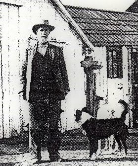
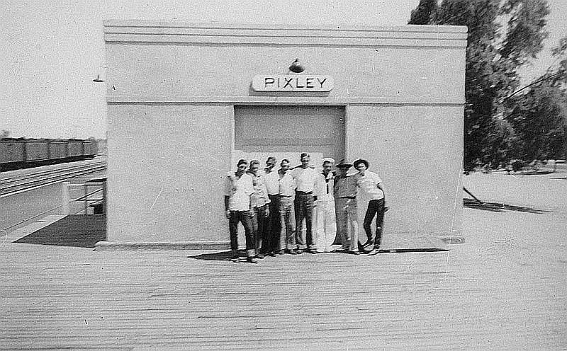
Sequoia and Kings Canyon National Parks Trail Crews  –  the People Whose Work We Walk on

by Laurie Schwaller

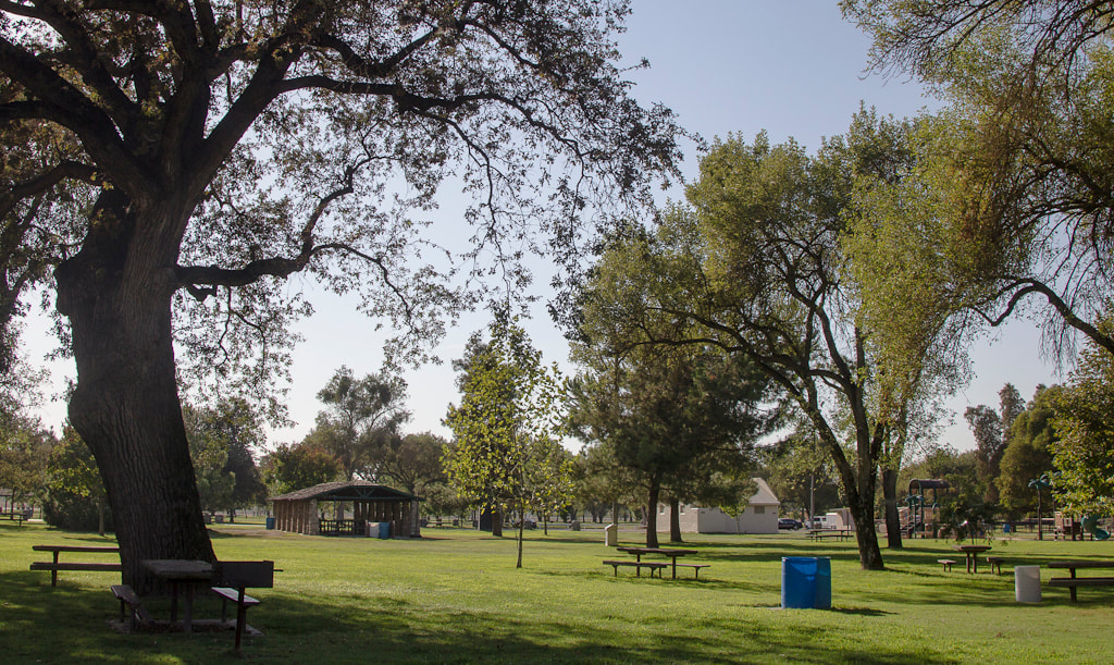
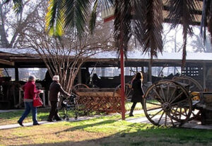
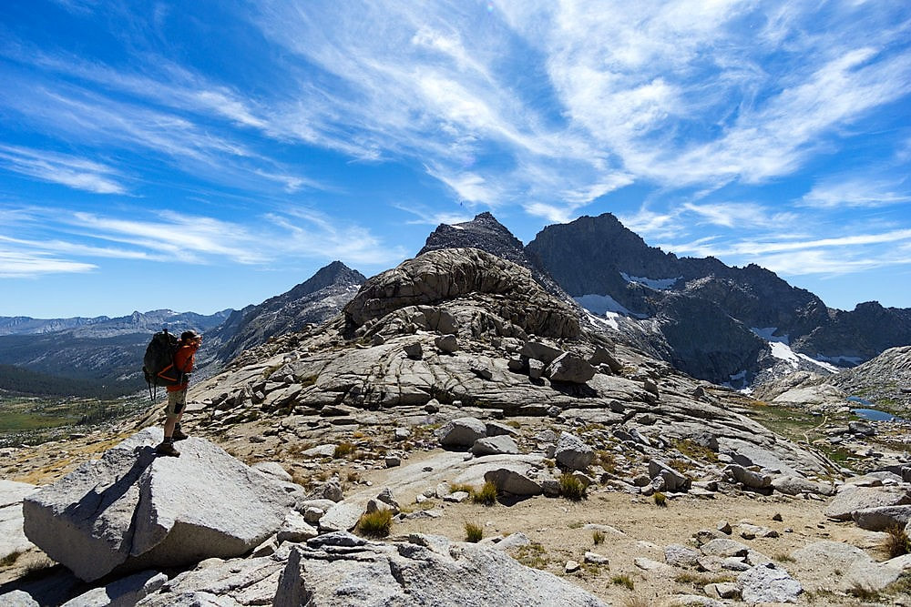
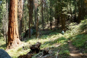
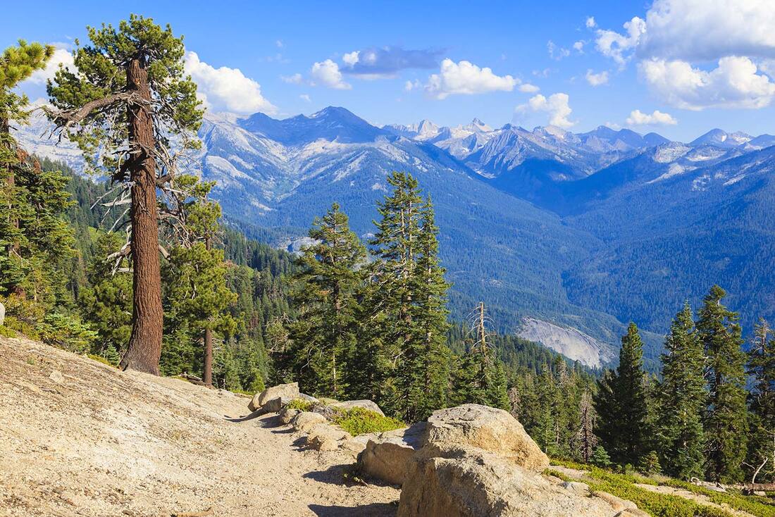
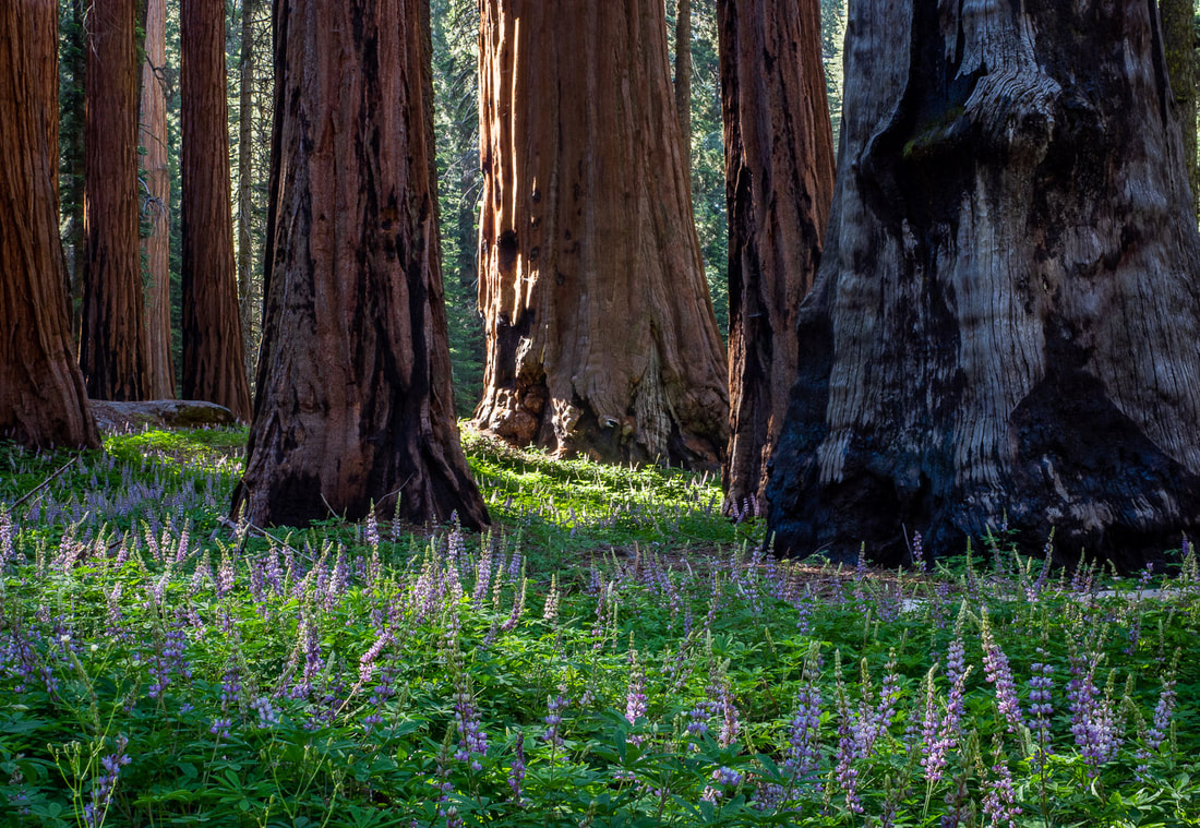
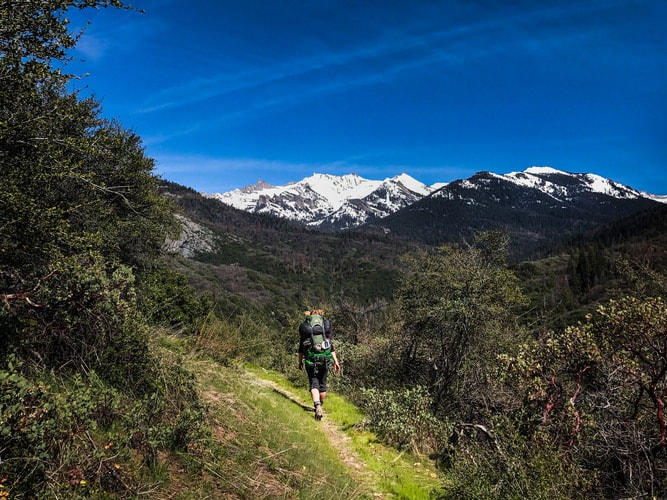
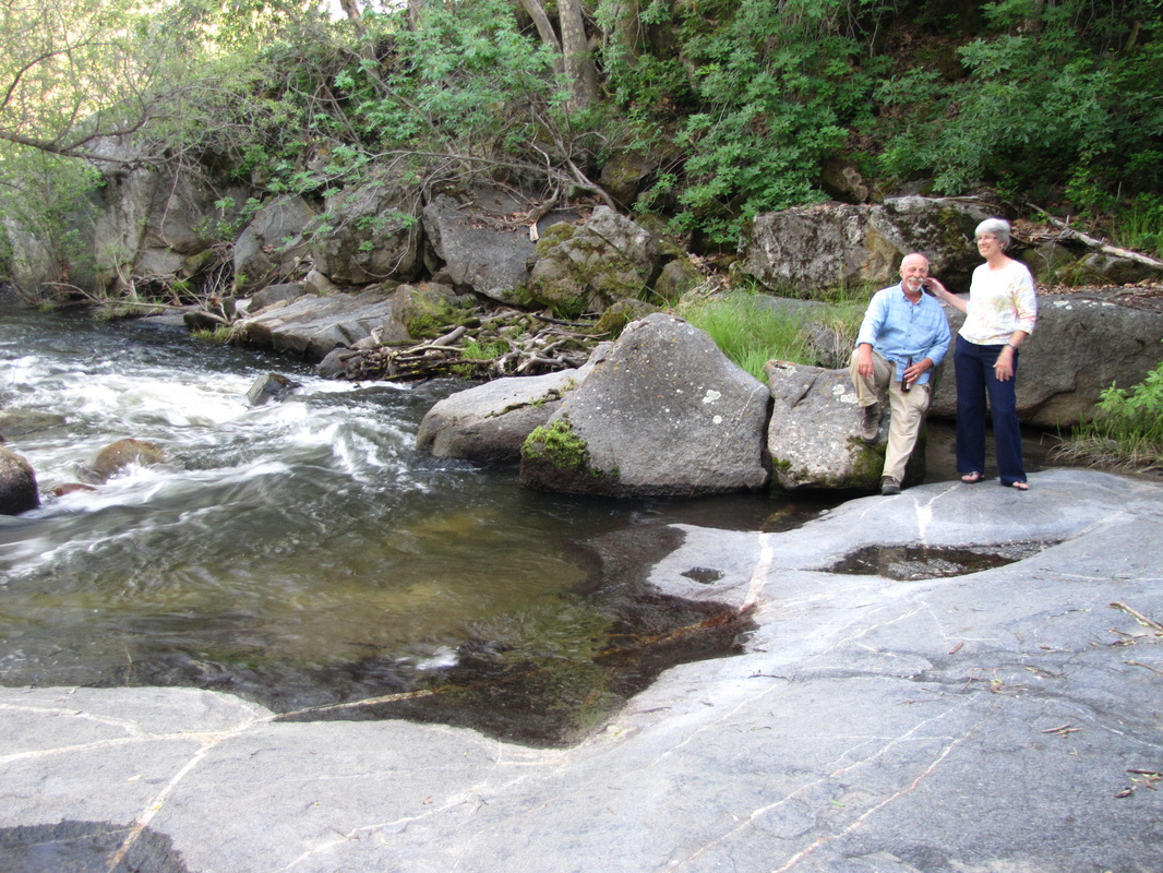
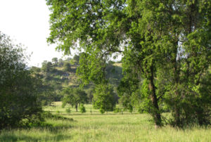
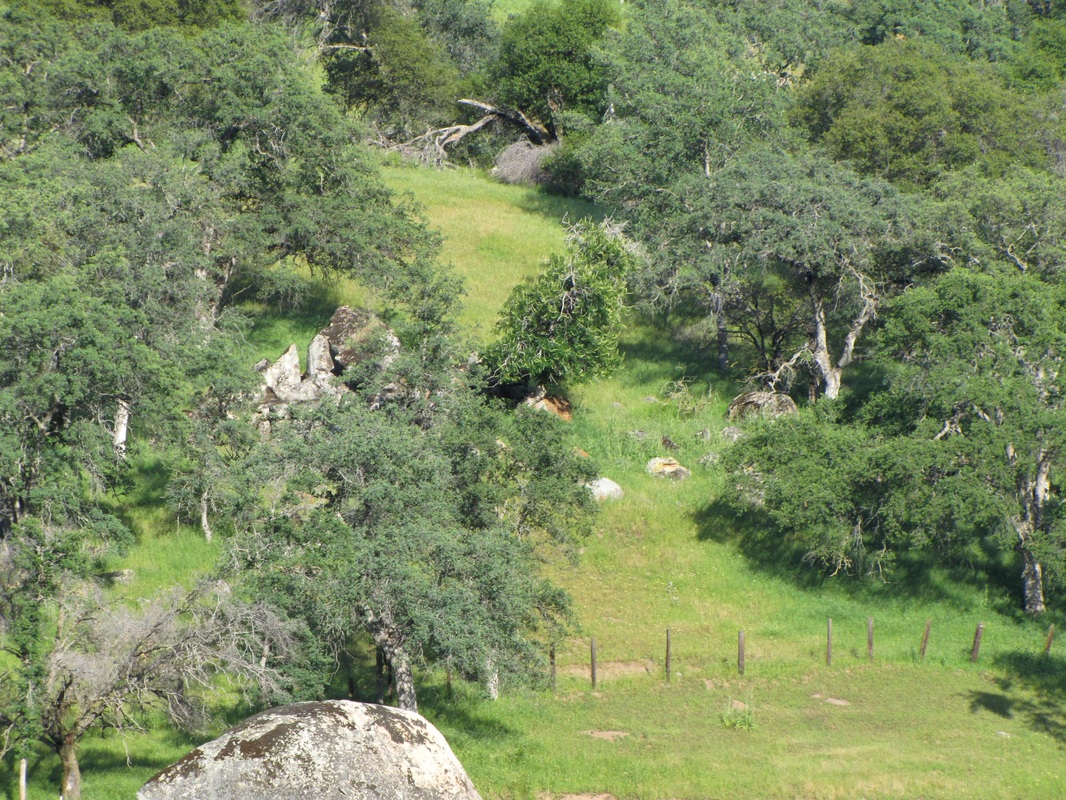
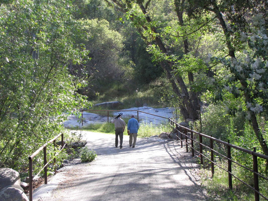
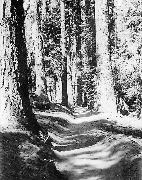
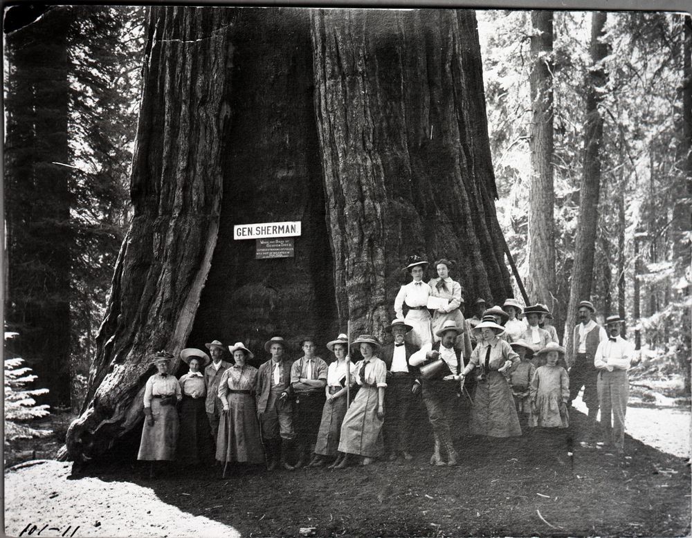
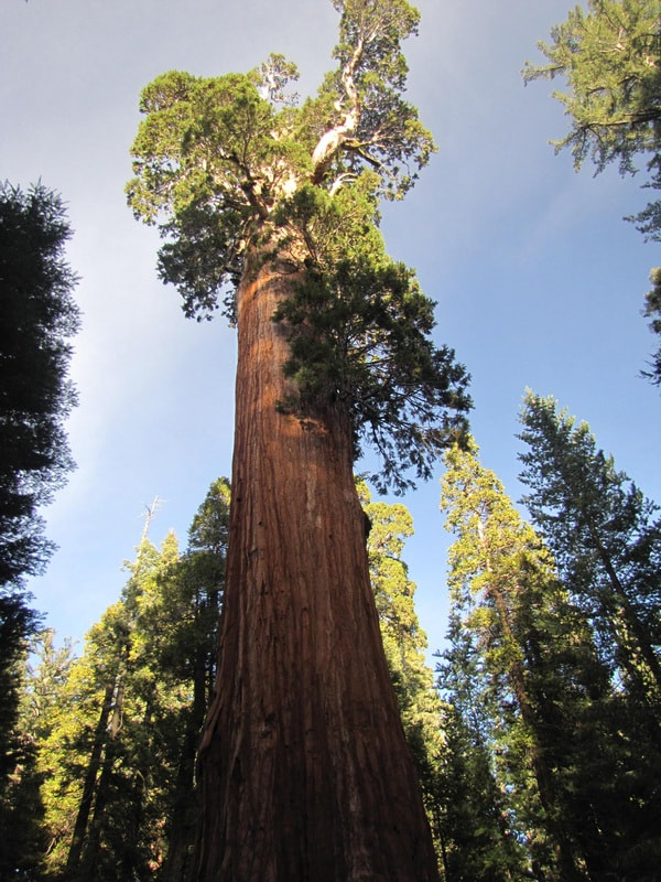
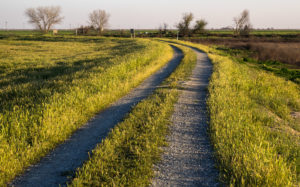
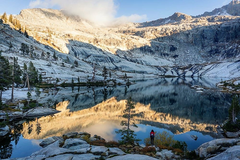
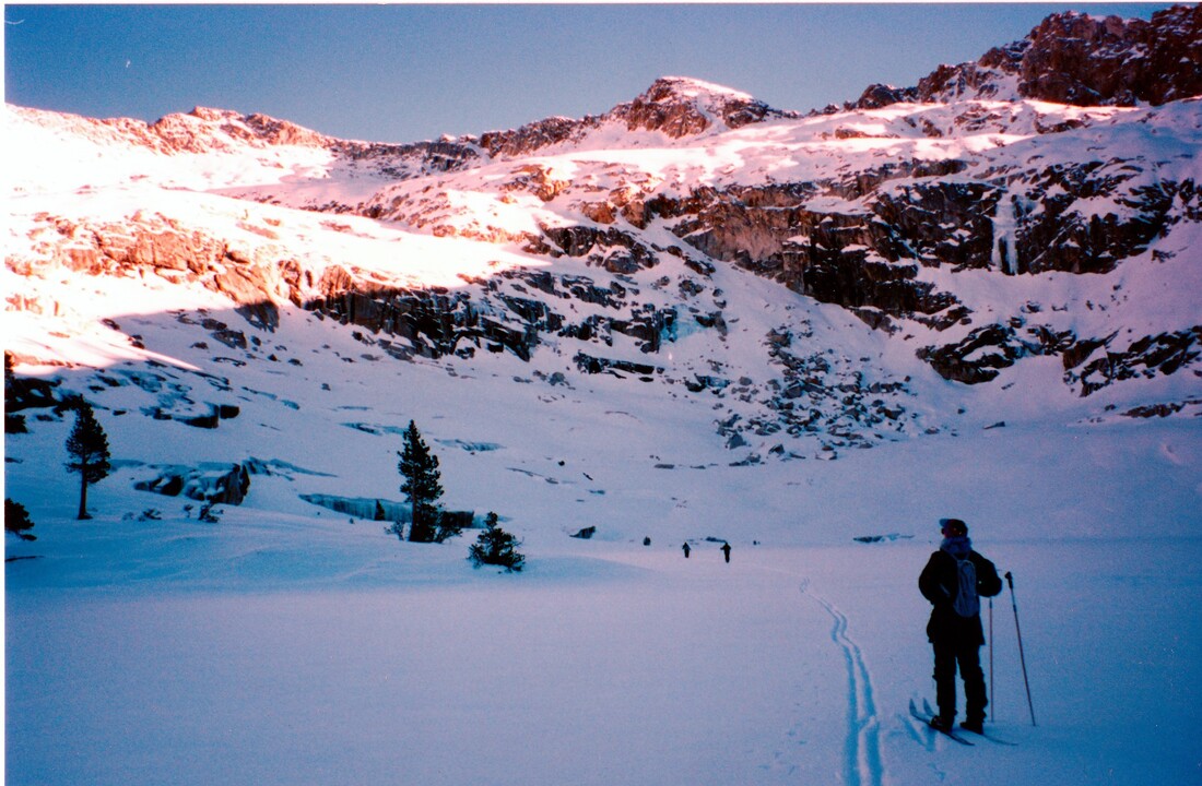
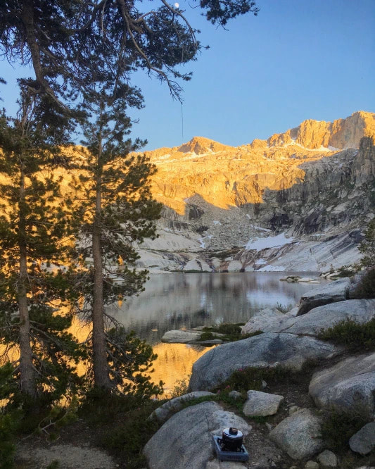
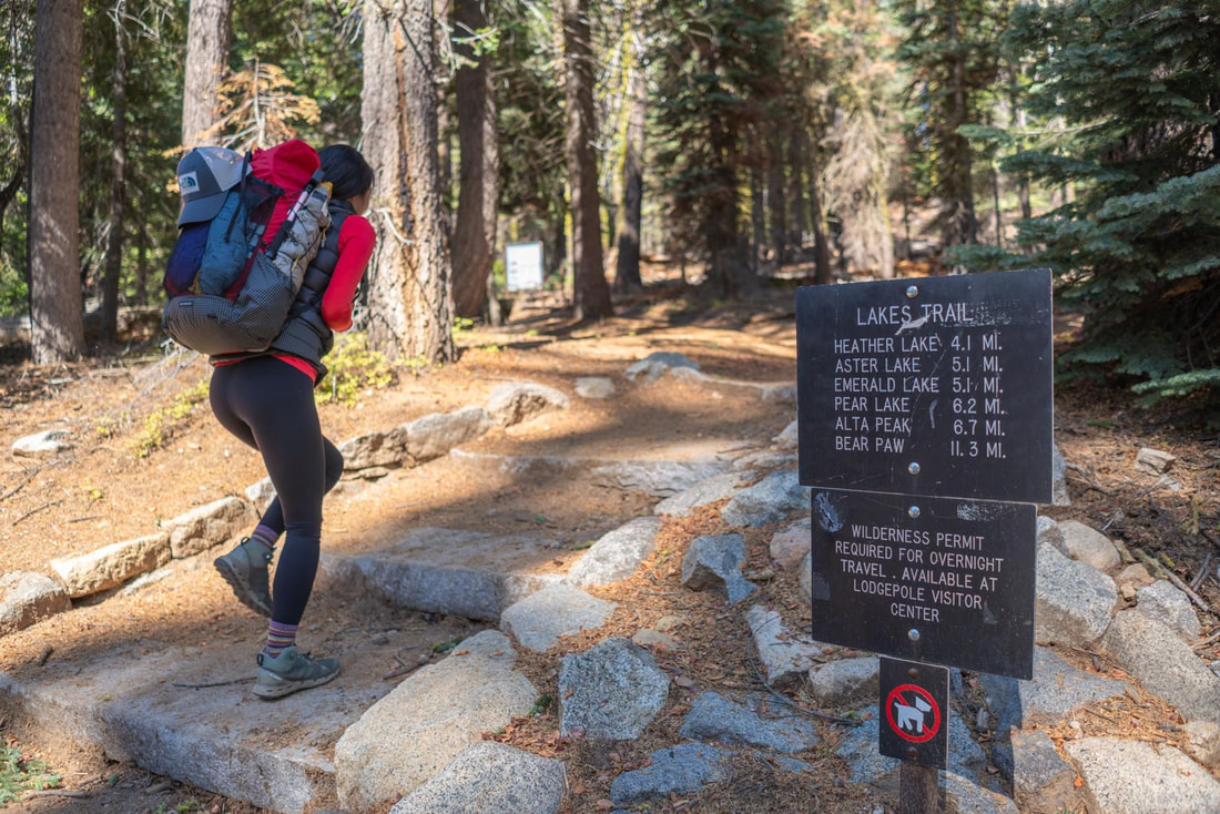
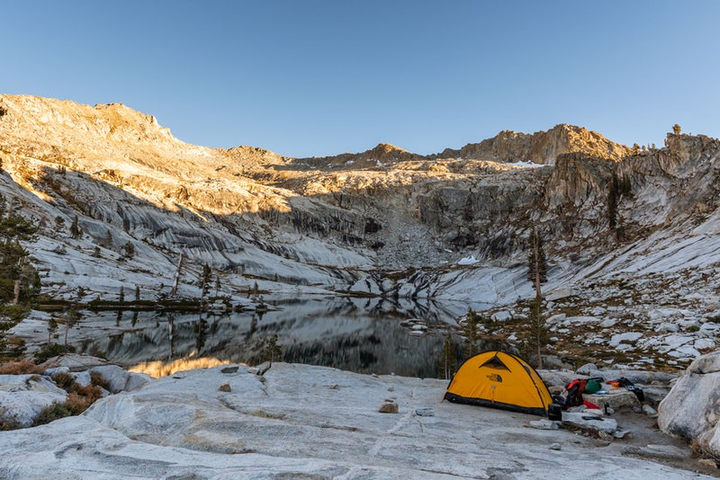
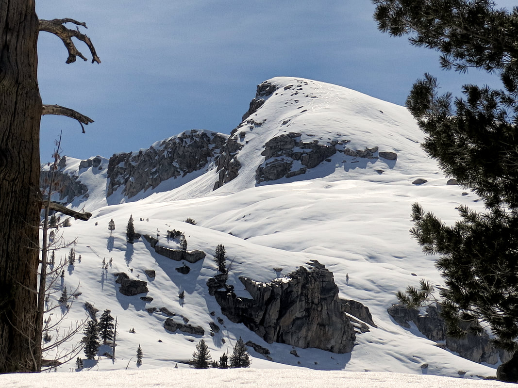
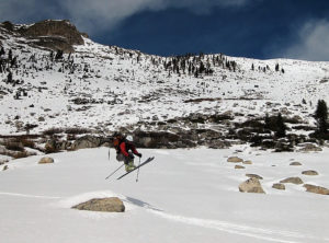
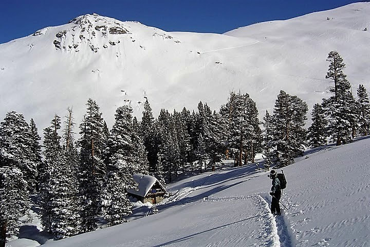
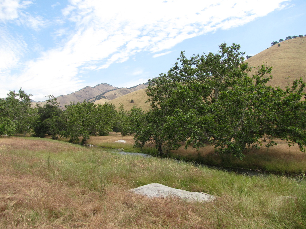
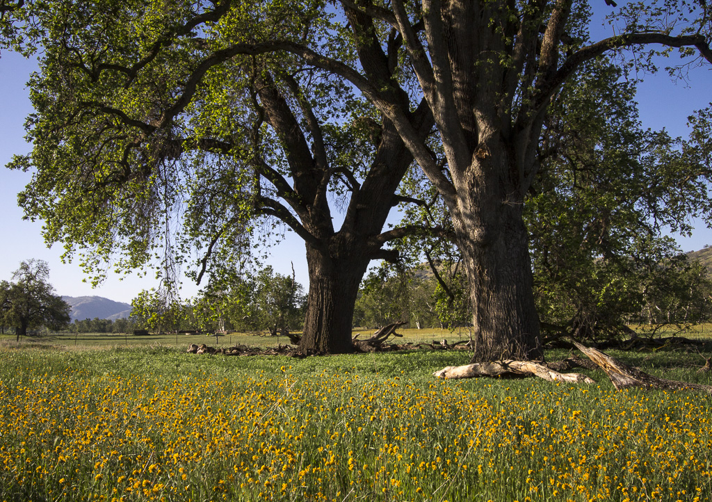
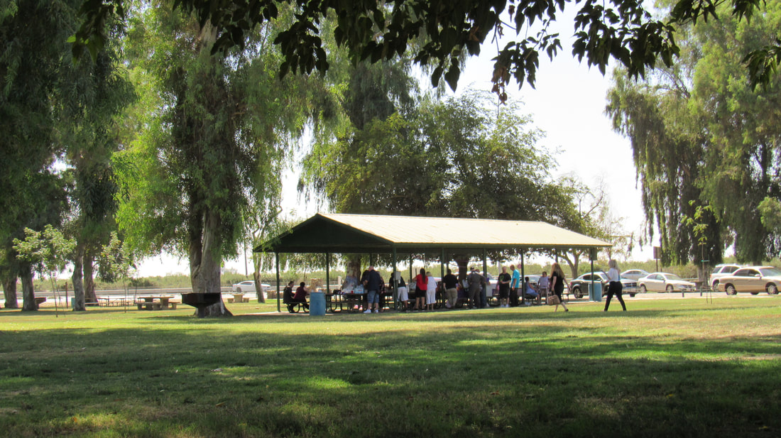
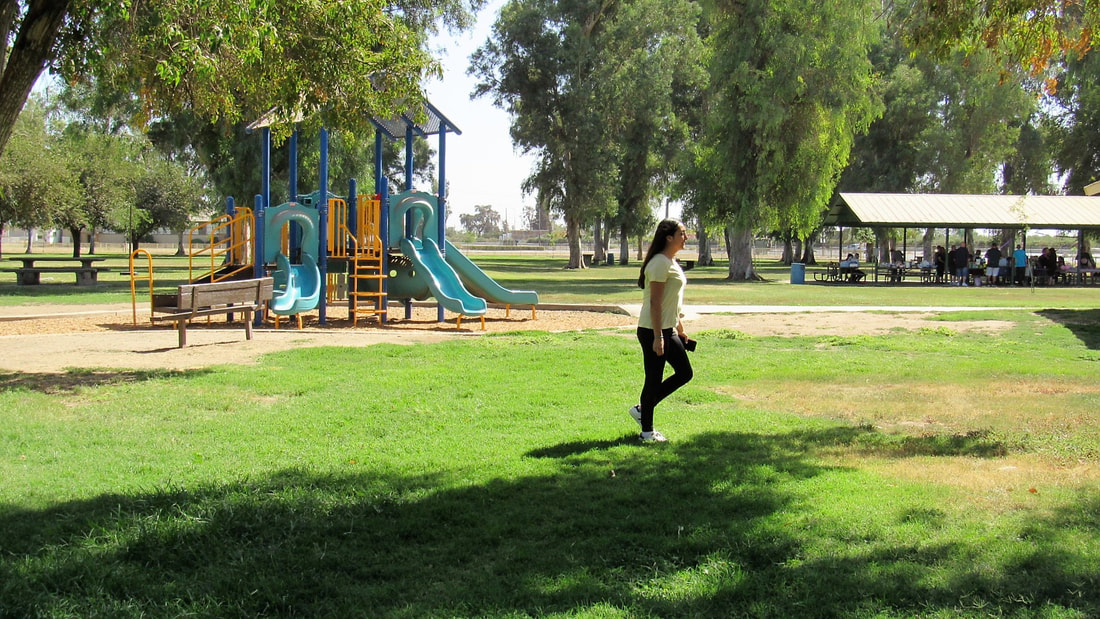
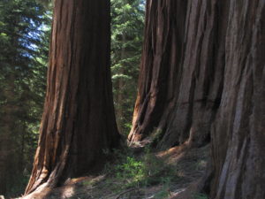
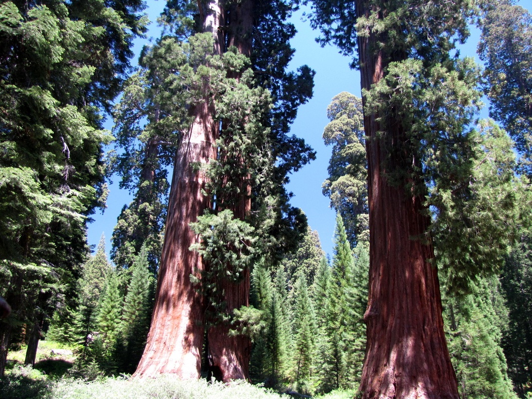
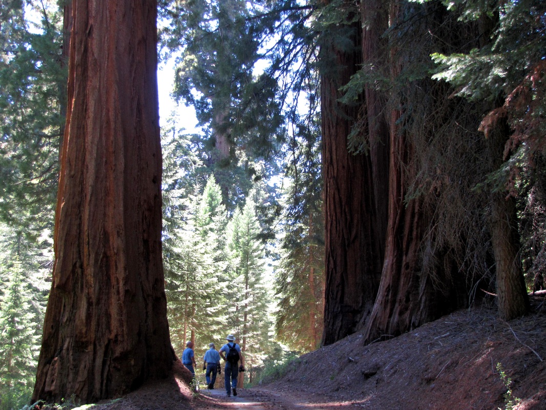
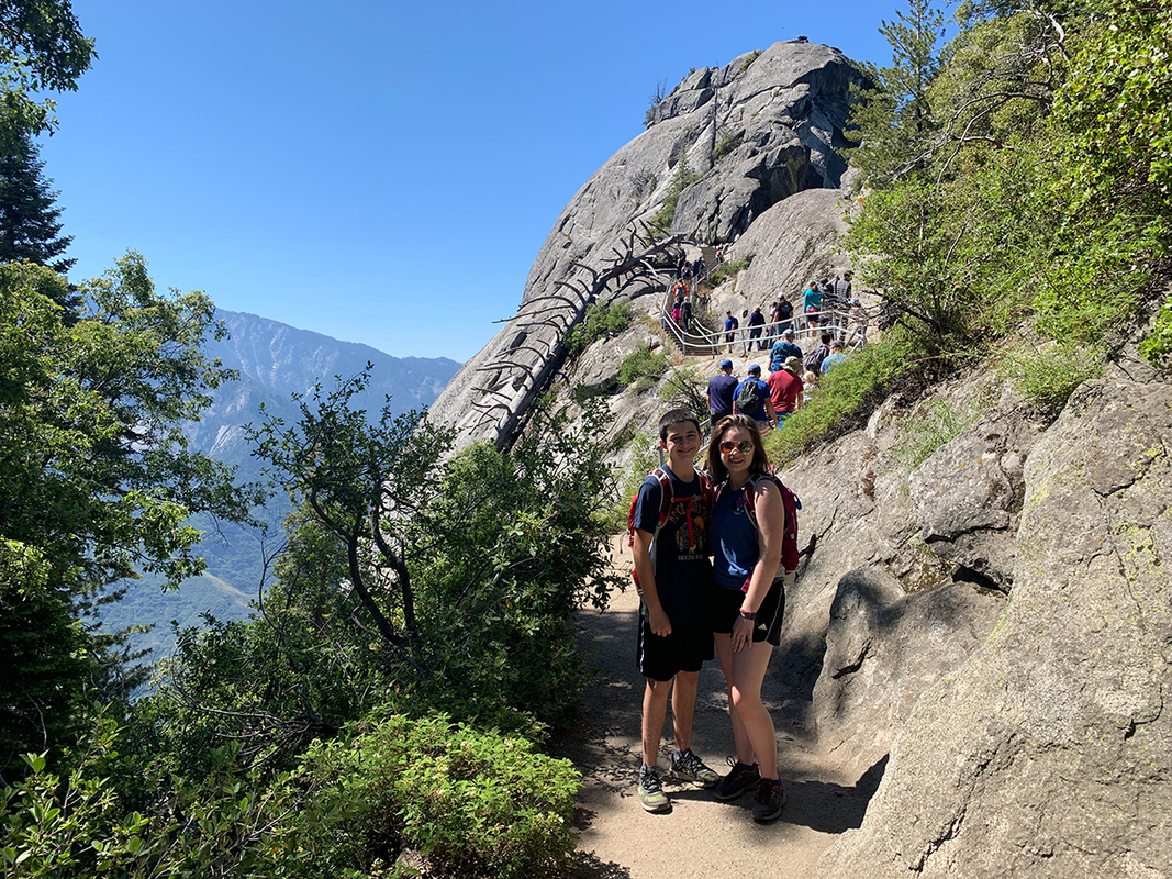
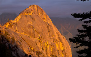
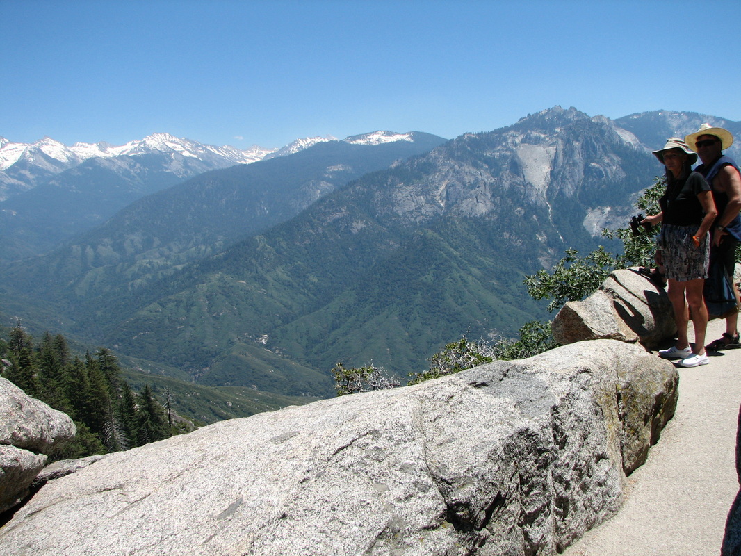
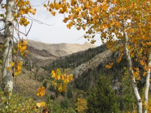
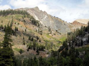
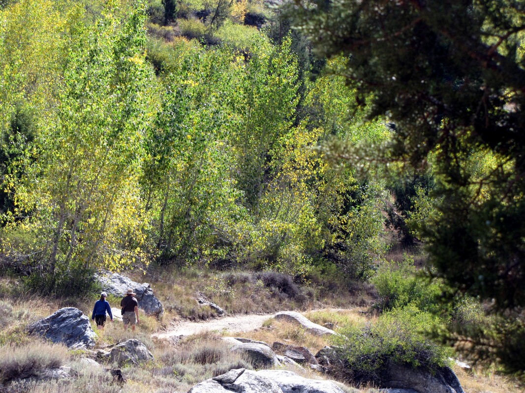
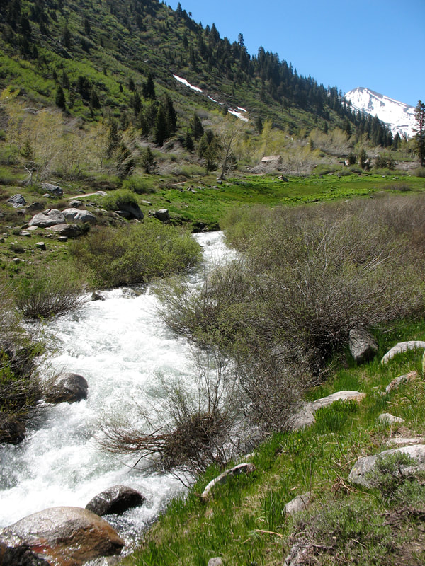
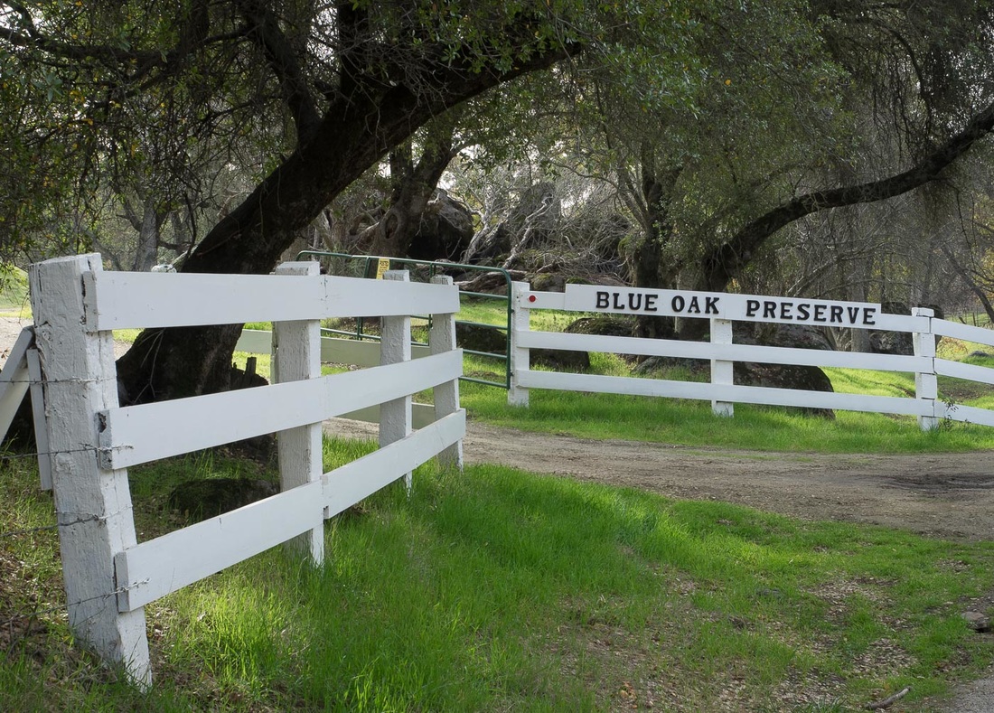
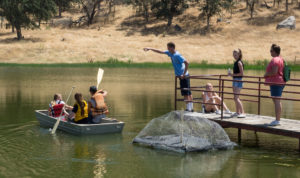
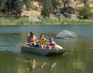
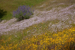
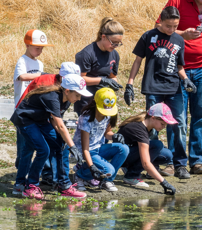
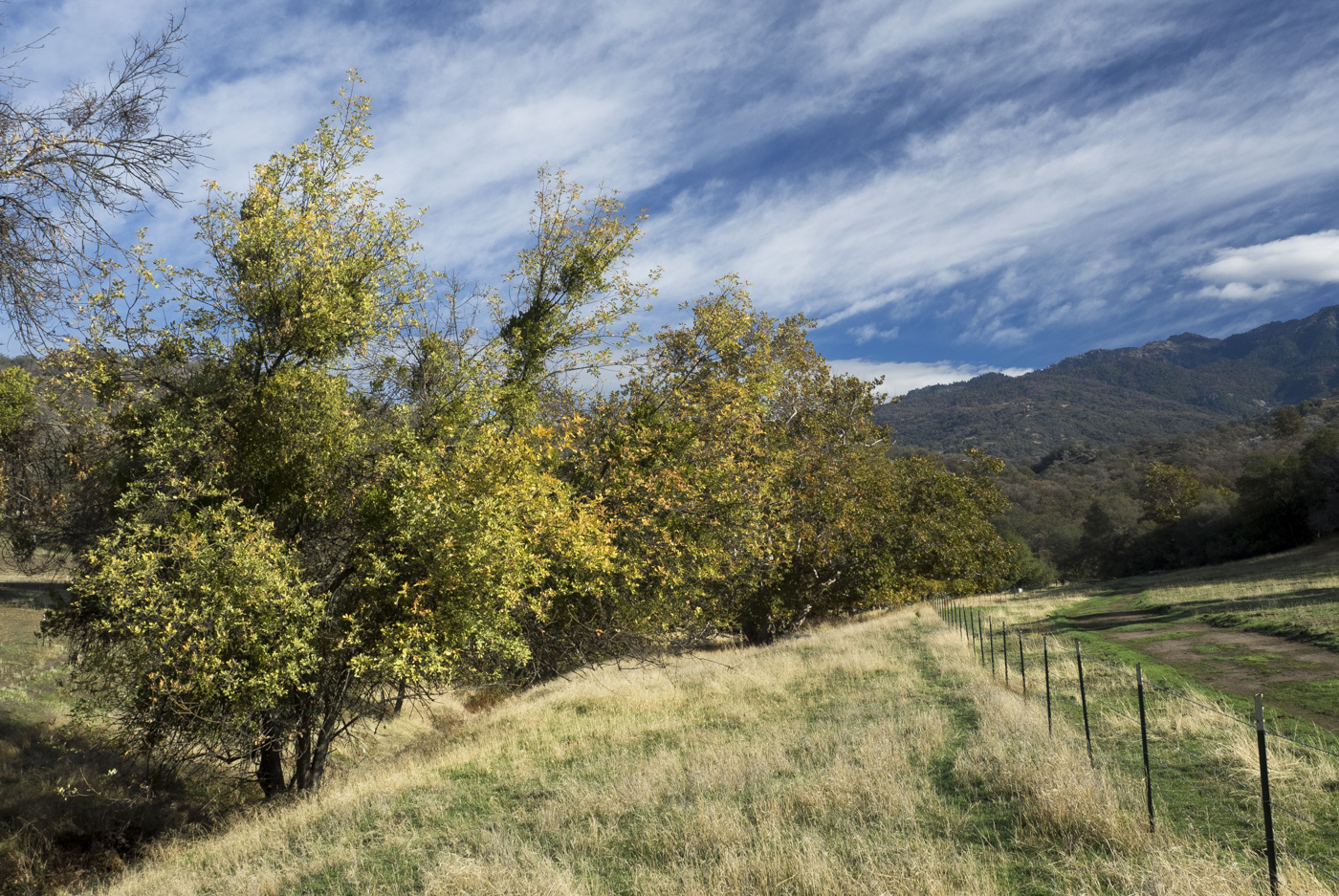
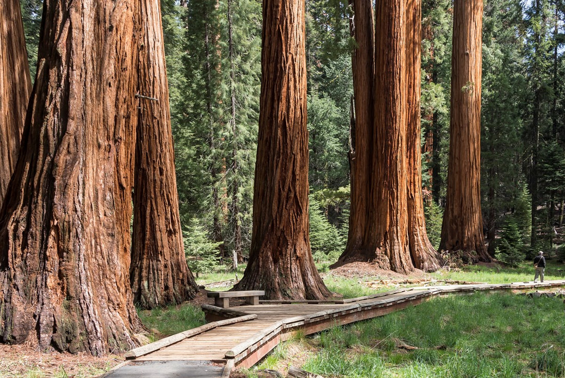
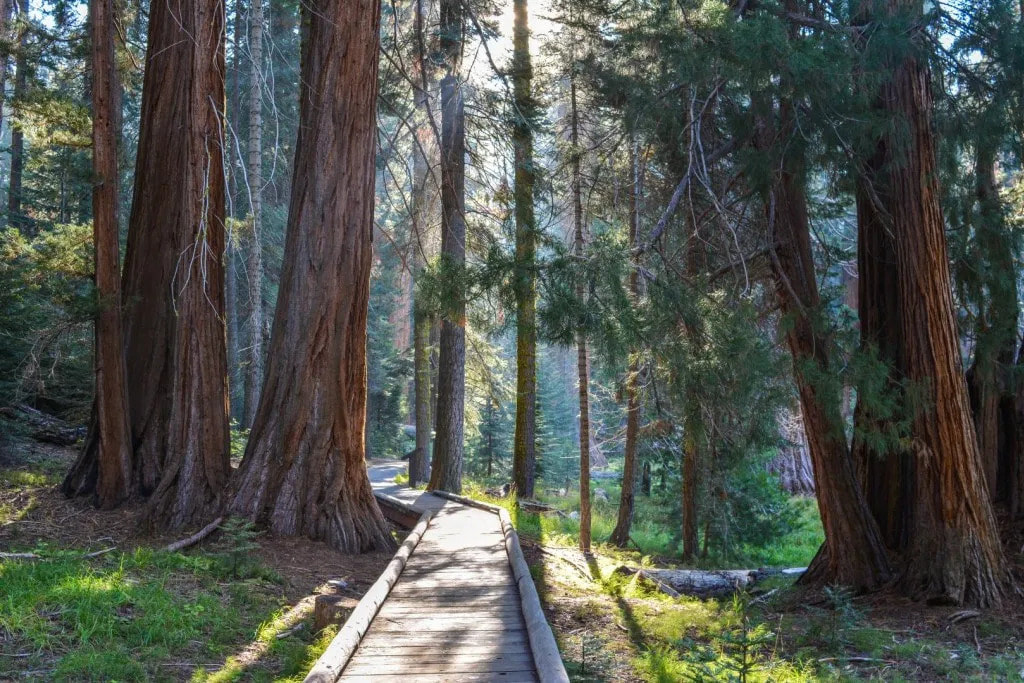
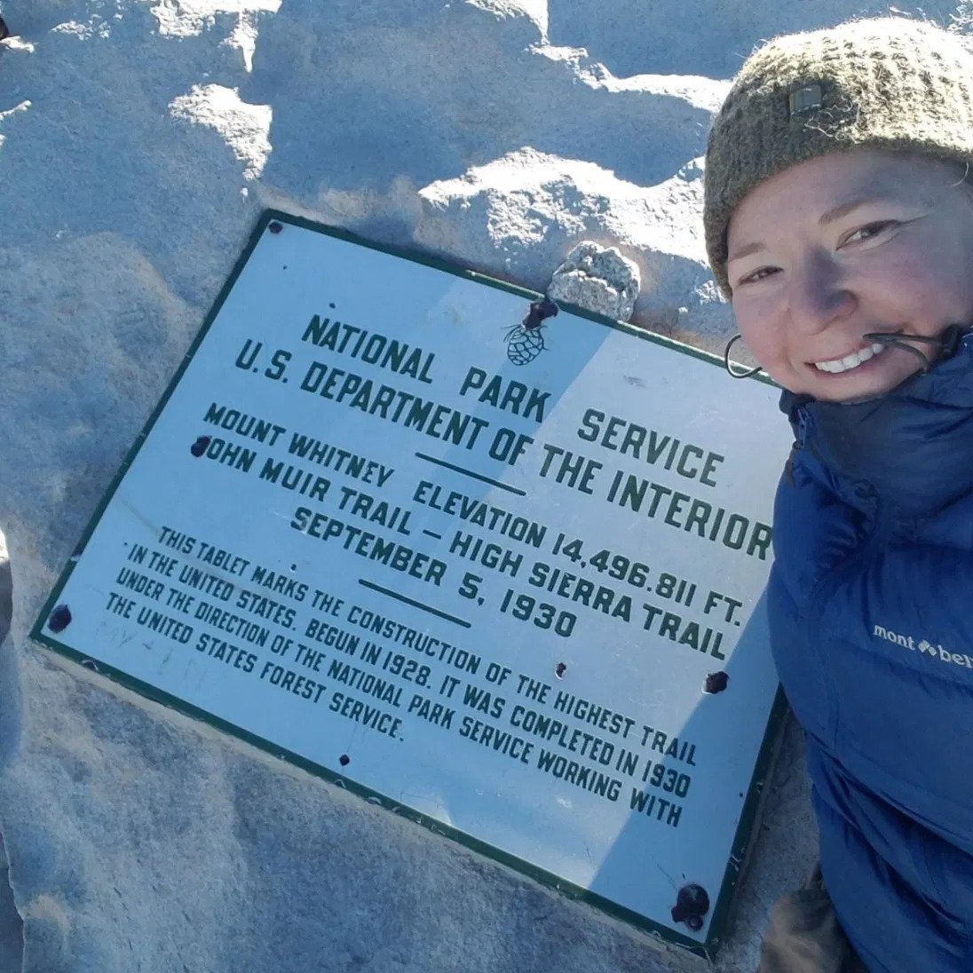
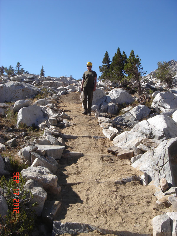
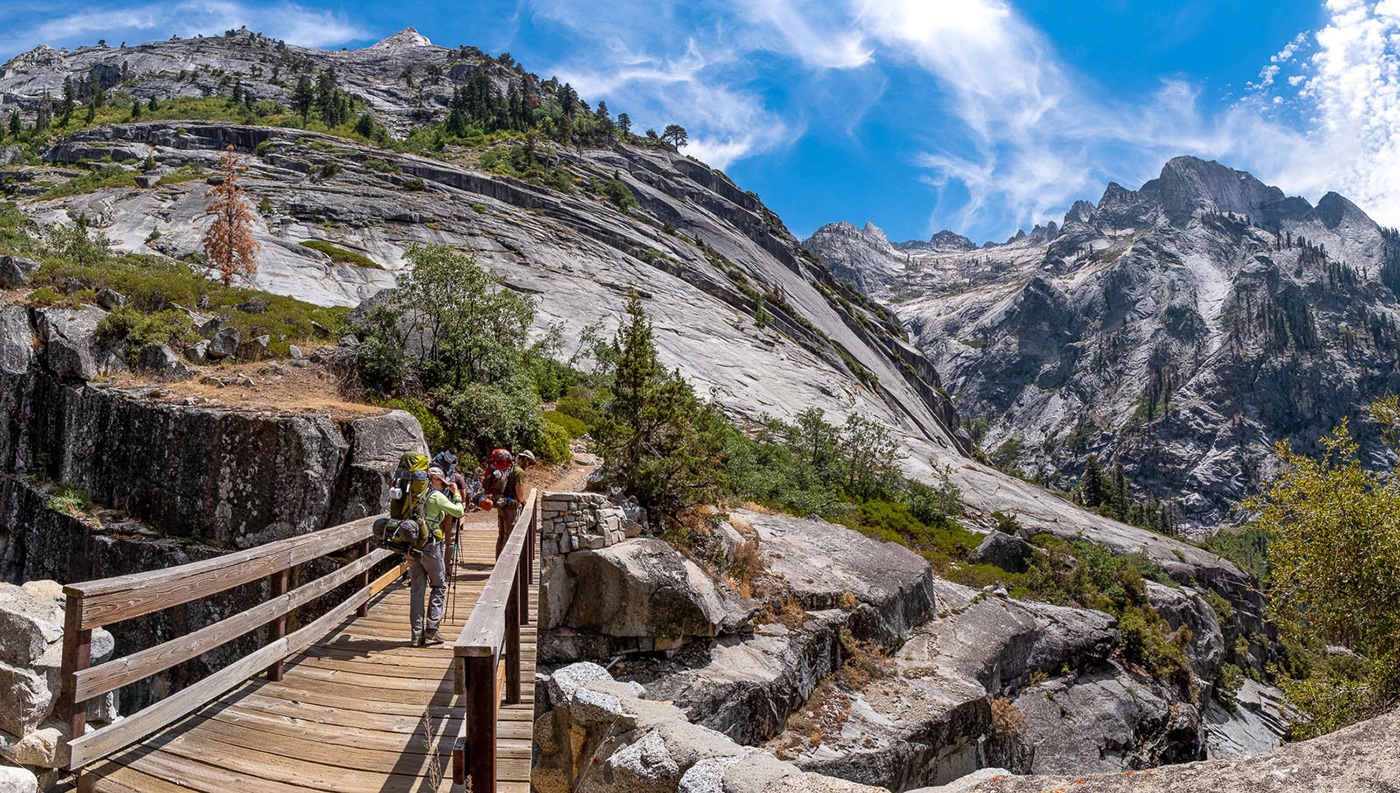
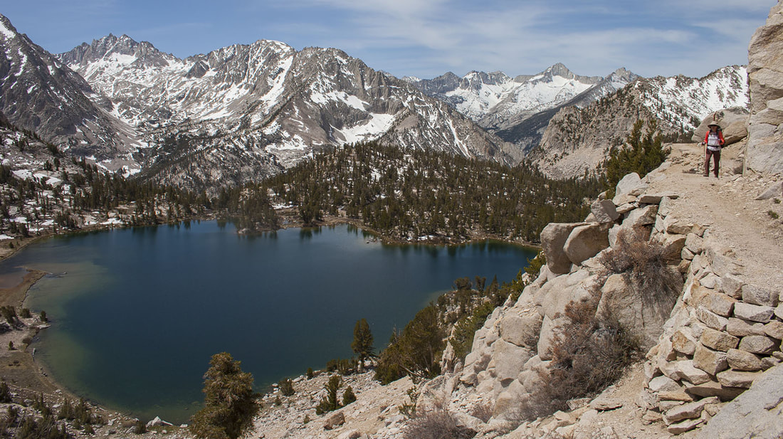
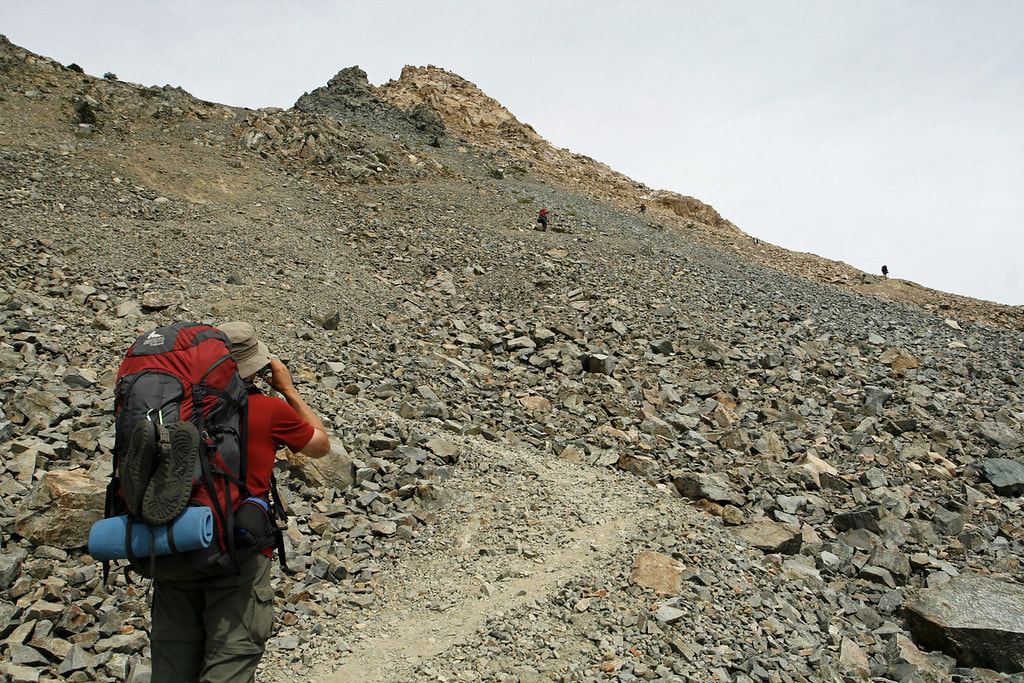
     Over a million people a year walk, hike, or ride horseback on the amazingly diverse trails of Sequoia and Kings Canyon National Parks. From a short, easy stroll into a magnificent giant sequoia grove to a strenuous backpacking trip to the summit of rugged Mt. Whitney, the highest peak in the 48 contiguous states, these paths offer people of all ages, inclinations, and abilities a multitude of opportunities to experience the parks’ wonders in the very best way: at a walking pace, free to pause whenever they please, immersed in the sights, scents, sounds, and thrills of the wild world.

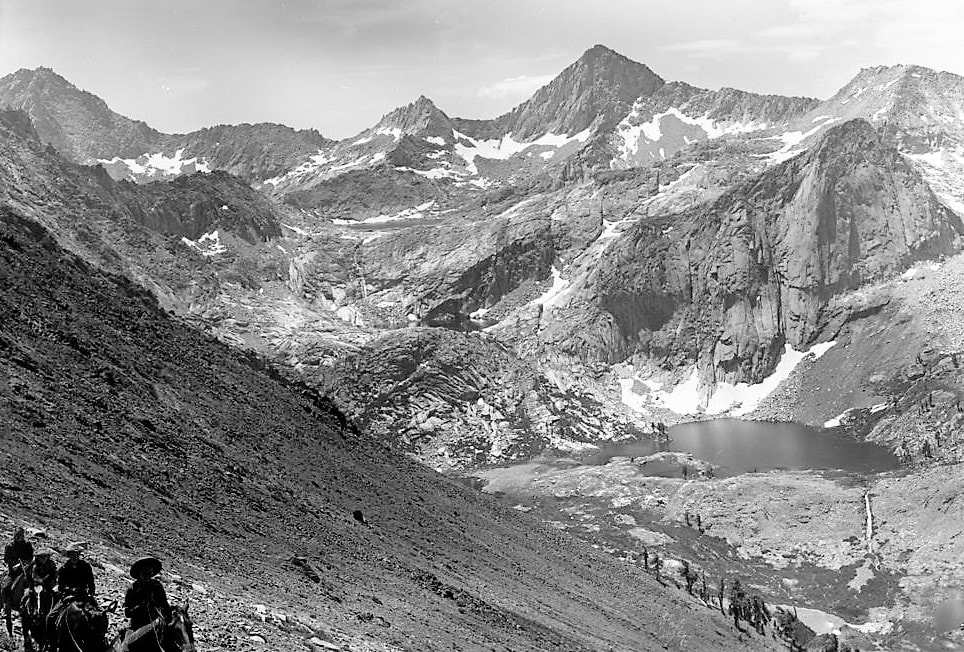
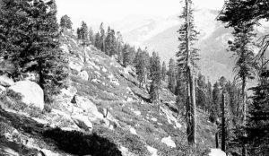
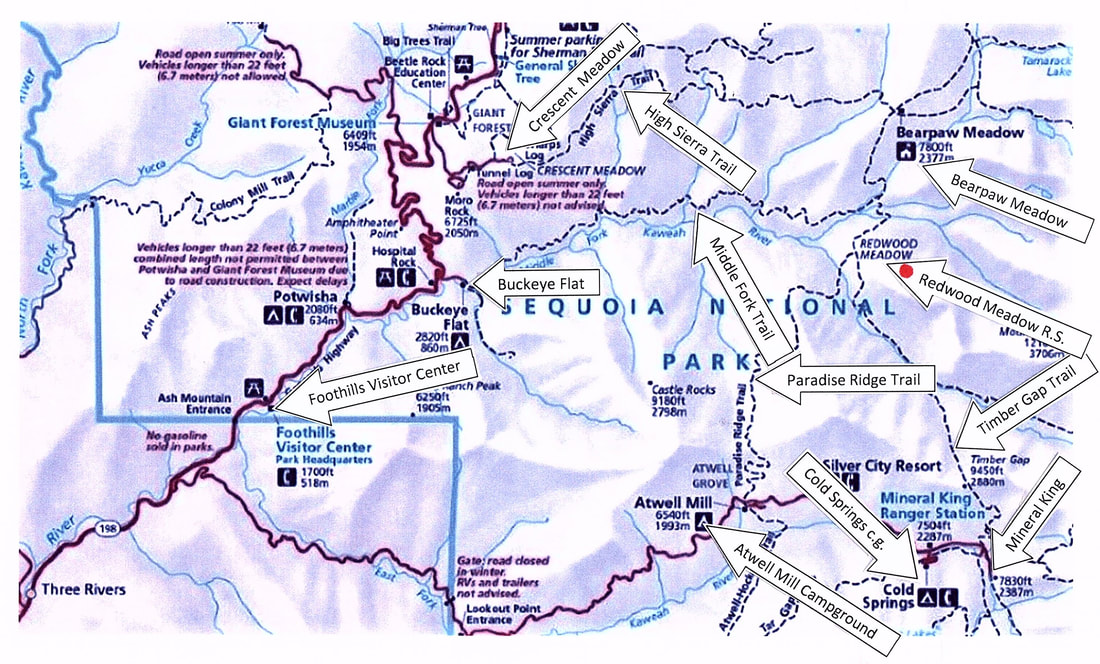
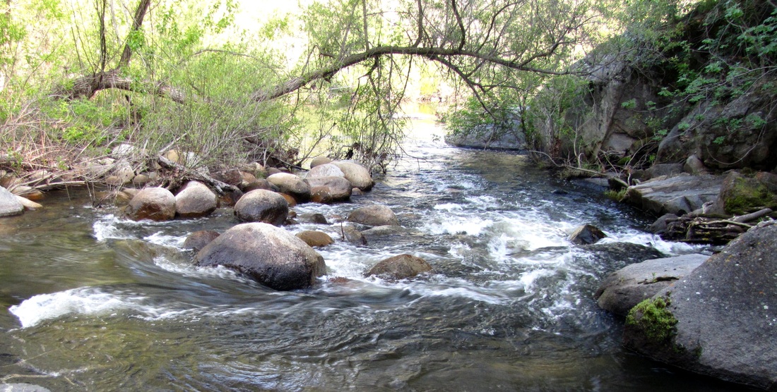
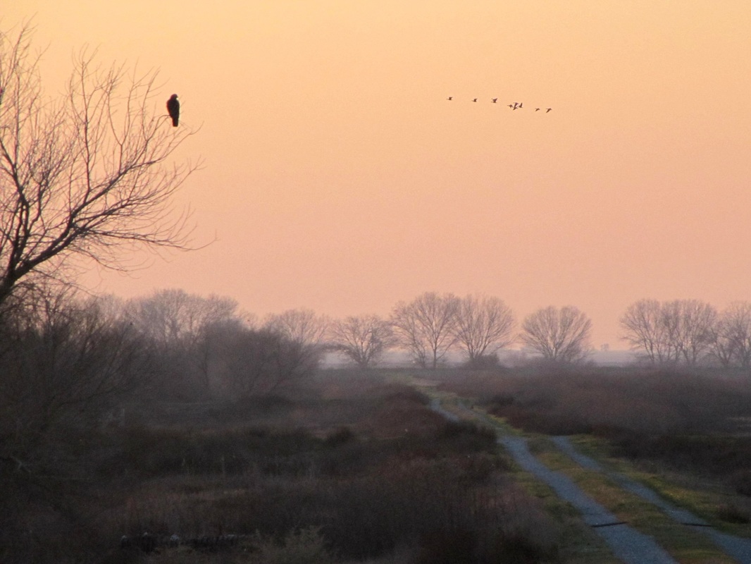
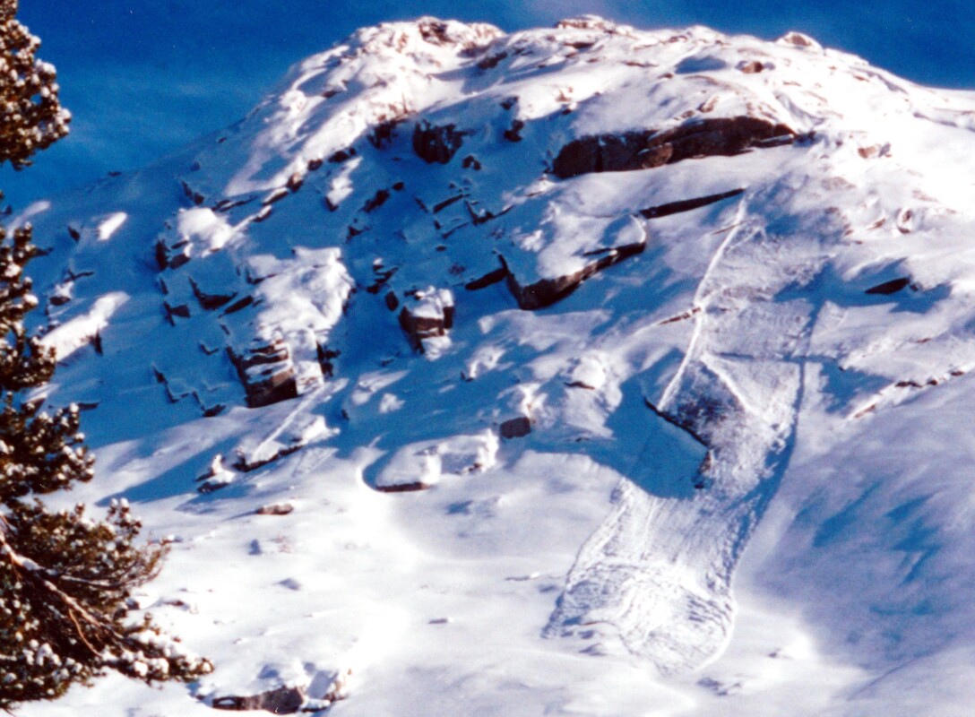
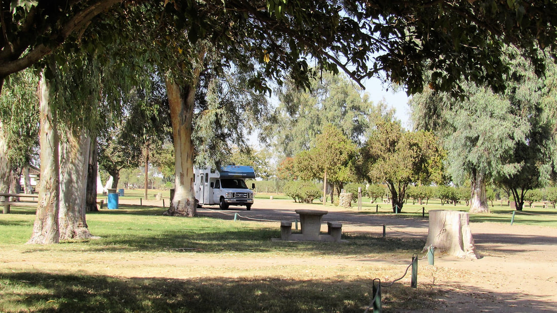
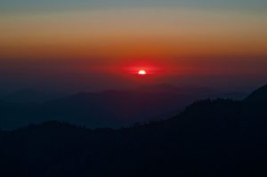
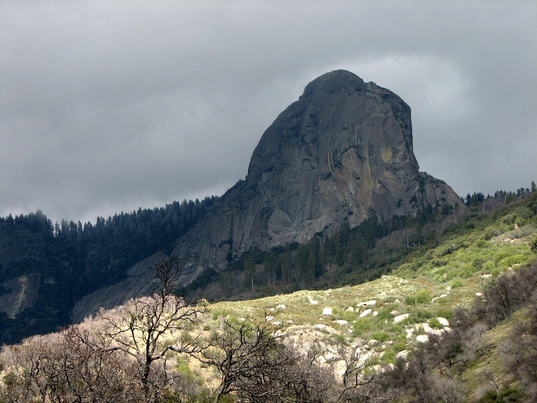
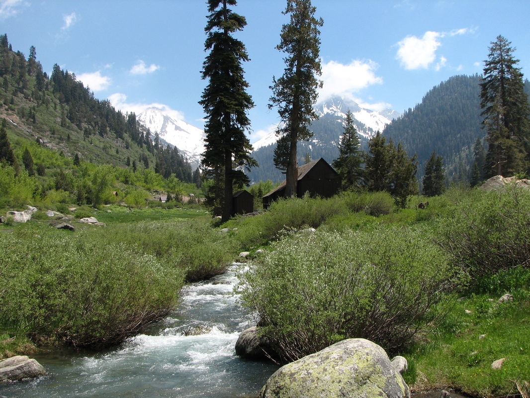
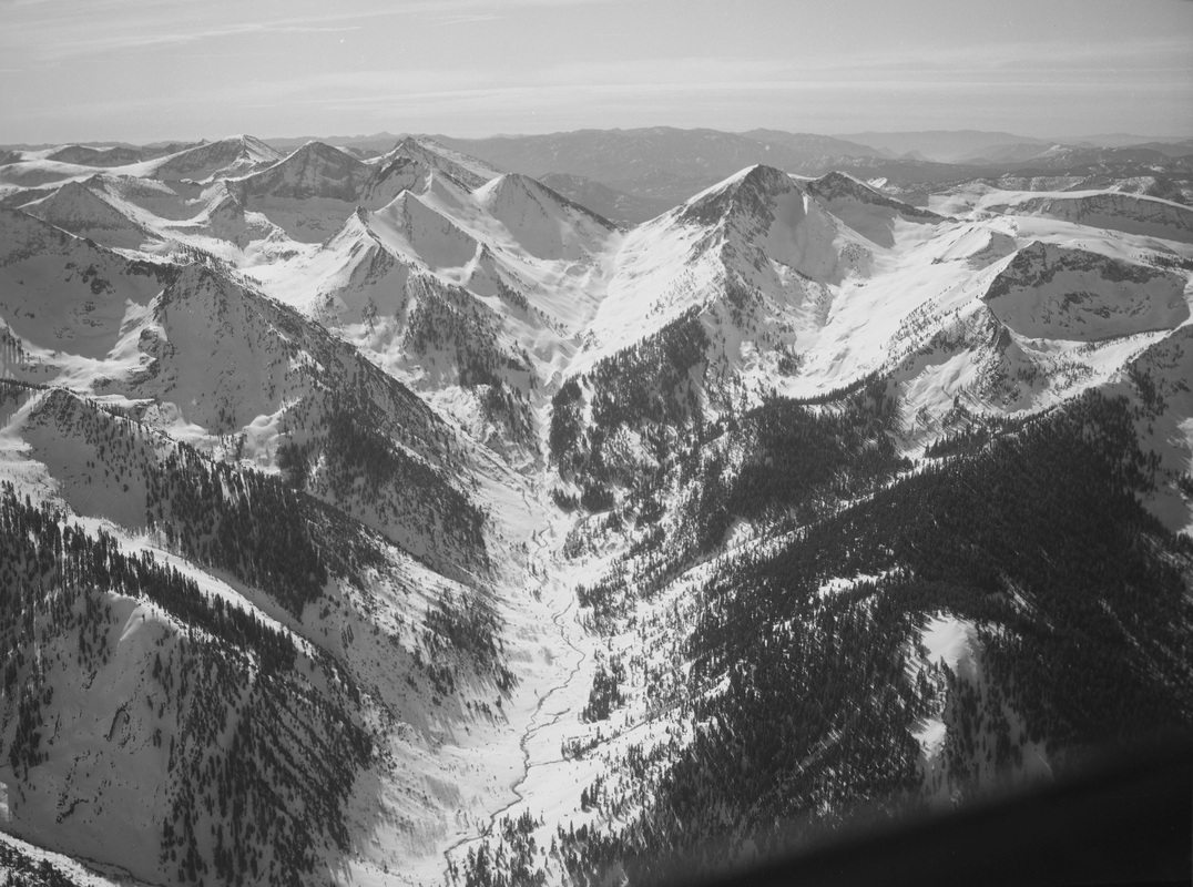
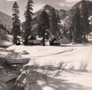
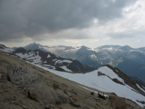
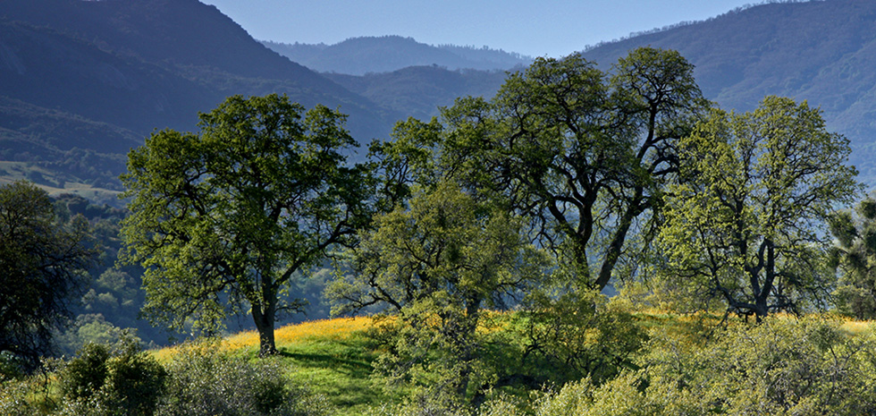
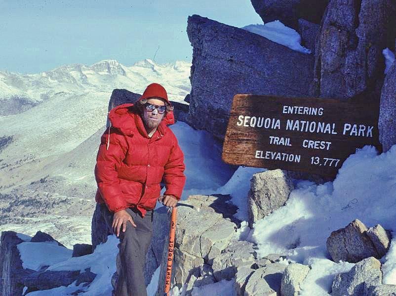
     Ranging in elevation from less than 2,000 feet up to 14,500 feet, the trails traverse over a thousand miles to connect the major features and extraordinary environments of these spectacular parks. Who builds these beckoning byways, and who maintains them in the face of floods, fires, avalanches, rock slides, falling trees, deep snows, and thoughtless trail-cutters?

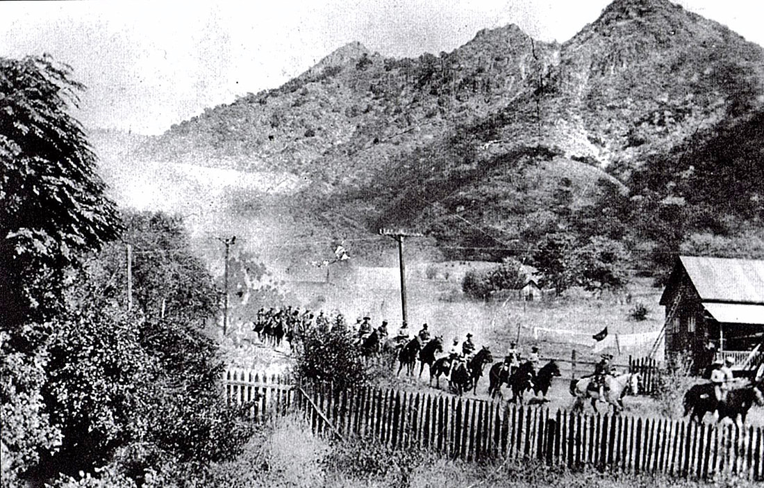
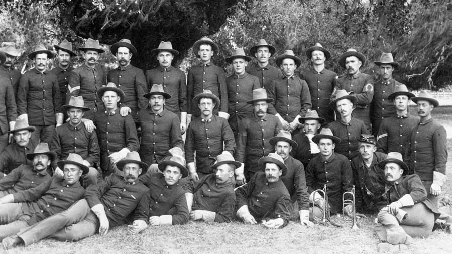
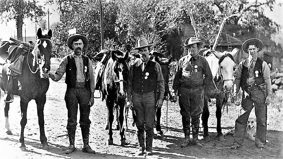
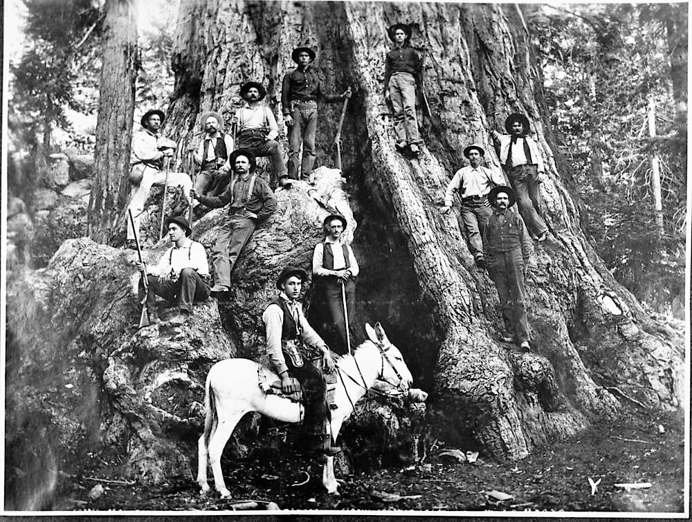
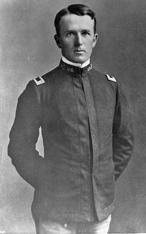
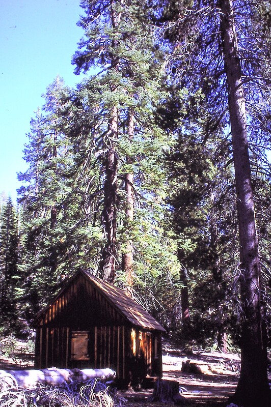
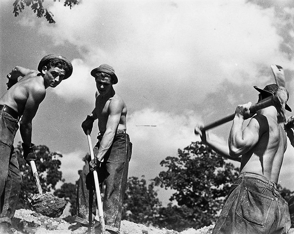
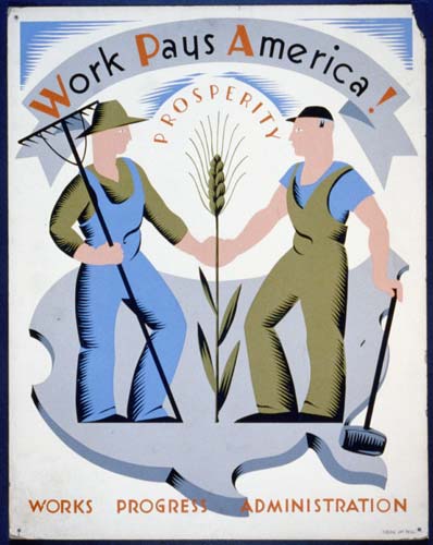
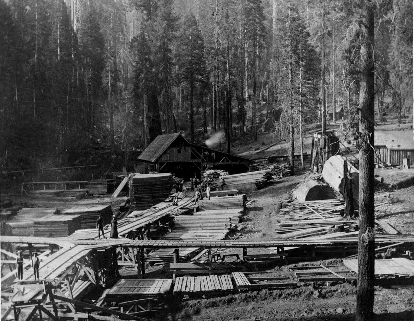
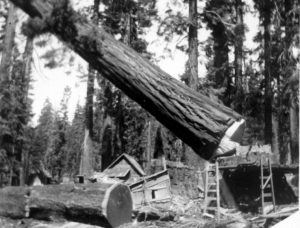
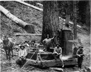
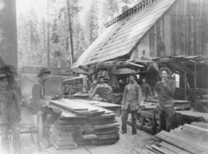
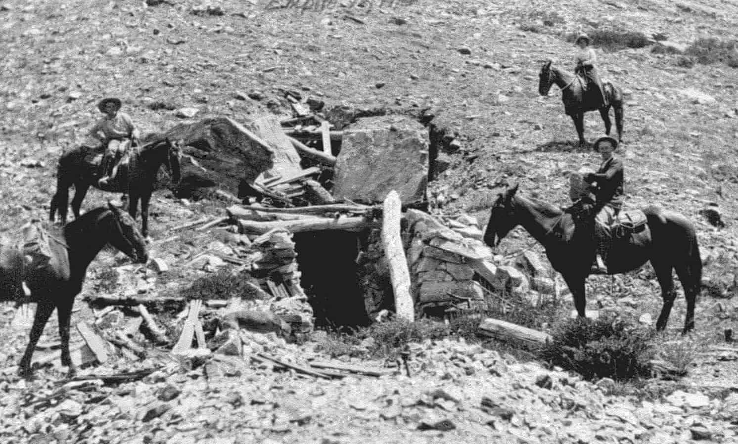
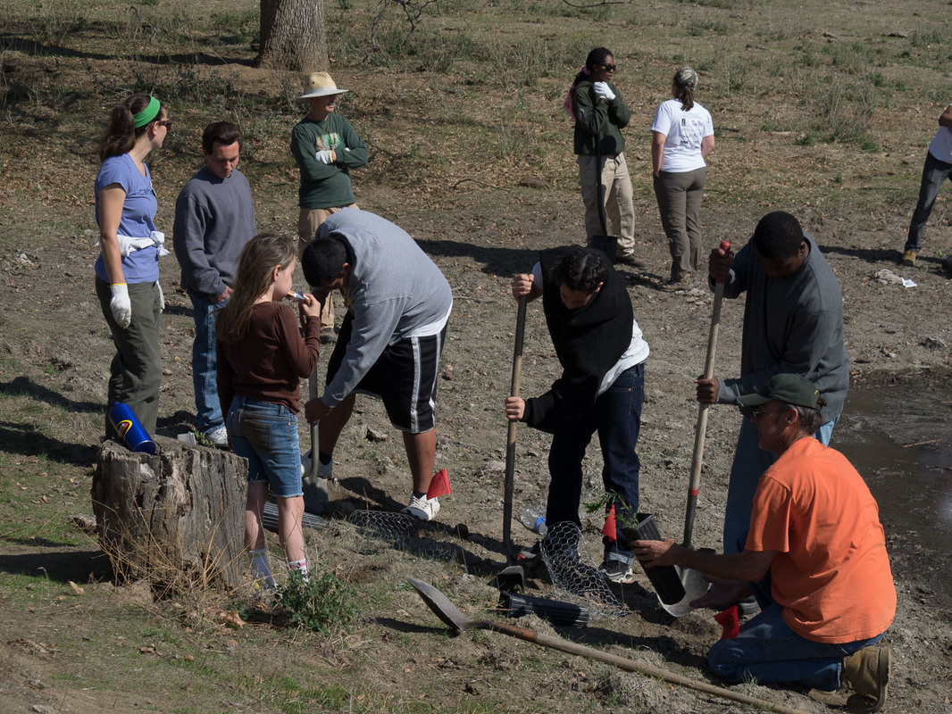
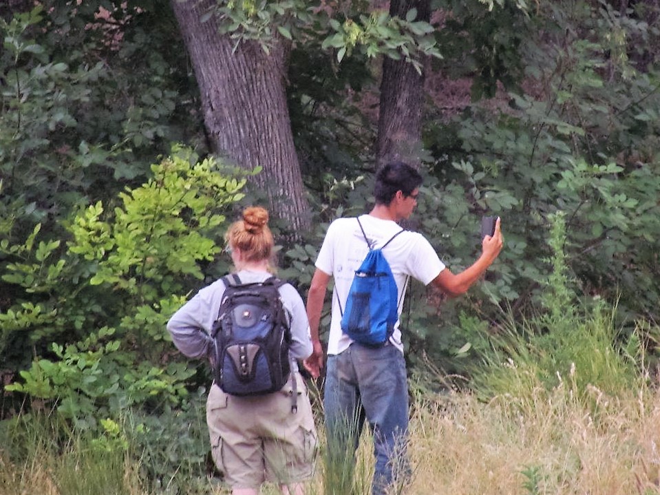
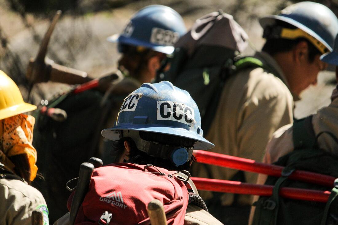
     Since the National Park Service was established in 1916, this essential work has been carried out primarily by NPS Trail Crews (while Civilian Conservation Corps workers contributed a tremendous amount of trail maintenance from 1933 to 1942). Beginning in the 1970s, the parks have also been partnering with volunteer service organizations such as the Youth Conservation Corps to help maintain the miles of trails being “loved to death” by the increasing national interest in outdoor recreation.

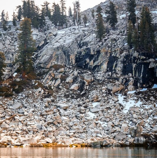
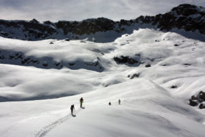
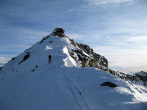
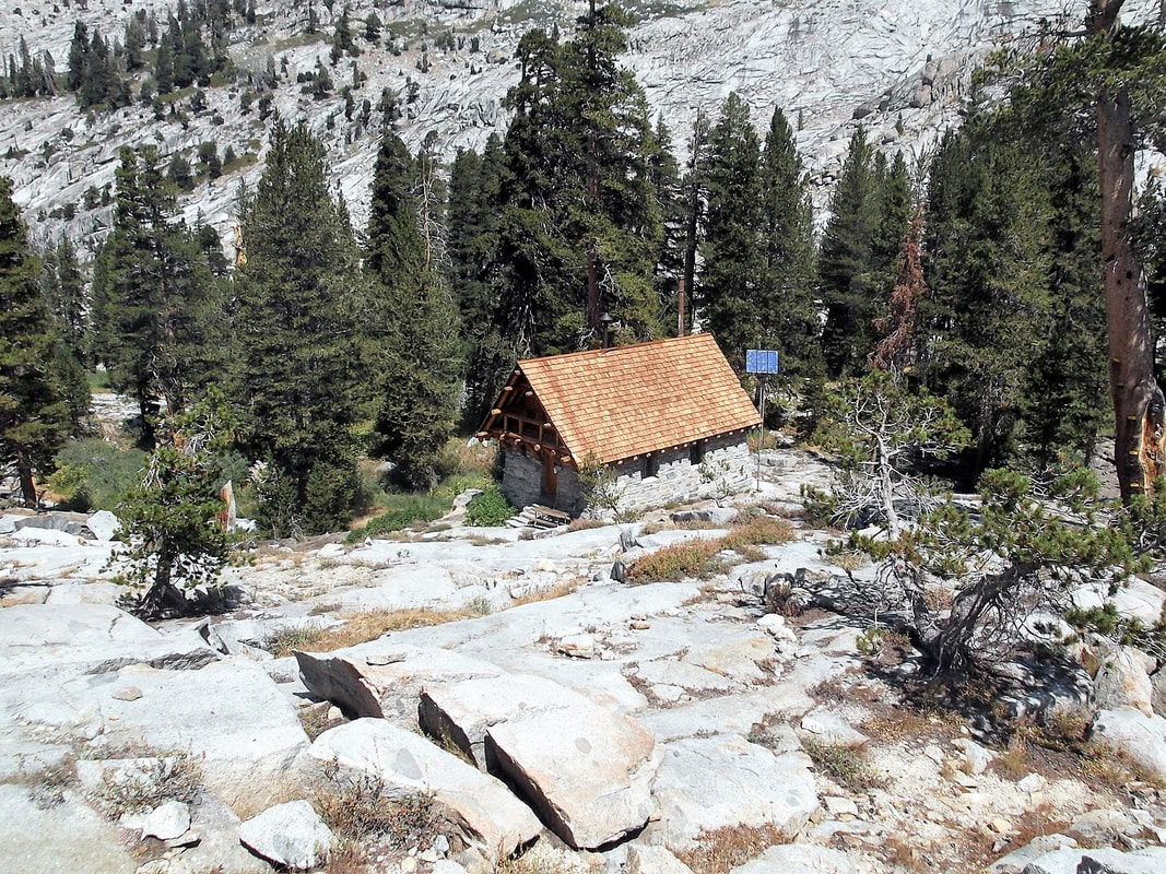
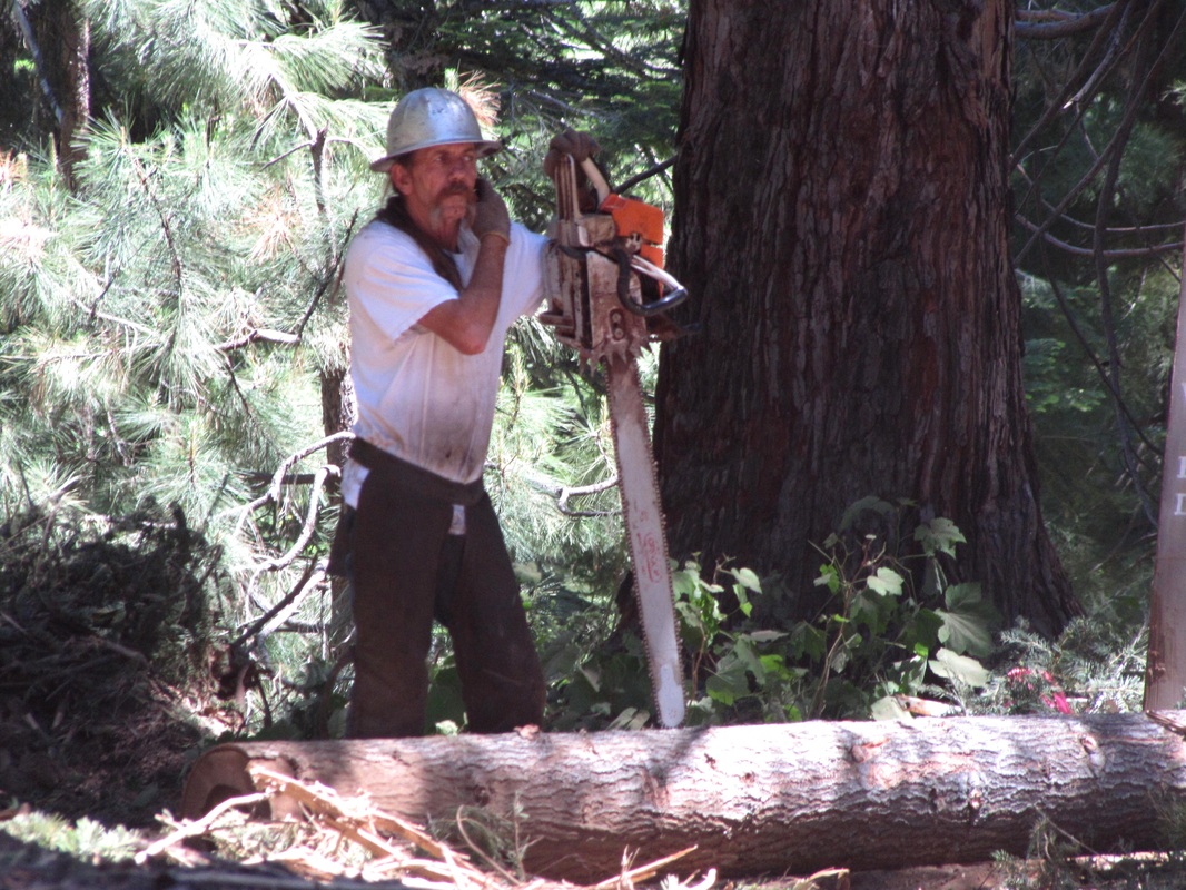
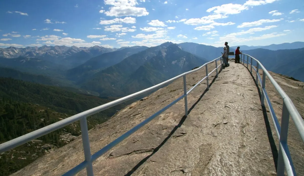
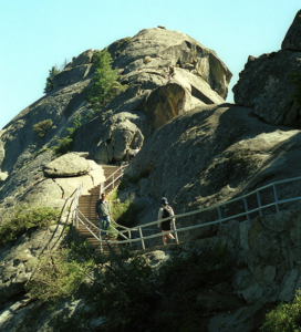
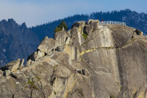
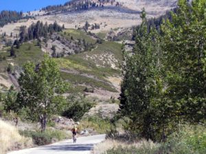
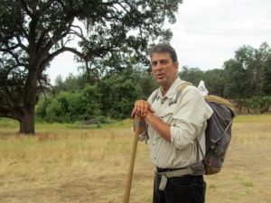
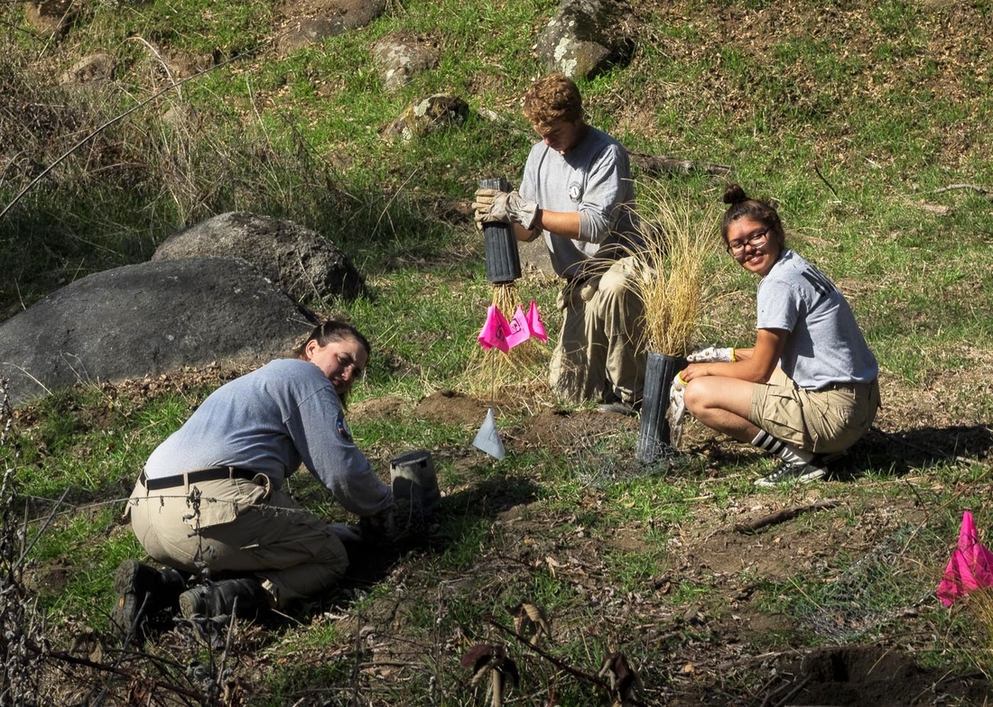
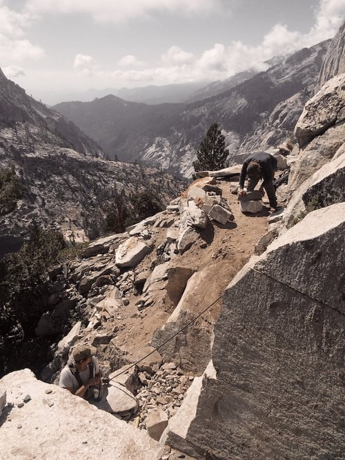
     It’s not easy to get hired on to a Sequoia and Kings Canyon National Parks trail crew. First, applicants must realize that their work locations may be in any area of these two parks, which are 93% wilderness and span “an extraordinary continuum of ecosystems, arrayed along the greatest vertical relief (1,370 to 14,495 feet elevation) of any protected area in the lower 48 states.”

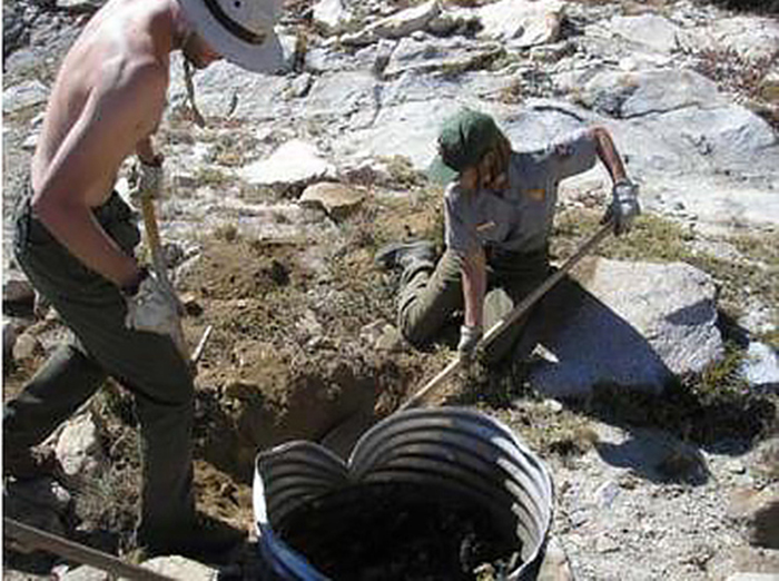
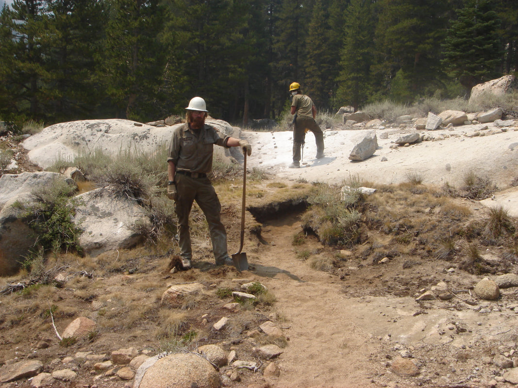
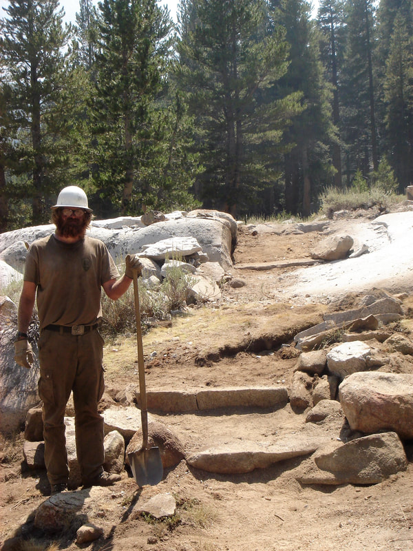
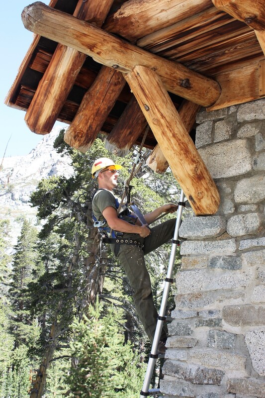
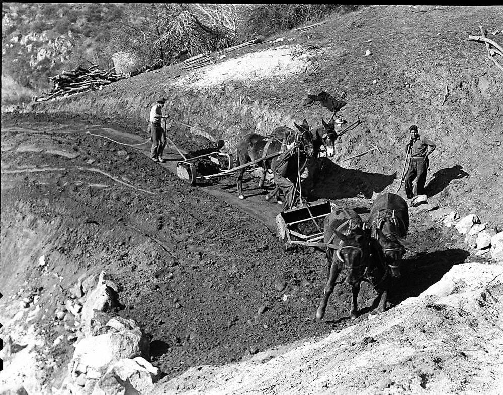
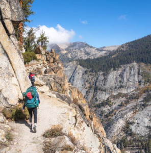
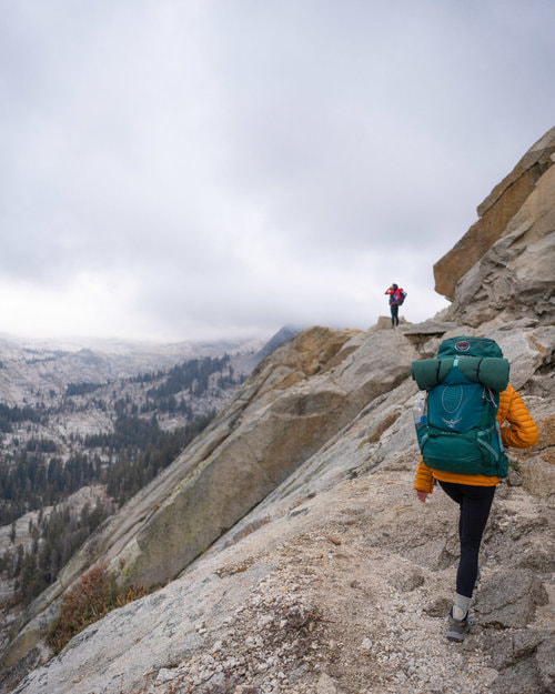
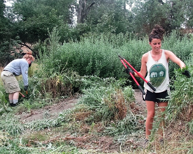
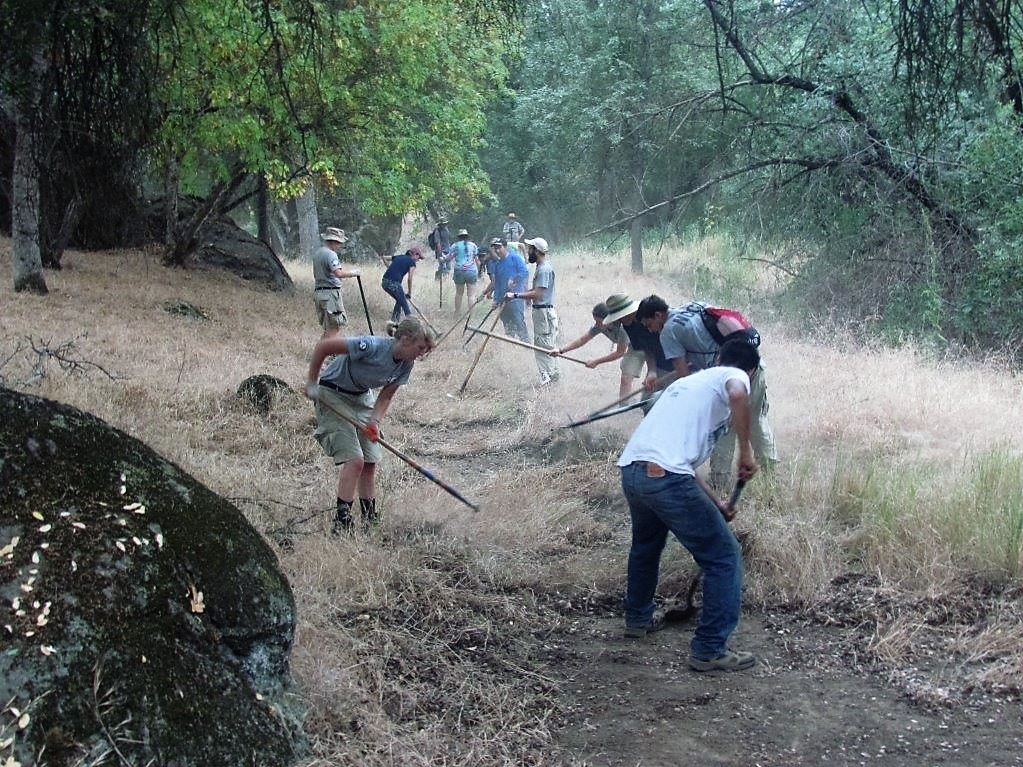
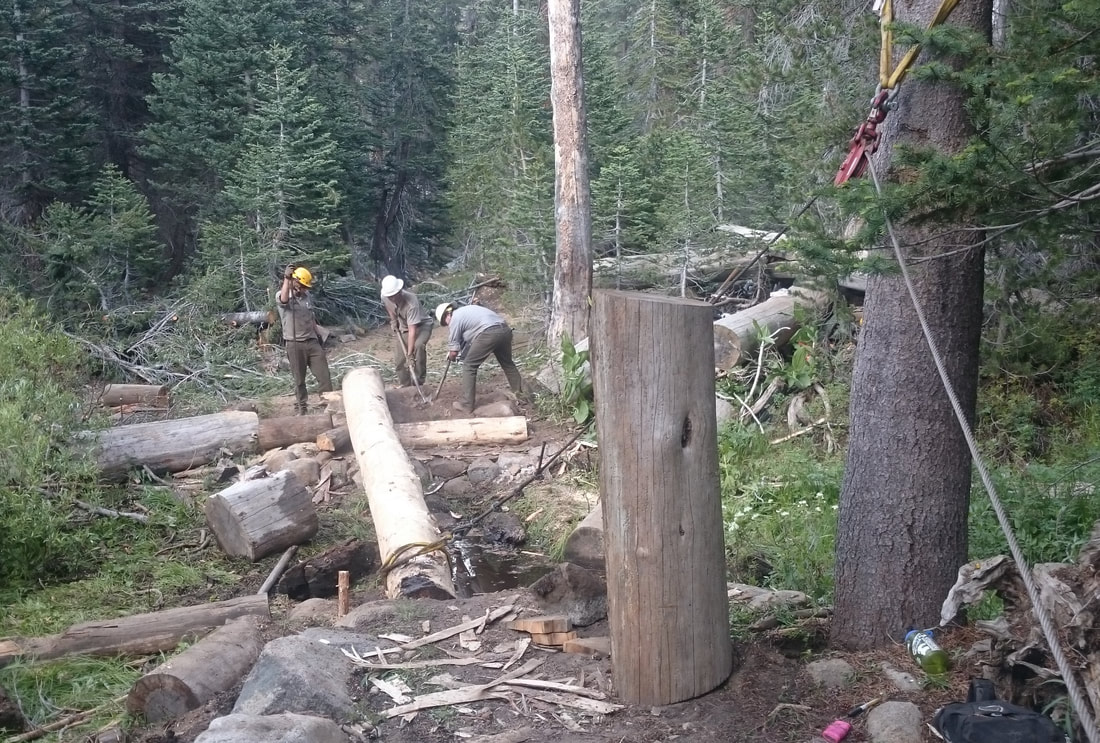
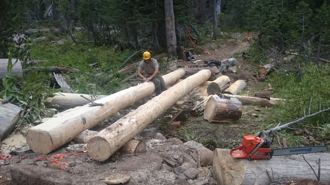
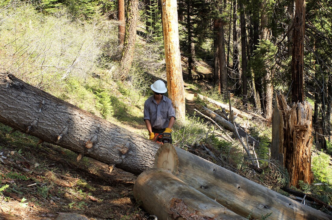
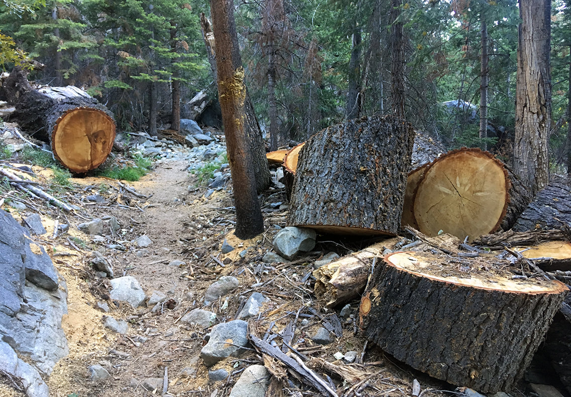
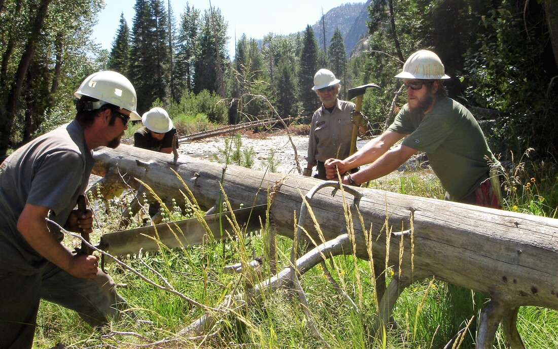
     Trail crew positions require wilderness travel and camping skills; the ability to hike at high altitude for extended periods of time and up to 20 miles a day while carrying backpacks, tools, and supplies weighing at least 50 pounds; and the ability to perform masonry and carpentry work in addition to a full spectrum of basic trail work, including clearing fallen logs, removing encroaching vegetation, digging to maintain drainage structures or trail tread, and moving materials of all shapes and sizes in rugged terrain.

     Are you still interested?

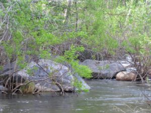
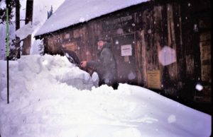
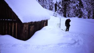
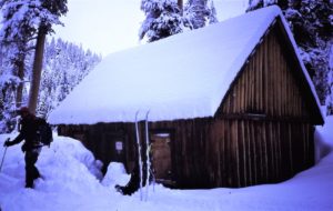
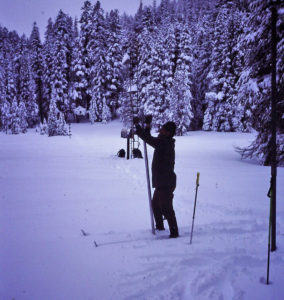
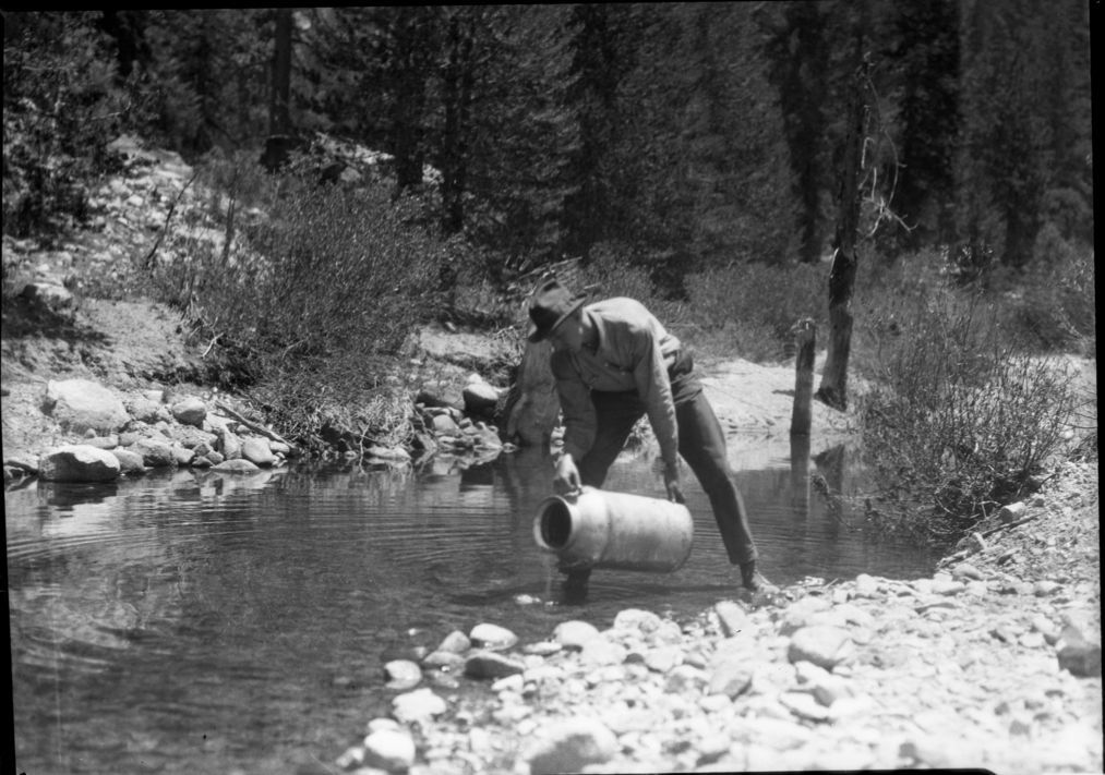
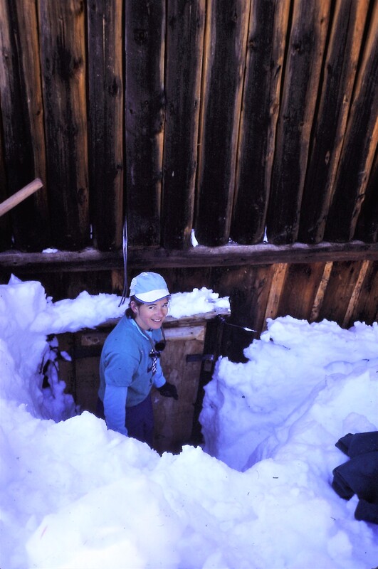
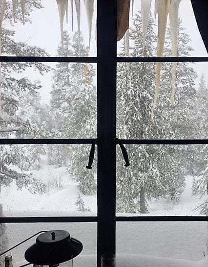
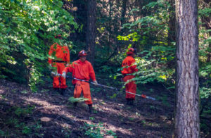
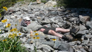
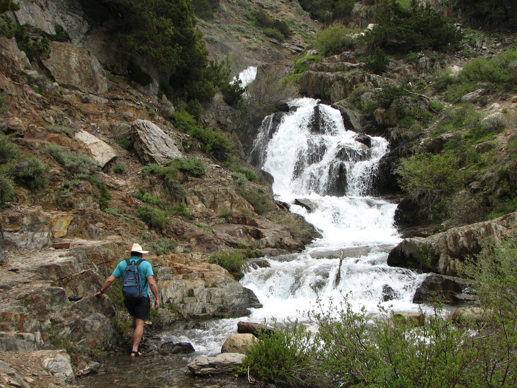
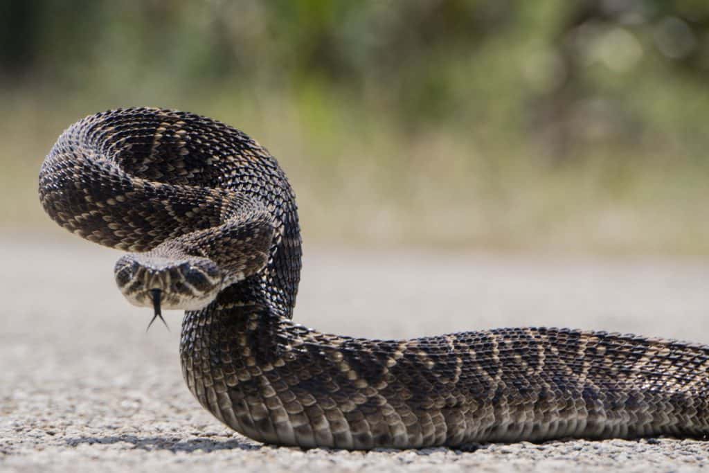
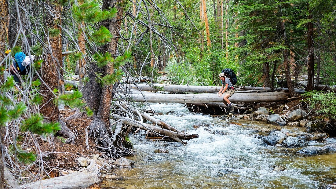
     Trail crews in these parks work outdoors in temperatures varying from over a hundred degrees down to near ten degrees, and may experience heavy rain, hail, and falling snow. Typically, the work environment is hot, dusty, dirty, and sometimes noisy. Working long hours, hiking or riding horseback in rough country, crews may encounter hazards such as poisonous plants and animals and high, cold, swift water at stream crossings.

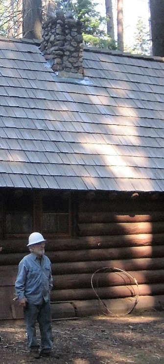
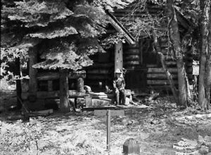
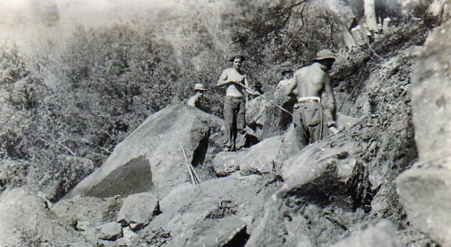
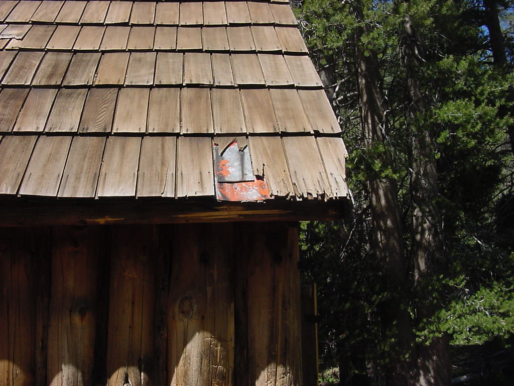
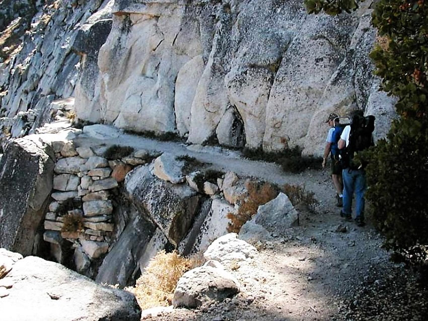
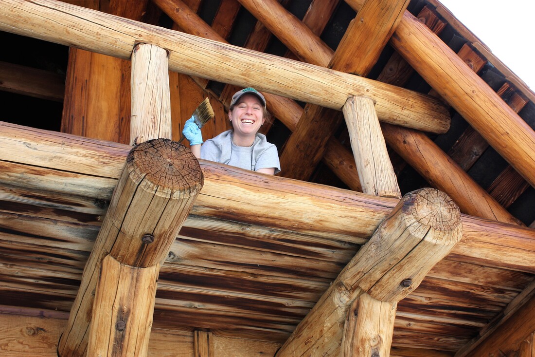
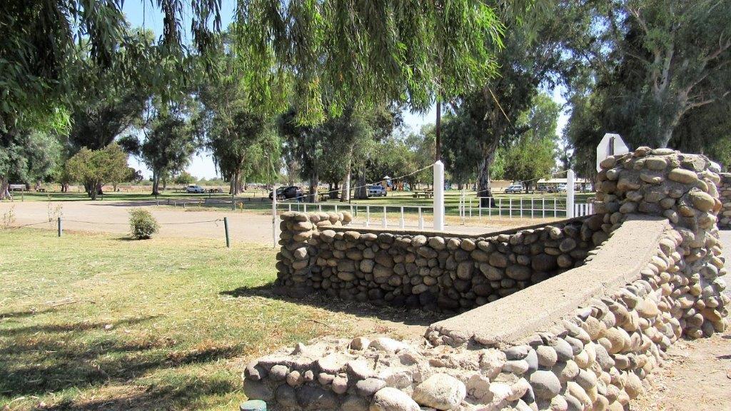
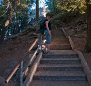
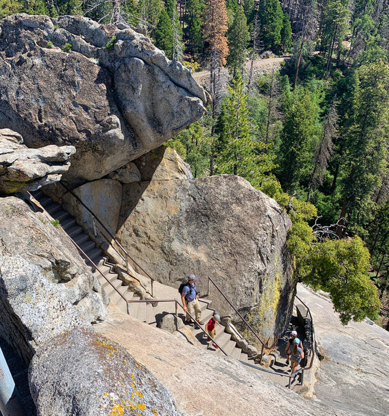
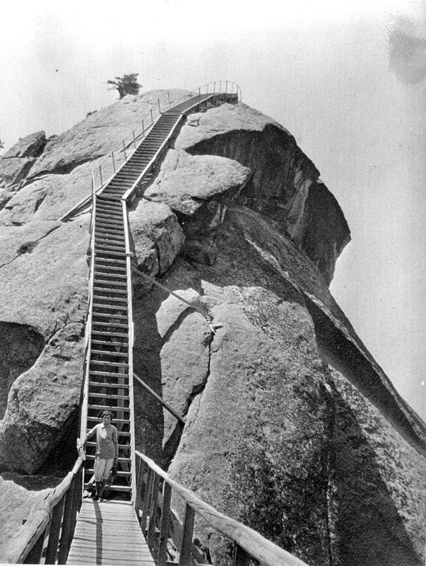
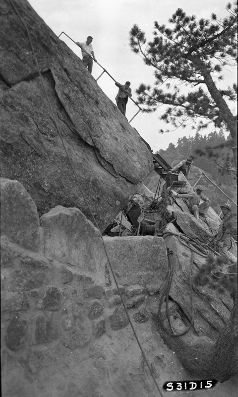
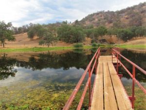
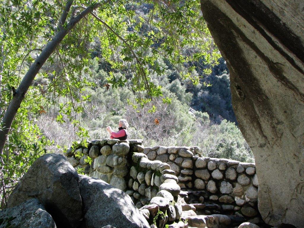
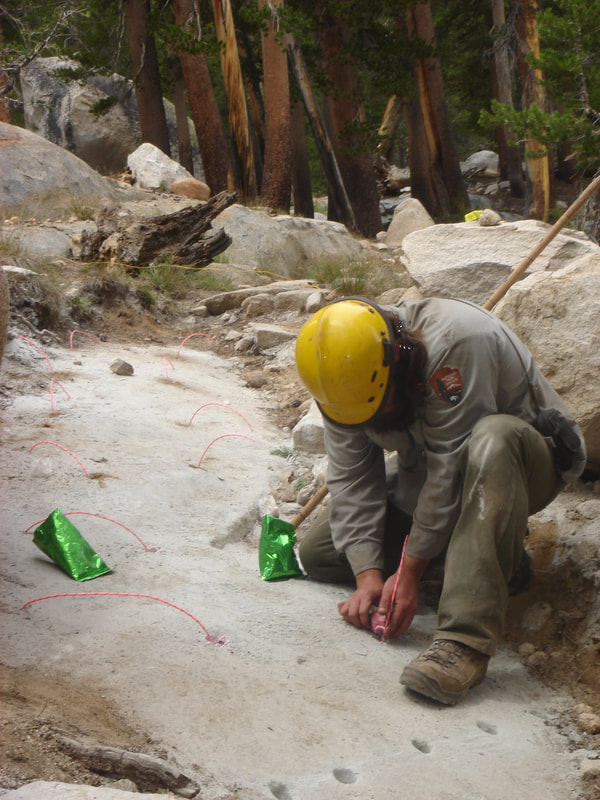
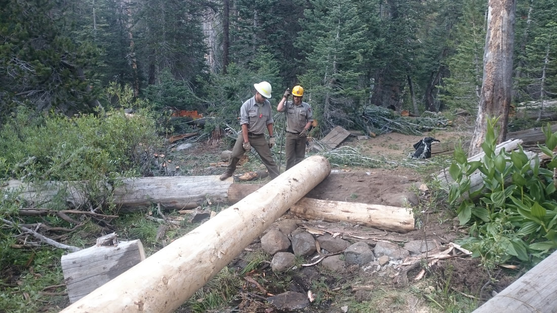
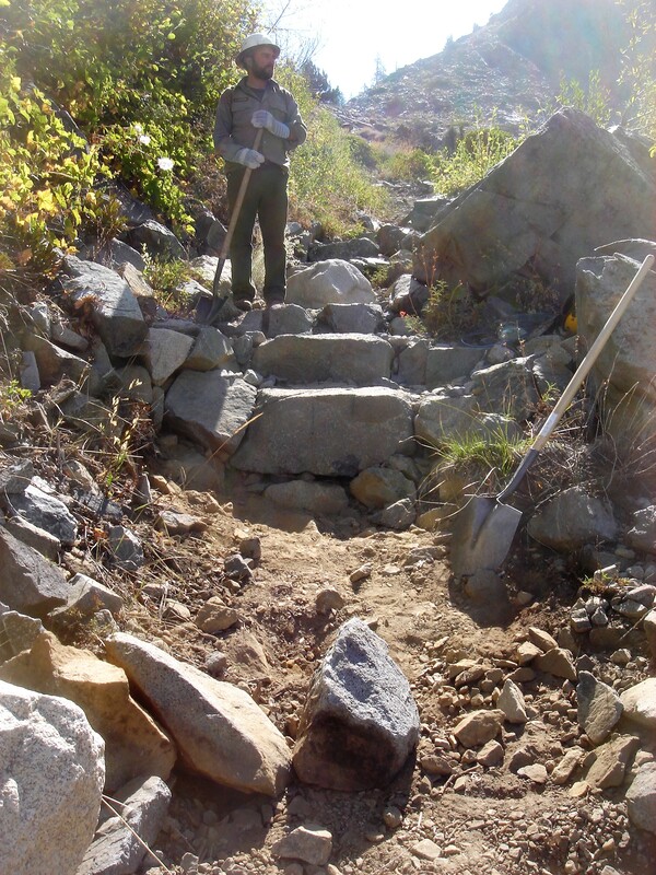
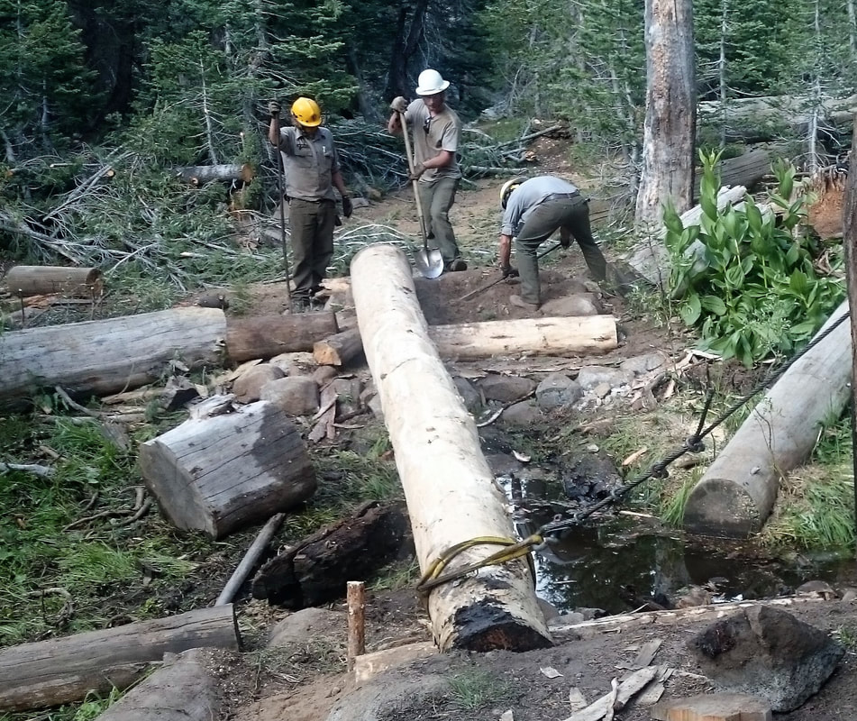
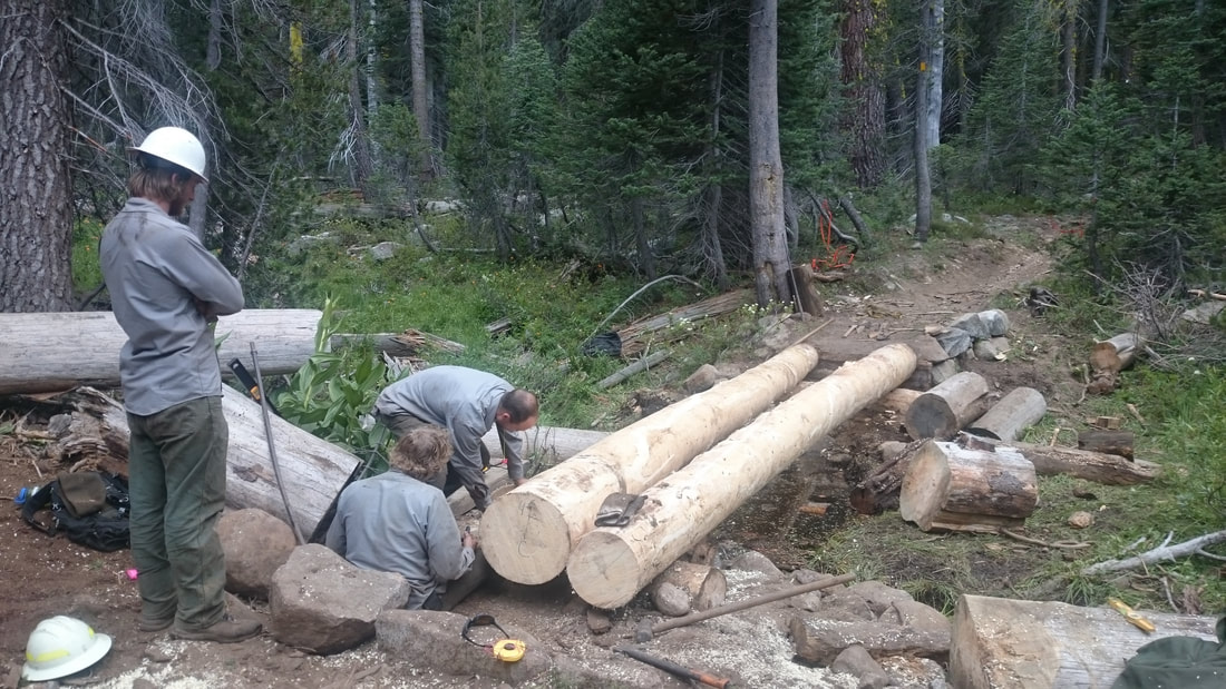
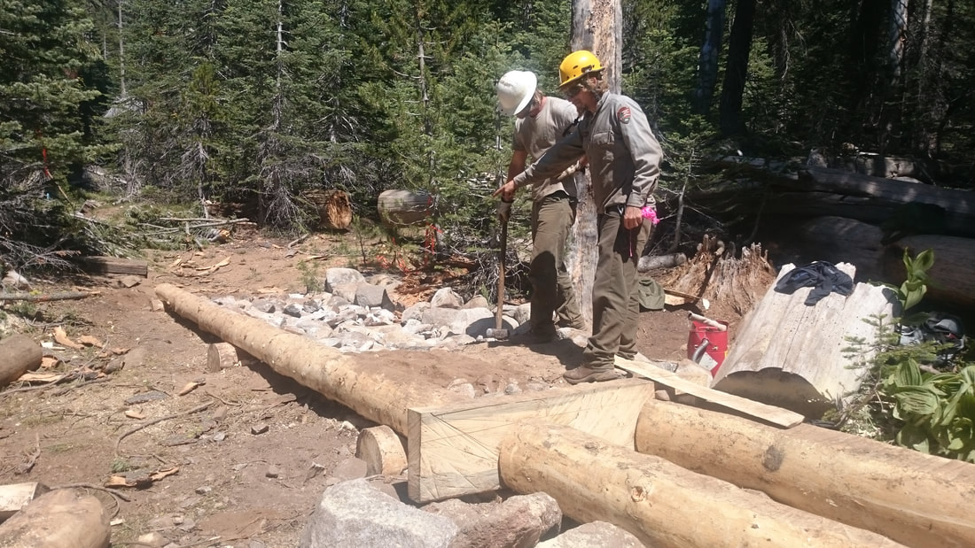
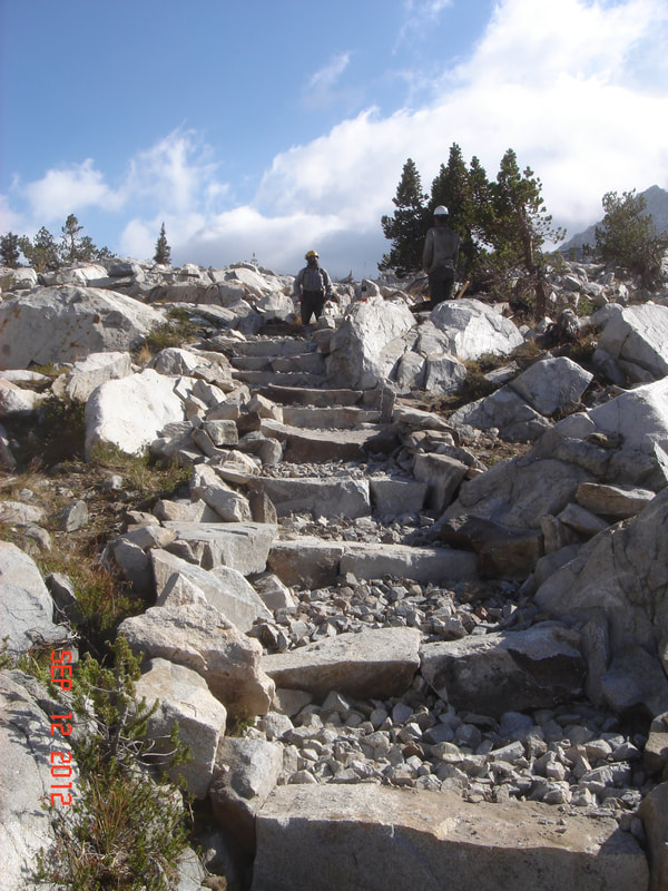
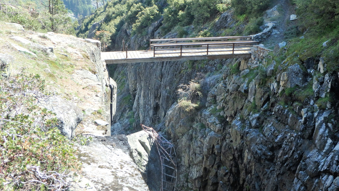
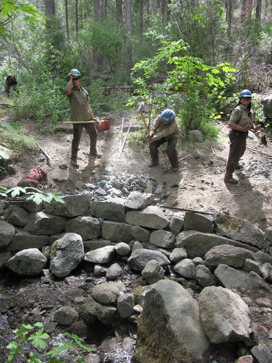
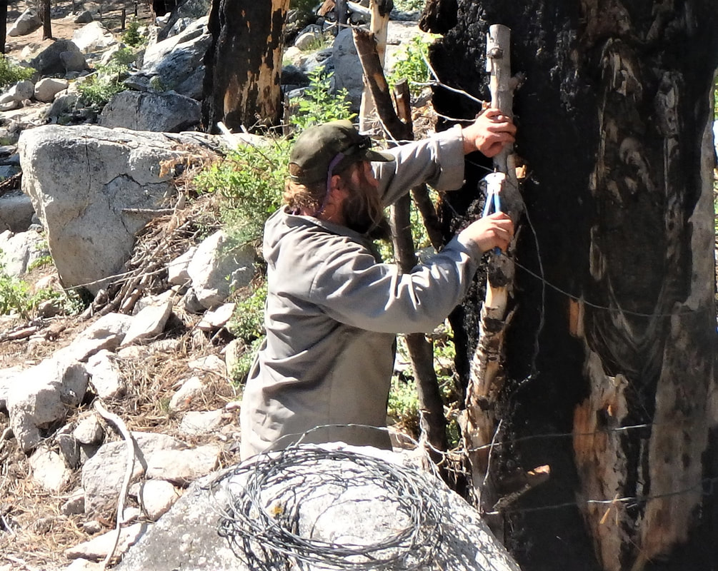
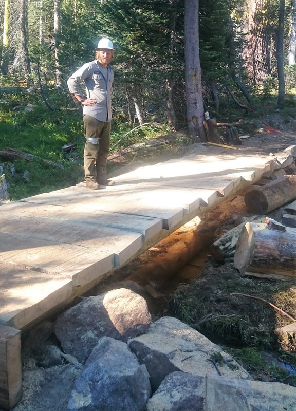
     They construct, repair, and maintain bridges, abutments, aesthetically pleasing rock walls, walkways, causeways, trail tread, water bars and retainer steps. Their tools include rock bars and drills, jacks, chisels, a variety of saws, timber tongs, draw knives, planes, and other masonry and carpentry tools, which they also clean and repair.

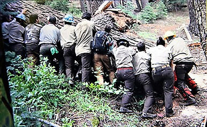
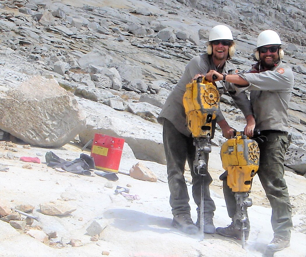
     Heavy physical effort is required in using both hand and power tools; frequently lifting , carrying, or rolling objects such as rocks and logs weighing over 100 pounds; moving slabs and boulders weighing several tons with rock bars; using hammers to crush or shape rock; and shoveling extensively.

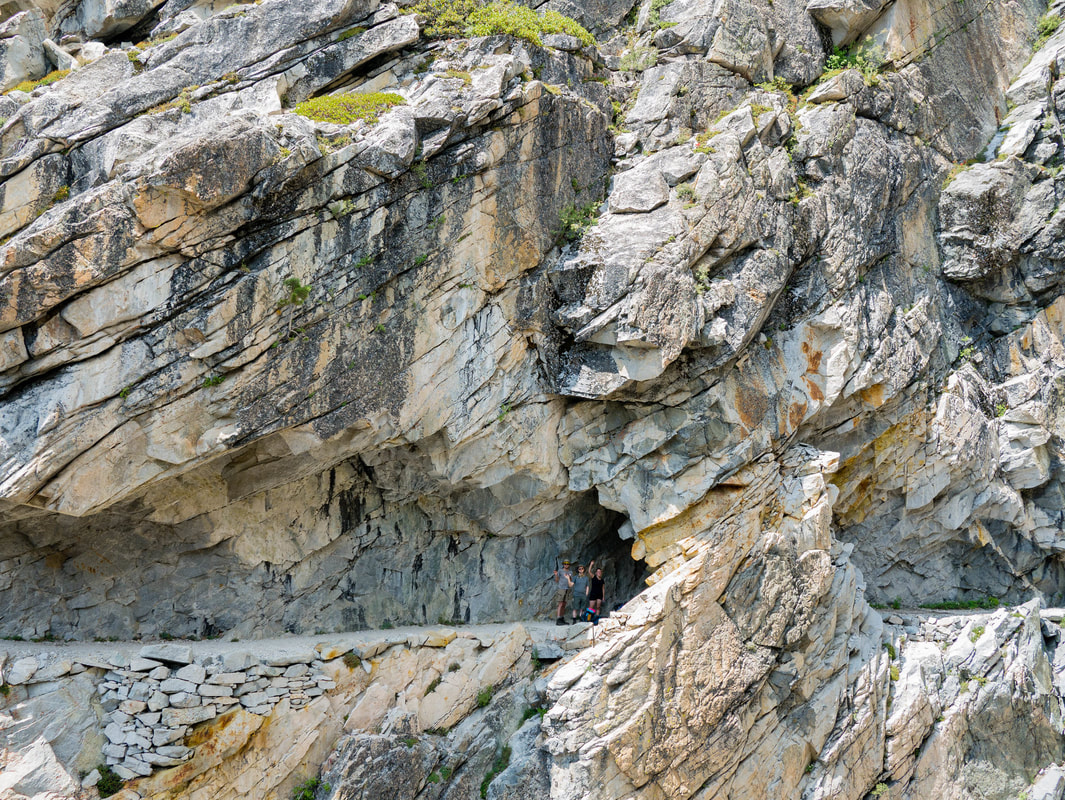
     To provide for visitor access and safety, the crews build all kinds of trails, from accessible trails meeting Americans with Disabilities Act guidelines in some frontcountry sites to trails that climb to high mountain peaks in the backcountry. Laws including the National Historic Preservation Act, the National Trail System Act, the Wilderness Act, the National Environmental Policy Act, the Endangered Species Act, and the Clean Water Act all apply in Sequoia and Kings Canyon.

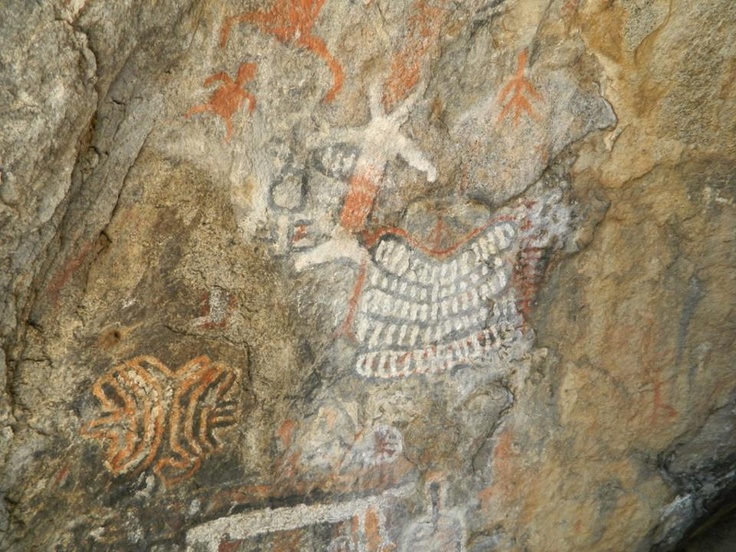
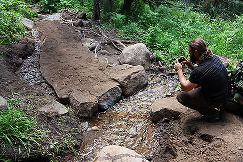
     These laws require trails to avoid damaging habitats or disrupting important lands, waters, or historic or prehistoric sites. To protect cultural and natural resources, crews may route trails around sensitive areas, construct boardwalks over wetlands, or seasonally close trails during nesting or migration times.

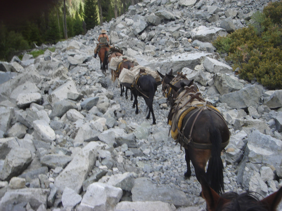
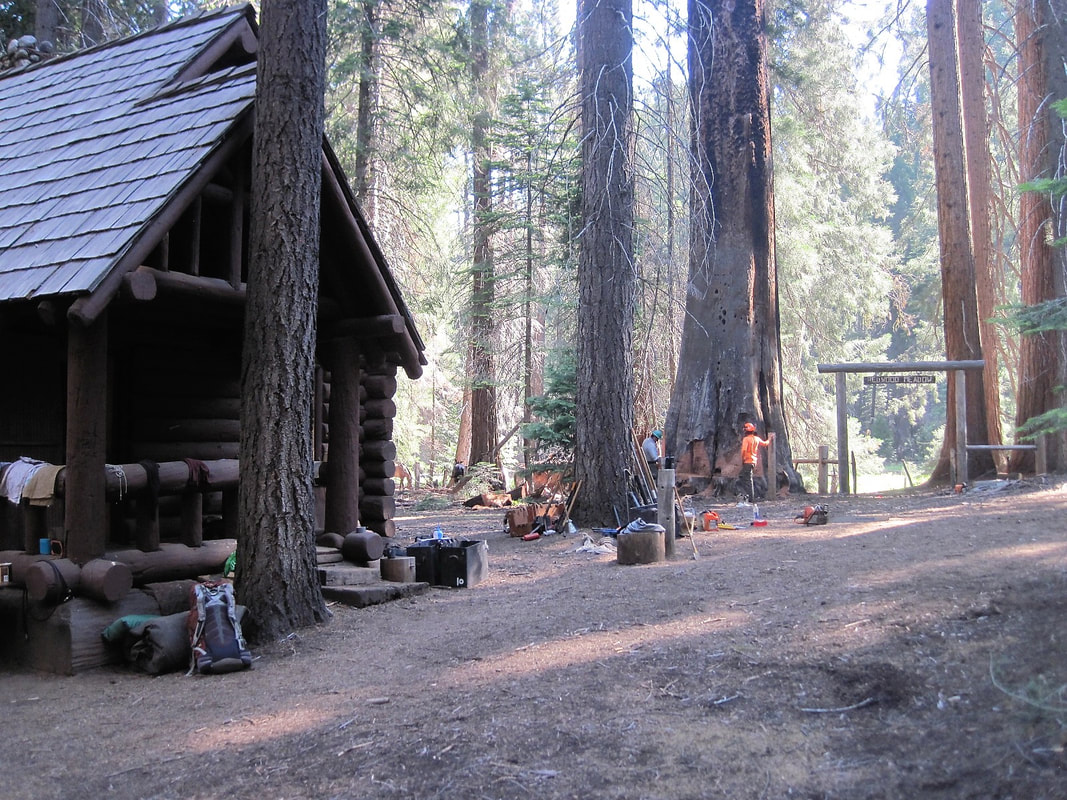
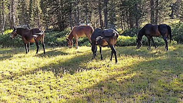
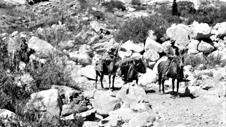
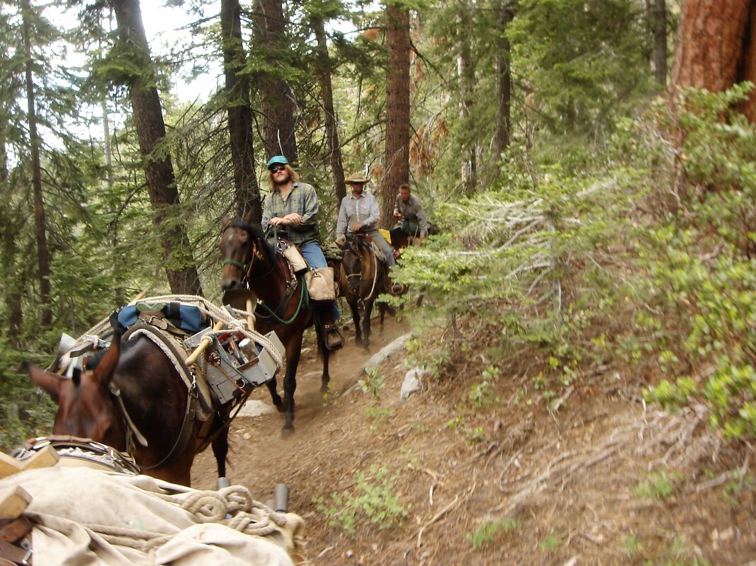
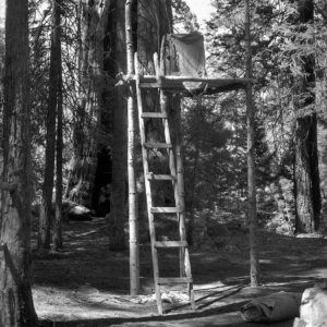
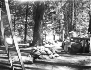
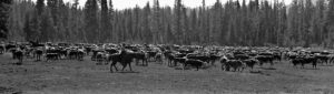
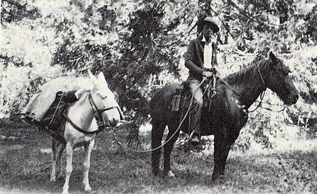
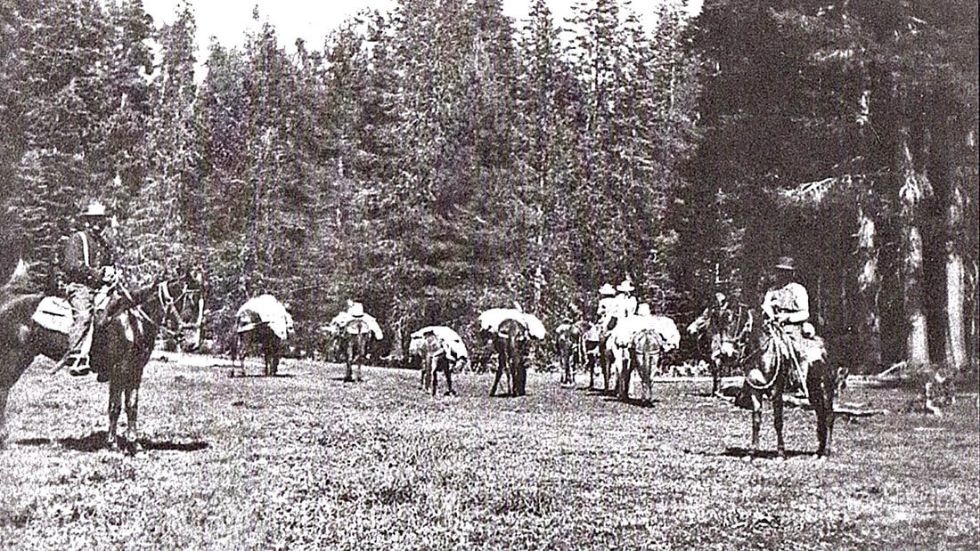
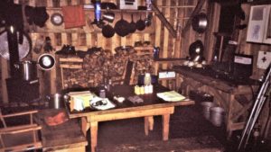
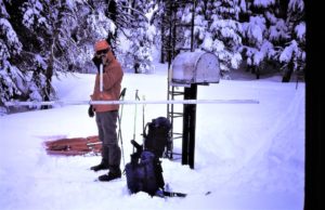
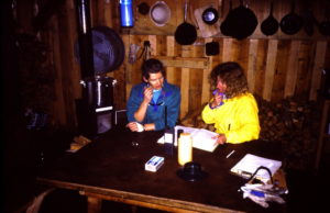
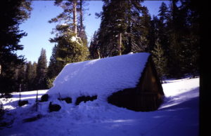
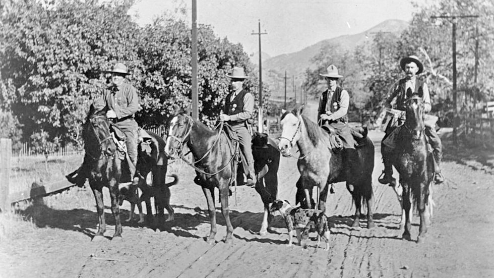
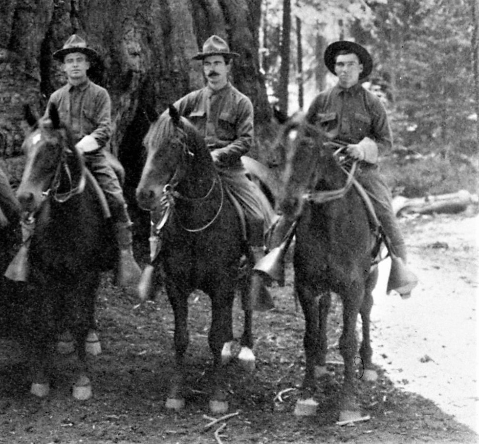
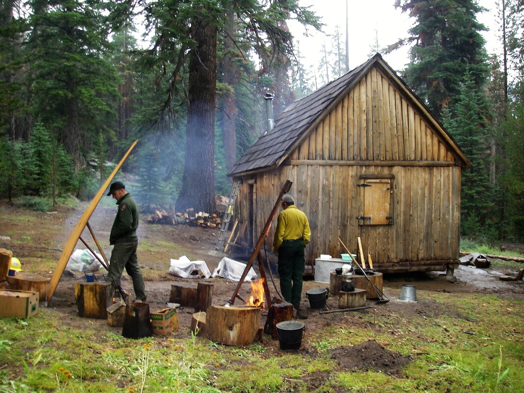
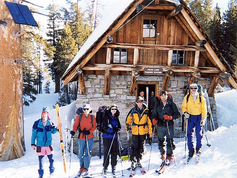
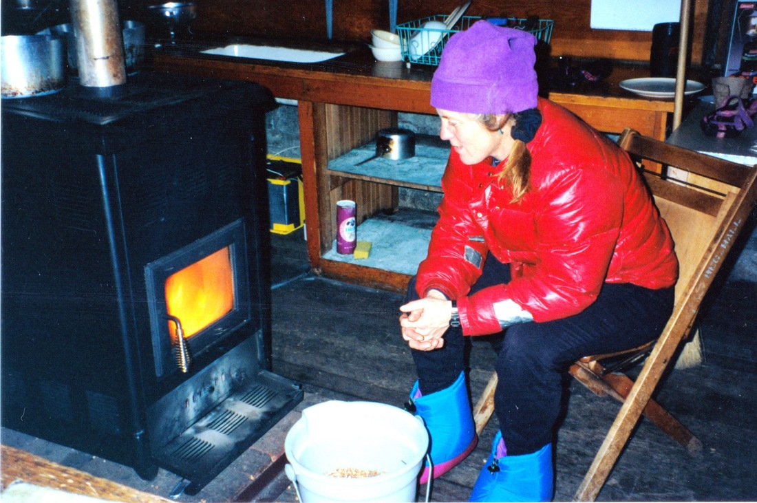
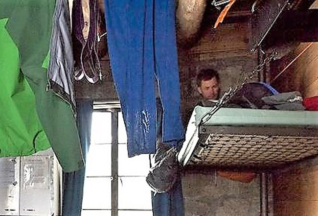
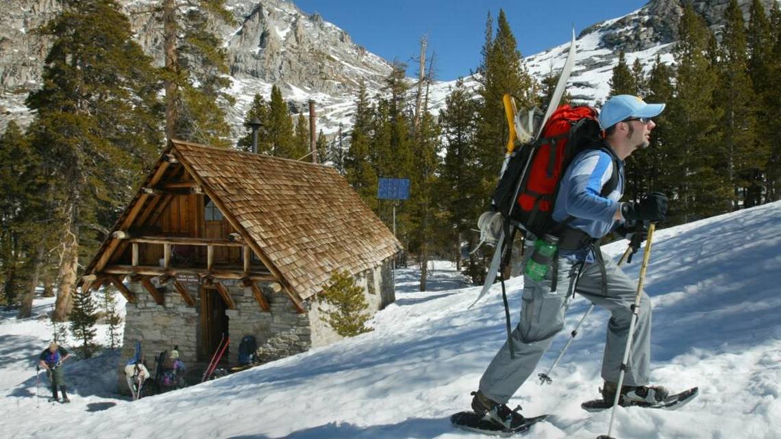
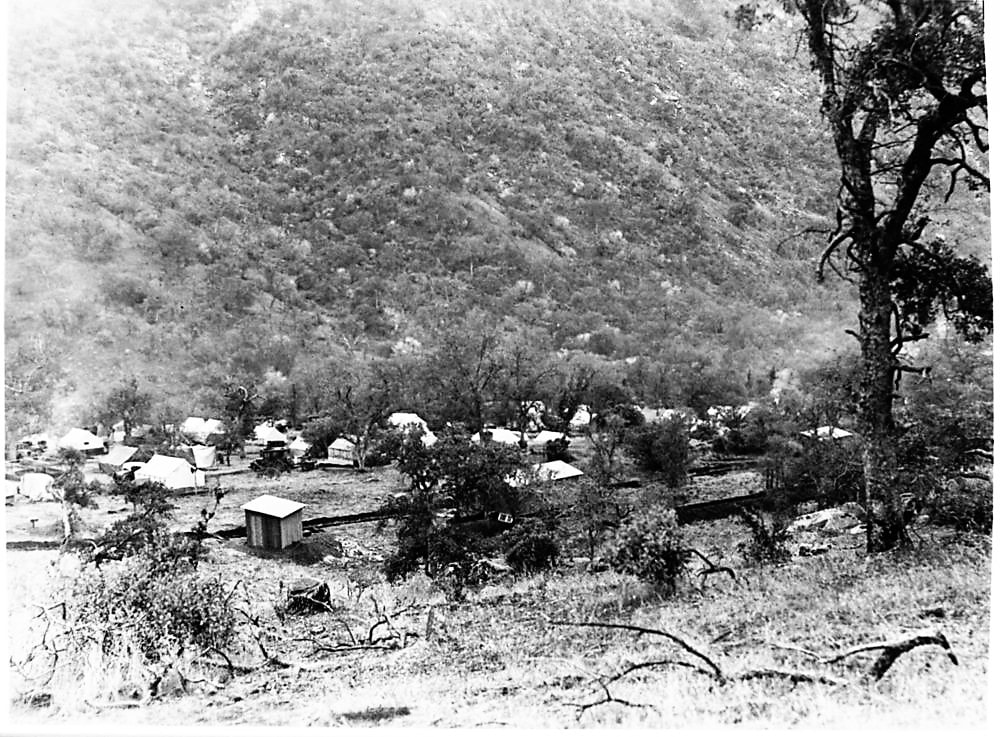
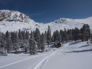
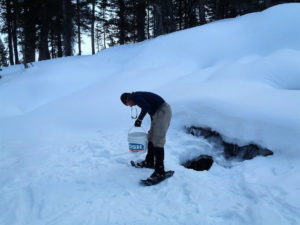
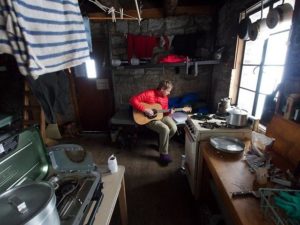
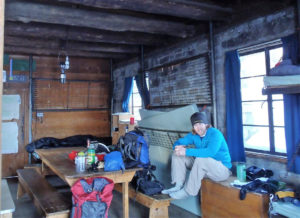
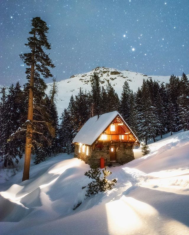
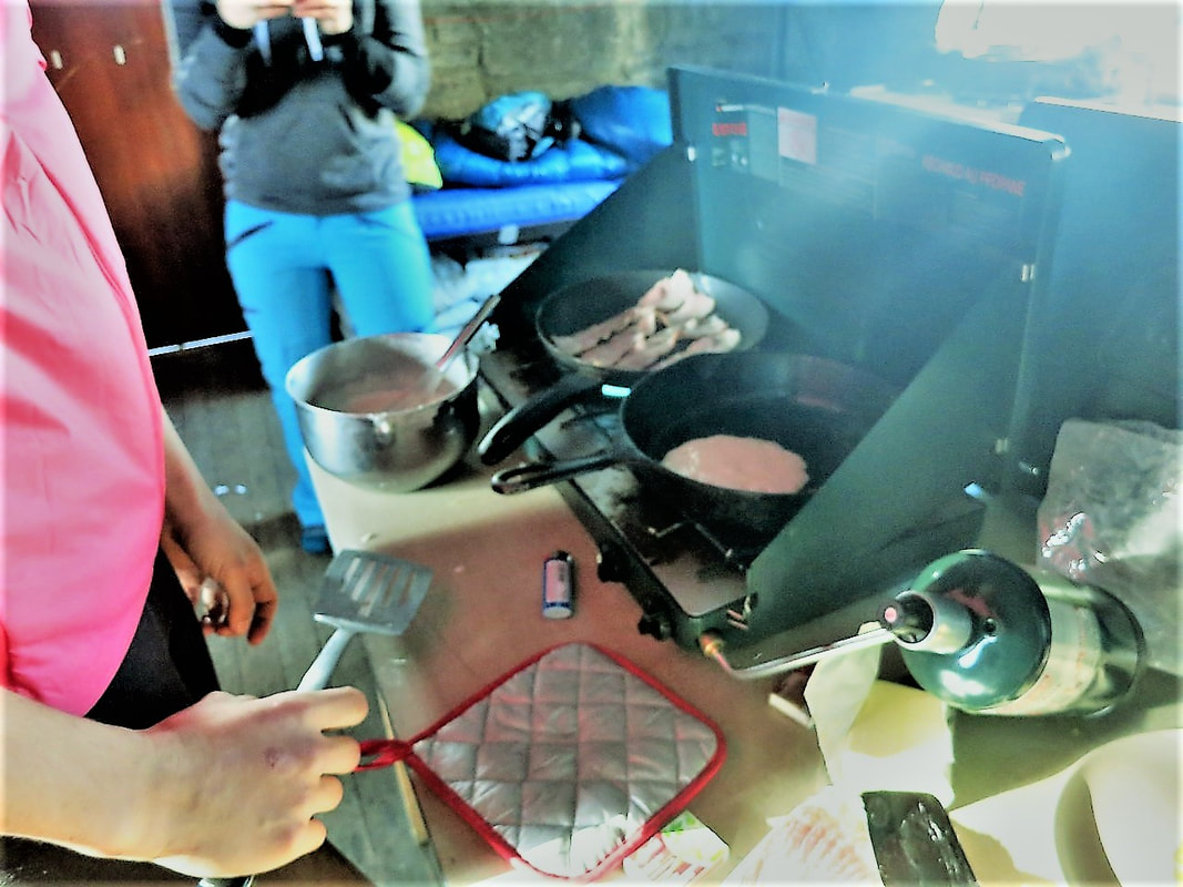
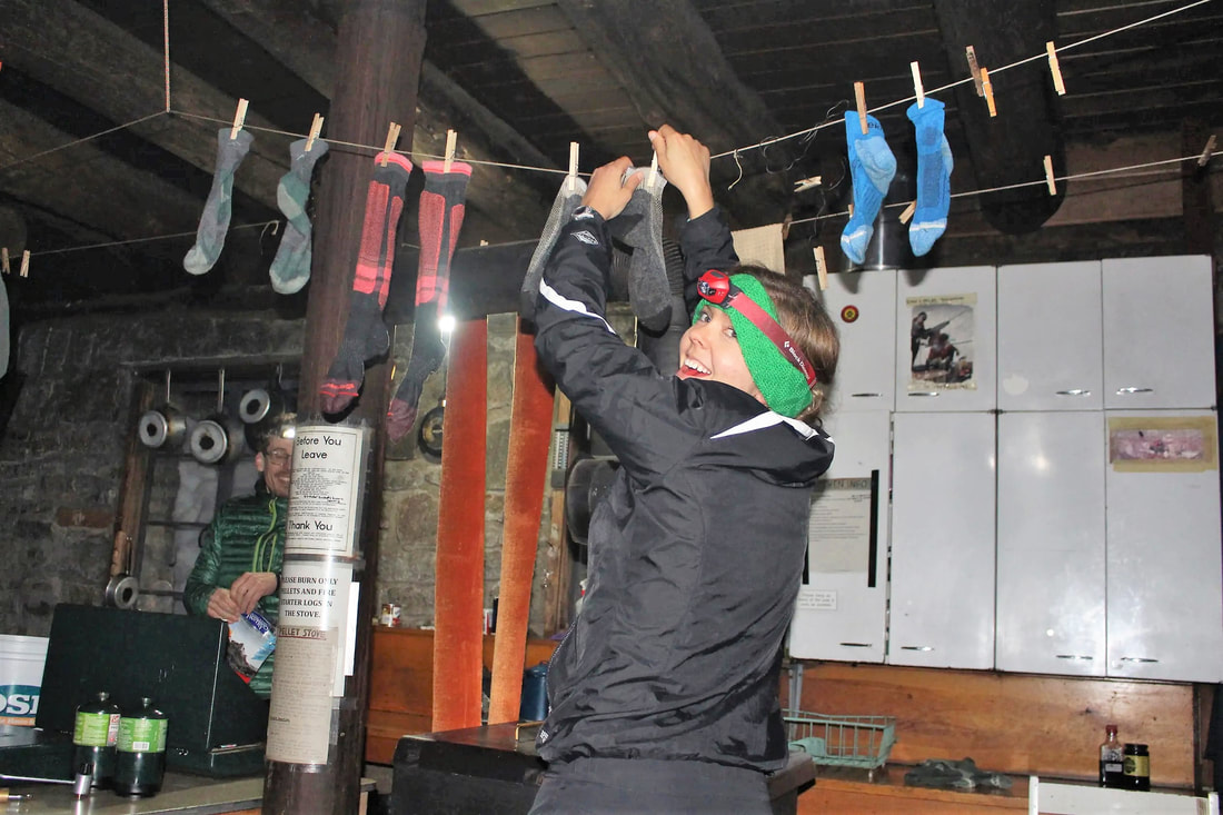
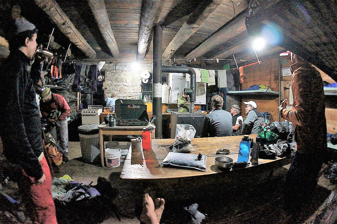
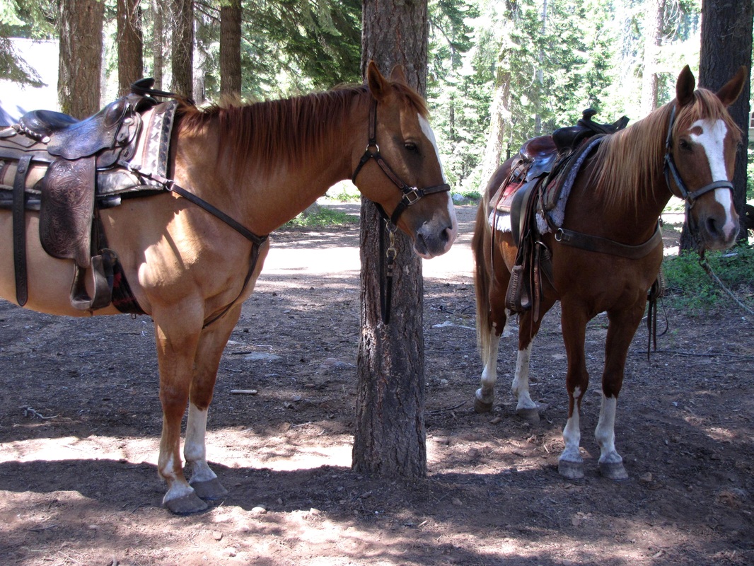
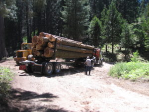
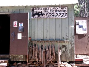
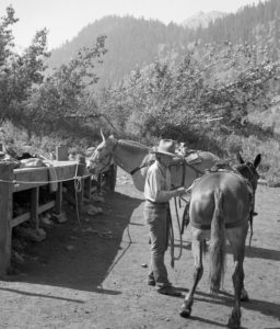
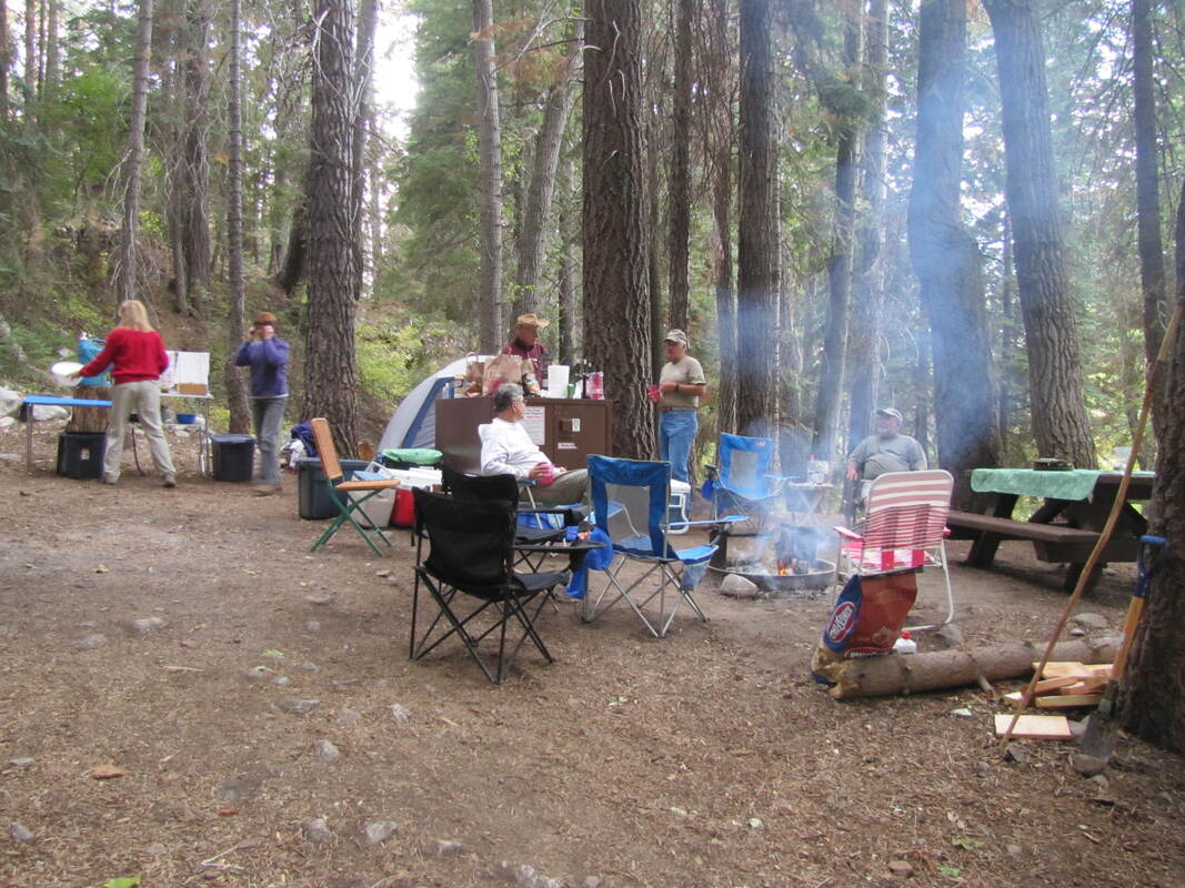
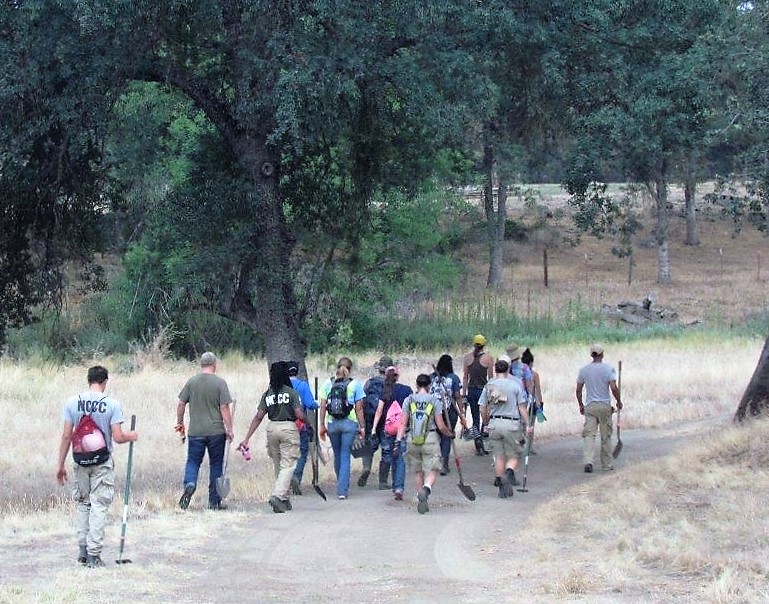
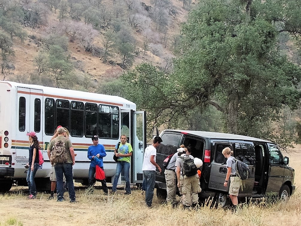
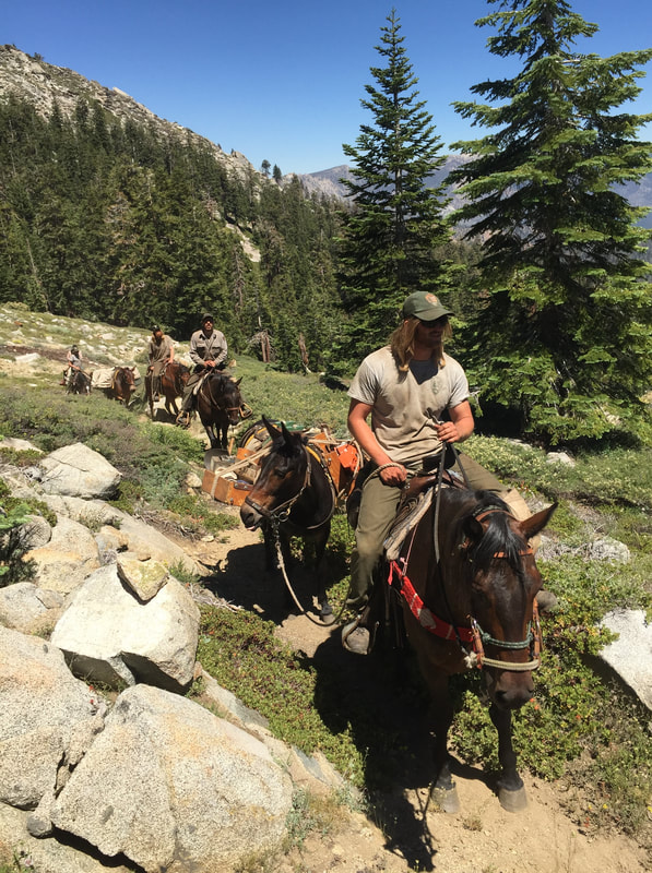
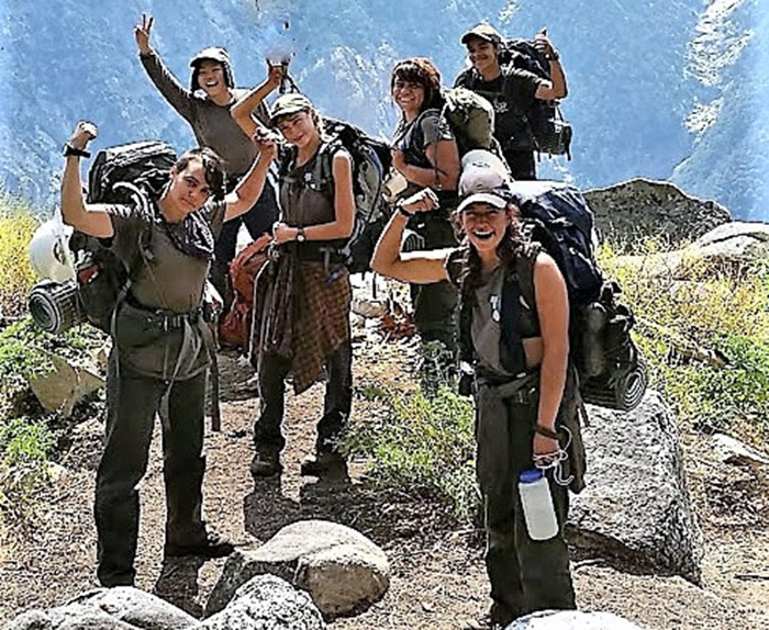
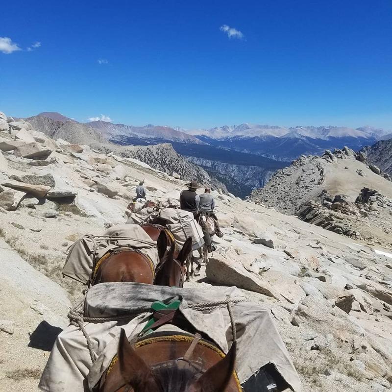
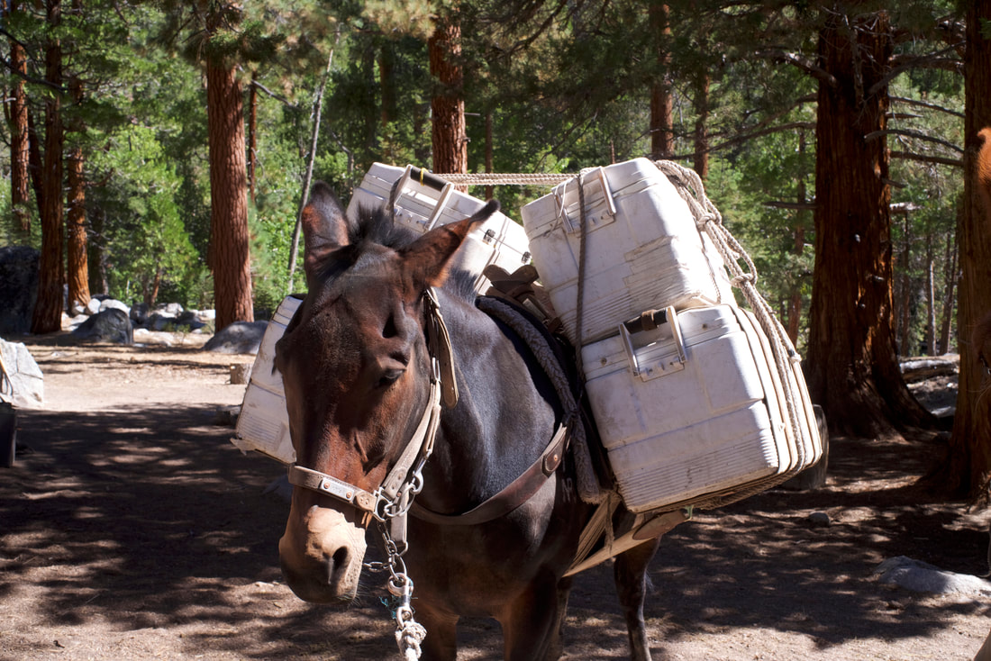
     Crew members must also have the ability to live and work effectively in remote, primitive backcountry areas in close contact with small numbers of people for two to twelve weeks at a time. Crews typically consist of three to ten NPS workers, and a Cook for work in the backcountry. Crews may be supplemented by work groups from the California Conservation Corps, the Student Conservation Corps, Volunteers-in-Parks, and other programs. To support backcountry projects, pack trains periodically bring in food, mail, supplies, and equipment.

     Would you like to gain the extra skills and responsibilities of a crew leader?

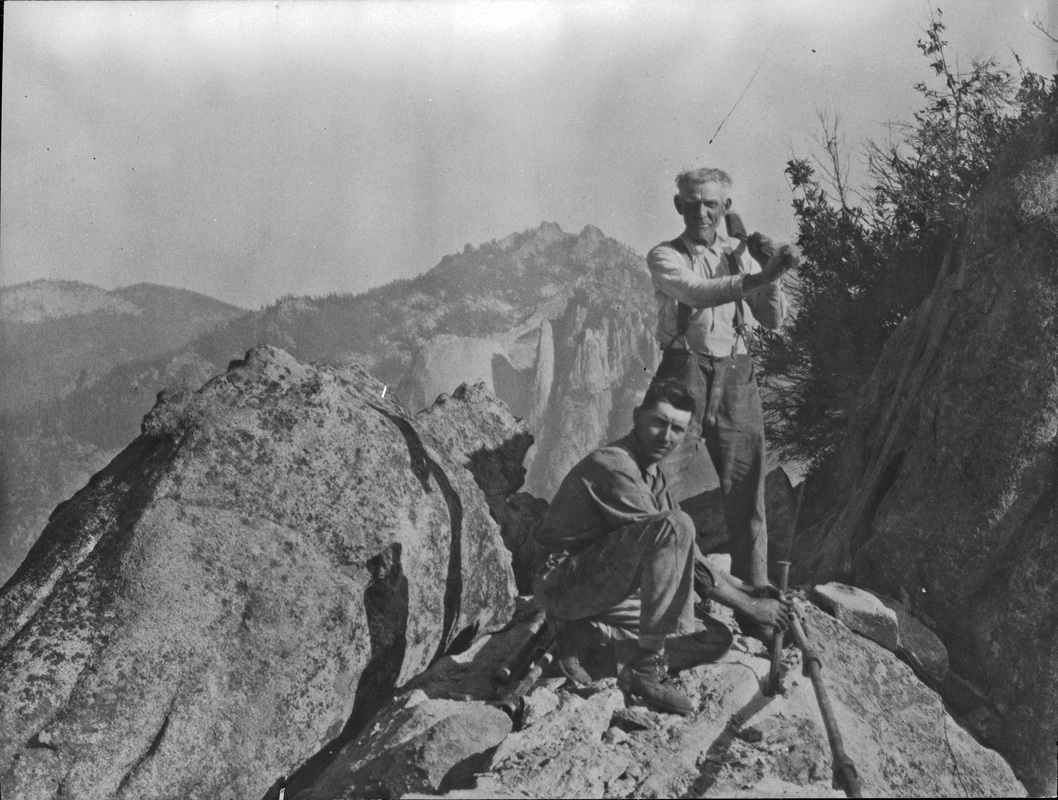
     Trail crew leaders not only perform the full spectrum of trail work themselves. They also have to perform inspections, surveys, and inventories of facilities for maintenance needs to provide for accurate planning and scheduling of work, and make informed recommendations for operational improvements. They plan, lead, and supervise the crew’s work, provide training, emphasize and monitor safety, and, of course, write reports.

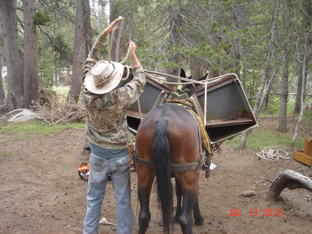
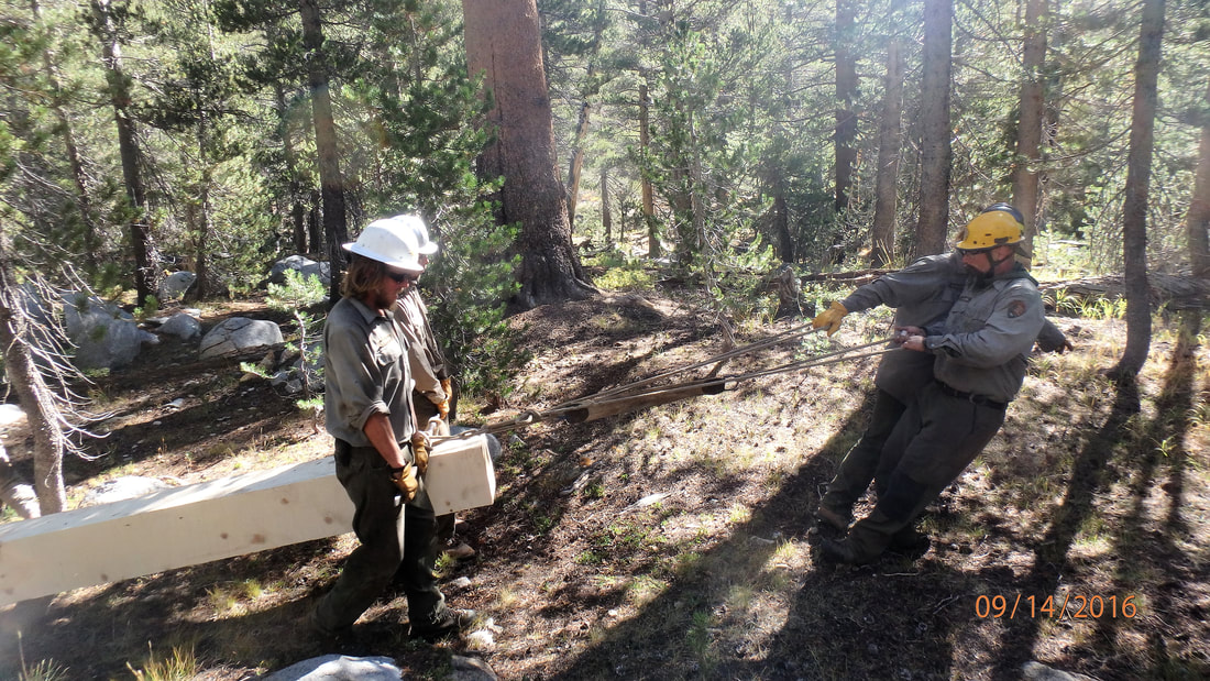
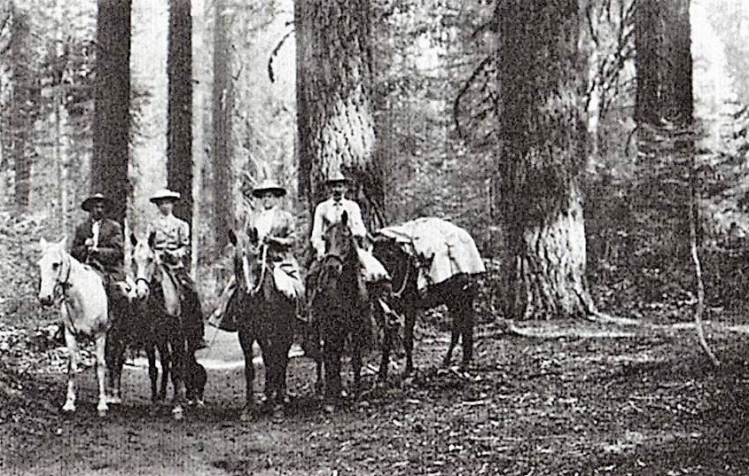
     Additionally, crew leaders must possess and maintain an NPS Blasters License because they serve as Blaster in Charge to remove obstacles such as logs and rocks from trail tread, to quarry stone for masonry work, and to establish trail bench in bedrock areas. They also assist in mule and horse packing operations by riding on mountainous trails, preparing supplies and materials for mule transport, tying on loads, and leading pack animals. To move big boulders and logs in the wilderness, they set up and use human-powered winches and rigging such as high-lines.

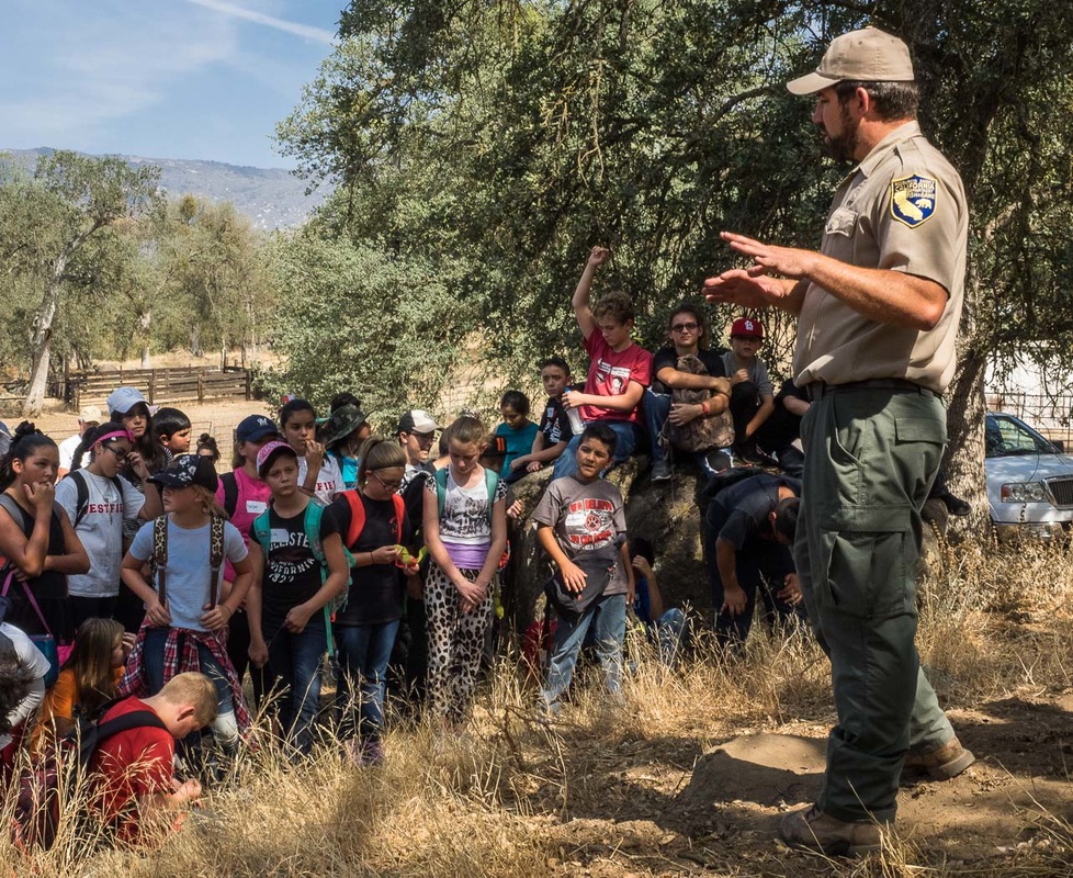
     The crews often coordinate with backcountry rangers to determine and prioritize projects in their work areas, and frequently assist park visitors by providing information about trails and weather, helping with communications and directions, and even participating in searches for persons reported missing or overdue.

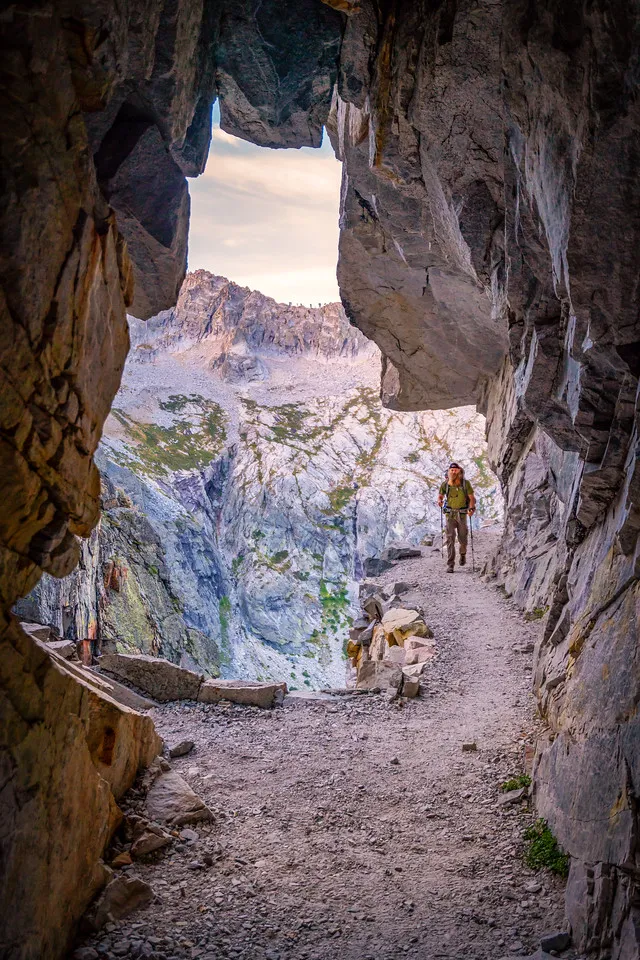
     Have you had the opportunity to thank a trail crew yet? Next time you’re traveling on some part of the tremendous trail network in Sequoia and Kings Canyon National Parks, pause to reflect on what you’re walking on and appreciate the work of the dedicated, skillful men and women who have labored for such long hours in such difficult conditions to make your journey as smooth and safe as they can.

     As a young worker from the Eastern Sierra Conservation Corps serving in our parks put it, ” It takes tremendous grit and passion for a member of a national park trail crew to thrive. Though the days may be long, the physical demands arduous, and the unexpected challenges difficult to navigate, one thing is for sure: serving on a trail crew guarantees an unforgettable experience.”

     (If you’d like to try to join a national park trail crew, check usajobs.gov and search for “maintenance worker trails”.)

May, 2020


NOTE:  To find the “History of the Wilderness Trail System of Sequoia and Kings Canyon National Parks, see Granite Pathways, by William C. Tweed (Three Rivers, CA; Sequoia Parks Conservancy, 2021).

[


Quotes & More Photos:

“Nothing will give you as much appreciation for the trails you tread on than serving on a trail crew. The stunning vistas, backpacker-friendly schedule (many crews work 8-10 days on, 4-6 days off) and group camaraderie are just icing on the cake.” — Paul Chisholm, 2017

“Working at a National Park teaches you confidence and perseverance. I spent six months with the Backcountry Trails Program in Kings Canyon National Park . . . . [T]the commute was the worst part. . . . I had to move as fast as I could with a pack and tools — shovels, McLeod’s, loppers, Pulaskis, sledgehammers, 20-pound rock bars, grip hoists — uphill, nonstop, for miles . . . at elevations exceeding 13,000 feet. We were the highest-elevation trail crew in the country that year . . . .” — Anna Mattinger, 2018

“We used hand tools for everything. To the tune of snow, heat, river crossings, and mosquitoes, we turned big rocks into little rocks into littler rocks . . . to make a foundation of several feet of ‘crush’ hidden underneath dirt trails to prevent overgrowth . . . .” — Anna Mattinger, 2018

“Trail crews frequently work in isolated areas where medical facilities are not readily available, and transportation of an injured person is often difficult and dangerous. Good safety practices demand that each crew member keep in good physical condition and maintain a high level of safety consciousness at all times, in camp as well as on the job. . . . [E]very employee must be his or her own safety inspector on the job, work in a safe manner, and point out unsafe practices to other crew members.” — NPS Trails Management Handbook

“You’ll learn to fear lightning when you’re working above the timberline. You’ll learn drystone masonry and how to build rock walls and stairs without cement. The standards are high: If your work can’t be expected to withstand a century of continuous foot traffic and weather, it isn’t good enough. . . . . Doing this stuff, you’ll learn that granite weighs around 170 pounds per cubic foot.” — Anna Mattinger, 07/18/18

“The trail crew cleared and blasted granite footing and widened the area around the bluffs. Great work, mules will no longer bang their boxes on the upslope side, the impact pushing the animal toward the trail edge.” — Joe Ventura, Hockett Meadow Ranger, 2009

“It has to be sturdy enough to take the steady thudding of boots and hooves without disintegrating. It has to be angled so that the water pouring down a slope doesn’t course through it and turn it into a stream. It has to be high and dry enough that boots and hooves don’t sink knee-deep in mud. Oh, and it can’t have fallen trees blocking it. When about 700 trees . . . were left sprawled across the 10 -mile trail . . . by winter’s high snows and spring’s high winds, someone had to clear them away.” — Felicity Barringer, 2011

“The trail was still going down as I passed some huge logs, freshly cut into pieces. The smell of fresh sawdust still hung in the air. I am always amazed about the people who do all this work: maintaining the trails, fighting fires, building bridges and cutting up big trees that obstruct the trail. I realized that they must bring all their tools, probably by mules or horses, but still they must hike days on the same trail as I was doing.” — Overseas Hiker, 2018

“[T]he regular National Park Service trail crews were supplemented for six weeks by a 14-member crew organized by the California Conservation Corps. The crew included seven veterans (some recruited through the three-year-old Veterans Green Jobs nonprofit) and was part of a pilot program to give former service members training in land conservation.” — Felicity Barringer 2011

“The first few weeks on the job, I contemplated quitting . . . . I am glad I did[n’t], because I learned so much. I was able to participate in creating a bridge over a stream–from felling the tree to using a grip hoist to set the bridge into place. I also was able to help in transforming a rocky slope into a usable trail. I got to rework trails so that water would run off them and erosion would be minimized. I believe these skills will be useful in a future career in landscape architecture.” — joinhandshake.com, 2018

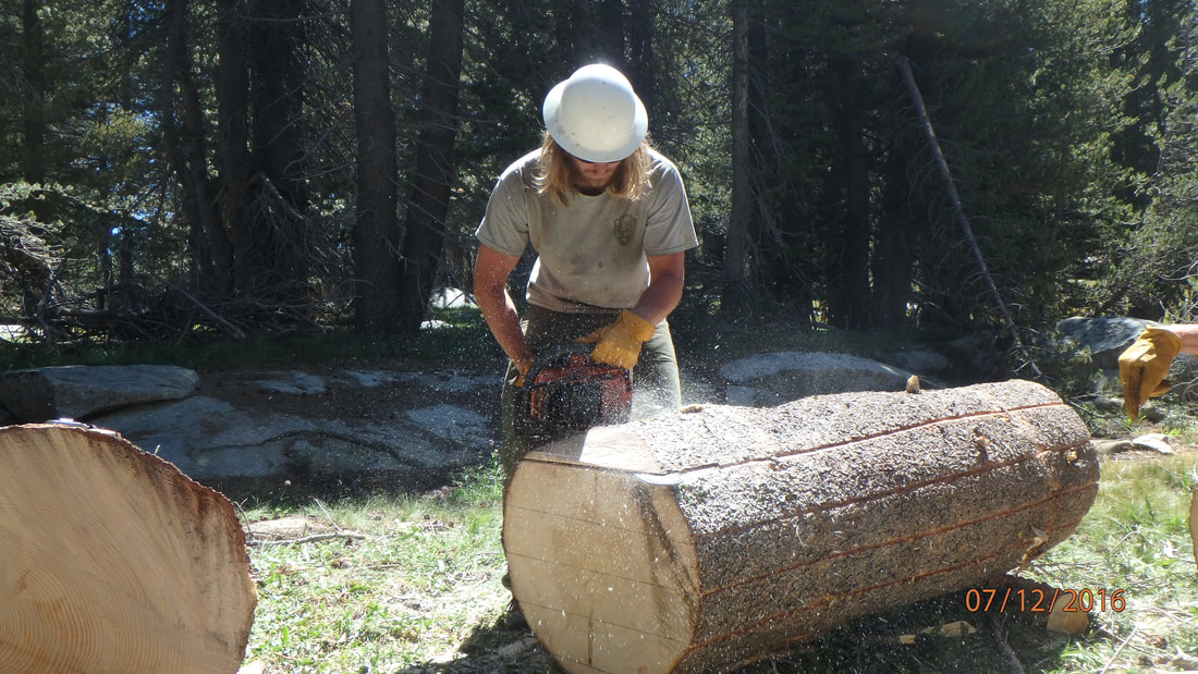
“Performs carpentry work, primarily using heavy log and rough-sawn lumber, on trail structures such as log checks, foot-bridges, multi-use bridges, corrals, hitch rails, and boardwalks.” Use a chain saw to “fell, buck, notch, and/or shape both native and pressure treated logs in the maintenance and construction of bridges, water bars and retainer steps, crib walls and steps, . . . and in clearing trails of down trees and brush. — from NPS job description

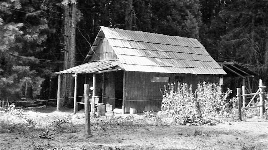
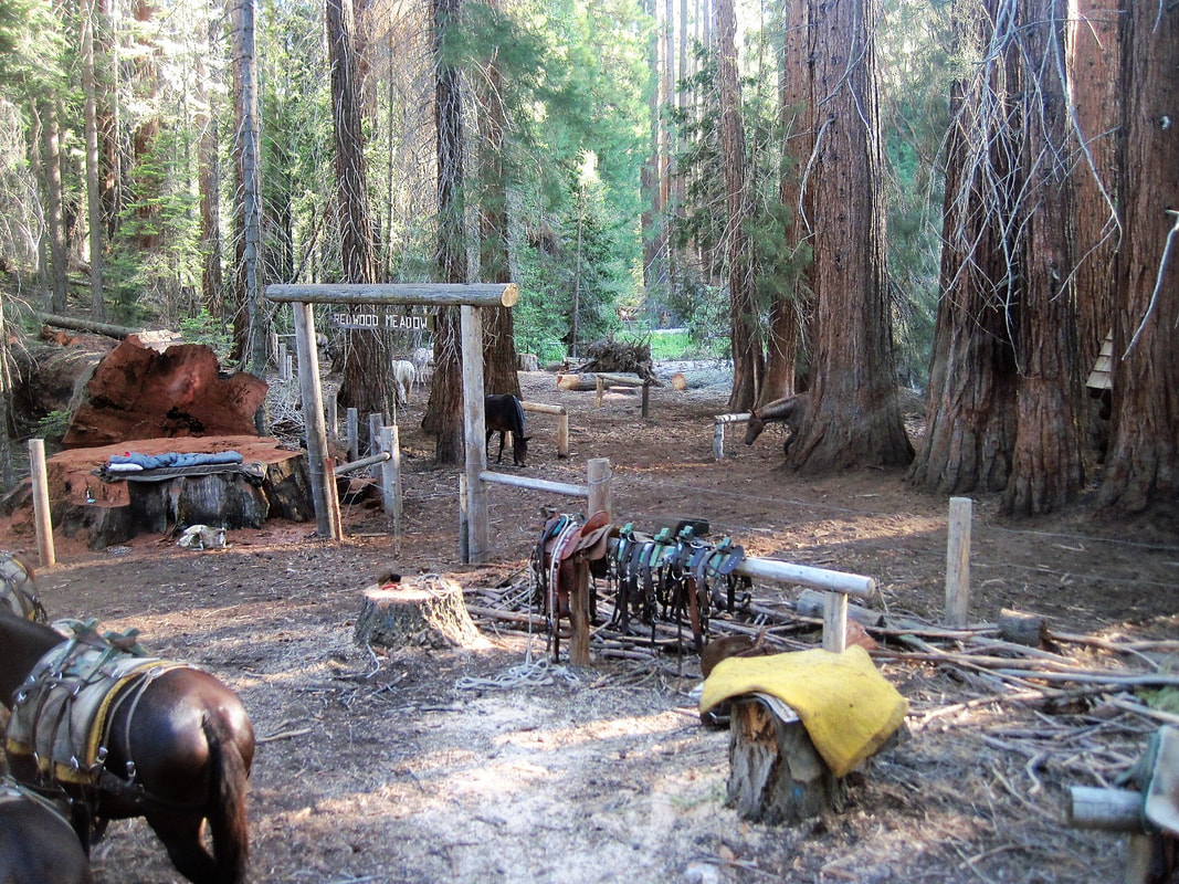
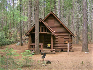
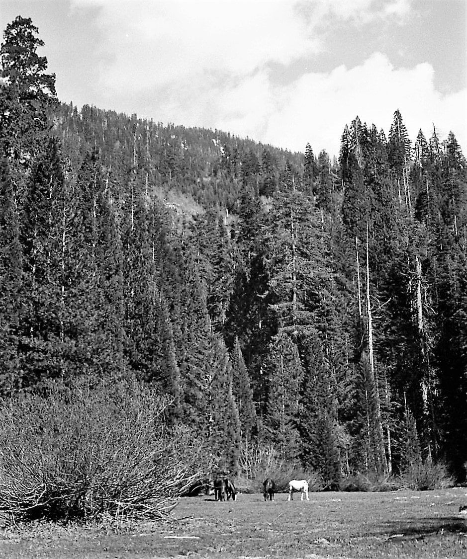
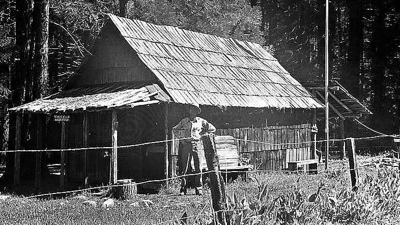
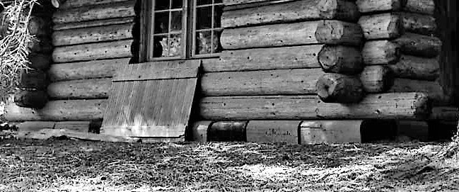
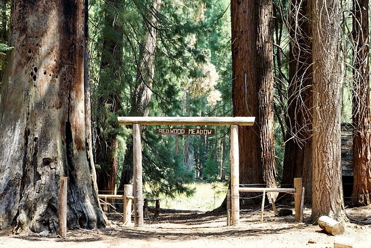
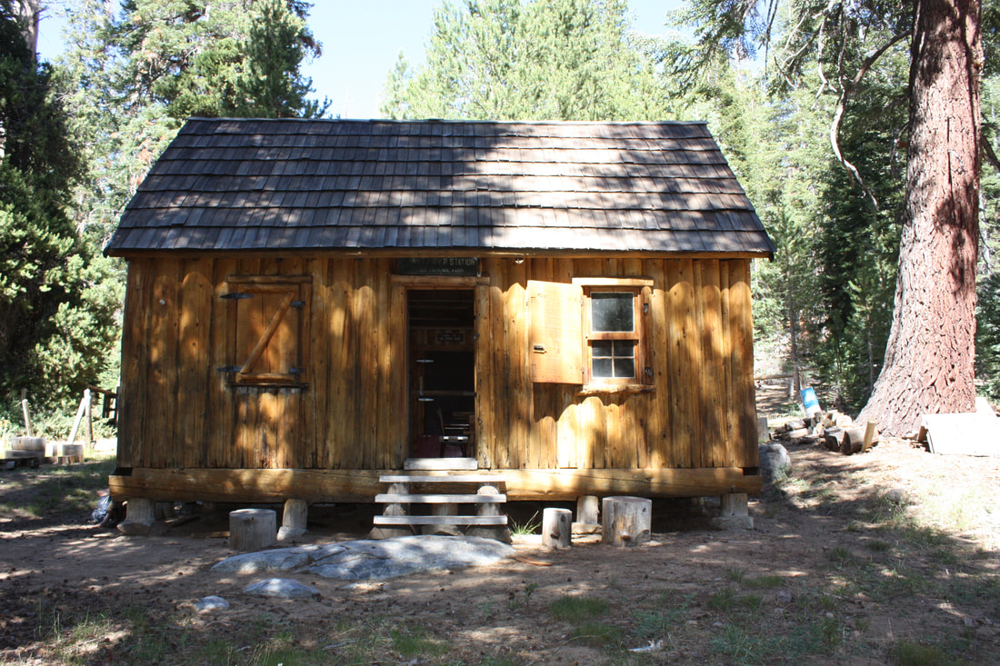
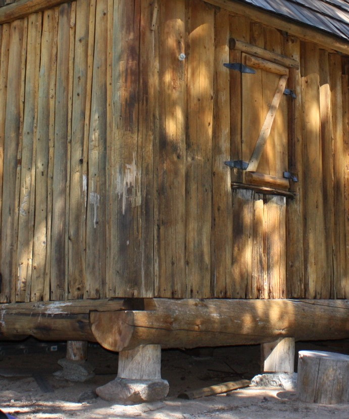
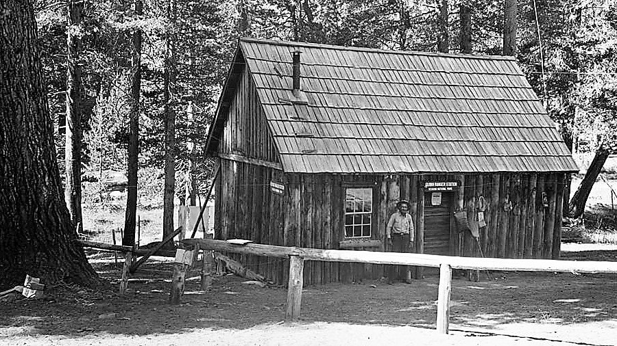
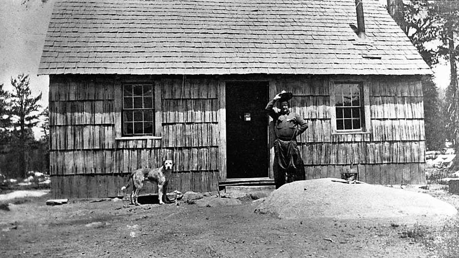
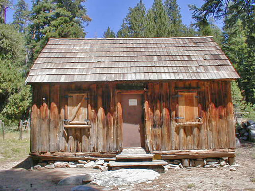
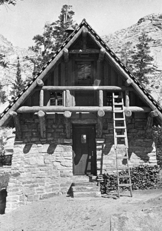
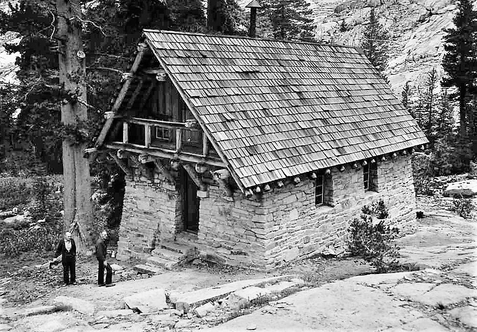
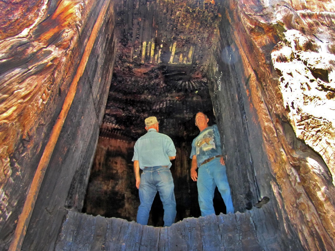
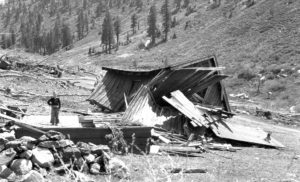
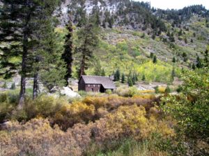
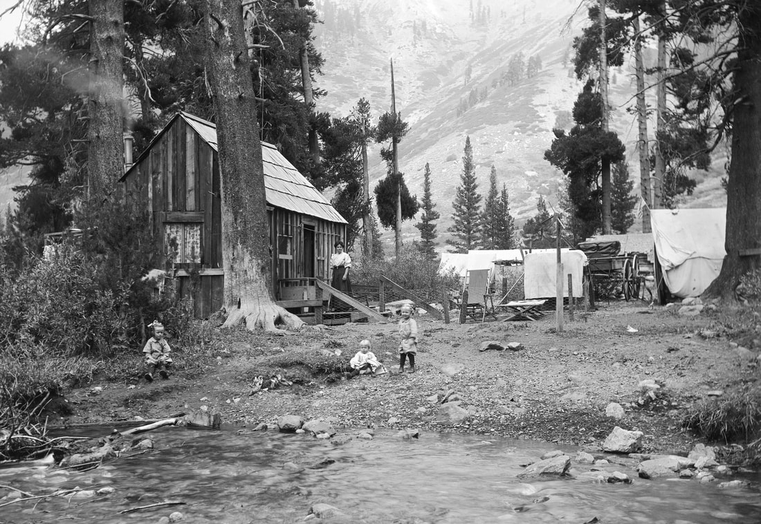
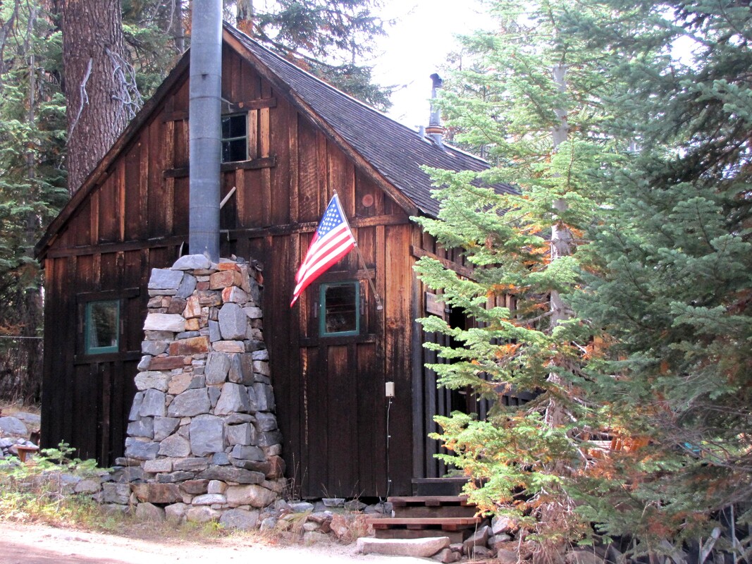
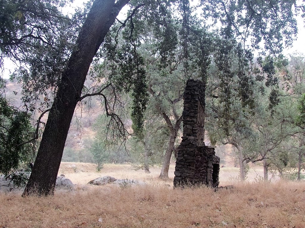
“In the summer of 1973, my backcountry crew and I were working at . . . Redwood Meadow . . . . An old fence, first built by the CCC . . . had long ago fallen into disrepair, so we started . . . replacing the rotten posts and stringing new wire. One afternoon . . . we uncovered an old metal bin [and] . . . found the carpentry tools the CCC had used to build the cabin at Redwood Meadow: double-bit axes, log carriers, drawknives, and a brace and bits. Their wooden handles were still dark from the oil and sweat of men working there thirty-five years earlier.” — Steve Sorensen, 2018

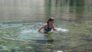
“[T]he [trail] crossing below [Redwood Meadow] . . . [needed] a series of wooden footbridges. . . . [A] lot of the satisfaction [in building the bridges] came from using those old tools . . . in the same way the CCC workers had used them long ago. . . . Before supper we’d hike down to Cliff Creek and jump . . . into a deep pool of clear water — the same place where the CCC boys had washed and played three decades earlier.” — Steve Sorensen, 2018

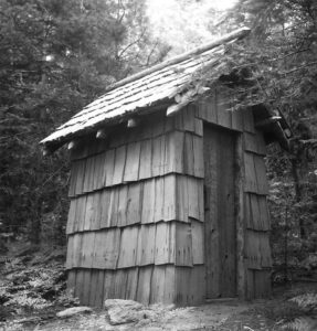
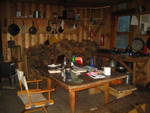
“During the trail crew visits . . . [w]ood was bucked up, split, hauled, etc. for the trail crew, Hockett ranger, wilderness seminar, and snow survey. Two new hitching rails were constructed . . . . One of the public outhouses was moved here at Hockett Meadow. Several days were spent . . . doing trail work (raking rocks) and on the new bridge near Horse Creek. ” — Lorenzo Stowell, Hockett Mdw. Ranger, 1992

“Once again, I received numerous glowing accolades from visitors regarding the quality of the trails in Sequoia and the friendliness and helpfulness of the crew members they encounter. Thanks, Sequoia Trails!” — Christina Gooch, Tyndall Creek Ranger, 2014

Click on photos for more information.

The Story of How Mooney Grove Park Came to be Saved

by William Tweed

     Tulare County residents have a long history of going out of their way to protect trees. This urge has resulted in a number of important creations, including both Sequoia National Park and the Sierra Forest Reserve (now the Sequoia National Forest). Perhaps the most beloved locally of all these early efforts, however, is the Tulare County park known as Mooney Grove.

     In the 1850s, when Euro-American settlers first began to occupy what is now the Visalia area, they found an extensive forest of valley oak trees (Quercus lobata) growing across the delta of the Kaweah River. The towering trees covered a large triangular wedge of land that had its eastern point near Lemon Cove where the Kaweah emerged from the Sierra and extended westward all the way to the shores of Tulare Lake southwest of modern Corcoran.

     Settlement and agriculture soon brought many of these trees down, and by the end of the nineteenth century only a few remnant stands of oaks remained. Among these, one of the best stood along the public road between Visalia and Tulare.

     This tract belonged to the Mooney family. It had first been settled by an early rancher named Benjamin Willis in 1853, but Willis did not cut his trees, and the oaks still stood densely on the property when Willis sold the land to Michael Mooney in 1878. Mooney died three years later, having left the trees alone over that period, and control of the tract fell to Mooney’s wife. Mrs. Eliza Mooney inherited a relatively large estate from her husband and felt no need to cut the oaks, which she came to enjoy.

     This state of affairs endured for several decades. Not until 1906, after Mrs. Mooney’s death, did a serious threat to the trees surface. The five Mooney children, who now owned the forest, were eager to dispose of the forested land and invest their inheritance in more profitable endeavors. They considered logging the land for firewood.

     It was at this point that interest surfaced in saving the grove. The key figure was John Tuohy, a resident of Tulare. Tuohy had a long interest in preserving local trees. One of the four chief Tulare County residents who led the campaign to create Sequoia National Park, he had actually been responsible for identifying the area preserved in the first Sequoia National Park act of September, 1890.

     Tuohy now approached the Mooney heirs, whom he knew, and negotiated an option to buy the property. His goal was to move the oak forest into public ownership as a park. There was considerable public support for the idea, but a problem surfaced: there was no law that authorized the Tulare County Board of Supervisors to purchase land for park purposes.

     So Tuohy went to work on that problem. Partnering with local State Senator Edward O. Miller, Tuohy quickly got a bill to the governor’s desk authorizing just such actions.

     Now things moved quickly. In August 1909, the county supervisors authorized the purchase of 100 acres of oak forest from the Mooney heirs for a total price of $15,000 (equal to about $350,000 in 2012 dollars).

     John Tuohy had done his work well. The sales contract required that the 100 acres be maintained forever as a “public pleasure ground and park,” and forbade the cutting of oaks except to ensure public safety. Three months after the completion of the purchase, Tuohy made his final major contribution to the protection of the oak forest. He again approached the Tulare County Board of Supervisors, this time encouraging them to establish a three-person park commission to oversee the development of Tulare County’s first park.

     The supervisors endorsed the idea, and the commissioners met for the first time on March 24, 1910. Looking after his new creation, John Tuohy served as the commission’s president until just before his death in 1916.

     Today, more than a century later, Mooney Grove Park has become one of Tulare County’s most beloved public spaces. In this role, the park not only preserves a remnant of Tulare County’s valley oak forest but also reminds us how the county’s early residents worked to preserve that beauty. Somewhere, John Tuohy is smiling.

September, 2012


Slideshow:

[


Quotes & More Photos:

“[V]alley oaks covered a 400-square-mile area when the first pioneers arrived. By the 1890s, however, most of this magnificent forest had disappeared, a victim of relentless agricultural clearing and timber harvest.” — Ginger Strong

“The Mooney’s [sic] desired the grove saved. It will be a monument to their family name, which has been known in the county almost since the beginning of its history, and will now live through all eternity.” — Visalia Delta newspaper, October 8, 1909

“One of the grandest objects of nature in Tulare county, second only to the majestic forest of sequoias within its confines . . ., is its oak trees . . . . ” — John Tuohy in the Hanford Journal, quoted in the Visalia Delta newspaper, October 8, 1909

“Unless the Mooney grove is purchased by the county and preserved, one of the grandest oak groves in California will be forever lost to posterity. A county which has such a heritage as that should not allow it to be destroyed, for nature has there provided a noble and interesting object to be enjoyed by the children’s children of the present adults of Tulare county . . . .” — the Hanford Journal, quoted in the Visalia Delta, October 8, 1909

“A grander picnic ground can not be seen anywhere in the world than the Mooney grove of magnificent oaks, which have withstood the heat and storms and floods of centuries . . . .” — Hanford Journal, quoted in the Visalia Delta, Oct. 8, 1909

]

[


Maps & Directions:


Address: 27000 South Mooney Blvd., Visalia, CA 93277


Latitude/Longitude:

36°16’49″N/119°18’34″W

36.280556, -119.311944


From Visalia: from Hwy 198 drive south 3.5 miles on Mooney Blvd/Hwy 63.

Mooney Grove Park (entrance fee) will be on your left (east).


]

[


Site Details & Activities:

Environment: Valley, urban park, Valley Oak grove
Activities: baseball, disc golf, dog park, dog walking (on leash; scoop poop), End of the Trail statue, historical buildings, horseshoes, inclusive playground, lagoon, museum, picnicking, Pioneer Village, special events
Open: For hours and reservations, call (559) 205-1100.  Note that all County parks are closed on Tuesday and Wednesday (except Mooney Grove in the summer), and hours are usually 8-5:00, with seasonal adjustments; closed on national holidays
Reservations for covered picnic areas taken throughout the year at same number
Entrance Fee: $6.00 per vehicle; Senior/Disabled Vehicle Fee (62 years or older); $3.00; Annual Park Pass: Regular $25.00; Seniors $12.00; contact Site Steward for additional current fees
Site Steward: Tulare County Department of Parks and Recreation, (559) 205-1100


Click on photos for more information.

The Story of Redwood Meadow Ranger Station

by Laurie Schwaller and William C. Tweed

   Sequoia National Park’s Redwood Meadow Ranger Station, built in 1938-1939, is a virtual twin of the park’s Hockett Meadow Ranger Station built in 1934. Constructed by the Civilian Conservation Corps to serve as ranger residences and headquarters, these classic stations stand about 20 miles apart. Both are located on significant backcountry trails and adjoin fine meadows for pasturing pack and riding stock.

   In 1938 Redwood Meadow was considered a strategically important site for such a facility. Park planners at the time could not foresee the forces that in just a few years would change that view.

   Both of these handsome, well-maintained structures are listed on the National Register of Historic Places. They are prime examples of iconic National Park Service rustic architecture, embodying its philosophy of harmonizing buildings with their environment by using local natural materials and avoiding an overly smooth, too-finished appearance. While reflecting the look of local pioneer structures, they admirably display the skilled craftsmanship of the workers who built them during the Depression under the national CCC program.

   Both stations were preceded by smaller, simpler buildings. The original Hockett station was built in 1906 to protect the park’s southern boundary area. There, before the Park was established, the lush meadows of the Hockett Plateau were grazed by many thousands of sheep as part of a major Valley rancher’s summer mountain operations.

   Redwood Meadow did not become part of Sequoia National Park until 1926, when Congress more than doubled the Park’s acreage. For decades before that time, cattleman James Lake Hamilton drove livestock from his Yokohl Valley ranch to use the meadow as summer pasture.

   Hamilton had a silver claim in Mineral King in 1874, and he was one of the first cattlemen to range his animals in the mountain meadows on a continuing basis. He acquired ownership of this prime seasonal grazing land via the 1850 Federal Swamp and Overflow Lands Act, which gave the states title to all lands within their boundaries that would require drainage or levees in order to be cultivated. Once surveyed by their respective counties, and their surveys approved by the Surveyor General, these lands could be sold by the states.

   Thus, Hamilton was able to buy Redwood, Quaking Aspen, and Wet meadows out of the public domain. When the surrounding Sierra Forest Reserve was established in 1893 (and became Sequoia National Forest in 1908), he retained the right to take his cattle through the forest to graze his private inholdings at the head of the Middle Fork of the Kaweah. To support his summer livestock operations, he erected several rustic buildings in the area, one of which became the original Redwood Meadow Ranger Station.

   In 1916, the National Park Service was founded and took over the administration of Sequoia and General Grant national parks. The Service’s first director (1916-1929) was Stephen T. Mather. Among Mather’s goals was his determination to eliminate as many of the private land inholdings as possible (since the parks’ mission was to be for all the people to enjoy).

  He was also intent on greatly expanding Sequoia National Park. Additionally he declared that scenery and significant objects were to be preserved for the public, while cutting trees, grazing cattle, and constructing roads and buildings were to be permitted only if absolutely necessary.

  Mather used his own funds and secured donations from other wealthy individuals and from organizations such as the National Geographic Society and the Tulare County Board of Trade to buy privately-held land not only inside the existing park boundary, but also in the area where he hoped to expand Sequoia. These parcels included Redwood, Wet, and Funston meadows.

  Thus, by the time President Calvin Coolidge signed the bill that greatly enlarged the park in July, 1926, Jim Hamilton had already sold his meadow inholdings. The Sierra Club held title to the property until turning it over to the park after its expansion.

  Redwood Meadow’s location and resources were deemed strategic to Sequoia National Park at that time when there were only two roads into the park, one ending at Giant Forest, the other at Mineral King Access to the park’s vast backcountry for rangers, recreationists, trail crews, and fire fighters was by a network of trails, and Redwood Meadow was mid-way between Giant Forest and Mineral King on the trail system.

  It was also a key stop on the main trail from Giant Forest to the Kern River country and Mt. Whitney, via Black Rock Pass. And, of course, its namesake redwoods (giant sequoias), thriving in the mixed conifer forest surrounding the meadow, were a major attraction.

  In those days, most people traveled the trails on horseback, with pack mules carrying their equipment and supplies. Therefore, Redwood Meadow’s excellent forage for stock was also strategically important. Additionally, some of Hamilton’s buildings were still there to be used, including a small rustic cabin that became Sequoia’s original Redwood Meadow Ranger Station.

   In the late 1930s, the park decided to take advantage of the Civilian Conservation Corps program to replace Hamilton’s ramshackle old cabin with a considerably better structure and to add a barn to store supplies, equipment, and tack for horses and mules. To save time and money, the design for the Hockett Meadow ranger station and barn built in 1934 was used for Redwood’s facilities.

  Thus, Redwood’s cabin measures 23 x 33 feet, its barn 17 x 26 feet. Their walls are made of peeled pine and fir logs, log rafters support their gable roofs covered with shakes, and a central stone chimney ventilates the cabin’s wood-burning cooking range.

  Redwood cabin’s 7′ x 12′ porch is just like Hockett’s except its floor is wooden, while Hockett’s is stone. And at Redwood the cabin walls rest on a foundation of big blocks of giant sequoia wood, while Hockett’s foundation is concrete veneered with stone. Redwood’s interior includes two bedrooms, a combination living room/kitchen, and a bathroom, while Hockett’s bathroom has always been an outhouse (and an outdoor shower). Both cabins’ interior rooms are finished with plywood paneling.

   Redwood’s barn stands just across the Redwood Meadow Trail from the ranger station, inside a fenced pasture. Its interior, like Hockett’s, is finished with 3/8″ x 4″ tongue and groove lumber. All these buildings were constructed by CCC workers using mostly native materials harvested from their sites, although the cut lumber, including that for the floors and ceilings, was packed in. Redwood’s ranger residence was built during the summers of 1938 and 1939, its barn in 1939-1941.

   Ironically, soon after the new Redwood Meadow facilities were completed, backcountry visitation dropped drastically as the U.S. entered World War II. After the war, backpacking gradually began to replace horse packing, and many hikers preferred the “Cadillac” High Sierra Trail route — completed in 1932 — from Giant Forest to the Kern River Canyon, because it crossed the Great Western Divide via Kaweah Gap, well over a thousand feet lower than Black Rock Pass.

  Backpackers also preferred Bearpaw Meadow over Redwood for their first camping site heading east, since it was directly on the High Sierra Trail at 7800′ in elevation and offered “full-service” camping at Bearpaw High Sierra Camp. In the 1950s and ’60s, radical advances in the design of backpacks and related equipment, along with the use of new materials and significant reductions in weight, drove a backpacking boom, and stock and foot traffic to Redwood Meadow continued to decline.

  As a result, in 1960, Redwood Meadow Ranger Station was demoted. The Park Service built a modern A-frame ranger station (since razed and replaced) at Bearpaw and made it the headquarters of the upper Middle Fork’s backcountry ranger.

  Since then, Redwood Meadow Ranger Station is periodically patrolled by the Bearpaw ranger and serves primarily as a base for backcountry trail crews. Their horses and mules graze the verdant meadow, the barn holds their equipment and supplies, and the classic cabin accommodates the crews.

  Redwood’s “demotion,” however, can be a real plus for backpackers and equestrians wishing to experience the magnificence of a beautiful giant sequoia grove much as visitors could in the past, without the crowds, the noise, and the developments for comfort and convenience that so often characterize these very special places today.

  Those prepared to hike or ride a horse about 13 fairly strenuous miles each way can camp under the stars in the stillness of the sequoias near the historic Redwood Meadow Station. Mid-week in the shoulder seasons, you might even have this splendid, remote grove of Big Trees all to yourself.*


*Be sure to check trail and camping conditions before you go: in spring, high water from snow melt may make stream crossings difficult; in summer and fall, water sources may be dry at Redwood Meadow.

May, 2020


Hamilton Lakes and Hamilton Creek are named for James Hamilton.  He stocked the naturally fishless lakes:  “Thinking it was a real shame that no fish were available in these lakes . . . for food and sport while they were there, he and his brother-in-law, John Taylor of Three Rivers, devised the plan to catch fish in Big Arroyo Creek, put them into milk tanks, carry the tanks on their backs up the steep grade to the lakes and turn the fish loose in these lake waters. . . . Hamilton Lakes went through several fish stages.  First, there were no fish in the lakes. . . . Each year the catch would get better and finally . . . there were so many fish in the lakes that a fisherman was forced to worm his hook while standing behind a tree.” — Rod Homer, 2008


Now read the article about: Sequoia and Kings Canyon National Parks Trail Crews


Slideshow:


Quotes & More Photos:

Redwood Meadow Ranger Station is about 12-13 miles in from most of these usual trailheads. (See directions below.)

“Once the Giant Forest Road was in place, in 1903, a network of well-graded trails was extended across Sequoia Park. The Alta Trail connected Giant Forest with Alta Meadow, and the Seven Mile Hill Trail led from near Alta Meadow to Redwood Meadow and the Mineral King country.” — William C. Tweed and Lary M. Dilsaver

“Redwood Meadow is a lovely green gem that lies at an elevation of 6,400 feet on the western slope of the Great Western Divide between Granite and Cliff creeks, tributaries of the Middle Fork of the Kaweah River. About thirty acres in size, it sits in the midst of a modest-sized grove of Sequoiadendron giganteum that is characterized by a mixture of ancient giants and prolific young growth.” — Ranger Gordon Wallace, 1936

“A little-traveled trail runs along its western fringe, and a snow-fed rivulet gurgles through its center. At the eastern edge, half-hidden in a clump of young Sequoia trees, sat a rustic one-room cabin that was now my home. The walls and pitched roof were constructed with shakes, and the floor consisted of rough-hewn split timber, polished smooth by the years of wear. . . . Erected . . . before this area became a part of the park, its character, together with the setting enhanced by isolation, gave it the ambiance of an earlier day when solitary mountain men pioneered the region.” — Ranger Gordon Wallace, 1936

“. . . I continued to make the patrols that were necessary to contact visitors to protect them as well as the park, to improve campgrounds, and to keep fishermen in line. . . . Although I rode more than seven hundred miles on patrol, I still put in fifteen days on duty at my ranger station. These were used to assist passersby, do my laundry, chop firewood, shoe my horses and mule, write reports, and entertain any guests who happened to be on hand.” — Ranger Gordon Wallace, 1937

“[W]e suddenly emerged from a dense forest and came into Redwood Meadow . . . The sun projected long fingers of shade as it lowered in the West, and . . . the orange trunks of the Sequoias at the edge of the meadow became pillars of fire topped with blue-green.” — Ranger Gordon Wallace, 1937

“Lie at the base of one of these forest giants, staring up at the massive expanse of cinnamon-red bark, and consider John Muir’s introduction to the stately sequoias: ‘When I entered this sublime wilderness, the day was nearly done, the trees with rosy, glowing countenances seemed to be hushed and thoughtful and one naturally walked softly and awestricken among them.’ [A]t Redwood Meadow, you can still experience the big trees as Muir did — in the wilderness, full of wonder, without the carloads of camera-wielding tourists.” — Dennis Lewon, 2017

“I had several CCC crews of 810 men, each headed by an ECW foreman, at my disposal when I took over as the Middle Fork District Ranger stationed at Redwood Meadow in 1936 and ’37. A great deal was accomplished: Campgrounds were cleaned up and improvements constructed; old pasture fences, drift fences, and gates were repaired and new ones installed; foot logs were placed across streams; old trails were maintained and new ones built; . . . existing water systems were repaired and improved and new ones built; . . . and a telephone line was installed. . . . [T]he CCC was a godsend . . . to the NPS as a caretaker of our great national playgrounds and historic shrines.” — Gordon Wallace, District Ranger, 1936-37

“[The] Civilian Conservation Corps built a fine old cabin there, known as the Redwood Meadow cabin, which stands on a foundation of rough-hewn redwood slabs so large, they had to be dragged into place by teams of mules. It’s a beautiful example of CCC craftsmanship.” — Steve Sorensen, 2018

“Places become imbued with the spirit of the people who lived and worked there . . . [T]hose young men in the CCC spent what might have been the happiest days of their lives working there. Then they went off to fight in World War II, and a lot of them never came back. Redwood cabin is infused with their memories. You can see the marks they made with their draw knives on the walls, see their fingerprints in the linseed oil coating the kitchen shelves.” — Steve Sorensen, 2018

“In the heart of Redwood Meadow Grove, we stop for lunch at the unoccupied ranger station, lounging in an eclectic variety of old, outdoor chairs left outside the log building. We had visited the Giant Forest . . . before starting out on this backpacking trip, and it’s majestic — but almost as busy as a shopping mall. Now, as the only people out here, we feel like the Lilliputians in Gulliver’s Travels. Trees stand too tall for us to see their crowns, with trunks so big around that all six of us could not link arms around some of them, and branches as thick as the base of a Douglas fir.” — Michael Lanza, 2019

“[G]iant sequoias loom overhead, surrounding the campsites at Redwood Meadow. This special area offers a rare opportunity within one of America’s most visited parks — to experience the giant sequoias . . . free from crowds, cars and ambient light. They exude a witchy and ancient wisdom when the sun sets, creating a perfect ambiance for storytelling by the fire.” — Emily Pennington, 2017

“If your goal is to find a wooded, mountainous backpacking adventure free of snow in the early spring, Redwood Meadow is the perfect place to lay your head and dream of the national parks of days past.” — Emily Pennington, 201


Maps & Directions:

Directions:

NOTE: Wilderness Permit required for overnight trips (see Links below in Site Details).  Always check trail, weather, water, and snow conditions ahead of travel.  High water may make stream crossings difficult; water sources may be dry at Redwood Meadowl.  Trailheads at several starting points provide access to Redwood Meadow (see trails map in Quotes section above), which is about 12-13 miles in from most of them (farther from Crescent Meadow):

  • (from Hospital Rock/Buckeye Flat via the Middle Fork Trail,
  • from Mineral King via the Timber Gap Trail/Redwood Meadow Trail,
  • from Atwell Mill campground area via the Paradise Ridge Trail, or
  • from Giant Forest/Crescent Meadow via the High Sierra Trail/Redwood Meadow Trail).  

 1. From Hospital Rock/Buckeye Flat area

From Visalia, take Hwy 198 east through Three Rivers to the park entrance station.  About a mile up the road, stop at the Wilderness Office near the Foothills Visitor Center to pick up your Wilderness Permit prior to any overnight stay in the Wilderness.  Proceed on the Generals Highway to the Hospital Rock/Buckeye Flat area.  Take the road toward Buckeye Flat and then the dirt road to the Middle Fork Trail trailhead


Directions:

2.  Mineral King area Timber Gap and Atwell Mill Paradise Ridge Trailheads :

From Visalia, take Hwy 198 east through most of Three Rivers. Two miles before the main Sequoia park entrance, watch for the National Park mileage sign on your right, at the junction with Mineral King Road.

NOTE: Mineral King Road is narrow (sometimes single lane), steep, winding, and partly unpaved, and is not recommended for RVs or trailers.

In about 23 miles from this junction, just past Cold Springs Campground, stop at the Mineral King Ranger Station (on your left) where you must pick up your Wilderness Permit prior to overnight stays in the Wilderness (see Links below in Site Details).

Then proceed to the parking area near the end of the road for the Timber Gap Trail trailhead,

OR backtrack to the Atwell Mill campground area for the Paradise Ridge Trail trailhead.


Directions:


3.  Giant Forest/Crescent Meadow High Sierra Trailhead:

From Visalia, take Hwy 198 east through Three Rivers to the park entrance station (fee). 

About a mile up the road, stop at the Wilderness Office near the Foothills Visitor Center to pick up your Wilderness Permit prior to any overnight stay in the Wilderness (see Links below in Site Details).

Proceed on the Generals Highway to just before the Giant Forest Museum area and turn right onto the Moro Rock/Crescent Meadow Road.

From the parking area at the end of the road at Crescent Meadow, follow the signs to the High Sierra Trail trailhead.


Site Details & Activities:

Environment: Mountains, meadow, giant sequoia grove, elevation: a little over 6,000′, Sequoia National Park (NOTE: Redwood Meadow is accessible only by foot/stock trail.)
Activities: Architecture and landscape architecture study, backpacking, birding, botanizing, camping (nearby; Wilderness Permit required), fishing (license required), history, photography, wildflower and wildlife viewing
Open: Sequoia National Park is always open, weather permitting (unless closed due to emergency conditions); park entrance fee; Wilderness Permit required for all overnight trips. NOTE: Park Ranger Stations serve as residences for rangers and backcountry crews. Therefore, while you may knock on the door, please respect the privacy of the cabin occupants. Knock on the door when park employees are present if you need assistance or information or have information to report (e.g., wildfire, hazardous conditions, etc.). You may also leave a note.
Site Steward: National Park Service-Sequoia and Kings Canyon National Parks, 559-565-3341; Wilderness Office, 559-565-3766
Opportunities for Involvement: donate, volunteer
Links:
Books: 1) A Branch of the Sky, Fifty Years of Adventure,Tragedy, & Restoration in the Sierra Nevada, by Steve Sorensen (Picacho, 2018)
2) Challenge of the Big Trees, The History of Sequoia and Kings Canyon National Parks, revised edition, by William C. Tweed and Lary M. Dilsaver (George F. Thompson Publishing in association with Sequoia Parks Foundation and American Land Publishing Project, 2016)
3) The Mule Men, A History of Stock Packing in the Sierra Nevada, by Louise A. Jackson (Mountain Press Publishing Company, 2004)
4) My Ranger Years: Sequoia National Park, 1935-1947, by Gordon Wallace (Sequoia Natural History Association, 1992)


Click on photos for more information.

The Story of River Ridge Ranch

by Paul Hurley

     Conservation works, and it pays its way at River Ridge Ranch.

     Gary Adest and his wife, Barbara Brydolf, are demonstrating a model for prudent land conservation at their River Ridge Ranch northeast of Springville. They have permanently conserved a working cattle ranch as a 722-acre preserve that features conservation demonstration projects, education, entertainment, cultural exploration, and recreation.

     But unlike many other examples of conserved property, River Ridge Ranch is a privately owned commercial venture. Gary and Barbara have figured out how to preserve the land for the future and preclude commercial real estate development while also deriving income from the property through a wide variety of enterprises that respect the land, harvest its potential for productive use, and welcome the public.

     “Our mission statement is to act as a demonstration ranch for local people and visitors on how to keep large parcels intact and simultaneously make a living,” Gary said. “So the value-added strategy is here to see. You can do special events of various kinds. You can get as creative as you want. You can afford, if you’re willing, to open it to the public under certain limited timings, for outdoor education, for example, for camps.”

     The enterprise has taken an uncommon amount of creative vision, which both Gary and Barbara have accumulated in eclectic careers and life experience. Gary is a native of Brooklyn, New York, and Barbara grew up in Pasadena. City-dwellers, they were both attracted to the outdoors as biologists.

     Gradually, they were able to move out of the cities and were happily living in a cabin in Camp Nelson when their dream property found them: the Negus Ranch came up for sale in 1998.

     The property was a working cattle ranch in the rolling foothills of the Sierra Nevada on the edge of what has become the Giant Sequoia National Monument. The ranch’s fields and pastures, blue oak woodland, and riparian corridor along the North Fork of the Tule River provided an abundance of native habitat for wildlife.

     Gary and Barbara were surprised at their good fortune at being in a position to make an offer on the property. “This is sort of a biologist’s dream,” Gary said, “where you find these large intact parcels, that while they have been used heavily, they’ve only been used for cattle grazing mostly, and that means that primarily they can recover, when managed properly. They haven’t been bulldozed and turned into suburban residential housing tracts.”

     Having volunteered with the local Tule Oaks Land Trust, the couple had some knowledge of how land conservation easements worked. By selling the subdivision rights and borrowing from their retirement savings, they managed to leverage the money for the purchase price, about $700,000.

     “I went back to school and got a teaching credential and got a job as a teacher, full-time,” Barbara said, “and that provided the income that we needed to be able to allow Gary to do what he wanted to do, which was to turn this into a working ranch which would actually pay for itself.”

     Gary immediately started looking for revenue opportunities. He negotiated rights for a wireless Internet site that serves Springville. He leased parts of the property for limited hunting of turkey and quail and for fishing. Cattle grazing continued on the ranch, but was converted to grass-fed, organic beef.

     “My management philosophy for the ranch is to manage it as an ecosystem,” Adest said. “You want high diversity, you want resilience, and that means that you’re buffered against fluctuations and changes in the economic environment.”

     Gary stumbled onto what became one of River Ridge Ranch’s prime sources of income when an acquaintance asked a question. “They said, ‘You know, we have some friends who want to do a wedding. Can they get married on the ranch? How much would that be?’” Gary recalled. “So I just picked a number out of the hat and they said, ‘Fine.’”

     When more people started to inquire about weddings on the ranch, Gary realized he had a huge opportunity. He created a web site and started advertising. Within ten years, weddings – as many as twenty a year – and other special events became the principal source of revenue for River Ridge.

     Gary continues to look for more eco-friendly and compatible uses for the property. The ranch hosts an annual camp for cancer-stricken children. It welcomes hundreds of school children each year for ecology education for programs such as Trout in the Classroom, where the kids raise fingerling trout and stock the ranch’s stream. A regular music event takes place on Wednesday evenings. Gary worked on an archery club with the local sheriff.

     “One of the things that I love about this place is that it did provide that connection with nature that both Gary and I were looking for,” Barbara said. “Every time I come here, I see something fabulous. So like today, I was watching the orioles and the black-headed grosbeaks, and then listening to the wrens singing, and I just love that stuff. That to me is what makes my life worthwhile.”

     Gary and Barbara are also gratified that they can not only preserve a piece of the Sierra Nevada foothills so future generations can know what it was like before settlement, they can also share the experience with people now.

     “We’ve been able to share it with lots of our friends, and share it with people who wanted a beautiful place to get married,” Barbara said. “Gary’s done all this stuff, Trout in the Classroom, where we allow school kids to come here. And we just love that, because we’re educators. We value this, and we want other people in Tulare County also to appreciate what they have and want to preserve it, so it doesn’t go away.”

NOTE:  Here is a link to a short video about Trout in the Classroom at River Ridge Ranch

November, 2012

UPDATE 021025: After hosting over 250 weddings, and having proven the concept of multiple, thoughtful revenue streams on a working landscape, the Ranch’s wedding business has closed, and it no longer hosts annual camps for kids, but it continues to host regular, free-to-the-public concerts at the ranch in the spring and fall. In a greater strategy to transition River Ridge “from ranch to reserve,” as a scientific research station, the ranch now has agreements with California State University, Long Beach; UC Merced; and the tribal youth non-profit Native Star Foundation, enabling undergraduate and graduate classes and Master’s degree and faculty research to become a regular part of River Ridge’s calendar. The public access component continues as part of this vision, via camping and lodging through Hipcamp.com, hikes and talks, live music, an annual Foothills Festival, and spontaneous events such as the Acorn 2-step, when volunteers planted 3,000 acorns in an hour!


Slideshow:


Quotes & More Photos:

“This lovely foothill belt where the blue oak live and grow turns out to be one of the most endangered habitats in the State. The blue oak woodland, which is the foothill woodland right here, is disappearing at an unprecedented rate in California.” — Barbara Brydolf

“Our mission statement is to act as a demonstration ranch for local people and visitors on how to keep large parcels intact and simultaneously make a living,” — Gary Adest

“Part of our mission is to continue educating people in Tulare County about what resources they have, what riches they have.” — Barbara Brydolf

“For those people who care about these places, for those who want to be able to take children and grandchildren to places like that, to learn about what does it take to raise a calf? What does it take to keep the pee and the poop out of the river? What is it like to walk across a place where very few people have ever walked before? What is it like to visit a place where there’s grinding holes from Native Americans from 4,000 years ago?” — Gary Adest

“You want high diversity, you want resilience, and that means that you’re buffered against fluctuations and changes in the economic environment.” — Gary Adest

“The plants that grow here provide habitat for the birds that migrate up and down the foothills of the Sierra Nevada . . . the connectivity to the mountains provides habitat for animals that migrate up and down mountains, like deer and bear and bobcats.” — Barbara Brydolf

“A lot of people are making memories here all the time.” — Gary Adest

“We just got done with a month’s worth of hosting 500 school children from 13 different schools in Tulare County for a program called Trout in the Classroom, where students raise eggs donated by Fish and Game and bring their little hatchlings to the ranch, have an entire day of outdoor education that’s taught by local non-profits — WildPlaces, Sequoia Riverlands Trust — and have a great time.” — Gary Adest


Maps & Directions:

Directions:

Address: 37675 Balch Park Road, Springville, CA, (559) 361-7453

Latitude/Longitude:

N36° 10.5661′, W118° 47.9201′

36.176102, -118.798668


From Visalia, take Hwy 198 east.  Turn right (south) onto Road 204/Spruce Rd.  Turn left (east) onto Hwy 65 south toward Porterville.  Turn left (east) onto County Route J28 through Strathmore to the junction with Hwy 190. 

Go left (east) on Hwy 190 into Springville.  Turn left (north) at the big white barn onto Balch Park Road/County Route J37.  Watch for the River Ridge Ranch sign, on your right, at 37675 Balch Park Road.


Site Details & Activities:

Environment: Foothills, riparian, oak woodland, working experimental ranch
Activities: archaeological sites, birdwatching, botanizing, camping and lodging (via Hipcamp), educational activities, entertainment events, fishing, hiking, hunting, nature study, photography, research and restoration, retreats (via Hipcamp), River Ridge Institute, swimming, wildflower and wildlife viewing
Open:  to the public in spring and fall, by appointment, and for special events, such as free concerts and annual Foothills Festival (check River Ridge Ranch & Institute-Calendar); open to researchers, year-round
Site Stewards: Property owners Gary Adest and Barbara Brydolf, 559-361-7453, info@river-ridge.net
Opportunities: donate, volunteer
Links:

Click on photos for more information.

What’s in a Name? Harry Quinn, the Early Sheep Industry, and the National Parks

by Laurie Schwaller

     In the summer of 1907, Sequoia National Park Ranger Harry Britten was charged with building a ranger station, as a headquarters from which to patrol the park’s southern boundary. The site he selected was very near Quinn’s Horse Camp, which had been there for decades, just north of Quinn’s Sheep Camp.

     Harry Quinn was an Irishman, born in 1843 on a small sheep farm in County Down. At age sixteen, he emigrated alone to Australia, hoping to strike it rich in the gold fields. Failing, like most, as a gold prospector and miner, Quinn worked on sheep ranches for the next eight years, learning the business well. Then, in 1868, he voyaged to California to pursue the American dream. Arriving in San Francisco, he worked as a stevedore and deck hand on boats between San Francisco and Stockton, where he met Archibald Leitch, a large-scale landowner and sheep raiser in Stanislaus County.

     Quinn’s desire was to buy sheep and rent land to pasture them on. He worked his way around the state managing sheep ranches and looking for opportunities. On the unsettled borderland where southern Tulare County and northern Kern County meet, he saw the free open range of stirrup-high, treeless grasslands as a paradise.

     In 1872, impressed by Quinn’s skills and energy, Leitch hired him to take flocks of his sheep to Kern County to graze. There, Quinn became one of the first settlers at Rag Gulch, about 10 miles east of Delano, just south of the Tulare County line. By 1873, he had filed a pre-emption claim on 160 acres and had purchased a half interest in Leitch’s band of 7,000 sheep.

     Leitch took him into partnership in 1874, and the firm of Leitch & Quinn prospered, eventually owning up to 22,000 acres of grazing land in both Kern and Tulare counties, including mountain land in Dry and Funston meadows, Peck’s Canyon, and even a small acreage in what became Sequoia National Park, where the sheep would be herded in the summer after the grass dried up in the Valley. While 28,000 sheep once pastured on the ranch, the flock averaged around 12,000 animals, divided into five bands.

     The profitable partnership continued until Leitch died in 1896, and then through his estate until 1906, when Quinn purchased the land and sheep interests of the firm. While he kept his ranch’s main headquarters at Rag Gulch, Quinn and his family often lived in Tulare County, where part of the ranch became the townsite of Richgrove. They often spent summers on their Upper Ranch west of Porterville.

     In 1890, the year Sequoia and General Grant national parks were created, none of the many men connected with the sheep interests of Tulare County had attained greater success or prominence.

     Naturally, Quinn opposed the ruling that sheep and cattle grazing would not be allowed on national park lands, when his sheep had used those mountain meadows for many years. He was also being forbidden to drive his sheep across park property to his own inholding and to others that he rented for grazing. Additionally, his horse camp, used to pasture the pack stock that regularly supplied his shepherds in the mountains, and sometimes serving as his summer home on the Hockett Plateau, was now enclosed in Sequoia National Park.

     In 1891, Acting Superintendent Captain Joseph Dorst sent troops out from Mineral King to survey the park’s boundaries. That summer, they covered almost a thousand miles patrolling from their base at Hockett Meadow (then called Zimmerman’s).

     They reported that the country bordering the area was so overgrazed that it could not support visiting parties of tourists. Thus, Dorst recommended that the eastern boundary of Sequoia National Park be extended all the way to Mt. Whitney and that the parks’ rules and regulations should be enforceable by legal penalties, since the troops’ only recourse to livestock trespass at the time was to escort the offenders back across the parks’ boundaries.

     In 1893, responding to the degradation of the public land’s resources, President Benjamin Harrison proclaimed the Sierra Forest Reserve. This withdrew most of the central and southern Sierra land from sale to private parties, including most of the land adjoining Sequoia and General Grant National Parks.

     While Valley residents generally supported the reservation as an effort to protect their water supply, the sheep, cattle, logging, and mining interests were strongly against it, even though they were able to continue to heavily exploit the reserve lands, since the proclamation did little to protect their natural features (features which were specifically protected in the national parks).

     Thus, Quinn’s sheep continued to appear on the parks’ land, and the sheepmen’s encroachments occupied a good deal of the Army’s time in the parks’ early years. Acting Superintendent Lt. Alexander Tracy Dean reported that, “This condition of affairs renders the duty of guarding the park more difficult, as these large bands of sheep are kept close to the line on all sides, and if not constantly watched will feed over them.”

     The troops continued to patrol, but they had many other responsibilities, such as building and maintaining trails, assisting visitors, fighting fires, and preventing hunting, By 1898, there were still no penalties for trespassing sheep and cattle herders other than expulsion from the parks. When the soldiers were unable to reach the parks until September that year, due to the impacts of the Spanish American War, they found that over 200,000 sheep had gotten into Sequoia, devastating its meadows.

     In 1900, two civilian rangers were hired to protect the parks in the winters and to work with the cavalry when it was on duty there in the summer. In that decade, the problem of large herds of sheep and cattle trespassing on the park diminished for several reasons. The struggle for forage among the many competing cattle and sheep outfits resulted in severe overgrazing, extensive erosion, and widespread deterioration of feed value on the mountain and foothill ranges.

     Effective control of grazing on the Forest Reserve lands began at last in 1905 with the formation of the National Forest system and the establishment of the Forest Service. Also, the parks’ soldiers and rangers were patrolling more rapidly and efficiently as park trails were extended and improved and remote patrol cabins were built. By 1911, with pasture land increasingly hard to get, Harry Quinn switched to raising short-horn Durham cattle.

     The parks’ new patrol cabins included the one built in 1907 near the sheepman’s long-used horse camp. Everyone who roamed the mountains knew the location as Quinn’s, and so the new ranger cabin used his name. The 1909 USGS Kaweah Quadrangle map labels “Quinn Horsecamp” right beside “Ranger Cabin.” Over the years, it has also been called Quinn Patrol Cabin and Quinn Snow Survey Cabin.

     In 1932, twenty-five years after the cabin was built, Quinn, a leading citizen of the bi-county area for over half a century, and “one of the last of the great landowners in the southern San Joaquin Valley,” died at his Quinn Ranch home, in his 89th year. He was buried in the Porterville cemetery.

     Some say the ranger cabin that bears his name is haunted. Perhaps Quinn’s dauntless pioneer spirit still pervades the high mountain meadow where he established his horse camp and spent his summers so many years ago. Or could it be Cavalry Corporal Klawing’s shade, still in pursuit of Quinn’s ghostly sheep? Or maybe Ranger Harry Britten, on his one good leg, is patrolling yet from the sturdy little cabin he built so long ago.

May, 2020

                      Now return to the Quinn Ranger Station article.


Quotes & More Photos:

“[Harry Quinn] rode through this valley when the ranges were limitless, lush and unimpeded by barbed wire fences. Sheepmen were free to roam at will over the entire valley and into the hills.” — Mary Quinn Falconer, daughter of Harry Quinn

“The original Quinn ranch headquarters was sometimes called Quinn’s Well.” — Mildred Quinn Richardson, daughter of Harry Quinn. “[It] had the only water well for miles around. It was not uncommon for travelers to stop by the Quinn Ranch on their way through the valley between Los Angeles and San Francisco.” — Dorothy Kasiner/Delano Historical Society “[The ranch] . . . was known as a landmark and a hospitable watering place since the early [18]70s . . . .” — Wallace Melvin Morgan, 1914

“Katie Robertson married Harry Quinn on December 15, 1886, and bore him . . . four boys and three girls. She maintained her home, raised her children, and aided her husband in his endeavors.” — Dorothy Kasiner/Delano Historical Society

“The Rag Gulch Ranch was the center of the sheep business and after 1906 was the Quinn family home. The family had lived on a small ranch near Poplar until the older children were graduated from Porterville High School.” — Mildred Quinn Richardson, Quinn’s daughter

“As the Quinn family increased and the ranch expanded, . . . a school was established to educate the Quinn children, their employees’ children, and the children from neighboring ranches.” — Dorothy Kasiner/Delano Historical Society

“Tho’ our [Quinn ranch] headquarters was just over the line in Kern County, part of our ranch was the townsite of Richgrove and all of the Reid Land and Development Company holdings. In early years our summer range was in the mountains of Tulare County. So I believe we could be called Tulare County sheep raisers.” — Mary Quinn Falconer, Quinn’s daughter

“[I]n the spring as the grass dried in the valley, they gradually worked their way up through the foothills and into the high mountain meadows . . . .” — Mary Quinn Falconer, Quinn’s daughter

“This has been an unusually dry season in the valley, and consequently feed for stock has been very scarce. The owners of stock have driven it into the mountains . . . . This . . . renders the duty of guarding the park more difficult, as these large bands of sheep are kept close to the line on all sides, and if not constantly watched will feed over them.” — Alex T. Dean, First Lieutenant, Fourth Cavalry, Acting Superintendent Sequoia National Park, 1894

“Up through the woods the hoofed locusts streamed beneath a cloud of brown dust. Scarcely were they driven a hundred yards from the old corral ere they seemed to know that at last they were going to new pastures, and rushed wildly ahead . . . . As soon as the boundary of the old eaten-out range was passed the hungry horde suddenly became calm . . . . Thenceforward they were allowed to eat their way as slowly as they wished, care being taken only to keep them headed toward the summit of the . . . divide. ” — John Muir

“It is not only a pity, no it is a shame and a sin to see those nasty sheep ruining that wonderful Mountain region and its flora. ” — Carl Purpus, 1895

“W]hen they had cleaned out every grass spot in the so called reservation – that name is nothing but a mockery, they went into the Sequoia park although protected by soldiers of the U. S. Army.” — Carl Purpus, 1896

“Mr. W.T. Dean, who has purchase certificates for 120 acres of swamp land and 200 acres of school land [private land inholdings inside the park] had rented his land to Mr. Quinn . . . . Mr. Quinn asked permission to take his sheep on this land and was refused. . . . Since that time Mr. Dean has . . . requested permission to have Mr. Quinn use his land. He was informed that until some official notification was received Mr. Quinn could not go on the park. Other parties are taking the same action as Mr. Dean.” — First Lieut. Alex T. Dean, 4th Cavalry, Acting Superintendent, Sequoia National Park, 1894

“July 12, 1894 — Sent Corp. Klawing to patrol . . . . He found a band of sheep on ridge near Wet Meadow, belonging to Mr. Quinn. The herder claimed Mr. Quinn had a permit to drive his sheep across that corner of the park to some deed land on the east side . . . . Corp. Klawing followed the band of sheep to park line (16 miles).” — Sgt. Robert D. Cooper, Commanding Officer Troop B, 4th Cavalry

“July 17, 1894 — Found Quinn’s band of sheep going north through Tar Gap, and, in compliance with orders received from Capt. Parker, turned them back and drove them south out of park (18 miles).” — Sgt. Robert D. Cooper, Commanding Officer Troop B, 4th Cavalry

“July 18, 1894 — Myself and Corp. Klawing went to south line of park and drove sheep of Mr. Quinn farther south from park, warning herder to hereafter keep clear of park limits.” — Sgt. Robert D. Cooper, Commanding Officer Troop B, 4th Cavalry

“July 25, 1894 — Myself and Corp. Klawing patrolled south line of park from Summit Meadow to Peck Canyon. Quinn’s sheep crossed out of canyon from White Chief. Left Corp. Klawing with sheep (18 miles).” — Sgt. Robert D. Cooper, Commanding Officer Troop B, 4th Cavalry


Click on photos for more information.

The Story of Quinn Ranger Station, aka Quinn Patrol Cabin, aka Quinn Snow Survey Cabin, aka Quinn’s Horse Camp

by Laurie Schwaller

     In the summer of 1906, Sequoia and General Grant national parks were still being administered by the United States War Department (now known as the Department of Defense). That summer, Captain Kirby Walker was serving as these parks’ Acting Superintendent. In May, he led Troop F of the Fourteenth Cavalry and a detachment of the U.S. Army Hospital Corps (the latter detailed to work on sanitation issues in the increasingly-visited parks) on the 260 mile march from the Presidio of Monterey to establish their camp on the North Fork of the Kaweah River near the little town of Three Rivers.

     Four local civilian rangers were also employed by the government to work with the troops. Their principal duties were “the preservation and protection against injury of the flora, trees, animals, birds, fishes, and wonders of nature on the Government lands within the parks, and the carrying out of such rules and regulations as the Interior Department might see fit to issue.” They were also “to prevent the unauthorized use of Government lands within the parks by cattle and sheep men, [and] to prevent forest fires.”

     The troops were on site only in the summer, usually from early June to mid-October or earlier, depending on the weather. The civilian rangers were responsible for patrolling and working on park projects year-round.

     That summer of 1906, Captain Walker decided that more ranger cabins were needed, to “serve as shelter during inclement weather for the rangers and detachments of soldiers, as a storage place for provisions, forage, and tools, and as a central point from which to patrol.” Two cabins had already been constructed on the Giant Forest road, another was underway at Hockett Meadow. Walker wanted to add four more in 1907: in the Black Oak area (in Sequoia’s northwest quadrant ), and at Giant Forest, Clough Cave, and Quinn’s Horse Camp.

     Growing numbers of tourists were visiting the park, and they needed access to its attractions. Thus, the Tar Gap, South Fork, and Quinn’s Horse Camp trails were being repaired in 1906. At over 8300 feet in elevation, Quinn’s Camp provided cool weather for visitors coming to the mountains for weeks or even months to escape the Valley’s long summer heat. It was a good camping area, with fine fishing nearby and a large meadow offering plentiful forage for stock. The popular soda springs only a mile away were another attraction. From their water, said to rival the famous Apollinaris water of Germany, visitors could make sparkling lemonade for further summer refreshment.

     On July 23, 1906, when a new slot opened in the park’s ranger force, Superintendent Walker appointed Harry F. Britten to the post and assigned him to duty in the southern part of Sequoia. Britten had originally been hired as a park ranger in 1902, but while on patrol in March, 1903, he accidentally discharged his pistol into his right thigh, resulting in $1,000 worth of medical expenses, amputation of his right leg above the knee, and eventually being fitted with an artificial leg.

     A year after the accident, Britten had learned to walk on the new limb and was employed as a clerk in the Sequoia Forest Reserve (predecessor of Sequoia National Forest). He had received no government compensation for his on-duty injury and consequent expenses, so Captain Walker thought it only fair that Britten should be rehired by the park.

     Thus, Harry Britten became responsible in 1907 for building the Quinn Ranger Station. Located on the southeast corner of the Quinn Horse Camp Meadow in a dense pine and fir forest, the one-room log cabin measured nineteen feet long by thirteen feet wide. Each long wall featured a central door and a glazed window while the end walls were solid. Split logs, rounded side out, placed (unusually) vertically, formed the walls, and, laid horizontally, formed the floor. Each vertical log wall stood on a big horizontal log providing a sill that was supported on a foundation of granite and wooden blocks. Shakes attached to a wooden frame created the gable roof.

     The simple cabin had no interior paneling or ceiling, but it was equipped with a wood stove and shutters for the windows, and an outhouse stood nearby. Within a few years, a barn was added about 75 feet away, along with a rail fence enclosing a few acres of meadow for horse pasture.

     Captain Walker was pleased. His 1907 report praised the park rangers’ work. Captain Walker noted that “In addition to their ordinary duties they have been of great assistance this year in taking immediate charge of the construction of ranger cabins, trail work, telephone work, and the distribution of fish. There are ranger cabins now at Rocky Gulch, Colony Mill, Hockett Meadows, and Quinn’s Horse Camp.”

     He also wrote that “A first-class trail connecting Hockett Meadows and Quinn’s Horse Camp was built this year, an important addition to the trails in use,” and reported that about 1100 tourists and campers visited General Grant Park during the 1907 season and about 900 visited Sequoia Park, up from around 900 and 700 respectively in 1906.

     Rangers used the Quinn cabin for a number of years as a headquarters for patrolling the southern part of the park. In 1917, the newly-created National Park Service took over administration of the parks, and its rangers continued that use until sometime after 1940. Then, downgraded to a patrol cabin, Quinn continued to serve park rangers, trail crews, and pack trains in the warmer months, and snow surveyors in the winter.

     Over the many decades since Quinn was built in 1907, park craftsmen have worked to maintain, improve, and restore this iconic ranger station. The addition of windows, one in each end wall, and another in each long wall, brought in more light. Sometime in the 1950s or 1960s, the rustic cabin was renovated. Its foundation was improved, and new sills were placed under the walls. The doors and shutters were replaced, and fiberboard paneling on the interior walls and a fiberboard ceiling were added.

     Minor roof repairs were made in 1984, and the roof and walls oiled, followed by significant conservation work in the 1990s. In 2006, ranger Joe Ventura packed shingles from Hockett to Quinn and patched a hole in the roof apparently dug by a bear in the winter. In 2011, the park’s historic restoration crew leveled the building, provided new sill logs and sturdy log shutters, and applied a new coat of stain. The cabin’s bunks also got long-requested new mattresses.

     Today, when visitation to Sequoia and Kings Canyon national parks is almost a thousand times greater than it was in 1907, the cabin that ranger Harry Britten built still stands and is still in use. For its local significance to military and conservation history, Quinn was listed on the National Register of Historic Places in 1976. It is the only ranger station remaining from the period when the U.S. Army administered Sequoia National Park. (The original Hockett Meadow Ranger Station, built in 1906, was replaced in 1934.)

     The trail to Quinn Ranger Station is still well maintained, the nearby fishing is still good, visitors can still camp near Quinn Meadow and graze their riding and pack stock there when conditions allow, and the water from Soda Springs Creek still refreshes thirsty hikers and equestrians. Stop by to salute this long-lived rustic cabin, savor its stories, and realize that you are a part of its history when you’re traveling on the beautiful Hockett Plateau.

May, 2020

                            Now read:  What’s in a Name?  Harry Quinn, the Early Sheep Industry, and the National Parks

Slideshow:


Quotes & More Photos:

Quinn Ranger Station, AKA Quinn Patrol Cabin, is located just above the southernmost boundary of Sequoia National Park, about 13 miles south of Mineral King as the crow flies.

Sequoia and General Grant national parks were established in 1890. Sequoia was our country’s second national park (Yellowstone was established in 1872). On October 1, 1890, President Benjamin Harrison signed another bill, which almost tripled the size of Sequoia and created Yosemite National Park (#3) and General Grant National Park (#4).

“By their use [of the new ranger cabins], rangers can more effectively and rapidly perform their duties.” — Captain Kirby Walker, 1906

“The number of tourists visiting this park is increasing rapidly. The scenic beauties to be found here, the charm of its forest life, its animal life, and its many other attractions, are just beginning to be known and appreciated.” — Capt. Kirby Walker, 1906

“The park rangers employed are Walter Fry, C.W. Blossom, and H.T. Britten, all of Three Rivers, near Sequoia Park, and L.L. Davis of Millwood. The first three are on duty in Sequoia Park. . . . They are all zealous, capable, and well fitted for the duties of ranger.” — Capt. Kirby Walker, 1907

“During the latter part of June, 1906, 17,300 fish were liberated in the waters of Sequoia Park. ” — Capt. Kirby Walker, 1906

“After heading south through a lush meadow generously sprinkled with wildflowers well into summer . . . you slowly curve east on the well-built trail . . . . Next ford a seasonal, incipient branch of Soda Spring Creek near a campsite above the trail and arrive at nicely preserved Quinn Cabin (8320′).” — J.C. Jenkins and Ruby Johnson Jenkins

” Its name heralds back to Harry Quinn, . . . . one of many settlers who made a living by sheepherding in the high sierra meadows. Quinn established a horse camp to pasture his pack stock that supported his sheepherding operations. . . . For the park and the military staff that patrolled it, keeping domestic sheep from the parks was a key goal.” — Sequoia & Kings Canyon National Parks

“Myself, privates Haydon and Stevens patrolled park along south line from Summit Meadows to Peck Canyon; found four head of stock, two horses and two mules, . . . presumably strays, and drove them out over south line.” — Sgt. Robert D. Cooper, 1894

“A man was found hunting in the southern part of Sequoia Park. His gun was taken from him and he was ejected from the park by Ranger Britten.” — Captain Kirby Walker, 1906

“A shovel lashed horizontally to the cabin just below the roof line demonstrates the depth of snow sometimes found by the surveyors who, after the long snowshoe trek in, have to shovel snow to uncover the cabin door. The hut is also used by the Hockett ranger on patrol; campsites can be found next to the meadow.” — J.C. Jenkins and Ruby Johnson Jenkins, 1995

“The Quinn cabin for its age is in good shape. Bud Walsh went in around late September and gave the place a good cleaning, and took out some old sleeping bags, trash and garbage.” — Ranger Joe Ventura, 2006

“Quinn Patrol Cabin is 107 years old and I am pleased to have had a small role in its care and maintenance over the years. We found little sign of mice inside the cabin but could hear them in the attic. . . . The shingles on the roof at the northwest corner are either rotting or damaged by a bear.” — Ranger Joe Ventura, 2015

“As the [2011] Lion Fire approached, [the firefighters] conducted strategic burning operations near [the Quinn Ranger Station] to remove fuels in front of the main fire and therefore protect the cabin. Thanks to the excellent work of the firefighters, the natural and cultural values that help define why the national parks exist were protected.” — Sequoia and Kings Canyon National Parks

“Quinn Cabin is still solid and always a pleasure to view thru the trees as one approaches from the south.” — Ranger Joe Ventura, 2009


Maps & Directions:

Directions:

Quinn Ranger Station is about 13 miles south of Mineral King as the crow flies. It is accessible only by foot/stock trail; trailheads at several starting points provide access.  (See trail map above in Quotes section.)

A) Most visitors start from the Mineral King area and travel via the Atwell-Hockett Trail, the Tar Gap Trail, or the Farewell Gap Trail.

For this approach, from Visalia, take Hwy 198 east through most of Three Rivers. Two miles before the main Sequoia National Park entrance, watch for the National Park mileage sign on your right, at the junction with Mineral King road. NOTE that Mineral King Road is narrow (sometimes single lane), steep, and winding, and is not recommended for RVs or trailers.

It is about 19 miles from this junction to Atwell Mill campground, trailhead for the Atwell-Hockett Trail; about 23 miles to Cold Springs campground, trailhead for the Tar Gap Trail; and maybe a half mile farther to the Mineral King ranger station, where you must pick up your Wilderness Permit prior to overnight stays in the Wilderness. Mineral King Valley, trailhead for the Farewell Gap Trail, is about 25 miles from the junction with Hwy 198.


B) Quinn Ranger Station is also accessible via the Garfield-Hockett Trail, which begins at South Fork campground, reached via South Fork Drive in Three Rivers.

From Visalia, take Hwy 198 east to Three Rivers and note the junction with South Fork Drive, on your right. However, do not exit here. You must first drive 5 more miles east on Hwy 198 to the main Sequoia National Park entrance and then continue to park headquarters at Ash Mountain to pick up your Wilderness Permit prior to any overnight stay in the Wilderness.

Then return to South Fork Drive and follow it east for 12.3 miles. The paved road ends a short distance before you reach South Fork Campground, and a rough dirt road, not recommended for vehicles with low clearance, continues to the campground area, where you will find the sign for the Garfield-Hockett Trail.

NOTE:  Severe winter storms in 2022-2023 destroyed South Fork Campground and wrecked the segment of the road on National Park land.  There are now no facilities at all in the campground area and the road is still impassable in 2024.  Be sure to contact the  Park for current information before attempting to access Park trails via South Fork Drive.


Site Details & Activities:

Environment: Mountains, meadow, pine and fir forest, elevation: about 8320′; Sequoia National Park (NOTE: Quinn Ranger Station is accessible only by foot/stock trail.)
Activities: Architecture and landscape architecture study, backpacking, botanizing, birding, camping (nearby; Wilderness Permit required), fishing (license required), history, photography, wildflower and wildlife viewing
Open: Sequoia National Park is always open, weather permitting (unless closed due to emergency conditions); park entrance fee; Wilderness Permit required for all overnight trips. NOTE: Park Ranger Stations serve as residences for rangers and backcountry crews. Therefore, while you may knock on the door, please respect the privacy of the cabin occupants. Knock on the door when park employees are present if you need assistance or information or have information to report (e.g., wildfire, hazardous conditions, etc.). You may also leave a note.
Site Steward: National Park Service-Sequoia and Kings Canyon National Parks; 559-565-3341; www.nps.gov/seki; Wilderness Office: 559-565-3766
Opportunities for Involvement: donate, volunteer
Links:
Books: 1) Challenge of the Big Trees -The History of Sequoia and Kings Canyon National Parks, revised edition, by William C. Tweed and Lary M. Dilsaver (George F. Thompson Publishing in association with Sequoia Parks Foundation and American Land Publishing Project, 2016)
2) Images of America, Delano Area, 1776-1930, by Dorothy Kasiner/Delano Historical Society (Arcadia Publishing, 1999)


Click on photos for more information.

A Tale of Two Post Offices: the Porterville Main and the Visalia Town Center POs

by Laurie Schwaller

     While some post offices today may not be seeing the traffic they once did, two Tulare County post offices — the Porterville Main and the Visalia Town Center — are definitely worth a visit. Both buildings are honored on the National Register of Historic Places, and both can easily be explored in a single day for a memorable double dose of artistry and history.

     Both feature distinctive architecture; timeless, eye-catching aesthetics; and high-quality construction. They’ve served their communities continuously since 1934 and are still going strong. Built during the hard times of the Great Depression, they provided jobs, services, faith in the future, and even a touch of glamour when these were needed most.

     America had been riding high on a wave of technical and industrial progress before the stock market crashed in 1929, followed by the onset of the Dust Bowl in 1930. By 1932, one in four American workers was unemployed. Tens of thousands of immigrants were streaming from other states into the San Joaquin Valley, desperately seeking work, affordable land, and a way to feed their families.

     In 1933, President Franklin D. Roosevelt responded to these crises by greatly expanding the nation’s public works programs begun by his predecessor, Herbert Hoover, creating jobs across the country to build significant, durable public facilities that included over 1,000 post offices, Porterville’s and Visalia’s among them.

     Renowned Fresno architects designed these two post offices in the Streamline Moderne style, typifying much government architecture of the thirties. The buildings’ classical, symmetrical proportions reduced design and construction costs while projecting a much-needed sense of stability and continuity.

     While these seem at first glance to be fairly simple buildings, their details are striking. Their use of modern, man-made materials such as etched glass, aluminum, chrome, and stainless steel reflected the nation’s burgeoning industrialism and brash confidence during the 1920s, and foretold a brighter future ahead. Art Deco geometric and nature motifs included plant, flower, and sunrise themes to simultaneously evoke growth, vigor, and renewal.

     H. Rafael Lake designed the Porterville post office. Its construction began in January, 1933, and was completed that November. The doors opened for business on January 2, 1934. Considered the town’s most sophisticated Art Deco structure, it was also Porterville’s last building with the basement dug by mules and a scraper. Now it is one of only three overtly Art Deco post offices remaining in California.

                                                              A Tour of the Porterville Main Post Office

     Note the two Art Deco columns flanking the steps leading to the front doors. The columns’ deeply carved designs echo the vertical piers and geometric and organic forms on the wall ahead, and these are reflected again in the etched glass and aluminum frames of the lantern atop each column.

     The grooved, vertical concrete piers on the front of the building hint at classical architecture’s columns and hold up a long horizontal frieze of strong, stylized federal eagles. Borders of curving Art Deco forms suggest thriving foliage and rising suns or the regenerative centers of flowers.

     The big north-facing windows are framed in bright polished aluminum, with cast aluminum panels below depicting forms like fern fronds about to unfold. In the panel above the entry doors, a circular leaf pattern points upward on either side. Beautiful bas relief panels on the east and west end walls of the post office reiterate these encouraging themes.

     Bright grooved aluminum panels frame the double doors, echoing the grooved columns, while cast aluminum letters above spell out the name of the post office. Inside, a lively black and white zig-zag patterned marble floor runs the length of the building, from the service area on the right, to the room housing the hundreds of individual metal post boxes on the left. Decorative aluminum grillework rises from the boxes to the ceiling, and traditional marble wainscoting lines the walls.

     Near the service windows, framed historic photos depict the construction of the post office. It was built in less than a year, but with meaningful materials that brought together the past and the future, and highly-skilled design and workmanship that have withstood the tests of time and changing tastes.

     Before leaving this landmark, you may want to take a few photos, so that you’ll be able to compare Porterville’s post office with Visalia’s when you get there.


     The Visalia Town Center Post Office was designed by William D. Coates, Jr., California’s State Architect from 1909-1911. Coates designed many significant buildings in this area, including high schools in Fresno, Hanford, and Porterville; the original Porterville fire station, and Bartlett Middle School in Porterville.

     His outstanding plan for this post office resulted in “the clearest statement in monumental Art Deco architecture applied to any public building constructed in California, . . . one of the most aesthetically successful post offices in California, and . . . one of the most sophisticated buildings in Visalia,” per the National Register.

     With blueprints completed in 1932, construction began in 1933, and the new post office opened to the public on July 30, 1934. While at first glance Visalia’s post office looks very different from Porterville’s, there are many similarities.

                                                                A Tour of the Visalia Town Center Post Office

     Like Porterville’s, its basic symmetrical exterior form is enlivened with Art Deco stylized plants, regal eagles, and many flower or sunburst motifs. They appear in the plaques and friezes above the tall north-facing windows, which feature elegant bronze-colored aluminum dividers. Cast aluminum panels below form ferny, feathery shapes along with zig-zags and chevrons.

     The raised brick panels on the russet-colored brick walls suggest simplified classical columns, topped with abstract designs in honey-colored terra cotta. Darker brick outlines a simple diamond pattern above the windows. The windows and doors are framed in the same terra cotta, grooved vertically to suggest columns again, and also grooved horizontally. The terra cotta panel running the length of the building at the top of the wall repeats the harmonious framing effect.

     As at Porterville, light fixtures flank the entry stairs. These are bronze scallop shells, supported by decorated columns that continue the building’s mixture of organic designs with abstract geometric patterns. Inside, geometric forms in red, yellow, gray, and green enliven the lobby’s terrazzo floor, while marble paneling and door frames enrich the walls.

     In the early 1980s, detailed restoration work was done at the Visalia post office, carefully following the specifications in Coates’s original drawings. The original service windows, bronze light fixtures, lobby desks (custom designed for the building), bronze post office boxes, and cast aluminum radiator grilles are all still in use 85 years after their installation. (Unfortunately, when the Porterville post office was remodeled in 1965, some of its original interior features and fixtures were lost.)

     These two iconic buildings connect us still, physically and aesthetically, to key events in the history of our nation and our communities. They embody a significant period in architecture and decoration, and reflect the enormous changes that were occurring culturally, economically, and technologically when they were created. Innovative when they were built, enduringly attractive, they continue to delight us and serve us well into the twenty-first century. They are true treasures of Tulare County.

May, 2018


Porterville P.O. Slideshow:


Visalia Town Center P.O. Slideshow:


Quotes & More Photos:

“The agencies of the Franklin D. Roosevelt administration had an enormous and largely unrecognized role in defining the public space we now use. In a short period of ten years, the Public Works Administration, the Works Progress Administration, and the Civilian Conservation Corps built facilities in practically every community in the country. Most are still providing service …. ” –Robert D. Leighninger

“[T]he second phase of Art Deco [was] known as Streamline Moderne, which began with the stock market crash and ended in most cases with the outbreak of World War II. It was less decorative — a more sober reflection of the Great Depression. It relied more on machine-inspired forms, and American ideas in industrial design. It was buttressed by the belief that times would get better and was infused with the optimistic futurism extolled at America’s Worlds Fairs of the 1930s.” — Miami Design Preservation League

“The stated goal of public building programs was to end the depression or, at least, alleviate its worst effects, Millions of people needed subsistence incomes. Work relief was preferred over public assistance (the dole) because it maintained self-respect, reinforced the work ethic, and kept skills sharp.” — Robert D. Leighninger

“The expanded federal construction program continued to maintain high standards for public building construction. Architects began introducing the new esthetic of industrial design, combining classical proportions with streamlined, Art Deco detailing. . . . It is a testimony to the durability of these buildings that many of them … continue to serve the functions for which they were built.” — General Services Administration/gsa.gov

“The ornamental terracotta and cast aluminum have no counterparts in the Porterville area, and are, in fact, typical of more urbanized areas such as San Francisco or Los Angeles. The terracotta roof is unusual for buildings in this style, though it is consistent with the local vernacular version of the Mission Revival style.” — NRHP Nomination Form

Even one or two striking historic buildings can help to define a community and hint at its past. The sense of history can contribute to community pride, and to a better understanding of the community’s present. — Community Tool Box

“Architecture is a direct and substantial representation of history and place. By preserving historic structures, we are able to share the very spaces and environments in which the generations before us lived. Historic preservation is the visual and tangible conservation of cultural identity.” — Washington Trust for Historic Preservation

W. D. Coates was raised in Fresno. From 1909 to 1911 he served as State Architect. In 1914, Coates moved back to Fresno. He designed the Liberty Theatre there, and also Fresno High School, Hanford High School, Exeter Grammar School, and Porterville High School. — mostly from Historic Fresno

“The country’s depressed economy forced modifications and cutbacks resulting in construction delays. For example, the use of aluminum for interior trim and grille work was in some places replaced with wrought iron painted to look like aluminum.” — Terry L. Ommen

“The ornate cast aluminum grates and trim, bronze post office boxes, marble furnishings, and the multi-colored terrazzo lobby floor, make this interesting building a magnet for the curious, especially those with a fascination for architectural history.” — Terry L. Ommen

“More than any other man-made element, historic buildings differentiate one community from all others. The quality of historic buildings and the quality of their preservation says much about a community’s self image. A community’s commitment to itself is a prerequisite for nearly all quality of life elements. ” — preservation.lacity.org


Porterville P.O. Map & Directions:

Directions:

Address: 65 W. Mill Ave., Porterville, CA 93257

From Visalia, take Hwy 198 east to Spruce Ave. and go south on Spruce Ave. to the junction with Hwy 65.

Turn left onto Hwy 65 and follow it south to Porterville.

Exit east onto Olive Avenue, and then turn left (north) onto North Main Street. Turn left (west) onto West Mill Avenue. The Post Office is 2.5 blocks ahead on the left.


Visalia Town Center P.O. Map & Directions:

Directions:

Address: 111 West Acequia Ave., Visalia, CA 93291


From Hwy 198 West in Visalia, exit north onto Court Street.

Go two blocks north to Acequia Ave., and turn left (west). The post office is on the left.

There is parking on both sides of Acequia Ave.


Site Details & Activities:

PORTERVILLE MAIN:
Environment: Valley, downtown Porterville, historic post office
Activities: visiting a historic post office, architecture, photography
Open: 9-5:00, Monday-Friday; 9:30-2:00, Saturday; closed Sunday
Site Steward: United States Postal Service, 559-784-4685;  www.uspspostoffices.com/ca/porterville/main
Opportunities:
Links:
VISALIA TOWN CENTER:
Environment: Valley, downtown Visalia, historic post office
Activities: visiting a historic post office, architecture, photography
Open: Monday-Friday, 9:00 a.m.-4:30 p.m.; closed Saturday and Sunday
Site Steward: U.S. Postal Service, 559-732-2445; http://www.uspspostoffices.com/ca/visalia/town-center
Opportunities:
Links:


Click on photos for more information.

The Story of the Pogue Hotel (Lemon Cove Women’s Club)

by Laurie Schwaller

     Hundreds of thousands of people bound for the giant sequoias speed past the old Pogue Hotel in Lemon Cove every year, never realizing that the handsome green and yellow two-story building, now home to the Lemon Cove Women’s Club, was once an important stopping place on the road from the Valley to the mountains.

     This enduring edifice was constructed in 1879 to offer dining and lodging to teamsters, tourists, and commercial travelers at the spot where the stage to the Kaweah Colony and Mineral King changed from horses to mules for the long, hard pull uphill. It has stood ever since as a witness to much of Tulare County’s history.

     Originally called “The Cottonwoods,” for its surrounding grove of trees, the hotel was built by a partnership of J.B. Wallace and C. W. Crocker of San Francisco, and James William Center Pogue as on-site superintendent. The three men bought about 9,000 acres of ranch land together in the 1870s on which to farm and grow livestock to supply the Mineral King silver rush, which began in 1873. The partners raised sheep, cattle, and grain, and also accommodated travelers in the 13-room hotel, which the J.W.C. Pogue family lived in and operated.

     In 1881, J.B. Wallace died, and his widow took her one-third share of the partnership as the Wallace Ranch. J.W.C. Pogue purchased C.W. Crocker’s share and became sole owner of the other 6,000 acres and the busy hotel, which had become a popular gathering place.

     Pogue was a visionary. He had come to California in a wagon train in 1857, married Nancy Melvina Blair, the wagon master’s daughter, in 1859, and then moved with her to Tulare County in 1862. He served two terms as a Tulare County supervisor, pioneered the citrus industry in the area, and introduced the cultivation of lemons to Tulare County. And he developed the town of Lemon Cove.

     The very first few orange trees were planted in Tulare County in the 1860s; the county assessor recorded a total of 100 in 1870, including some being grown by Pogue. By 1877, he had established about 20 trees, which he replanted from his ranch to near the hotel, adding some limes, oranges, and lemons.

     All thrived, even though no one else thought lemons could succeed so far north. In the sheltering cove of the hills, watered from irrigation ditches he’d built, they grew so well that Pogue’s lemons won a blue ribbon at the Los Angeles Fair in 1885. By 1904, Pogue had 75 acres of citrus, and others had formed enterprises such as the Kaweah Lemon Company, the Ohio Lemon Company, and the Lemon Cove Citrus Company, planting hundreds of acres around Lemon Cove in the fruits that were to become a billion dollar citrus industry in Tulare County.

     The town of Lemon Cove began in 1894, when Pogue laid out 48 lots on 15 acres of his family’s ranch, centered on the bustling hotel. By the early 1900s, Lemon Cove had a population of 500. A store, a post office, a school, a church, a blacksmith shop, a livery stable and stage depot, and several other businesses, including, of course, the Pogue Hotel, served residents and the many travelers on the main road from Visalia to Three Rivers, Sequoia National Park, and Mineral King.

     In 1891, Pogue’s wife, Nancy, died. From 1898-1904, the hotel was operated as a rooming house by Pogue’s oldest child, Mrs. Martha Louisa (Lydia) Pogue Moffett, and her husband, who leased it and a blacksmith shop from Pogue. In 1904, Pogue gave the hotel to Nora Alice Pogue, the youngest of his nine children. Nora had been born in the building, and now was marrying Dr. Robert Bruce Montgomery, Lemon Cove’s first resident physician and justice of the peace. The young couple turned the hotel into their home, and Pogue lived his last three years with them and died there in 1907.

     In 1920, the Montgomery family moved from their hotel-turned-private-home to a new house built on their ranch. Nora continued to be active in community affairs and in 1924 became a founding member of the Lemon Cove Community Club, organized to promote friendships and community service.

     The distinguished old hotel stood empty until the 1930s, when local residents became increasingly aware of its historical and social importance to their town. In 1934, Jonathan Early Pogue, J.W.C. Pogue’s son, remodeled the structure to become a community center. In 1936, the Community Club officially chartered itself as the Lemon Cove Woman’s Club and voted to assume the debt of the building; Nora Pogue Montgomery gave the club the use of the remodeled house and its quarter acre of land, but stipulated in the deed that if the club ever ceased to use the property, it would revert to the Pogue heirs.

     Today, 80 years later, the Woman’s (now “Women’s”) Club is as active as ever in its gracious, lovingly maintained home. The members meet there and host a number of special events annually, with several open to the public. They also collect and preserve local artifacts and memorabilia, many of which are on display in the clubhouse.

     In 1976, the club voted to work on making their building a historical landmark. Pogue’s grand-daughter Marion Pogue Polly chaired their two successful campaigns. In 1977, the Tulare County Historical Society placed a Historical Marker on the lawn, recognizing the importance of the Pogue Hotel and the Pogue family to the area. In 1991, the Pogue Hotel gained listing on the National Register of Historic Places, noted for its distinctive Late Victorian architecture, and because “The Pogue Hotel/residence forms a tangible link with the central themes of the history of Lemoncove, California. The building has been directly associated with the settlement, development of area agriculture, and the civic and social history of the community.”

     So, next time you’re heading for the hills, don’t just drive by this beautiful building, still surrounded by hundreds of acres of thriving citrus. Pick a day when the clubhouse is open and walk into 135 years of Tulare County history. In December, at the Women’s Club’s annual Christmas Luncheon and Bazaar, you can even stop there just as travelers did on the old wagon road to the mountains back in the 1800s and enjoy eating a meal in the dining room of the fine old Pogue Hotel.

May, 2016

2017 Update:  This beautiful building has now been painted green with yellow trim and doors, replacing the previous yellow-with-brown-trim color palette.  Don’t miss it!


Slideshow:


Quotes & More Photos:

“A community is made up of people and becomes only what they make it, reflecting their pride or indifference.” — Nora Pogue Montgomery

“In the early days, there were only barren plains and hogwallows between Lemon Cove and Exeter. Now this property is practically all in orchards and vineyards. . . . We owe much, for the advantages we enjoy, to those early pioneers and those who followed after, who had the same pioneering spirit. May that spirit still survive in our generation and the generations to follow, so that our descendants may look back with pride upon our achievements.” — Nora Pogue Montgomery

“My parents thought this spot would be great for a hotel and home. Silver was being mined in Mineral King, lumber and timber were being hauled down from the high mountains, and the Kaweah Colony had been established on the North Fork of the Kaweah River. . . . We had drivers, miners, colonists and their families staying here. The single men often slept on pallets in the attic — hot in the summer, cold in the winter, but it cost less than renting a whole room.” — Lemon Cove Women’s Club presentation based on Nora Montgomery’s memoir and newspaper archives

“The historic setting of the Pogue Hotel has changed very little since its completion in 1879. The original decision as to building placement was influenced by the location of a nearby wagon road which connected Visalia and Mineral King. . . . Though originally built in a grove of cottonwoods, J.W.C. Pogue replaced the cottonwoods (1880s) with experimental varieties of citrus.” — NRHP Nomination Form

“In 1877, Pogue began an experimental grove of citrus in his family orchard on the ‘Ditch Ranch.’ After the completion of the company-built hotel in 1879, Pogue moved 20 citrus trees to the site. ‘Of vital importance to the fledgling citrus industry was the fact that Mr. Pogue moved his orange and lemon trees from Dry Creek in 200-pound balls of dirt. Twenty survived and he planted ten more — four Washington navels, two Valencias, two Lisbon lemons, and two lime trees. They all grew in the new location, but the lemons exceeded everyone’s expectations. It was evident that Mr. Pogue had an ideal place for lemons.'” — NRHP Nomination Form and Annie R. Mitchell quote

“In 1889, a small store was built a short distance north and was connected by a picket fence. This store later housed the post office. After Pogue surveyed the townsite of Lemon Cove in 1894, the hotel and store functioned as the town center.” — NRHP Nomination Form

“[Pogue] named the town Lemon Cove, though later the post office changed the spelling to Lemoncove to avoid confusion with Lemon Grove. The community has remained rural, being surrounded by cattle ranches, orange and lemon groves, and grain fields.” — NRHP Nomination Form

“The hotel, and the appearance of the property in general, have changed very little retaining a key association with the rural landscape of Tulare County.” — NRHP Nomination Form

“June, 1979. The old Pogue Hotel and Home, now the Lemon Cove Woman’s Club House, will celebrate its 100th Anniversary this fall. In the hopes of preserving it for another 100 years, and for future generations, it is in the process of having a face lifting job. . . . If you would like to have a share in this project, any donation would be gratefully received.” — note from Marion Pogue Polly to Tulare County Historical Society

“[T]he Pogue Hotel building has been a private home, a hotel, a community center, and a branch library. It has served the Red Cross, the Woodmen of the World, the American Legion and has been home to the Lemon Cove Women’s Club for [over] 76 years.” — Lemon Cove Women’s Club

“The purpose of the Lemon Cove Women’s Club is to promote community welfare, to further civic and cultural opportunities, and to support the historic preservation of the Pogue Hotel.” — Lemon Cove Women’s Club


Maps & Directions:

Directions:

Address: 32792 Sierra Dr. (Hwy 198), Lemon Cove, CA 93244

From Visalia, take Hwy 198 east toward Sequoia National Park about 24 miles to Lemon Cove. The Lemon Cove Women’s Club will be on the right, on the southeast corner of the intersection.


Site Details & Activities:

Environment: Valley, town of Lemon Cove (AKA Lemoncove), historic hotel now home of Lemon Cove Women’s Club
Activities: architecture study, events, history, memorabilia, museum, photography
Open: as announced for events such as annual holiday luncheon; check Lemon Cove Women’s Club website for events: lemoncovewc.org
Site Steward: Lemon Cove Women’s Club; email info@lemoncovewc.org; website lemoncovewc.org
Opportunities for Involvement: donate, volunteer
Links:
Books: 1) The Way It Was: The Colorful History of Tulare County, by Annie R. Mitchell (Panorama West Publishing, 1987)
2) Early Days in Lemon Cove, by Nora Pogue Montgomery (privately published, 1966)

Click on photos for more information.

The Story of Pixley National Wildlife Refuge

by Nancy Bruce

     For hundreds of millennia, Tulare Lake’s vast wetland ecosystem supported a rich tapestry of life, strongly woven and resilient to the variations in climate and fluctuations of water availability. It provided essential winter habitat for tens of millions of migrating birds and abundant wildlife such as Tule elk, pronghorn antelope and grizzly bears. For at least ten thousand years, Yokuts and their ancestors hunted and fished from the tremendous bounty of these freshwater wetlands. Reports of the sky being darkened overhead by the enormous flocks of migrating waterfowl came from Yokuts and early non-native settlers alike.

     By the late 1800s, however, California’s growing population began to transform the landscape. Settlers living along the upstream tributaries began digging ditches to divert water for growing wheat and barley, diversifying to other crops as irrigation systems were developed. Tulare Lake and its surrounding wetlands dwindled as tule marshes were drained and reclaimed as farmland.

     A seemingly inexhaustible wealth of water supported the expansion of Central Valley farming communities in the last two decades of the 1800’s. Artesian wells irrigated the semi-arid land in Pixley, Tipton, and Tulare. But by the early 1900s, these wells dried up, and farmers began drilling deeper wells and pumping ground water to nourish crops. The once-vast wetlands shrank and shriveled as farm operations increasingly diverted water from the Kaweah, Tule, and Kern rivers until Tulare Lake, once the largest body of fresh water west of the Mississippi, was gone.

Wetland at Sunset
Duck Decoys

     As the great lake and its ecosystem dwindled away, so did the huge flocks of ducks, geese, and cranes that had wintered there. Alarmed at this loss, local sportsmen formed duck clubs, private organizations of hunter-conservationists dedicated to preserving wetlands for continuing the tradition of waterfowl hunting; and so, in the 1920s, a resurgence began. The clubs bought or leased tracts of marginal agricultural land and flooded them in the fall to create wetlands that attracted birds. In spring, the land dried, creating fields in prime condition for cattle grazing. For many years, duck clubs were the sole provider of wetland habitat for over-wintering waterfowl in the Tulare basin.

     Meanwhile, by around 1930, the highly alkaline soils in the Pixley area were proving unfit for agriculture, forcing numerous homesteaders to abandon their 160-acre tracts. When this non-productive farmland reverted to the government, it was retired from agriculture and placed under the management of the United States Forest Service. These changes created a profound opportunity for bringing back what had been lost.

     Momentum built as scientists and ordinary citizens began to recognize the importance of providing places for waterfowl to take up winter residence or stop to rest along this inland portion of the Pacific Flyway — an avian superhighway that stretches from northern Canada’s summer breeding habitats south to Mexico.

     Outspoken J. Martin Winton, who grew up hunting in waterfowl- rich wetlands of Tulare Basin, became an enduring advocate for protection of this vanishing habitat. Local interest grew for creation of a waterfowl refuge in the southern Central Valley. Sportsmen supporting the refuge included State Fish and Game warden Joe Burnett of Tulare; Eldon Ball, Superintendent of Sequoia National Park; and Judge O.W. Bryan of Pixley. In January, 1957, Tulare resident Zaven Egoian approached the Tulare County Board of Supervisors and won their support for a waterfowl management area in the worn out farmlands outside of Pixley. Less than three years later, Pixley National Wildlife Refuge (NWR) was created by Federal action, on November 17, 1959, to be administered by the U.S. Fish and Wildlife Service under the Migratory Bird Conservation Act for the benefit of migratory birds and other wildlife.

     Now all that prevented the recovery of wetlands and waterfowl at Pixley NWR was lack of a reliable water source. With no water and no waterfowl, attention turned to expanding the refuge’s Valley Grassland habitat—its plant communities, native songbirds, and wildlife. Over 2,200 acres of additional grasslands were acquired in an effort to support populations of three threatened or endangered species living there: the Tipton kangaroo rat, the blunt-nosed leopard lizard, and the San Joaquin kit fox. Grasslands thrive with appropriate grazing levels, so cattle grazing was—and continues to be—used as a tool to maintain healthy upland habitat.

     Finally, Pixley NWR was granted a permanent allocation of water from the Friant-Kern Canal as part of the Central Valley Project Improvement Act of 1992. Unfortunately, no suitable canals or pipelines connect the refuge to its water source.

     Then Ducks Unlimited (DU), an organization of duck hunters dedicated to increasing waterfowl populations nationwide, stepped up to help make refuge wetlands a reality. In partnership with the refuge, DU acquired grants to drill a deep well as an interim water source and create wetland basins contoured to meet the needs of waterfowl. In autumn of 1994, the first water flowed out to flood the basins and revive the wetlands.

     The water brought increasing populations of migrating waterfowl to rest and feed at Pixley. But the refuge had no infrastructure for public access until Barbara Hopkins, then Tulare County Audubon Society president, became desperate to view her first-ever Fulvous Whistling Duck. As she ducked under the barbed wire perimeter fence and hurried along the levee with her spotting scope, Nick Stanley, the Refuge manager, observed her intrusion and approached in his pickup truck. When he confronted Barbara with her trespassing, she fired back, “Well, you should consider giving the public access to this place.” And so a nature trail and viewing platform were born, built by volunteers from Tulare Audubon and opened to the public in 2001.

     Today, from the public parking lot, the half-mile nature trail, and the viewing platform, you can watch dynamic flocks of ibis swoop into flight over fields of emerald and gold. When an approaching falcon stirs the flock, you’ll hear the thrumming wing beats of thousands of ducks taking off from grasslands and wetlands, and the cacophony of ducks, geese, and cranes conversing. Come an hour before sunset in fall and winter to experience the thrilling evening fly-in, when the glowing sky fills with skein after skein of calling wildfowl seeking refuge for the night. And as you marvel at this vital habitat and its wonderfully diverse populations of birds, plants, and animals, you can thank the tenacity of life itself and the persistence of dedicated individuals— ranchers, hunters, scientists, farmers, bird watchers, and wildlife enthusiasts—working together for the common goal of conservation.

October, 2014


Slideshow:


Quotes & More Photos:

“In a world older and more complete than ours [animals] move finished and complete, gifted with extensions of the senses we have lost or never attained, living by voices we shall never hear. They are not brethren, they are not underlings; they are other nations, caught with ourselves in the net of life and time, fellow prisoners of the splendour and travail of the earth.”– Henry Beston

“Migrating waterfowl blackened the skies. Grizzly bears prowled the forests. Vast herds of deer, pronghorn antelope, and elk  . . . thundered across the plains.” — Philip L. Fradkin

“We crossed an arm of the lake and landed on a small wooded island . . . . There were birds in almost incredible numbers — ducks, geese, swans, cranes, curlews, snipes, and various other kinds . . . and eggs by thousands . . . . ” — James Capen Adams, 1911

“There is symbolic as well as actual beauty in the migration of the birds . . . . There is something infinitely healing in the repeated refrains of nature – the assurance that dawn comes after night, and spring after the winter.” — Rachel Carson

“[T]he real stars of the show were the sandhill cranes, their wild, primitive chortle echoing up and down the valley . . . .” — Gary Ferguson

“[C]ranes have been around since the Eocene, which ended 34 million years ago. They are among the world’s oldest living birds and one of the planet’s most successful life forms. . . . The particularly successful sandhill crane of North America has not changed appreciably in ten million years.” — Alex Shoumatoff

“Dance is one thing cranes are credited by many societies with giving us. Another is language, perhaps because they are so vocal and a single crane’s calls . . . can carry a mile. [C]ranes fly in loose, drifting, chimeric lines that are constantly, kaleidoscopically coming apart and forming, the ancient Greeks imagined, many letters. Crane hieroglyphs were applied to the Temples of Karnak 4,000 years ago.” — Alex Shoumatoff

“For the Greeks, and later the Romans, the dance of the cranes was said to be a celebration of the joy of life.” — Gary Ferguson

“Ranging in height from three to four feet, they are moving on black stiltlike legs (their ‘knees’ are modified heels, so they actually walk on their toes), with their necks bent down, stabbing at the stubble with long daggerlike beaks, flipping cow pies, crunching up insects, snails, frogs and snakes.” — Alex Shoumatoff

“We feel that we are in the presence of something extraordinary, the abundance that was once everywhere.” — Alex Shoumatoff

“Before the cranes fly in, White-face Ibis arrive by the thousands, often forming dense black clouds of birds before funneling into the marsh. Ibis with their down-turned impressive bills are bronzy-colored long-legged wading birds of fields and marsh. Immediately after these dark waders settle into their night roost, lines of cranes from all directions fill the horizon, announcing their approach with their loud bugling calls.” — Tulare County Audubon Society

“Hearing and seeing 8,000 Sandhill Cranes descend into the marshes of the Pixley National Wildlife Refuge (NWR) at sunset is certainly one of the premiere nature events in Tulare County as well as all of California. This is a must-see show for every Tulare County resident.” — Tulare County Audubon Society


Maps & Directions:

Directions:

Address: Road 88, Pixley, CA 93256;

From Visalia, take Hwy 99 south. At Earlimart, take the Avenue 56 exit (Sierra Ave.) and go west 5.7 miles. Just before Road 88 is a small sign directing you to the Refuge; turn north (right) onto Road 88. In about 1 mile, cross a small ditch (Deer Creek). Immediately after the ditch, and to the west (left), is a gravel parking area and the trailhead. Trail guides are available in the box near the information sign


Site Details & Activities:

Environment: Valley, 6,939 acre wildlife refuge, wetlands, uplands, nature trail, wheelchair-accessible viewing platform
Activities: birding, botanizing, educational activities (signed 1.5 mile round-trip nature trail; guided walks may be arranged by contacting the Refuge at least 2 weeks in advance; the Audubon Society also conducts guided walks), hiking (on nature trail only), photography, wildflower and wildlife viewing; camping nearby at Allensworth State Historic Park
Open: daily, sunrise to sunset, free; no fires or smoking; no hunting (sandhill cranes usually present approximately late September to early March)
Site Steward: U. S. Fish and Wildlife Service, Pixley National Wildlife Refuge/Kern National Wildlife Refuge Complex; 661-725-2767 (office at 10811 Corcoran Rd., Delano, CA 93215; open Monday-Friday, 7:00 – 4:30)
Opportunities: volunteer
Links:
Books: 1) Seeking Refuge, by Robert M. Wilson (University of Washington Press, 2010)
2) The Fall and Rise of the Wetlands of California’s Great Central Valley, by Philip Garone (University of California Press, 2011)
3) Vanishing Landscapes – Land and Life in the Tulare Lake Basin, by William L. Preston (University of California Press, 1981)


Click on photos for more information.

Pear Lake Ski Hut
AKA Pear Lake Winter Hut, Pear Lake Ranger Station

by Louise Jackson

     Awakening to the soft whir of a wood pellet stove. Eyes opening to the glow from the small glass pane in its metal door. Looking over to the window in the wall above, its eight panes etched with frozen ice crystals, then up at the heavy, hand-hewn pine beam above the bed. Reaching one hand out of a warm sleeping bag to touch the cold dampness of the hand-cut granite wall. Listening to the muffled sounds of movement in the loft above the long main room, then to the clump of footsteps coming down stairs. The voice of the hut’s winter manager breaks the spell.

     “Good morning, everyone,” he calls from the kitchen area. “It looks like we’re in for a perfect Pear Lake day!”

     Tucked into a glacial valley below one of the most prominent peaks in Sequoia National Park, Pear Lake offers a rare opportunity of a true backcountry experience within front country hiking range. The sparkling, high alpine lake, set directly under 11,208 ft. Alta Peak’s rugged cliffs, is a day hike or overnight backpack trip worth every moment of the six-mile trek on foot, skis, or snowshoes. And its historic winter ski hut/summer ranger station is a treasure to be remembered.

     The routes to Pear Lake are just as special as the hut itself. In summer, the Lakes Trail passes three small alpine lakes, each nestled into its own high-altitude scenery. The Watchtower segment, its popular summer portion of the trail, takes you through a cliff-hugging section with a spectacular view of Sequoia National Park’s mountain ranges.

     Starting from 7,200 feet of elevation at the park’s Wolverton trailhead, both routes are rigorous hikes with a 2,000-foot vertical rise to reach the Pear Lake Hut. On the Lakes Trail, summer campgrounds at Emerald and Pear lakes provide the opportunity to make it an overnight adventure.

     In winter, the Watchtower portion is impassable and the Lakes Trail takes all the traffic up one final pull called “The Hump” to the ski hut. The sight of the hut, standing at the edge of a grove of lodgepole pines and surrounded by granite highlands, welcomes the visitor to a true alpine experience of historic significance.

     The winter hut ski experience came late to the Sierra Nevada. Born from the recreational use of sheep and dairy cattle herders’ huts in the alpine regions of Europe, the concept formally arrived in the northeastern United States and Canada in the 1880s. From there, it spread to the Rocky Mountain regions and finally, to California’s Sierra Nevada.

     It took the financial boom years of the roaring 1920s to make it happen. As America’s National Parks began encouraging their concessionaires to increase their summer services to accommodate rapidly increasing numbers of summer visitors, California’s Sierra Club began demanding that winter sports be included in their services. Both Yosemite and Sequoia national parks responded by installing small rope ski tows and small ice-skating rinks in their tourist areas, but the concept of wilderness skiing was just a talking point.

     It wasn’t until the National Ski Association’s 1936 convention openly castigated the Park Service for effectively keeping winter recreation a low priority in its parks that Sequoia National Park Superintendent John R. White promised to start planning the construction of ski huts in its wilderness.

     It wouldn’t be easy, for the nation was in the throes of the Great Depression, and any construction depended on a workforce from the federal Civilian Conservation Corps. But it wasn’t until 1938, when the CCC program was winding down, that a plan was finally approved. Then, after April 29, 1939, when the CCC did fund $3,000 for construction of three shelter cabins in Sequoia’s backcountry, the park’s new superintendent, Eivind T. Scoyen, immediately made some changes.

     Urging a “cautious approach to the development of an extensive system of trail shelters in Sequoia,” Scoyen put the focus on just one hut at Pear Lake and revised the building plans to a cheaper, one-and-a-half-story, two-room, low-to-the ground structure. In August, a stub camp of the Three Rivers Camp Buckeye crew was opened. The crew had already done much work on Sequoia National Park’s truck trails, the Generals Highway, and buildings at Ash Mountain headquarters. But the Pear Lake Hut was a new experience.

     Following the Park’s architectural focus that emphasized the relationship between a structure and its natural environment, the wood and stone hut was placed at the edge of a grove of lodgepole pines where it blended in with its surroundings. Nearly everything on the exterior of the building came from the surrounding area, and the work was handcrafted as much as possible.

     By October, an access trail had been built, and all the local sand, rock, and logs needed gathered. Fifteen percent of outsourced building materials had been packed in to the site, and preliminary work on the site was begun. Then, with the onset of snow season, work stopped.

     In July, 1940, work began again with a 20-man CCC crew. Scoyen’s monthly reports were terse and noted growing problems. “Due to inexperienced labor, this project may not be completed,” he wrote in August. In September: “Cold weather may prevent the completion of this project this year.” And in October, after completion of all the rock work, except for one corner, he reported “Work has been discontinued until next year.”

     The next year was no easier. “The snow is still deep in the backcountry, even JO Pass is not open as of the end of June,” Scoyen reported. Work wasn’t restarted until August, with the completion of the masonry, and plate logs, porch brackets, and beam logs in place. It wasn’t until September 29, 1941, that the building was declared completed. And just in time. “The CCC program is rapidly coming to a halt,” Scoyen noted. “From a high of 7 camps in the park, only two are operating and one of these is about to leave.”

     The Hut was placed on the National Register of Historic Places on May 5, 1978. Its nomination form cites two main contributing factors. One was the structure’s intensive levels of hand labor and high levels of craftsmanship that made it a particularly appropriate memorial to the CCC program. The second was its example as “the best of National Park Service rustic architecture . . . one of the most environmentally successful alpine structures ever designed by the NPS.”

     It took time for the Pear Lake Hut to become reality. Careful time to make it the special treasure it remains. As you go out from its seemingly indestructible basic comforts to ski or hike the inviting granite slopes surrounding it, you might take time to pause and look back before the hut melds into the landscape. And marvel, that there is a place you can go where human enterprise and nature can still be one.

March, 2022


 *The geology of the Pear Lake environment is in many ways visible and ongoing: Pear Lake is a glacial lake in a small basin under the north face of 11,208-foot Alta Peak, rimmed by vertical cliffs to the south and west that were eroded and sculpted by glaciers as they periodically advanced and receded over time. Before the glacial period, Alta Peak was a large dome of intruded granite formed from cooled molten rock miles below the earth’s surface. This granite pluton was exposed with the uplift and erosion of the Sierra Nevada starting nearly 10M years ago.

Today the visitor can see the remaining southern portion of the glaciated dome of Alta Peak, as well as remnants of the glacial sedimentary deposits from eroded bedrock at its base. There are also bedrock surfaces “polished” by the advancing glaciers, and even boulders that were transported long distances on glaciers and left stranded after the glacier receded. Weather related erosion continues today with rockfalls and landslides visible beneath the cliffs. — Laurel Di Silvestro, geophysicist


Slideshow:


Quotes & More Photos:

“Pear Lake Ski Hut is the highest, and arguably the nicest, of California’s winter backcountry huts. Available from December through April via a lottery and reservation system, the hut provides wintertime backcountry skiers and snowshoers with a comfortable yet rustic accommodation among the craggy granite ridges of the Sierra high country.” — outdoorproject.com

“This historic cabin is available to the public from December to April (weather, snow and trail conditions may change closure date). The advanced level ski-snowshoe trail offers a chance to explore the beautiful wilderness of the Sierra Nevada mountains during the winter months with a cozy cabin waiting for you at the end of your day.” — Sequoia Parks Conservancy

“Compared to other California ski huts, . . . Pear Lake Ski Hut is remote, situated 6 miles from the trailhead. Reaching the hut in winter is no easy feat. But for those willing to make the slog in, the vast wintertime playground that surrounds the hut holds bountiful wintertime rewards.” — outdoorproject.com

“If a ski descent down 11,328-foot Winter Alta [AKA Skiers Alta] doesn’t get you grinning ear-to-ear, we’re not sure what will. . . [N]orth of often climbed Alta Peak, sharing the same ridgeline . . . it’s one of the better intermediate backcountry ski runs in the Sierra. High above tree line, this north-facing bowl holds great snow during winter and offers over 2,000 feet of vertical along with stellar views and a backcountry ski hut to boot.” — Aron Bosworth”

“The ski hut remains hidden from view within the Pear Lake drainage until you’re nearly on top of it. The hut sits on the edge of a cluster of trees in the drainage one-third of a mile down hill from Pear Lake proper.” — Aron Bosworth

“One of the snow surveys we did four times a year was the Pear Lake survey . . . . We would stay at the Pear Lake ski hut, . . . a handsome stone structure that looks like an enchanted cottage from a Nordic fairy tale. . . . [I]t’s the only backcountry cabin in Sequoia available in the winter for public use, on a reservation basis.” — Steve Sorensen

“Standing near timberline in a spectacular alpine setting, the [Pear Lake] shelter’s design purposely avoided drawing attention to itself. Not only did the use of natural materials cause the building to harmonize well with its natural surroundings, but the design of the building made it appear considerably smaller than it actually was. . . . [T]he oversized windows in the sidewalls created an optical illusion that reduced the apparent size of the structure.” — National Register of Historic Places Nomination Form, 1977

“The Project at Pear Lake will require a crew of 20 CCC enrollees for a period of 100 working days. The stone masonry will require 150 days of skilled labor at a cost of $80. Packing of 130,000 lbs of materials will cost $1,960. Packing labor will be an additional 175 man-days @ $5.” — Sequoia National Park Superintendent Eivind Scoyen, July 20, 1939

“The masonry structure, which measures 17 by 30 feet, seems to rise naturally out of the bedrock.” “Nearly all of the exterior materials used in the structure are of natural origin. The masonry walls were constructed of irregular native granite and battered to increase the resemblance to nature. The roof rafters and brackets were constructed of pine logs cut in the immediate vicinity. . . .The roof was shingled.” — National Register of Historic Places Nomination Form, 1977

“A stub camp has been established at Pear Lake and work now consists mainly of constructing a section of approach trail (1600 feet). Logs will be cut to season over the winter, and all materials brought to the site as soon as possible.” — Sequoia National Park Superintendent Eivind Scoyen, August, 1939

“The interior is divided into two portions—a large room which comprises over three-quarters of the interior and serves for sleeping and cooking, and a narrow chamber at the rear which is further subdivided into a storage chamber and a chemical toilet closet . . .One of the roof gables shelters a second-story balcony.” – National Register of Historic Places Nomination Form, 1977

“Wood pellet heating stove with fuel – this was pretty awesome, we were able to hang anything that got wet just above it to dry. It was quite cold when we were out there, so having this was a luxury.” — beyondlimitsonfoot.com

“As you would expect, hanging out in the hut telling stories and playing cards with the hutmaster and other outdoor enthusiasts was a great experience!” — highsierratopix.com


Maps & Directions:

Directions:

Pear Lake Ski Hut/Winter Hut/Ranger Station is accessible via the Lakes Trail, which begins at the Wolverton picnic area parking lot in Sequoia National Park.

From Visalia, drive east on Hwy 198 through the town of Three Rivers to the Park entrance (fee). Follow Hwy 198 (called the Generals Highway in the Park) up the mountain to the Giant Forest.

Shortly after passing the winter parking area for the General Sherman tree, turn right onto the road to Wolverton. The trailhead is on the north edge of Wolverton’s east parking area, elevation 7,280′.

The trail ascends a steep six miles to the Pear Lake area at 9,200′, where a ~1/3 mile spur trail leads to the hut.

The snow season trip to the hut, which roughly follows the Hump portion of the trail, is for experienced backcountry skiers and snowshoers; winter conditions are potentially very dangerous.

Advance reservations are required. For site details and reservations, see the links below.  In summer, the hut serves as a Sequoia National Park backcounty wilderness Ranger Station and houses Park personnel only.


Site Details & Activities:

Environment: Mountains, conifer forest near timberline, elevation 9,200 feet, in Sequoia National Park*
Activities: architecture study, backpacking, hiking, history, photography, skiing, snow shoeing, wildflower and wildlife viewing (NOTE: The hut can be visited only by foot/ski/snowshoe trail in winter; stock is permitted on the Lakes Trail in summer, for day use only, and never on the Watchtower portion.)
Open: Sequoia National Park is always open, weather permitting, unless closed due to emergency conditions; park entrance fee; Wilderness Permit required for all overnight trips; winter hut use is by advance reservation only via Sequoia Parks Conservancy. In summer, the hut serves as a backcounty wilderness Ranger Station. Note: Park Ranger Stations serve as residences for rangers and backcountry crews. Therefore, while you may knock on the door, please respect the occupants’ privacy. Knock on the door when park employees are present if you need assistance or have information to report (e.g., wildfire, hazardous conditions, etc.). You may also leave a note.
Site Steward: National Park Service-Sequoia and Kings Canyon National Parks; 559-565-334.  Pear Lake Winter Hut is managed by the Sequoia Parks Conservancy; 559-565-4251. In summer, the hut serves as a Sequoia National Park backcountry wilderness Ranger Station
Opportunities for Involvement:  donate, volunteer; Sequoia Parks Conservancy (SPC) membership
Links: 


Click on photos for more information.

The Story of Prehistoric Native American Conservation in Tulare County


by Louise Jackson

     In the beginning, there were no fences. There were only the trails of animals and people winding through the oak trees and swamplands, along rivers, up into the foothills and mountains, and across the dry, hummocked prairie of Tulare County.

     For thousands of years, migrants with different languages from distant lands walked those trails. They met each other, hunted, gathered, traded, and sometimes fought, moving often with the seasons and fluctuating climate. Intensely aware of the need to respect and conserve the natural world they depended on, they adapted to each change and prospered.

     Today, we often follow those same ancient trails but there is little to remind us of their vital past. They have been widened, straightened, paved and bent around property lines. The rich river-bottom lands have been flattened into fields. The small villages that dotted them have been replaced by towns and cities. The children of the ancient people are scattered now. Generations of new immigrants fill the land.

     By the time modern Europeans and Americans found their way to the rich Central Valleys of California in the 1850s and 1860s, two broad cultural prehistoric groups had broken into dozens of separate tribal entities. The lands of Tulare County were home to the Yokuts and Western Mono or Monache.

     Two sub-groups or tribelets of California’s great Yokuts nation settled along the lower waterways and alluvial plains of the Kaweah and Tule rivers. The Kaweah River’s Wukchumni and the Tule River’s Yaudanchi were descendants of generations of people who migrated east and south from Asia thousands of years ago. They shared a common basic language, culture, and conservation skills. The first American adventurers to encounter them generally noted them as a peaceful, structured, and friendly people. Blessed with abundant valley and mountain resources, they engaged in few territorial battles, enjoying a culture of job specialization, cooperation, intertribal trade, tradition, gaming, revelry—and also strict taboos.

     The most important practices and taboos were those that conserved the resources on which the Yokuts so closely depended. Nature was the basis for everything the Wukchumni and Yaudanchi did. They utilized natural features wherever possible, rather than creating new structures. They enhanced food sources by pruning and selectively cutting vegetation, rather than cultivating more plants. They learned to respect and utilize the wild floods that raged down the rivers bringing fresh nutrients to the soils, rather than diverting water sources.

     They used fire selectively and sparingly to clear the tangled brush lands, promote new growth, and drive prey to hunting fields. Having settled in permanent winter villages, they carefully rotated their hunting grounds and gathering fields on a regular basis in order not to deplete them. Their diets and eating practices encouraged light meals shared by an entire family and often friends. They consumed only what nature furnished and they killed and gathered only what they had need for. Waste was discouraged.

     Their social practices were just as important. Family moieties divided society into two ritual groups with barriers to certain unions. Strict adherence to marriage rules and the restrictions of countless family traditions, strong taboos, the important teachings of elders, and birth control all helped prevent overpopulation.

     Around 400 to 700 years ago, a totally different group of people settled above the Wukchumni and Yaudanchi villages. These people came from the desert areas east of the Sierra Nevada where there were fewer resources, where the Shoshonean Paiute culture practiced stream management and irrigation and had strict divisions of property. They were a more competitive people for whom warfare could guarantee survival. Known as the Monache or Western Mono, they moved into the 3,000 to 7,000 foot elevation hunting grounds of the Yokuts over a period of many years, and they, too, followed careful conservation and preservation practices.

     Most of the Western Monache who settled in the Tulare Country area lived in small family groupings. The hunting camps, plant gathering bases, and trading stations that they called home lay in traditional Wukchumni and Yaudanchi hunting territories and were set up and disbanded regularly.

     On the Kaweah River, the merger of the two groups seems to have been a friendly one with intermarriages and joint use of hunting and foraging lands. The Wuksachi and Potwisha (Padwisha) sub-tribes of the Monache created semi-permanent settlements above the current town of Three Rivers. One major village was at Hospital Rock, where Sequoia National Park maintains an interpretive display about their known culture.

     The Tule River people had a different history from that of the Kaweah’s. The Yaudanchi Yokuts had long enjoyed at least five permanent villages on all three forks of the Tule down to today’s San Joaquin Valley town of Porterville. However, the Monache who migrated into the upper Tule territories came from various areas. Some came directly from the eastern Sierra and some drifted from the Kaweah River, but the competitive Paiutes from the Owens Valley also had camps in the Tule area’s highlands. Constantly moving in and out of Yokuts territory, they evidently engaged in small territorial battles on occasion.

     Most of the prehistoric Yokuts and Western Monache sites have been lost — destroyed by time, adaptive usage, neglect, vandalism, and treasure hunters. A few exist only as scattered rocks, grinding holes, cupules, painted and pecked drawings on large boulders, and a few uncovered artifacts. Those that are known are almost all hidden from the public, in an effort to protect them. Many of these places are still used by descendants of Tulare County’s first residents. And, fortunately, there are a few sites that all of us still can visit today.

     Two interesting automobile tours provide wonderful glimpses into Tulare County’s prehistoric past. One is in the drainage of the Kaweah River. The other is in the watershed of the Tule. Filled with beauty, questions, and mysteries, these tours offer many clues to what life was like for the vital people who lived here so successfully for thousands of years before written history came to our county. There is much we can learn from them for our own lives today.

November, 2014


Slideshow:


Quotes & More Photos:

“Through twelve thousand or more years of existence in what is now California, humans knit themselves to nature through their vast knowledge base and practical experience. In the process, they maintained, enhanced, and in part created a fertility that was eventually to be exploited by European and Asian farmers, ranchers, and entrepreneurs . . . .” — M. Kat Anderson

“Settlement by people culturally akin to the Yokuts probably began about 7,000 years ago. . . . Four or five thousand years ago, these forebears of the Yokuts adopted a method of acorn leaching which allowed them to tap a vast new food supply.” — William L. Preston

“It is difficult to say whether the Yokuts intentionally engaged in plant domestication, but it is clear that they applied some of their horticultural knowledge to foster growth of favorite food plants.” — William L. Preston

“Food taboos and totem relationships protected certain animals from overhunting, and land rights protected especially productive areas from over-exploitation.” — William L. Preston

“The Yokuts were true conservationists, and never took more than they could use.” — Annie Mitchell

“Most tribes had legends that vividly told of the consequences that would befall humans if they took nature for granted or violated natural laws: . . . one must interact respectfully with nature and coexist with all life-forms.” — M. Kat Anderson

“Human impacts on the natural systems were real and significant, but an approximate equilibrium had been established that later residents of the region misperceived as purely natural.” — Lary M. Dilsaver and William C. Tweed

“Their life and customs are those of Nature herself, who with a liberal hand supplies them with wild quadrupeds, fowls, fish, and nourishing seeds, with which they meet their only need.” — Jose Bandini, 1828

“Staring in awe at the . . . extensive beds of golden and purple flowers in the Central Valley, [John] Muir was eyeing what were really the fertile seed, bulb, and greens gathering grounds of the Miwok and Yokuts Indians, kept open and productive by centuries of carefully planned indigenous burning, harvesting, and seed scattering.” — M. Kat Anderson

“. . . [T]he Western Mono established over time a line of winter village sites in the middle foothills of the west slope [of the Sierra Nevada]. Several of these village sites, including Hospital Rock and Potwisha along the Middle Fork of the Kaweah River, are now within Sequoia National Park.” — Lary M. Dilsaver and William C. Tweed

“The largest known Potwisha village apparently occupied the narrow river terrace along the Middle Fork of the Kaweah now known as Hospital Rock.” — Lary M. Dilsaver and William C. Tweed


Suggested Native American Treasures Tours: 

 NOTE: These Treasures are irreplaceable, often fragile, and very important to the descendants of the people who created them, so always admire and study them with care and great respect, and please do not disturb them.

Kaweah River Tour Directions:

Open year round to Hospital Rock; the road is usually open beyond Hospital Rock, weather permitting, except that the road from Giant Forest Museum to Crescent Meadow is closed to vehicles during snow season (open to foot, ski, and snowshoe traffic); always carry chains in winter if planning to drive beyond Hospital Rock.

From Visalia:  go south from Hwy 198 onto Mooney Blvd./Hwy 63 to the Tulare County Museum in Mooney Grove to see its extensive Native American basketry and artifacts display (free with park entrance fee; closed Tuesday and Wednesday, open 10:00 a.m. to 4:00 p.m. Thurs.-Mon.).  Return to Hwy 198 and go east from Visalia to the U.S. Army Corps of Engineers’ Lake Kaweah and its Kaweah Heritage Visitor Center, where displays include a bedrock mortar retrieved from a village site inundated by the lake. Continue east on Hwy 198 into Three Rivers and stop at the Three Rivers Historical Museum (42268 Sierra Drive/Hwy 198) to see the Native American structures outside and artifacts inside. Proceed next to the entrance to Sequoia National Park (entrance fee), and stop at the Foothills Visitor Center for information, maps, exhibits, book store, and Park-related shopping. Continue east and stop at Hospital Rock to read the interpretive panels and view the original prehistoric rock art, cupules, grinding holes, and “hospital” cave across the road. Continue up into the mountains on the Generals Highway to complete your tour at the exhibits at the Giant Forest Museum, or turn right onto the road to Crescent Meadow, where Native Americans living along the Kaweah River led Hale Tharp in the mid-1800s to show him the giant sequoias.  For many years thereafter, Tharp returned to bring his cattle to graze in the mountain meadows. Enjoy the beautiful, easy walk from Crescent Meadow to Tharp’s summer home inside the fallen sequoia now called “Tharp’s Log” at nearby Log Meadow. Then retrace your route back down the mountain, past the Foothill Visitor Center, and, if you have time, stop in the parking lot across the Generals Highway from Potwisha Campground and follow the small trail upriver toward the suspension bridge. Along the way, you’ll see many more grinding holes, and, if you look carefully, you’ll spot more rock art. And last, as you continue west on Hwy 198, take the 2-mile detour south to Exeter to view two large murals (part of the town’s wonderful murals tour) depicting Yokuts people.


Maps & Directions:

Tule River Tour Directions:

The Balch Park area in the mountains is usually open mid-May to mid-November, depending on weather.

From Visalia: Go east on Hwy 198 to Hwy 63 south to Porterville. Go east on Hwy 190 from Porterville to Springville.

From Springville, take Balch Park Dr. (J37) north to turn right onto Bear Creek Road.

Follow Bear Creek Road up the mountain and past Balch Park into Mountain Home Demonstration State Forest. In about two miles from Balch Park, you’ll see a turnout on the west (left) side of the road with a large wooden sign designating Sunset Point Archaeological Site, where interpretive signed trails lead to prehistoric bedrock mortars, mysterious rock basins, and Sunset Point. Picnic tables are nearby.


Site Details & Activities:

Environment: Valley, Foothills, Mountains
Activities: birdwatching, botanizing, educational activities, hiking, historic and prehistoric sites, photography, picnicking, wildflower and wildlife viewing
Open: Most of these sites are open year-round, weather permitting; NOTE: these Treasures are irreplaceable, often fragile, and very important to the descendants of the people who created them, so always admire and study them with care and great respect, and please do not disturb them.
Site Stewards: Native American sites exist throughout Tulare County; they are on land stewarded by the National Parks, the National Forests, the National Monument, the Bureau of Land Management, the Archaeological Conservancy, Sequoia Riverlands Trust, and many private landowners, while several of the local museums conserve and display Native American artifacts.
Opportunities: Volunteer opportunities are available with all of the above organizations.
Links:
KAWEAH RIVER TOUR:
TULE RIVER TOUR:
Books: 1) Challenge of the Big Trees, by Lary M. Dilsaver and William C. Tweed (Sequoia Natural History Association, Inc., 1990)
2) Handbook of Yokuts Indians, by Frank F. Latta (Bear State Books, 1949; 2nd edition, 1977)
3) The Men of Mammoth Forest, by Floyd L. Otter (self-published, 1963)
4) The Sierra Nevada Before History, by Louise A. Jackson (Mountain Press Publishing Co., 2010)
5) Tending the Wild, by M. Kat Anderson (University of California Press, 2005)
6) The Way It Was, by Annie Mitchell (Tulare County Historical Society, 1976)

Click on photos for more information.

Pixley Park: Serving the Southwest County and Travelers from Near and Far

by Laurie Schwaller

     By 1937, Tulare County boasted four large county parks. Mooney Grove and Cutler, near Visalia, and Bartlett and Balch, accessed from Porterville and Springville, regularly attracted large crowds and offered many amenities. But the southwest county had only Alpaugh’s little 2-acre park, which was much too small to serve the area’s growing population.

     The Pixley Chamber of Commerce determined to remedy this situation by adding a substantial county park in Pixley. Located on Highway 99, Pixley was central to the communities the park would serve, including Alpaugh, Angiola, Ducor, Earlimart, Edendale, Saucelito, Terra Bella, and Tipton. The Chamber appointed a committee to work with the Pixley Community Club to promote the plan, and in a remarkably cooperative effort, the surrounding towns, instead of squabbling over which should host the park, joined in supporting Pixley’s campaign.

     The committees advertised for a site and soon received an offer of a 20-acre tract a half mile north of town beside the highway. The $750 price was a lot of money in the Great Depression, but Jay G. Brown, newly-appointed Supervisor of the Fifth District, offered his support and advised the park advocates to present their case to the County Board of Supervisors.

     The Supervisors admitted the need for the park and discussed how it might be financed. In August, at Supervisor Brown’s request, County Parks Superintendent R. B. (Bob) Tucker visited Pixley and concluded that trees and shrubs could be furnished from the Mooney Grove nursery while lumber for the park attendant’s home, fences, and restrooms could be provided from the county’s Balch Park saw mill, greatly reducing development costs.

     In April, 1938, the Supervisors unanimously adopted a resolution to accept the proposed parkland. Following Porterville’s example, the communities would raise the money to buy the land, then deed it to the county, which would develop and maintain the park. The Pixley Chamber promptly appointed a Ways and Means committee to raise the funds.

     The very next week, Supervisor Brown and Superintendent Tucker inspected the site to work out a budget for the park. Their report had to be submitted before the county’s fiscal year ended on June 25th for the park’s development to be funded in the 1938-39 budget. Otherwise, construction would be delayed for a year.

     Tucker estimated it would take about $3,500 to make the park land ready. He included an entrance gate, roads and parking areas, fences, a caretaker’s cottage, two “thoroughly modern” restroom facilities, lights, and a storeroom. A pump house and irrigation system would distribute water from the existing 200-foot well. The county would apply for help from the Works Progress Administration (WPA), the New Deal public works program.

     Fund-raising began immediately, along with work to clear stumps, rubbish, and weeds from the site. Superintendent Tucker planned to top and trim the existing trees, to transplant at least a hundred oaks to the park to provide permanent shade, and to fill in the area with more fast-growing trees while the oaks matured.

     Tucker and County Surveyor Wayne Switzer surveyed the site and prepared detailed drawings of what the park would look like within twelve years. Meanwhile, the communities that the new park would serve decided to raise money with a barbecue picnic and festival to be held at the park grounds on June 2.

     On that day, the new Southern Pacific Railway station at Pixley was being dedicated, with Governor Frank Merriam invited to speak. A crowd of over 1,000 was expected, so for a $1.00 admission, many people would be able to see the park site and help raise the $750 to pay for it.

     In May, a large road camp crew was at work readying the site for the June event, which would start after the 10:00 a.m. depot dedication. The program committee had arranged for music by the Delano band, an old fiddlers’ contest, track events, contests, and sports in the afternoon, followed by an evening dance at the Soares dance hall. The menu for the BBQ dinner was set, and cold drinks stands and concessions would dot the grounds.

     The big day was a success. The money was raised, the land was purchased and turned over to the county, and the park plans were finalized. The project got a huge boost in October when the County learned that the WPA had approved $7,045 for park improvements. Along with $2,538 of county money, the funds would be used to complete the clearing, grubbing, and grading, construct the buildings and infrastructure, add landscaping and drinking fountains, and perform “incidental and appurtenant” work.

     Superintendent Tucker’s plan for the park showed two entrances and the caretaker’s house in the middle with roadways radiating from it out to the corners. Parking facilities and 20 picnic tables with benches were scattered throughout, with restrooms near the caretaker’s house. Other amenities included an arbor, a playground, a ball park, and a big barbecue pit in the southeast corner. The pumping plant, the caretaker’s quarters, and the restrooms would be constructed first, with other improvements made “as fast as funds are available.”

     Work began in mid-November, with 23 WPA men, Superintendent L.C. Canaday of Tulare, and two county men on the site. The park caretaker had been hired and was on the job along with a carpenter from Mooney Grove Park building the 24’x26′ caretaker’s house.

     Six months later, on June 2, 1939, when the second annual fundraising barbecue and dance for the park was held, the program included the park’s opening and dedication service, followed by an amateur talent contest and a ball game. The Park Booster Club sold tickets for 50 cents, with the proceeds going into the treasury for a lighted ball field.

     At the third annual park BBQ, in June, 1940, the new lighted ball diamond was dedicated. The united efforts of the southwest district’s communities, with considerable help from the county and the WPA, had achieved all their original goals for their park, a very bright spot in those dark Depression days.

     Now, over 80 years since the people of Pixley envisioned a park in their future, that green open space continues to serve not only southwest county residents, but also thousands of travelers seeking a respite from hectic Highway 99. They come to enjoy a stretch outdoors, walk their dogs, let their kids run free or exercise on the playground equipment, participate in sports, socialize, celebrate a special event, or have a picnic in the shade of its many trees. Next time you’re passing through Pixley, stop and join them — and check out the granite marker near the park entrance to learn some history. A famous train robbery occurred nearby in 1889!

October, 2018


Slideshow:


Quotes & More Photos:

“Parks have a value to communities that transcends the amount of dollars invested or the revenues gained from fees. Parks provide a sense of public pride and cohesion to every community.” — National Recreation and Parks Association

“The Pixley Chamber of Commerce, which has successfully petitioned for a new depot for Pixley and also secured a county fire truck with resident driver, has originated plans for a county park here, which, if the plan goes through successfully, will bring to Pixley the only county park in southwestern Tulare county.” — Pixley Enterprise, August 13, 1937

“The local Chamber of Commerce appointed a park committee . . . to work with a committee from the Pixley Community club . . . .” Members of these two committees and the Earlimart P.T.A., Tipton’s Women’s Club, Pixley Community Club, Pixley Grange, “Pixley United Brethern [sic] church and others interested, met the County Supervisors in session and presented their plan.” — Pixley Enterprise, August 13, 1937

“Judge Ellis of Alpaugh could not be present, but telephoned the supervisors that he was heartily in favor of the plan and he felt that if this part of the county were given more recreational advantages, his duties would be greatly lightened.” — Pixley Enterprise, August 13, 1937

“The action by the board [of supervisors] at the Tuesday meeting is the culmination of much effort spent by people from this section, and previous propositions have been made to the county but were rejected due to economic conditions.” — Pixley Enterprise, April 22, 1938

” It has been with extreme pleasure that we have witnessed the growth of cooperation in the development of the new Southern Tulare County park project. . . . Tipton residents realize that the park will be just as much theirs as Pixley’s. And Earlimart people that they will get just as much pleasure out of the playground as Tipton. And so on, through all the communities in the region.” — Pixley Enterprise, August 10, 1938

“All the other communities in the district will have a share in promoting the barbecue.” Committees already appointed are: speakers committee, entertainment, sports, dance, concessions, publicity, and the barbecue cookery. “Various women’s clubs of the district will be in charge of the serving.” — Terra Bella News, May 6, 1938

“Park committeemen who viewed the plans were well pleased with the arrangement, and as work commences on the ground people will the more realize the advantage of the beauty spot for this section of the county.” — Pixley Enterprise, June 22, 1938

“It is doubtful if any one thing is enjoyed by more people than our parks . . . The people to the south are to be congratulated upon envisioning and perfecting the plan for a new park in that area, and the board of supervisors is to be complimented for realizing its value and giving full support to the project.” — Tulare AdvanceRegister, April ?, 1938

“This park has proved to be a most welcome haven from the heat of our numerous trips down the Central Valley. We have enjoyed picnic lunches in its clean surroundings and our daughter has played on the equipment. Thank you again. Yours sincerely, Mrs. Robert A. Post, Long Beach, CA, October 22, 1963”


Maps & Directions:

Directions:


Address: 950 N. Park Dr., Pixley, CA; located 1 mile NE of Pixley on Road 124, adjacent to Hwy 99.


From Visalia, take Hwy 99 south to just north of Pixley. Take the Main Street exit (70C) south into Pixley. Turn left (east) onto E. Court Ave. and cross over the freeway. Turn left (north) onto N. Park Drive and follow it to the park entrance on your right.


Site Details & Activities:

Environment: Valley, 1/2 mi. NE of Pixley; 22 acres; lots of trees
Activities: basketball (1 full court and one half court, where tennis court used to be), birdwatching, disc golf, dog walking (on leash), history, photography, picnicking, playground, rest stop, sports field (for baseball, football, soccer)
Open: Summer (June 1 – September 8) 8:00 a.m. – 8:00 p.m. except closed on Tues. and Wed.; Fall (Sept. 9 – Oct. 31) 8:00 a.m. – 5:00 p.m. on Mon., Thurs., and Friday; 8:00 a.m. – 7:00 p.m. on Sat. and Sun. (closed on Tues. and Wed.); Winter (Nov.-Feb.) 8:00 a.m. – 5:00 p.m., except closed Tues. and Wed.; Spring (Mar.-May) 8:00 a.m. – 5:00 p.m. on Mon., Thurs., and Fri., 8:00 a.m. – 7:00 p.m. on Sat. and Sun. (closed on Tues. and Wed.). Reservations for picnic arbors taken throughout the year ($40 and $55 in summer, 2024; no electricity; some have non-potable water). No entrance fee.  Two restrooms.  No potable water
Site Steward: Tulare County Parks, 559-205-1100; same number for reservations. Contact Site Steward for current Arbor fees.
Opportunities for Involvement: donate, volunteer


Click on photos for more information.

The Story of the Mountain Home Demonstration State Forest

by Louise Jackson

     Dave Dulitz stands beneath the towering arms of a giant sequoia and spreads his own arms in a wide arc. A 2,000 to 3,000 year-old grove of trees surrounds him. “Look around you,” he says. “Everything you see except these redwoods has been logged two or three times and you can’t tell it.”

     We are deep in Mountain Home Demonstration State Forest, located in the approximate center of Tulare County. The lush 4,800-acre public forest contains sequoia groves that, in 1875, John Muir called the very finest in the Sierra.

     When the first settlers arrived in the area in the early 1860s they grazed sheep, cattle, and hogs in the meadows and some set up sawmills and shingle mills. Redwood lumber was a valuable sales commodity at the time and the industry quickly grew.

     So did recreation. During the forest’s early settlement, several Central Valley grain farmers built small summer cabins in the area and other Valley residents soon followed. For years, six hundred to seven hundred visitors arrived each summer to spend extended vacations. In 1886, Andrew and Sarah Doty created the small resort community of Mountain Home and even more people came.

     Then hard times hit. During the 1890s the mills began to close. In 1907 the Central California Redwood Company sold the largest tract of timberland to the Hume-Bennett Lumber Company, and when that company went into bankruptcy the mortgage company put the land up for sale again. But there were no takers. For over twenty years the forest lay commercially idle while campers, hunters, and fishermen used the old logging roads, streams, millponds, and stock trails without restriction.

     The logging hiatus ended in 1930 after Donald “Dude” Sutch bought rights to cut fence posts from dead sequoia trees on the old Hume-Bennett acreage. Dude worked the forest deadfall until 1941, when efforts to sell the property began anew.

     The Michigan Trust Company owned the property at the time. Jack Brattin, the company’s executive who handled the property, had determined the land was no longer a good prospect for commercial usage, so he offered the entire 4,800 acres for sale to the Forest Service—only to be turned down. Undeterred, Jack decided to create a compelling reason for a public agency to buy it. He authorized Dude Sutch to start felling live sequoia trees and also brought in two commercial lumber companies to do the same.

     The ploy succeeded. Thousands of board feet of sequoias fell to axes and dynamite as recreationists, conservationists, newspapers, and over forty citizen groups and organizations set up a cry. Four years of haggling followed among the Forest Service, the State, and especially Arthur H. Drew, who heavily lobbied the state legislature as a representative of the Native Sons of the Golden West. Finally, the state capitulated. In 1946 the Mountain Home Demonstration State Forest was signed into law by then Governor Earl Warren and, amid much controversy, the State of California went into the forestry business.

     The act seemed necessary, in great part because the growing decimation of California’s forest lands was becoming an economic concern. Tourism, crucial watershed resources for agriculture, and the state’s ecological health were all being threatened. The Mountain Home Demonstration State Forest was created to address those concerns through scientific research and experimentation. It became the first of seven state forests, but remains unique as the only one dedicated to demonstrating the compatibility of recreation uses with timber growing and harvesting.

     Dave Dulitz, who was the forest’s manager for twenty-six years, sees it as far more than that. Following in the dedicated footsteps of Deputy State Forester Cecil E. Metcalf and previous manager Floyd Otter, Dave considers Mountain Home to be not only a mandated research facility, but also an educational opportunity.

     It is a demonstration of cutting-edge forestry,” Dave says. “Trees are not cut for profit but to create funds for both recreation opportunities and better forest management.” The development of sustainable cutting practices; regeneration of the sequoias; implementation of tree planting, natural fertilization, and thinning techniques; creation of beneficial burn practices; the study of animal and human effects — all are part of the experimental studies of the forest. The findings are shared with other foresters and the public.

     As our group of visitors walks through the forest, we inhale the mixed aromas of vegetation, rich soil, and fresh air. We notice hundreds of tiny sequoia trees sprouting at the edge of our trail that we now know will need to be cleared. We hear birds and the ripple of water near a cleared meadow. Laughter and the high shrills of playing children drift from a historic campground. We explore a site of immense granite basins that one member of our group tells us, according to legend, are the grinding holes of an ancient tribe of giants. In hushed silence, we stop for three deer that cross our path. And, with every step, we feel the immensity, the inconceivable age of a pristine forest that supports our way of life.

     John Muir was right. This may be the finest sequoia forest in the Sierra. But today, because of the dedication of people with vision, it is even healthier, more beautiful, and open to our wonder than it was in John Muir’s day.

October, 2012


Slideshow:


Quotes & More Photos:

“The Mountain Home Tract Forest in Tulare County shall be developed and maintained . . . as a multiple-use forest, primarily for public hunting, fishing, and recreation.” State of California Public Resources Code, Section 4658

“Mountain Home Demonstration State Forest is the only giant sequoia forest in the world that is specifically set up to be managed as a working forest as opposed to a park.” — Floyd L. Otter

“I didn’t like to see the big trees go down any better than anyone else. But if I hadn’t cut them someone else would have. I used dynamite by the ton. If they had left me go another five years there wouldn’t have been any good redwood left.” — Dude Sutch

“Unless this tract is taken over by the State or some other agency before next season, the logging operations will continue on a larger scale and in a short course of time this magnificent growth of timber will be gone forever.” — Resolution of Native Sons of the Golden West, 1942

“This power of life or death over living things that can never be replaced in our lifetime, or the lifetimes of our children, has always seemed to me a highly important responsibility. Sometimes I felt that a forester, when marking trees to be cut, stands in God’s shoes at Judgment Day.” — FLoyd L. Otter

“My words are tied in one, With the great mountains, With the great rocks, With the great trees, In one with my body And my heart. Do you all help me, With supernatural power, And you, day, And you, night! All of you see me One with this world!” — Yokuts prayer recorded by Alfred Kroeber

“Going to the mountains is going home.” — John Muir

[


Maps & Directions:


36-14’24” N/Longitude: 118-40’20” W

36.2399453/Longitude: -118.6723141

From Visalia, the slightly quicker route is to go east on Hwy 198 to Spruce/Road 204. Go south (right) at the stoplight on Spruce to the junction with Hwy 65. Go east (left) onto Hwy 65 to Porterville and the junction with Hwy 190. Take Hwy 190 east to Springville. At the east end of Springville, take Balch Park Drive/Road J37 north (left). Then take Bear Creek Road/Road M220 east (right) to Mountain Home Demonstration State Forest.

For a loop trip, drive through Mountain Home Demonstration State Forest on Bear Creek Road to its junction with Balch Park Rd./Road M296. Go west (left) onto Balch Park Road and follow it back to its junction with Yokohl Valley Road. Here, you can either turn right onto Yokohl Valley Road and follow it back to Hwy 198 and Visalia, or you can turn left to stay on Balch Park Drive/J37 back to Springville, Hwy 190 to Porterville, and Hwy 65 back to Hwy 198 and Visalia.


]


Site Details & Activities:

Environment: Mountains, mixed-conifer forest, giant sequoias, 4807 acres, 4800′-7600′ elevation
Activities: archaeological sites, backpacking, birding, botanizing, camping (fee*), dog walking (under owner’s restricted control or on 6′ leash; scoop poop), fishing, hiking, historical sites, horseback riding, hunting, pack station, photography, picnicking, rock climbing, scenic drives, viewing logging operations, wildflower and wildlife viewing
*NOTE: Camping fee (2024) is $15/night (includes registration and one vehicle); $5/night for 1 additional vehicle (e.g., travel or utility trailer, car, etc.); limit 2 vehicles/site; overflow parking available at Shake Camp and Frasier Mill; self-register prior to camping; reservations required for Methuselah Group Camp and for handicapped-accessible site at Frasier Mill. Other campgrounds are first come, first served. Campsites open May through October, depending on snow conditions.
Site Steward: California Department of Forestry and Fire Protection (CAL FIRE); 559-539-2321 summer, 559-539-2855 winter (leave message for call-back within 24-48 hours)
Open: Daily, weather permitting, unless closed due to emergency conditions.
Links:
Books: 1) A Guide to the Sequoia Groves of California, by Dwight Willard (Yosemite Association, 2000)
2) The History of A Giant Sequoia Forest: the Story of Mountain Home Demonstration State Forest, by Floyd L. Otter and David Dulitz, 2007
3) The Men of Mammoth Forest: A Hundred-year History of a Sequoia Forest and its People in Tulare County, California, by Floyd L. Otter, 1963
4) King Sequoia: The Tree That Inspired a Nation, Created Our National Park System, and Changed the Way We Think about Nature, by William C. Tweed (Heyday, 2016)


Click on photos for more information.

The Story of the Moro Rock Stairway

by William Tweed

     We tend to divide the Treasures of Tulare County into two categories – natural and cultural – but in one special place the two are blended together in a nearly seamless fashion. That place is Moro Rock in Sequoia National Park.

     A towering granite dome, Moro Rock stands on the southern edge of the Giant Forest plateau, home of the world’s largest trees. The rock’s summit offers one of the great views of the southern Sierra. The 360-degree panorama takes in everything from 13,000-foot peaks to the floor of the San Joaquin Valley. The dome also overlooks the huge canyon of the Middle Fork of the Kaweah River, which cuts into the Sierra’s western slope by nearly a vertical mile, a scale that makes it equal in depth to the Grand Canyon of Arizona.

     Because of both its prominence and the great views from its 6,720-foot peak, Moro Rock has long attracted visitors who seek out its summit. The rock was first climbed by pioneer cattleman Hale Tharp and his family in the 1860s, and they found getting to the top a difficult scramble. The only possible route led along a narrow fin of granite with alarming exposure on both sides. A false step could result in a fall of several hundred feet.

     After the Giant Forest, with its wonderful sequoia trees, became a part of Sequoia National Park in 1890, the rock gained attention as a tourist destination. By 1903 the soldiers who looked after the park in those early days had built a wagon road that allowed visitors to get to the northern base of the rock. Ascending the rock, however, still required a risky scramble.

     Finally, in 1917, the park found the money to do something about Moro Rock. During that summer a set of wooden steps was built up the narrow ridge that led to the summit. The steps made it easier to get to the top of the rock, but even after they were constructed few called the climb easy. Climbing Moro Rock still required a vertical ascent of over 300 feet – equal to a thirty-story building – and many found the steps almost as exposed and alarming as the rock itself. Jumping from boulder to boulder, the wooden steps leapt across great gaps of open air, and much of the route had only minimal handrails. Nonetheless, the rock became one of the park’s major attractions.

     The Giant Forest area receives heavy snow during the winter months, and the wooden steps soon proved to be both fragile and expensive to repair. A better solution was needed.

     By the late 1920s, the National Park Service, the agency now in charge of Sequoia National Park, had begun to develop both a design philosophy and professional staff to execute its concepts. The design philosophy, called “rustic architecture,” called for buildings, bridges, and even trail structures to blend into the landscape as completely as possible. The key to this was the use of natural materials. Also important was how structures were placed on the ground; whenever possible, they needed to be nestled into the natural shape of the terrain.

     Moro Rock presented a severe design challenge. The rock badly needed safe, permanent steps, but how could such a route be placed upon the towering granite promontory without disfiguring it? To answer the question, the Park Service assigned two men the challenge of designing a permanent trail to the summit of Moro Rock: engineer Frank Diehl and landscape architect Merel Sager. The two men studied the rock carefully, and eventually worked out a brilliant solution. The new trail, instead of running straight up the north ridge, would seek out the rock’s natural ledges and fissures. By linking these natural routes, a circuitous route to the summit could be constructed. To blend the new trail into the rock, it would be framed by granite masonry walls built of large boulders taken from the site. Even the trail’s surface, to be made of concrete, would be colored so as to look like granite.

     Construction took place over the summer of 1931. To allow the construction crew to move large rocks and concrete along the trail’s proposed route, the Park Service erected a “high line” above the project site that allowed materials to be moved through the air and then dropped into place. To establish the highline, the government borrowed a life saving cannon from the Coast Guard, a device used to shoot ropes across water to wrecked ships stranded on rocks or sandbars. By the end of the summer, the new steps were complete, and for the first time casual visitors could access Moro Rock’s summit. The climb still involved the ascent of nearly 400 steps, but compared to the old wooden steps, the route now offered a much greater sense of physical security. More amazingly, when viewed from a distance, the trail blended so well into the rock that it essentially disappeared. Diehl and Sager had conquered Moro Rock without defacing it.

     Today, more than eighty years later, Moro Rock remains one of the best-loved features of Sequoia National Park. Several hundred thousand visitors climb the rock each year, all of them following the trail built so carefully in 1931. The route remains unchanged and nearly all of the massive granite walls erected so long ago still stand. Modern safety concerns have seen the addition of metal handrails to some of the stonework, but essentially the trail functions, and still appears, as originally designed.

     Over the years, appreciation of the trail’s design has grown. It is hard to imagine how the trail could have been more carefully placed on the rock. In 1978, in recognition of its superlative design, the Moro Rock Stairway was added to the National Register of Historic Places as an example of rustic design by the National Park Service. The National Register nomination form lauds both the design of the trail and the quality of the workmanship that built it.

     At Moro Rock, nature and human design come together to form yet another of Tulare County’s Treasures.

May, 2013


Slideshow:


Quotes & More Photos:

“As you enter Sequoia National Park, Moro Rock looms overhead, thousands of feet above the highway. This large granite dome is a spectacular geologic feature that can be enjoyed from above or below.” — National Park Service

“This stairway was built [in 1917] to afford the best possible opportunity to view the magnificent scenery of the park region and the mountains beyond. Moro Rock, 6,719 feet in altitude, is a monolith of enormous yet graceful proportions. Its summit is nearly 4,000 feet above the floor of the valley of the Middle Fork of the Kaweah below, and the huge granite mass stands apart from the canyon wall in a manner that affords one a marvelous panoramic view.”—Stephen Mather

“At Sequoia . . a new stairway was built [in 1917] to the summit of Moro Rock, from which the entire park and surrounding mountains could be viewed. The sturdy 364-foot stairway of wood timbers, planks, and railings was a common type of trail improvement built in the 1910s and 1920s to provide safe access to precipitous and spectacular viewpoints, often across steep and rugged ground.” —Linda Flint McClelland

“To [Stephen] Mather [creator of the National Park Service] the stairway was magnificent, a fine achievement for service engineers and a demonstration of the fledgling agency’s commitment to making park scenery accessible to the general public and not just seasoned mountaineers.” —Linda Flint McClelland

“In the construction of roads, trails, buildings, and other improvements, particular attention must be devoted always to the harmonizing of these improvements with the landscape.”— National Park Policy statement, 1918

In 1931, construction crews ferried men and materials to the stairway project site on Moro Rock via this highline.

“The view from the top of the rock is indescribably wonderful, the panorama of the peaks of the Great Western Divide being the most thrilling scene to greet one as he mounts the summit of Moro.” –Stephen Mather

“It’s a fantastic trip up to Moro Rock. I’m a survivor of the march up to Moro . . . . What a fantastic hike it was. It’s a spectacular place.” — George W. Bush, 05/30/2001


Maps & Directions:


Directions:

Address:  In Giant Forest, Sequoia National Park

Latitude/Longitude:

36-32’39” N,  118-45’54” W

36.5441116,  -118.765098

From Visalia, take Hwy 198 east through Three Rivers into Sequoia National Park (entrance fee). As you enter the Giant Forest Village area, follow the signs and turn right onto the road to Crescent Meadow and Moro Rock parking lot (road closed to vehicle traffic in winter; RVs and trailers not recommended; shuttle service available in summer).


Site Details & Activities:

Environment: Mountains, Sequoia National Park, granite dome, steep 1/4 mile stairway ascends @ 300′ (91.4 m) and @ 400 steps to top of rock (about .25 mi one way to summit; from @6400′ to summit elevation @ 6720′)
Activities: birdwatching, climbing stairway, educational activities (signage and Ranger walks and talks), photography, picnicking, scenic views, wildlife viewing
Open: daily (fee to enter National Park); road from Giant Forest Village to Moro Rock closed to vehicle traffic in winter; climbing the stairway is NOT recommended when thunder and lightning are in the area or when snow and/or ice are on the stairway. The Park is always open, weather permitting (unless closed due to emergency conditions).
Site Steward: Sequoia National Park, 559-565-3341; www.nps.gov/seki
Opportunities for Involvement: donate, volunteer
Links:
Books: Challenge of the Big Trees -The History of Sequoia and Kings Canyon National Parks-Revised Edition, by William C. Tweed and Lary M. Dilsaver (George F. Thompson Publishing, 2017)


Click on photos for more information.

The Story of Mineral King

by Louise Jackson

     Sometimes it takes more than an individual, organization, community, government agencies, or political and legal processes to preserve an important piece of our environment and human history. Sometimes it can take all of them.

  Even in 1863, when hunter Harry Parole discovered the pristine Mineral King Valley, the ravages of the Industrial Revolution and international commerce were beginning to show their effects across the nation. Still, it took decades for an awareness of mankind’s place in his environment to grow. By the 1930s conservation movements were forming throughout the world and Tulare County’s Mineral King Valley became a major landmark in the American conflict between commercial development and preservation of our mountain resources.

     By the end of World War II, the Mineral King Valley had experienced three quarters of a century of exploitation by stockmen, miners, recreationists, and lumber and power company interests. Its small communities of Cabin Cove, Silver City, and the old mining town of Beulah had survived the governance, agendas, and changing policies of several government agencies through constant adaptation and sometimes conflict. However, now the communities were in danger of extinction. Between 1945 and 1960, with the national economy and disposable wealth rapidly growing, both state and federal agencies were promoting increased commercial use of Sierra resources and the potential of a Mineral King Valley ski resort emerged.

     In 1946, Alf Engen, U.S. Olympic Ski Team coach, declared the valley to be the best ski country in the United States. A year later a winter survey team concurred with that assessment and in 1948 the Sierra Club, along with several other organizations, local communities and businesses, publicly backed a proposal for its recreational development. In response, the Sequoia National Forest issued a prospectus for a small winter sports complex, but no qualified bids were received. The narrow, winding dirt road into the valley proved too great a deterrent.

     Still, the dream continued. Several moneyed interests and ski enthusiasts including Luggi Foeger, Walt Disney, and Robert Brandt and his wife, actress Janet Leigh, visited the valley. The Brandts requested a re-opening of bids and in February of 1965 Sequoia National Forest issued a new prospectus for a huge multi-million dollar sports complex. This time, the agency received six bids, four of them far exceeding the prospectus requirements. It seemed the greatest ski area in the United States, or perhaps the world, was about to be born.

     At the same time, the national environmental movement was growing. In 1962 Rachel Carson’s Silent Spring was published. In 1963 and 1964 the first Clean Air Act and the Wilderness Preservation Act were passed. When the scope of the Mineral King project was publicized, the proposed “rape” of such a pristine Sierra valley became a national issue.

     In March of 1965, the Sierra Club once again released a statement backing the concept of a Mineral King ski area, but two months later its members voted to oppose it. That summer the Mineral King community formed the Mineral King District Association to resist planned destruction of its three cabin enclaves. When Disney’s WED Corporation won the bid in December, the Sierra Club led a fight by the District Association and several other organizations to stop the immense $35 million development. In 1966 the National Park Service became involved when it held a hearing on wilderness designation along its portion of the Mineral King Road.

     In spite of the increasing opposition, the Forest Service and Disney Corporation forged ahead. By 1968, with several years of research, development of a master plan, and state funding lined up for an all-season road, the resort appeared to be an accomplished fact. However, the next year the Sierra Club won an injunction against the building and maintenance of the planned all-season highway and a ten-year journey through the nation’s district and federal court system began. Finally, the lawsuit reached the Supreme Court of the United States.

     On April 19, 1972, the Supreme Court, by a vote of four to three, rendered its decision. The Sierra Club could not show that the club itself would suffer economic or other injury from development of the valley so it lacked standing to sue.

     It was a landmark decision. Not because it seemed big business interests had won, but because of the dissenting opinion of Justice William O. Douglas, which asserted that environmental well-being is as important as economic well-being and that entities as well as individuals may sue if they can show direct cause for harm. That opinion would help guide and motivate the forces for conservation throughout the nation and the world for years to come.

     Planning resumed for the Disney resort, but on a smaller scale. At the same time, another long-contemplated solution to protect Mineral King’s historic and natural character took shape. California Congressman Phillip Burton was helping to craft an “omnibus” bill redefining the management of nearly one hundred national scenic areas, trails and rivers. In conjunction, California Congressman John Krebs also wrote a bill to include Mineral King’s transfer to Sequoia National Park in the omnibus bill and President Jimmy Carter agreed to support it. On October 12, 1978, the bill passed. Once again, Mineral King faced the challenge of management by another agency and, while no ski resort could be built, the new law still called for eventual termination of the cabin communities.

     In 1982, Sequoia and Kings Canyon National Parks completed a cultural resources plan in which the 113-year-old Mineral King cabin community was not included. Also, as cabin owners of record began to die, the 1978 legal mandate to remove those cabins became reality, and community member Ora Kay Peterson became alarmed. In the summer of 1986 she invited a few other concerned people to her cabin and the Mineral King Preservation Society was born. Its key goal was to preserve mankind’s historic role in his natural surroundings, specifically in the Mineral King Valley.

     For seventeen years, Ora Kay led a comprehensive program of surveying, mapping, and recording historic sites; setting up a repository and display for historic writings, photos, and artifacts; restoring the last remaining original resort cabin; funding a written history of the valley; and most critical, working toward listing the historic district on the National Register of Historic Places.

     The state and national process of gaining National Register listing dragged through the next eleven years. Finally, while in the midst of creating a new park general management plan, Sequoia and Kings Canyon National Parks officials decided to proceed with their own nomination. Six more years passed before National Register listing was at last achieved, but there was still one caveat. The Mineral King Road Cultural Landscape District would preserve the historic nature of the road and communities, but the law still said the cabins could be removed.

     It required one final effort to preserve the historic valley. This time it was the Mineral King District Association that took the lead. Members John Crowe and Kathy Hath spearheaded the effort with a San Francisco environmental law attorney, a congressional lobbyist, and young California Congressman Devin Nunes. Nunes wrote a bill amending the 1978 legislation to grant the Mineral King summer homeowners and their “heirs, successors and assigns” the right to continue ownership in perpetuity of their privately owned cabins on lands leased from the park. President George W. Bush signed the bill into law on December 8, 2004, and the Mineral King communities continued their time-honored role as conservators of the Mineral King Valley’s unique history.

     Today the National Park Service, Mineral King Preservation Society, and Mineral King District Association work together to assure the historic integrity of the valley’s communities and the natural resources surrounding them.

June, 2013


Slideshow:


Quotes & More Photos:

“My father considered a walk among the mountains as the equivalent of churchgoing.” ​— Aldous Huxley

“Mineral King is doubtless like other wonders of the Sierra Nevada. . . . Those who hike it, fish it, hunt it, camp in it, or visit merely to sit in solitude and wonderment are legitimate spokesmen for it, whether they be few or many. Those who have that intimate relation with the inanimate object about to be injured, polluted, or otherwise despoiled are its legitimate spokesmen.” —U.S. Supreme Court Justice William O. Douglas.

“By this time most conscious people realize the incredibly delicate inter-relationships of the earth and its inhabitants. Like the human body, any abuse in any one part affects the whole system . . . [Therefore] we, the real owners of the public land, parks and forests, should not hesitate to help formulate general plans that affect the air, water and land by which we live.” ​—Mineral King Planning Committee, an organization of cabin owners, 1972.

“There are no better stewards of the environment than those who live in an area that the federal government is seeking to protect.” ​— Jo Findaro, legislative advocate.

“Before these priceless bits of Americana (such as a valley, an alpine meadow, a river, or a lake) are forever lost or are so transformed as to be reduced to the eventual rubble of our urban environment, the voice of the existing beneficiaries of these environmental wonders should be heard.” —U.S. Supreme Court Justice William O. Douglas.

​”A true conservative is a man who knows that the world is not given by his fathers, but borrowed from his children.” ​—John James Audubon

“Eventually, all things merge into one, and a river runs through it.” — Norman McLean

“It is here, in our lives, that we must come to know our essential connection to the wilder earth, because it is here, in the activity of our daily lives, that we most surely affect this earth, for good or ill.” ​— Lyanda Lynn Haupt

“Our public lands are lands held in trust for all of us. A certain responsibility goes with that, for the government, for the public at large, and for the people of the region. As for stewardship, or trust, we can see that the whole world is in the trust of humans now, whether we want this responsibility or not. The air and waters, the rivers, the deer and owls, the genetic health of all life are in our trust.” — Gary Snyder


Maps & Directions:

Directions:

Address: Mineral King, Sequoia National Park

Location Coordinates:

WGS84 36° 16′ 13.08″ N, 118° 21′ 14.76″ W

36.2703, -118.3541

UTM 11S 378373 4014780

From Visalia, take Hwy 198 east into Three Rivers to the sign for Sequoia National Park and Mineral King; turn right onto Mineral King Road. Stay left on Mineral King Road at the junction with Hammond Road. There is an NPS self-service fee station at Lookout Point about 12-13 miles up the road. The road is steep, narrow, and winding for 25 miles; drive cautiously and yield to oncoming traffic. 

Note: Mineral King road is closed below Lookout Point during the winter. Road is open all the way to Mineral King Valley usually Memorial Day to mid-October depending on weather. Wide vehicles, RVs and trailers are not recommended. Call 559-565-3341, (then press 1, 1, 1) for road status and advisories.


Site Details & Activities:

Environment: Foothills, Mountains, Sequoia National Park, historical and cultural landscape
Activities: backpacking, birding, botanizing, camping (at Atwell Mill and Cold Springs), educational activities (historic structures, small visitor center/ranger station with displays, signage, interpretive walks and talks), hiking, photography, picnicking, fishing (license required) scenic views, wildflower and wildlife viewing; food and lodging available at Silver City store and resort
Open: Sequoia National Park is always open unless closed due to weather or emergency conditions (fee to enter National Park); road from Three Rivers to Mineral King is steep, narrow, and winding for 25 miles; drive cautiously and yield to oncoming traffic. Note: road is closed in winter.
Site Stewards: Sequoia & Kings Canyon National Parks (SEKI), 559-565-3341; Mineral King Ranger Station (open only in summer), 559-565-3768; SEKI Wilderness Office, 559-565-3766; Mineral King District Association, Mineral King Preservation Society
Opportunities for Involvement: donate, volunteer; Sequoia Parks Conservancy
Links:
Books: 1) Mineral King: The Story Of Beulah, by Louise A. Jackson, (Sequoia Natural History Association, 2006)
2) Challenge of the Big Trees: The Updated History of Sequoia and Kings Canyon National Parks, by William C. Tweed and Lary M. Dilsaver (George F. Thompson Publishing; Revised edition 2016)
3) Mineral King:Public Concern With Government Policy, by John L. Harper (Pacifica Publishing, 1982)


Click on photos for more information.

The Story of McCarthy Blue Oak Ranch Preserve

by Laurie Schwaller
with John Greening and Skip May

     When the staff and directors of Sequoia Riverlands Trust (SRT) learned in 2005 that a nearly two-square-mile portion of the 4,000 acre Golden Sierra Ranch just five miles north of Springville was coming up for sale, they knew they had to find the funds to buy it.

     Bordered by Dennison and Sycamore creeks and the north fork of the Tule River, this beautiful land supported biologically rich riparian areas and extensive blue oak woodlands. Cattle had grazed its grasslands for over one hundred years, and all kinds of wildlife visited its ponds and springs. Substantial elevation changes provided varied habitat and marvelous 360-degree views. Rising from the river up the slopes toward Giant Sequoia National Monument, the ranchland also served as an important travel corridor enabling wild creatures such as mule deer, black bears, mountain lions, bobcats, and Pacific fishers to move unhindered between the foothills and the mountains.

     Both Harris Road and Bear Creek Road provided easy access to the property, and just across Bear Creek Road, SCICON, the Tulare County Office of Education’s Clemmie Gill School of Science and Conservation, protected 1,000 similar acres. Historic ranch structures and prehistoric artifacts added cultural values to the site. In short, the parcel was a perfect fit with the land trust’s mission of permanently protecting the productive land and healthy natural systems that promote our county’s vitality and prosperity.

     Along the north fork of the Tule, Sequoia RIverlands Trust already held conservation easements on other key landscapes, including River Ridge Ranch and SCICON’s Circle J-Norris Ranch. But on the Golden Sierra Ranch, hundreds of homesites had been mapped out on one- and two-acre lots. Fortunately, a loan from the Packard Foundation enabled SRT to make the purchase, with the goal of managing the newly-named Blue Oak Ranch as a permanent nature preserve.

     Opening the new preserve to the public was a priority, but detailed planning and multiple projects had to be completed first. Since education is another SRT priority, the land trust reached out to involve local students of the Environmental Sciences Academy (ESA) career-based learning program at Porterville’s Monache High School in these processes. The first idea was to work over the summer with some engineering student interns, who would have the opportunity to plan and build trails to lead visitors into the ranch. Then Geographical Positioning System (GPS) and Geographic Information System (GIS) training became important, then communications skills, then creating a video record of the students’ work.

     Over several summers, the ESA student interns were joined by AmeriCorps volunteers, working closely with SRT project leaders to design and carry out the tasks at Blue Oak that would gradually return the land to its natural balance as a healthy riparian oak savannah and make it more visitor-friendly. The volunteers dedicated thousands of hours under the hot summer sun to removing stubborn invasive species such as the Himalayan blackberries that had overrun and blocked the riparian areas, and the massive patches of Italian and bull thistles that were degrading the grasslands.

     They planted appropriate native species in the salvaged spaces. With GPS and GIS, they located and mapped significant biological, archaeological, and historic sites on the preserve and determined where trails should go. Then they shouldered their shovels and set out to build the trails they had designed for the public to follow and share in the riches of Blue Oak Ranch Preserve.

     Armed with their ever-increasing knowledge of the preserve’s resources, the young volunteers helped plan a preview day for Blue Oak Ranch held on December 4, 2014. They proudly served as docents, led interpretive tours, and introduced visitors to the many recreational activities to be enjoyed there, including hiking, birdwatching, photography, horseback riding and biking at special events, and even archery on a parcel leased to the Springville Archery Club.

  While Blue Oak is presently open to the public only on first Saturdays and for special events, students continue to regularly work there, volunteering both during the school year and in a specialized summer program, carrying out research, monitoring the Western Pond Turtle population, creating phenology records, enhancing maps and trails, and increasing their knowledge and skills related to preserve management. During their senior year, in cooperation with their teachers, local officials, and various non-profit organizations, the students continue to design projects for the preserve.

     This resource-rich new link in the chain of preserves protecting a vital watershed is well on its way to becoming a key environmental, educational, and recreational asset to Tulare County. SRT is planning to house residential caretakers on the ranch, establish a sustainable cattle grazing operation, develop interpretive signage and other features to help the public learn more about the blue oak woodlands, and increase the days that the preserve is open to the public.

     On open days, visitors can take a short, easy walk from the parking area by the old corrals to a shady oak grove where a tall granite chimney is all that remains of a historic ranch house. Just a few hundred feet from there are bedrock mortars etched into the big boulders where generations of native Yokuts women ground acorns into nutritious meal. Take the quick path up a gentle hillside and you’ll find a beautiful pond, perfectly reflecting the bordering oaks and hillsides and the sky above. Adventurous hikers can make their way to the top of the peak for a real workout and a tremendous view.

     On a lucky day, you might see a rare Swainson’s thrush or black swift flying by. And if you spot some students at work, stop and ask what they’re doing. What you learn from them will add to your appreciation of this vital foothill landscape that still looks much as it did when the first Euro-American settlers arrived, 175 years ago.


                                                                                                                                                                                                               September, 2016

UPDATE: In 2023, this preserve’s name was shortened from Sopac McCarthy Mulholland Blue Oak Ranch Preserve to McCarthy Blue Oak Ranch Preserve.


Slideshow:


Quotes & More Photos:

“Conservation and rural-life policies are really two sides of the same policy; and down at the bottom this policy rests upon the fundamental law that neither man nor nation can prosper unless, in dealing with the present, thought is steadily given for the future.” — Theodore Roosevelt

“Throughout California’s history, people have lived among the oaks, raised families in homes shaded by oaks, worked and played around these generous natural and cultural icons. Oaks have played a crucial role in supporting the health and well being of people, plants, and animals across the state for decades.” — Janet Cobb

“[A]n intimate awareness of the continuity between our lives and the rest of life is the only thing that will truly conserve the earth — this wonderful earth that we rightly love.” — Lyanda Lynn Haupt

“I’m proud of [Porterville Unified’s Environmental Sciences Academy students’] accomplishments, . . . amazed at their growth, knowledge, and confidence. [They] sacrificed their weekends, free time, summer vacation . . . to come work in the . . . preserve . . . .” — Bud Darwin

“I feel like Blue Oak Ranch is my second home because I was out here GPS mapping and trail walking all summer long. It was a great experience for me, and made me want to pursue a career in environmental science.” — Luis Galvan

“Come forth into the light of things, let nature be your teacher.” — William Wordsworth

“Don’t judge each day by the harvest you reap but by the seeds that you plant.” — Robert Louis Stevenson

“There is new life in the soil for every man. There is healing in the trees for tired minds and for our overburdened spirits, there is strength in the hills, if only we will lift up our eyes. Remember that nature is your great restorer.” — Calvin Coolidge

“These old Blue Oaks, charcoal gray after rain, gathered to the shady side of every draw, have seen all kinds of weather, evolved to survive and give back more than they take away.” — John Dofflemyer

“I wandered among the oaks, sat on their roots, and observed their changing moods in different light and different seasons. Slowly, I began to hear their whispers.” — William Guion


Maps & Directions:

Directions:

Address:  40865 Harris Rd., Springville, CA  93265

From Visalia, take Hwy 198 east. Turn right (south) onto Road 204/Spruce Rd. Turn left onto Hwy 65 south toward Porterville.  Turn left onto County Route J28 through Strathmore to the junction with Hwy 190.  Go left (east) on Hwy 190 into Springville. Turn left (north) onto J37/Balch Park Dr. Watch carefully for the right turn in about 5 miles onto Harris Rd. Proceed about 1/2 mile on Harris Rd. to the entrance to Blue Oak Ranch Preserve on your right.


Site Details & Activities:

Environment: Foothills, near Springville; 928 acre blue oak woodland with pond, streams, and trails; working ranch featuring sustainable cattle ranching practices
Activities: archaeology, birdwatching, botanizing, dog-walking (on leash; scoop poop), educational activities, events, hiking, history, photography, picnicking, wildflower and wildlife viewing
Open: on weekends sunrise to sunset, and as announced for events; check Sequoia Riverlands Trust website for open hours and events; no fee for entry, but donations are greatly appreciated
Site Steward: Sequoia Riverlands Trust; 559-738-0211 
Opportunities for Involvement: donate, volunteer
Links: