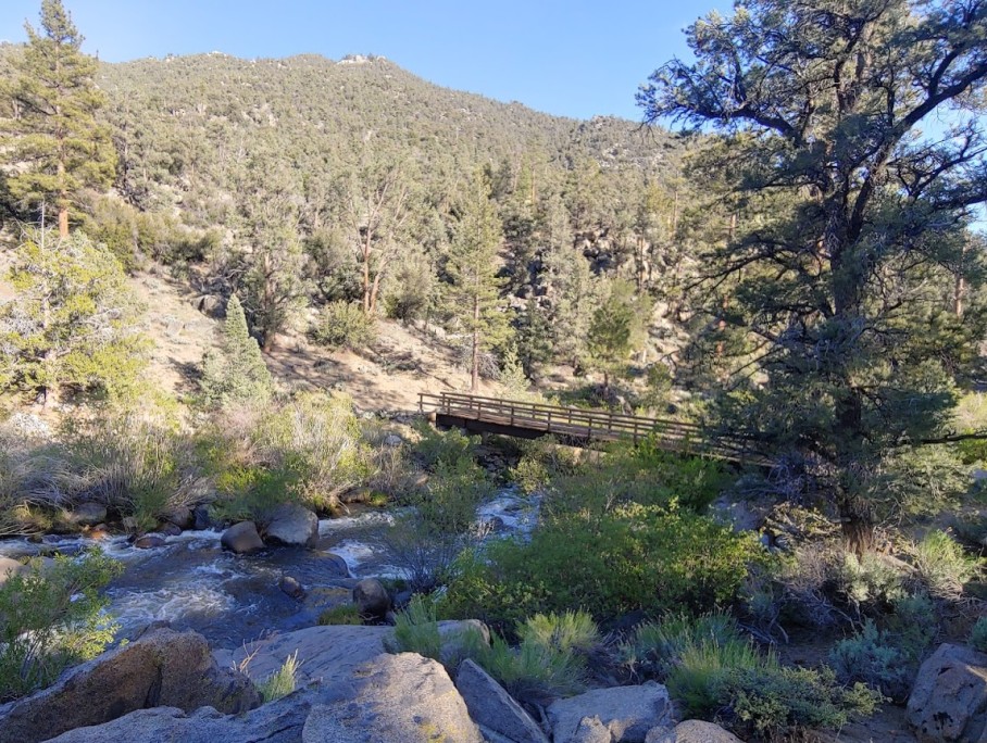
Bridge Over the Kern River on the PCT in South Sierra Wilderness
Bridge Over the Kern River on the PCT in South Sierra WildernessClick on photo for more information.

Visiting the South Sierra Wilderness

by Laurie Schwaller

     The wonderfully diverse, readily accessible, family friendly (especially the west side) South Sierra Wilderness includes miles of trails and waterways (highlights: the Pacific Crest National Scenic Trail and the Wild and Scenic South Fork of the Kern River), along with plentiful wildlife, California’s State Fish (the gleaming Golden Trout), long meadows flanked by rolling hills, rocky ridges, and many mountains to climb (elevations run from 6100′ at Kennedy Meadows to 12,000+’ atop Olancha Peak), and forests ranging from pinyon-juniper woodlands to Jeffrey, lodgepole, and red fir higher up.  Don’t miss this inviting Wilderness.

     The South Sierra Wilderness was established by the California Wilderness Act of 1984, passed by the U.S. Congress that September, authorizing the addition of over three million acres within California to the National Wilderness Preservation System.  Archaeological evidence, including bedrock mortars and obsidian tools and points, shows that Native Americans (likely Owens Valley Paiute and Panamint Shoshone) have inhabited this area for at least 6,000 years.

March, 2026

NOTE: The Project Team will be conducting research for a full article as volunteer time allows.  Contact us if you’d like to help research, write about, and/or illustrate this Treasure!  


Maps & Directions:

NOTE: There is no quick way to get to South Sierra Wilderness from Visalia.

From Visalia, go east on Hwy 198 and exit right onto Hwy 65 south.  Go past Porterville to Ducor.  Exit east at Ducor onto J22/Ave. 56 toward Fountain Springs.  At Fountain Springs, continue east on M-56/Hot Springs Drive toward California Hot Springs.  Continue past California Hot Springs to go north (left) at the junction with FR23S03/M-504.  Take this Forest Road to Johnsondale and then continue east on M-99 to FR 22S06 (Sherman Pass Road) to its junction with Rd. J41/Kennedy Meadows Rd.  Go left (north) on J41/FR 21S08 to the Kennedy Meadows trailhead and campground, a primary gateway to the South Sierra Wilderness and access to the Pacific Crest Trail.

You can also access the Kennedy Meadows trailhead from Hwy 395 on the Sierra’s east side by exiting on J41/Nine Mile Canyon Rd., which becomes Kennedy Meadows Rd.

To access the more northerly areas of this Wilderness from the east side of the Sierra, go south from Visalia on Hwy 99 to Bakersfield, then east from Bakersfield on Hwy 58 East to Hwy 14 north to Hwy 395 north to the Haiwee Pass Trailhead* at the end of Haiwee Canyon Rd. and/or the farther north Olancha Pass Trailhead via the Sage Flat Trailhead (to access Olancha Peak).  *NOTE: As of 12/17/25 Inyo National Forest does NOT recommend entering/exiting South Sierra Wilderness via the Haiwee Pass trail as wildfires and flooding have damaged the trail.




Site Details & Activities:

Environment:  62,700 acre Wilderness spanning the Southern Sierra crest, elev. 6100′-12,132′; west of the crest is in Sequoia N.F., in Tulare County, with the balance in Inyo N.F. on the east; miles of the Wild and Scenic South Fork of the Kern River and the Pacific Crest National Scenic Trail on the relatively gentler west side with many meadows, extensive conifer forests (Jeffrey and lodgepole pine ranging up to red fir), and alpine flora in the northern section’s high peaks, all with corresponding wildlife and native plants, including some rare ones; borders Golden Trout Wilderness on the north and Domeland Wilderness on the south, affording extended Wilderness travels
Activities:  backpacking, birdwatching, botanizing, camping (campfire permit [free] required for gas lanterns, stoves, BBQs,and campfires; available online at https://permit.preventwildfiresca.org/), dogs must be kept on 6′ leash and under owner’s control (must not harass wildlife), fishing (with valid licenses and in compliance with state and local regulations), hiking (including 7 miles of Pacific Crest National Scenic Trail, along the valley of the South Fork Kern River, with the Rockhouse Trail in Domeland Wilderness continuing 4 more miles along the river), horseback riding and packing, hunting (with valid licenses and in compliance with state and local regulations), mountaineering, peakbagging, photography, rock climbing, stargazing, wildflower and wildlife viewing
Open:  The Wilderness is always open, depending on weather, except when closed due to emergency conditions; low water levels and hot temperatures occur in summer in the lower elevations. Always carry water; treat (filter or boil) water from streams or rivers.
Wilderness permits are not required for South Sierra Wilderness; they are required for traveling north of Olancha Peak into Golden Trout Wilderness. Obtain Wilderness permits from recreation.gov, 877-444-6777.
If traveling more than 500 miles on the PCT, a long-distance permit from the PCTA is required.
Site Stewards:  Sequoia National Forest, Kern River Ranger District, 760-376-3781, SM.FS.SequoiaNF@usda.gov (west side, in Tulare County);
Inyo National Forest (east side of Sierra crest) as of 03/23/26 had no live contact information available; see Links below for general information. 
Opportunities for Involvement:  donate   National Forest Foundation  [https://www.nationalforests.org/donate-support/] ,  volunteer  Visit volunteer.gov or reach out to your local National Forest or BLM office for information on opportunities near you.  See also Forest Service Volunteer Opportunities  [https://www.fs.usda.gov/working-with-us/volunteers/opportunities] and Forest Service Volunteers  [https://www.fs.usda.gov/working-with-us/volunteers]
Links:  South Sierra Wilderness west side (Sequoia National Forest)   [https://www.fs.usda.gov/r05/sequoia/recreation/south-sierra-wilderness]